As weekend storm fizzles, next chance of snow arrives Monday night and Tuesday

As expected, this weekend's "system" didn't turn out to be all that much of a system after all.
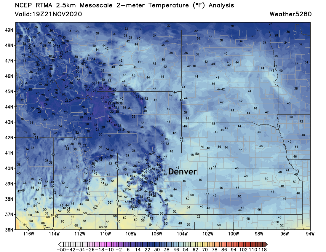
Cooler? Yes. After highs WELL above average for much of this month, highs in the 40s and 50s this afternoon have us feeling much more November-like across the region. Here's a look at temperatures across the region midday Saturday, with highs topping out in the low to mid 50s for most locations along the urban corridor Saturday afternoon:

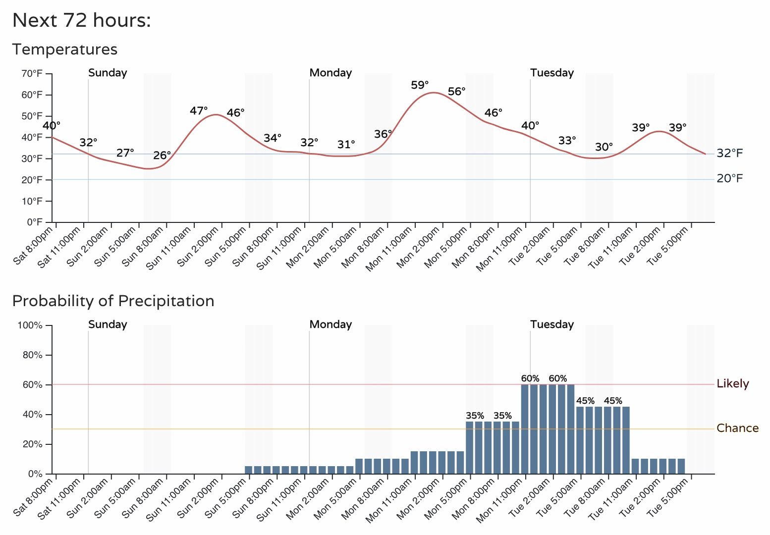
Sunday will be much the same: cool, but mostly dry across the state.
The week ahead
The next disturbance moves through late Monday into Tuesday, and will try once more to bring a bit of snow to the mountains and Front Range. Right now the data shows the best snow chances along the Palmer Divide and Denver's southwest suburbs, with low-end totals in the cities north and south. This is due at least in part to the fact that temperatures will (at least initially) be on the warm side, so any precipitation we do see may begin as rain Monday night for most locations across lower elevations.
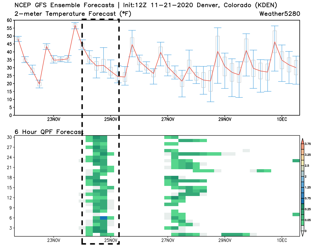
While operational models have been all over the place with whether we'll actually see measurable snow east of the hills, the ensemble data is actually pretty consistent in showing some moisture for the Denver area Monday night and Tuesday. Below is a look at the latest GEFS forecast, showing most of the 30 ensemble members forecasting measurable precipitation in that period (each green block indicates a 6 hour precipitation forecast for each member on the y-axis). You'll also note it shows yet another disturbance swinging through later in the week – with lower confidence there.
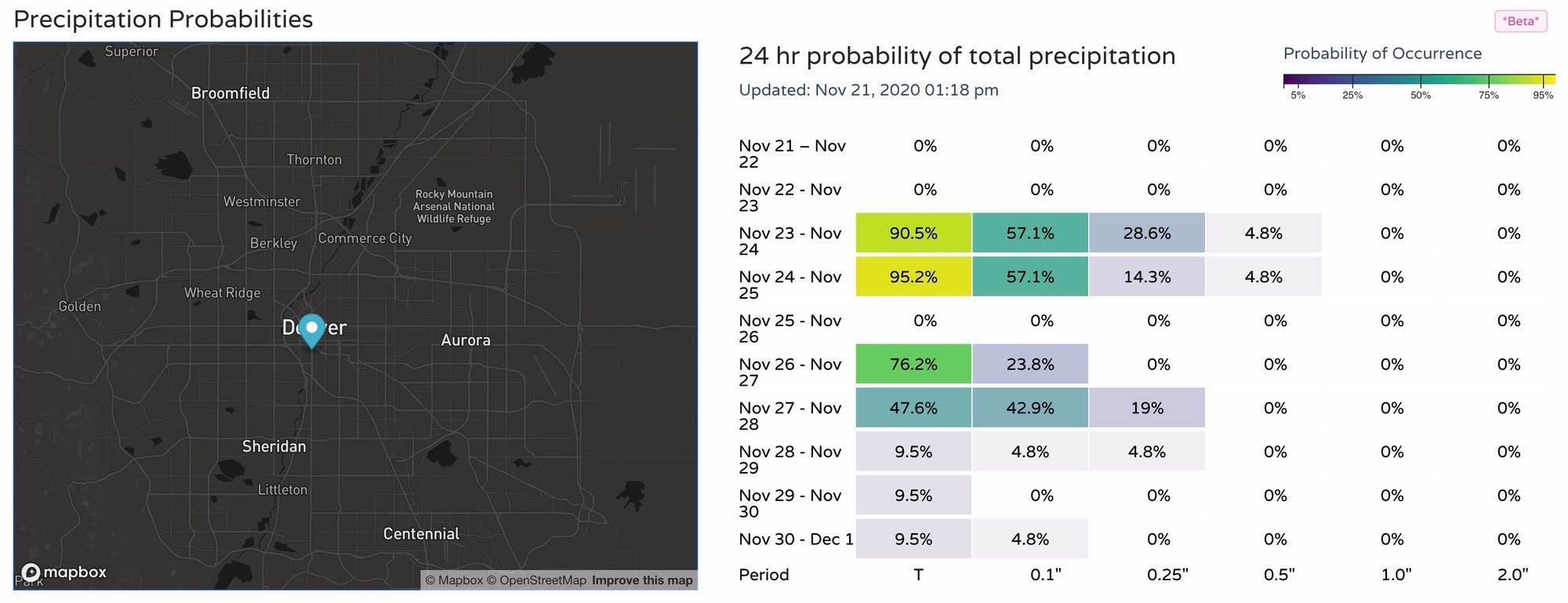
If we look at our precipitation probabilities, we see also some okay odds showing up for some moisture early this week, as well as the same secondary system noted above. Nothing huge, but something!
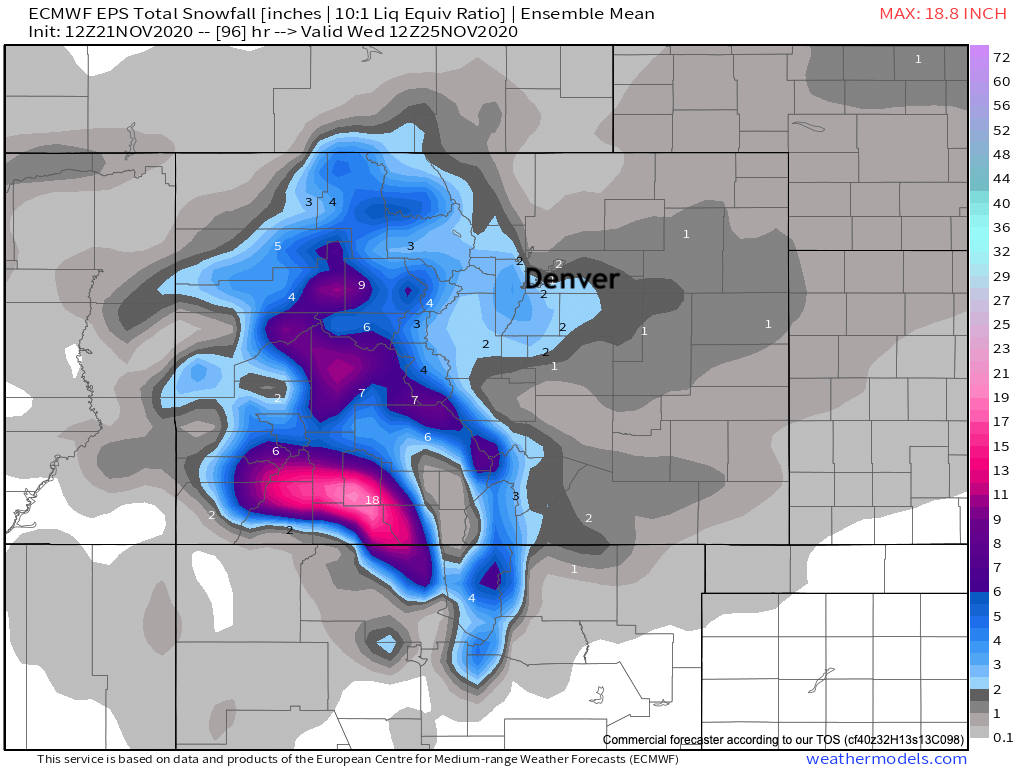
Finally, a look at the latest European ensemble snowfall forecast shows a pretty good snow on the way for Southwest Colorado to start the week, with a Trace to 3" showing up in the data as of now for the Denver metro area – primarily south of I-76, and north of Colorado Springs.
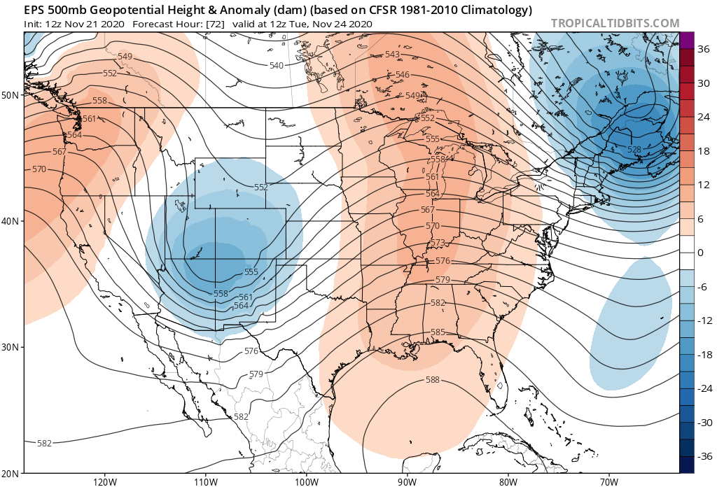
At 500 mb we see the system flying through the Four Corners early Tuesday, but not really closing off. This is a nice placement for snow across much of the state, but being progressive will will mean less snowfall potential east of the hills.
Should it strengthen and slow, the snowfall outlook would go up. While we'll lean toward the open look of the ensembles (below) for now, it's worth noting that some models are in fact showing this – with the Canadian model for example showing the low closing off across Eastern Colorado Tuesday morning and therefore producing more snow across the metro areas and Eastern Plains than some other models may be at this time. It'll be interesting and important to watch which way things trend in tomorrow's data.
And with that all that said, here's the hourly planner for Denver. Cool, but dry on Sunday, with increase chance of rain then rain and snow as we head into Monday night:
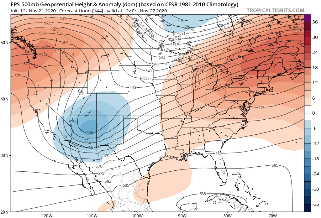
A quick look at the 500mb map for Friday morning shows a similar system set to move through – though the best energy with this one looks like it may drop too far south for much impacts across Northern Colorado, at least how it is forecast now. Another system to watch nonetheless.
Enjoy your weekend, and keep an eye on the forecast for early this coming week!