Tuesday PM update: Latest on potentially significant winter storm headed for Denver, Northern Colorado

We are full swing into information overload as mets across the region struggle with how to effectively communicate the potential with our weekend storm, and the continued uncertainty with regard to how impactful (i.e. how much snow) will ultimately accumulate. What's clear is folks are interested in the evolution of this forecast, and of course with a high-end potential event everyone will be hanging on every update in the coming days. We will continue to push plentiful updates as we check this storm, so be sure to subscribe, and take a look at our post from this morning on how this may compare to Marches in the past:
The good news is, since our updates yesterday, there haven't been any fundamental changes in any of the modeling as we sometimes see tracking a system at range. All the models that had a TON of snow in yesterday's runs continue to have a TON of snow, and ensemble model runs continue to be pretty steady – showing potential for a significant snowfall late this week and weekend, especially across Northern Colorado.
The setup
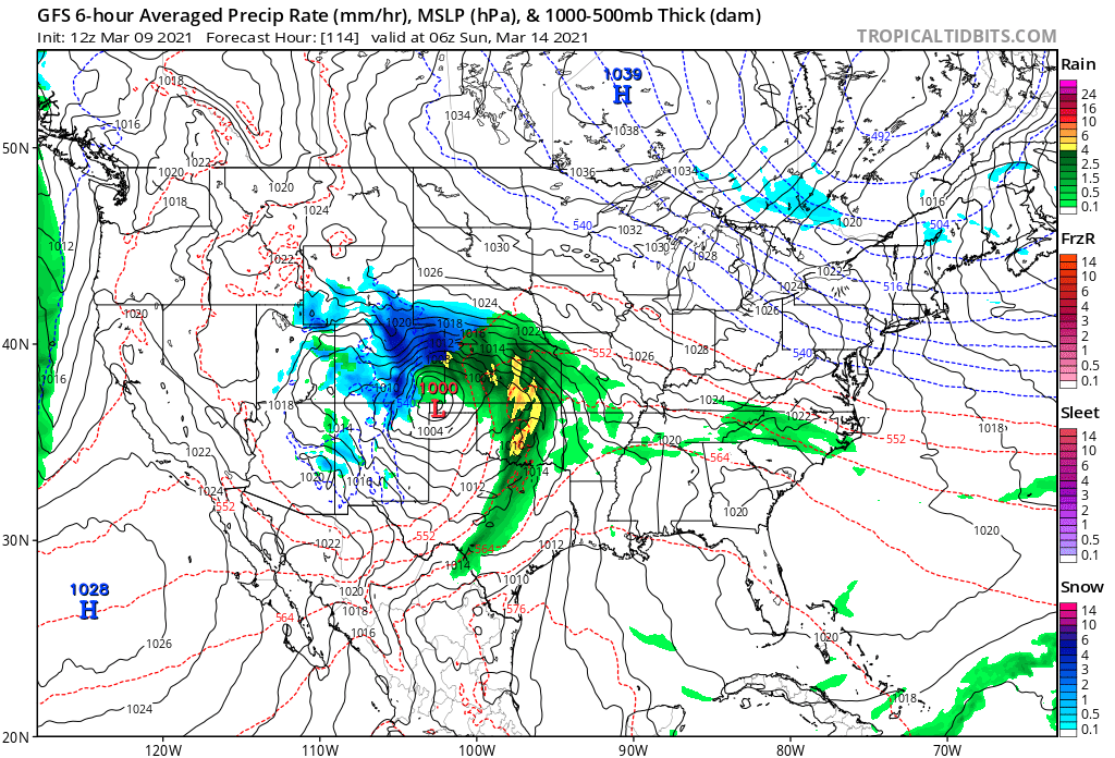
A large upper level low is forecast to move into the Southwest United States late this week, then traverse through the Four Corners as we head into the weekend. The low will eventually track east of the Rockies and intensify, resulting in an extended period of snow across portions of Eastern Colorado this weekend. Snow, heavy at times, could accumulate to a foot or more in some locations, depending on exact track, speed, and intensity of the low as it ultimately evolves.
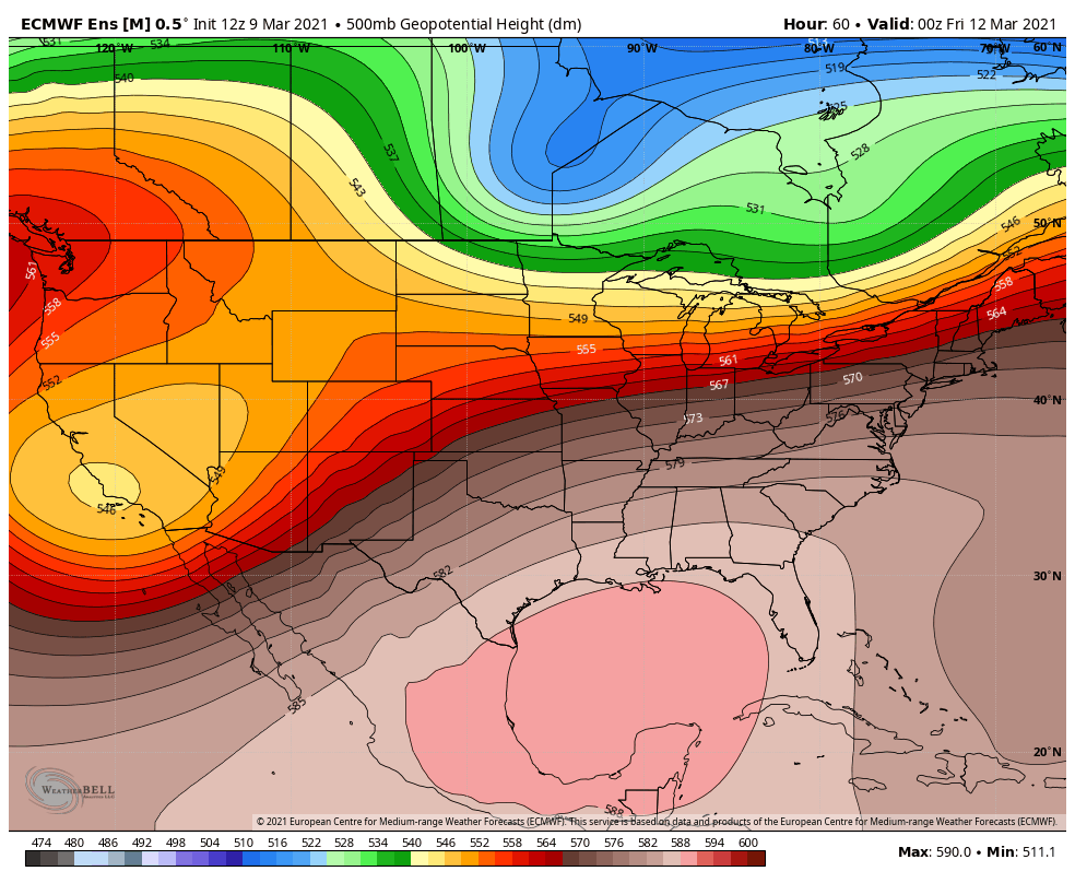
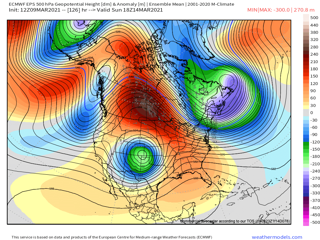
The latest track of the 500mb Low from the European ensemble models favors a significant snow event for much of Northern Colorado this weekend, coming to and end Sunday night or Monday:
Uncertainty!
Still, plenty of uncertainty on the details. Large, lumbering Lows coming out of the Southwest will wobble to the very end – and a difference of just a few miles in track will be greatly impactful to snowfall totals in the end. A wobble north or south will mean heavier snow could end up north into Wyoming, or south across Southern Colorado. Somewhere in between (which is where we are now) favors heavy snow along the northern Front Range.
Then there are other things to consider – things that ultimately can bust even the surest of forecasts. Do we see convective storms east of our area rob moisture? Do we see a dry-slot setup and rob are significant area of the heaviest snow? Some models are more progressive with the low as it moves east of the Rockies, some less so. If the low intensifies too far east, it could hurt snowfall potential along the Front Range foothills. A lot to consider.
The models
Most of the data has remained relatively consistent, all things considered. We've seen some runs featuring a more northerly track, and some models continue to drop the Low pretty far to our south. The European ensemble is showing a clear bias more north than it was yesterday, which we'll show below. Overall models are a bit slower, with more impact expected over the weekend than any time before.
The GEFS mean precipitation forecast is up from what we shared yesterday, suggesting near 3.0" of liquid in Denver from this event. As you can see, however, still a LARGE spread, with the low-end ensemble members closer to 1", and a few outliers north of 4.0 inches. Event the low-end members would equate to a good amount of snow around here.

The European ensemble is showing higher confidence in greater precipitation totals for Northern Colorado and a clear shift north from where it was yesterday. This aligns with this particular model moving the trough through more negatively tilted, which would favor a northern solution.
IF you are hoping for heavy snow from the Palmer Divide north through Fort Collins this is the solution you want to have verify. IF you live across southern Colorado and are hoping for the same – not so much. What will be important to watch here is if that northern trend continues – does it ultimately pull heavier precipitation even further north into Wyoming/Nebraska vs the Front Range urban corridor?
Here are latest probabilities for 1" of liquid or more through Monday evening:
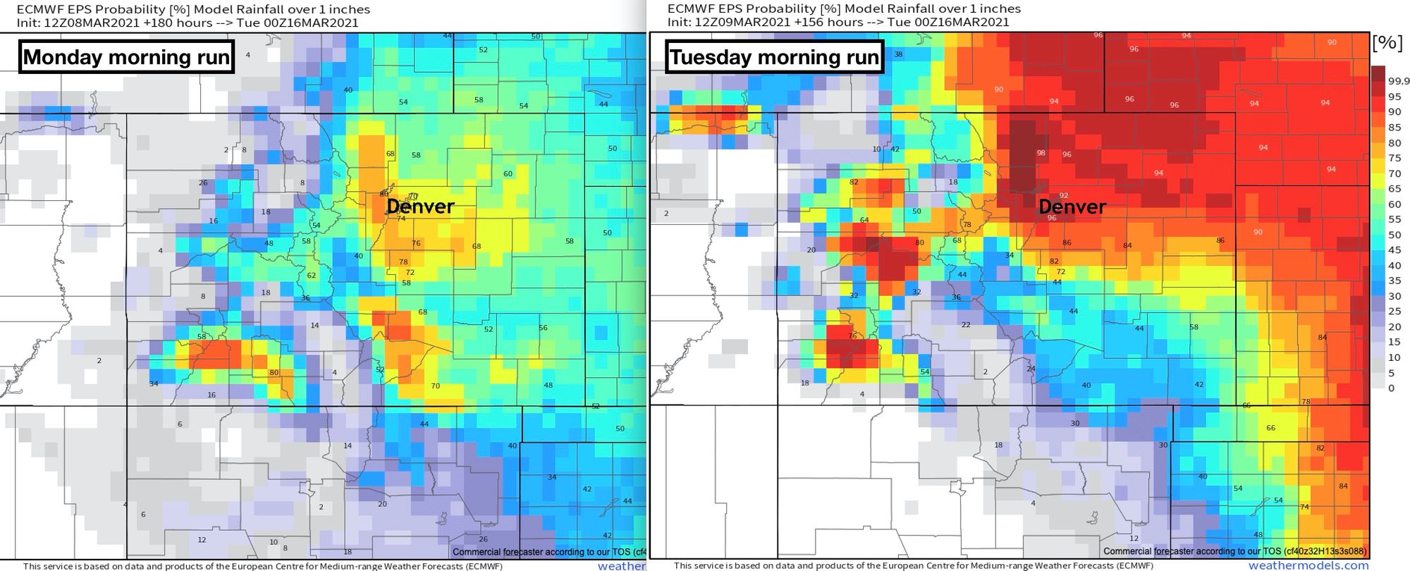
Similarly for snow, the greatest odds for a foot or more of snow through Tuesday morning are across Northern Colorado. According to this model, those odds are in the 80 to 90% range as of this posting for the Denver-Fort Collins urban corridor, but drop quickly as you head south of the Palmer Divide into Colorado Springs.

Our gamblers are similar (you can find them here), but a bit lower with the high-end probabilities. Still, 70% odds for a foot or more of snow in Denver with several days to go here:

And a look at the 500mb map for Sunday morning showing a strong cutoff low right where you want it for heavy precipitation across Northern Colorado:
And finally, the mean snowfall output from this model, showing a good 20" for most areas across Northeast Colorado at this time. Perhaps an opening bid of 10 - 20" for many locations is a good place to be with several days for things to change still.

Timing
We will start to feel the presence of the approaching system across Colorado by Thursday, but we think most of the most impactful weather will hold off until Friday night and then stick with us through Sunday in many cases. Again, eventual strength and track will determine exactly how long we are under best setup for snow, but best to plan for a snowy weekend around here at this point.
Here is the latest planner, taking us into Friday night. As you can see a steady increase in those precipitation chances, with temperatures gradually cooling as we head to the weekend as well.

While we still aren't sure about some of the rather remarkable snowfall totals the GFS is producing, the timing seems like a good idea for the greatest impacts – plus or minus 6 to 12 hours on either side.
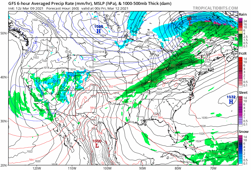
The following loop takes us from late Thursday night through Monday morning. As you can see it has rain and snow on the increase across Western Colorado Thursday night, and keeps light snow lingering into Monday morning across Northeast Colorado. Models usually overdo the duration of events, but with a cutoff like this and the potential to stall a bit... it's not off the table.
Takeaways
The takeaways stay the same. The potential for a significant snowstorm remains on the table, but the details are yet to be worked out. Still plenty of time for everything to fall apart, and if trends continue north it just may.
Still, good to keep up to date with the forecasts for the remainder of the week, and we will continue to offer frequent updates.
- Timing: Late Friday through Sunday evening for the worst of the impacts across Eastern Colorado
- Snowfall totals: Upwards of 1 foot, potentially several feet, where the heaviest snow ultimately ends up. Where that is isn't decided just yet.
- Forecast confidence: Medium. We expect an impactful storm to move through the region this weekend, but still expect some curveballs in what its eventual evolution will look like and WHO will see the heaviest of the snow.