
Another chance of snow on Friday, quiet weekend ahead

The rapid succession of storms continues along the Front Range. Most of these systems continue to produce minimal snow accumulation for the majority of those living along the urban corridor, but icing and pockets of more meaningful snow have meant they haven't come without some inconvenience and a wintry January feel around here.
As we covered on Weather5280 Insider yesterday, tomorrow brings another snow chance to the Front Range, with a break for the weekend, before another system moves through to start next week.
Like each of our last couple of systems, tomorrow's snow chance will favor the foothills west of Boulder and Denver, the western Palmer Divide, and Northern Colorado Springs areas – with much lower chances for accumulating snow across the northern urban corridor (Fort Collins) and east of I-25.
For Denver, there's about a 50% chance for snow on Friday, focused on the midday to early evening timeframe. What snow we see is expected to be on the light side, with snowfall totals from 0 to 2" for Denver proper. Still, should we see that snow setup over the city, the evening commute could once again be impacted across the metro area.

For Castle Rock, those snowfall probabilities are higher, in the 70% range Friday afternoon:

As for snowfall totals? Here's how thing should shake out:
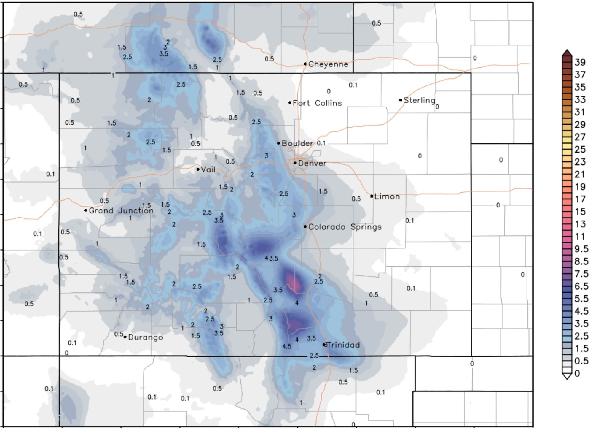
- Fort Collins: 0 - 1"
- Boulder: Trace - 2"
- Denver: 0 - 2"
- Golden: Trace - 3"
- Evergreen: 1 - 3"
- Castle Rock: Trace - 3"
- Monument: Trace - 3"
- Colorado Springs: 0 - 2"
For what it's worth, the latest European model run shows virtually no snow for Denver tomorrow (and about 1 - 2" for the foothills west of town), but does continue to show more potential with the system early next week.
The temperature forecast shows highs near 40°F tomorrow and Saturday in Denver, warming up Sunday, then cooling off Monday and Tuesday as the next system moves through:

Given how far south and west models are trying to pull tomorrow's low as it drops out of the northern Rockies and cuts off, the inclination to lean toward a bust vs a boom with tomorrow's snow chance seems like the wiser move. This is certainly true for those living along and east of I-25, and the further north of Denver you live – hard to be too excited about those snow chances.

We'll be tracking the system for next week over the weekend and pass along updates as needed. For now not a lot of confidence that this one will deliver much in the way of meaningful snow either, but there's a chance!