Snowfall totals and a look ahead to the next chance of snow for Eastern Colorado on Thursday

To have a chance of snow every couple days is a rapid cadence for those of us living along the Front Range, but that's the pattern we've been in and remain in this week as another quick-hitting system will move through on Thursday on the heels of yesterday's snow.
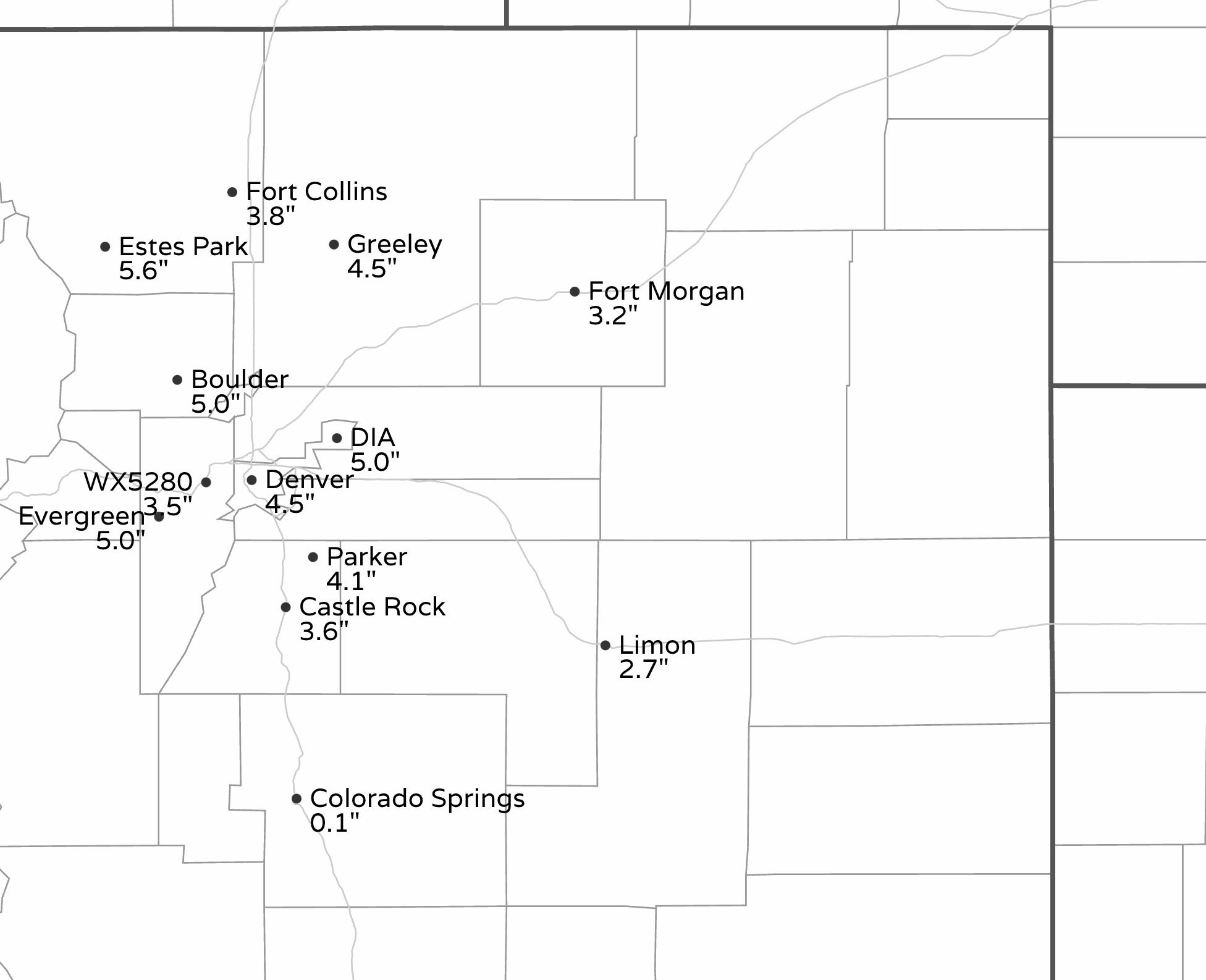
Our 3 - 7" and 2 - 4" ranges yesterday worked out pretty well, and where we missed we missed low which is usually welcome by the 5280 readership! With 10.6" of snow so far this January, Denver has now picked up 15.4" of snow on the season, which is still well below average but starting to close the gap a bit. The city's seasonal average through the end of January is 27.0". Notably, the 10.6" of snow so far this month is well above the longterm average of 6.5" for January, and we could add to that tomorrow.
Below are area totals from Tuesday's snow, with most folks ending up in the 3 - 5" range, with a few 10"+ reports from the higher foothills terrain.

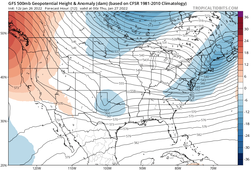
Yet another shortwave embedded in the northwest flow aloft will move through tomorrow, and in a similar setup to yesterday bring with it a chance of snow to the region. While drier, some ares could once again see a couple inches of snow where the heavier banded snow sets up.
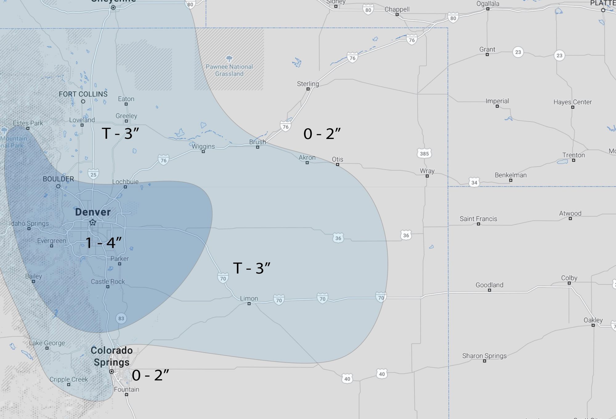
Always a tough call on exactly where the main band will setup, but we like the greater metro area for tomorrow. Under this band 1 - 4" will be possible, with lower totals elsewhere.
Snowfall forecast for Thursday:
As for timing... well, it could be another slow morning commute for some areas along the Front Range as the greatest chance for Denver (below) comes between 5am and 4pm Thursday.
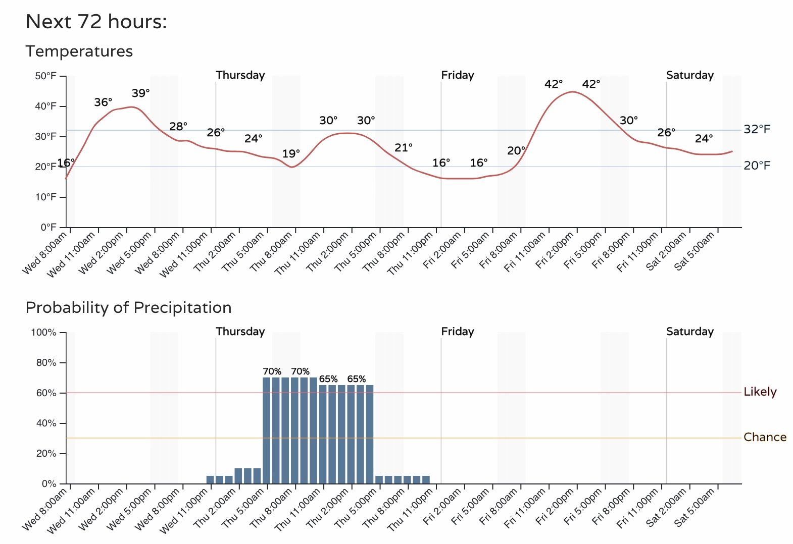
The latest HRRR model shows the main band dropping out of Weld county right during the morning rush, and spreading light to moderate snow across first the northern metro area, then points south by mid to late morning.
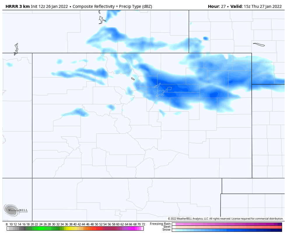
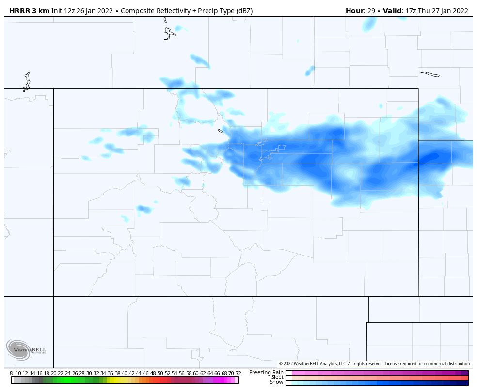
This model, as do most, have the snow coming to an end by early to mid afternoon over most of Eastern Colorado, with a very chilly night setting up across the plains Thursday into Friday.
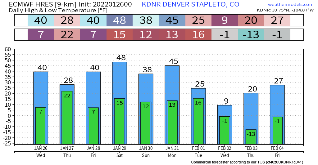
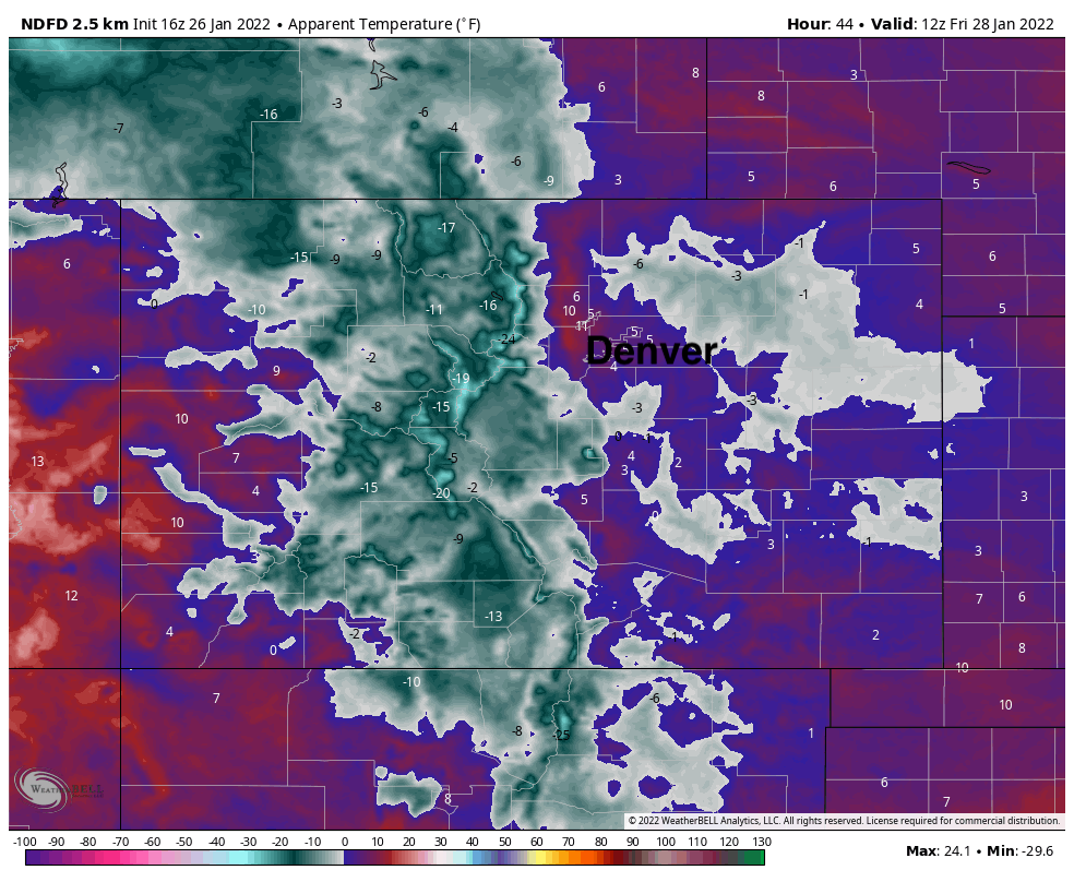
Temperatures will be in the single digits and teens across the state Thursday night, with apparent temperatures early Friday will be in the single digits and below zero across the plains, with most of the mountain areas feeling well below zero.
Milder weather on tap for the weekend, before we start tracking the next system to impact the state by the early to middle part of next week!