Snowfall totals, weekend outlook, and an eye to next week's chance of snow

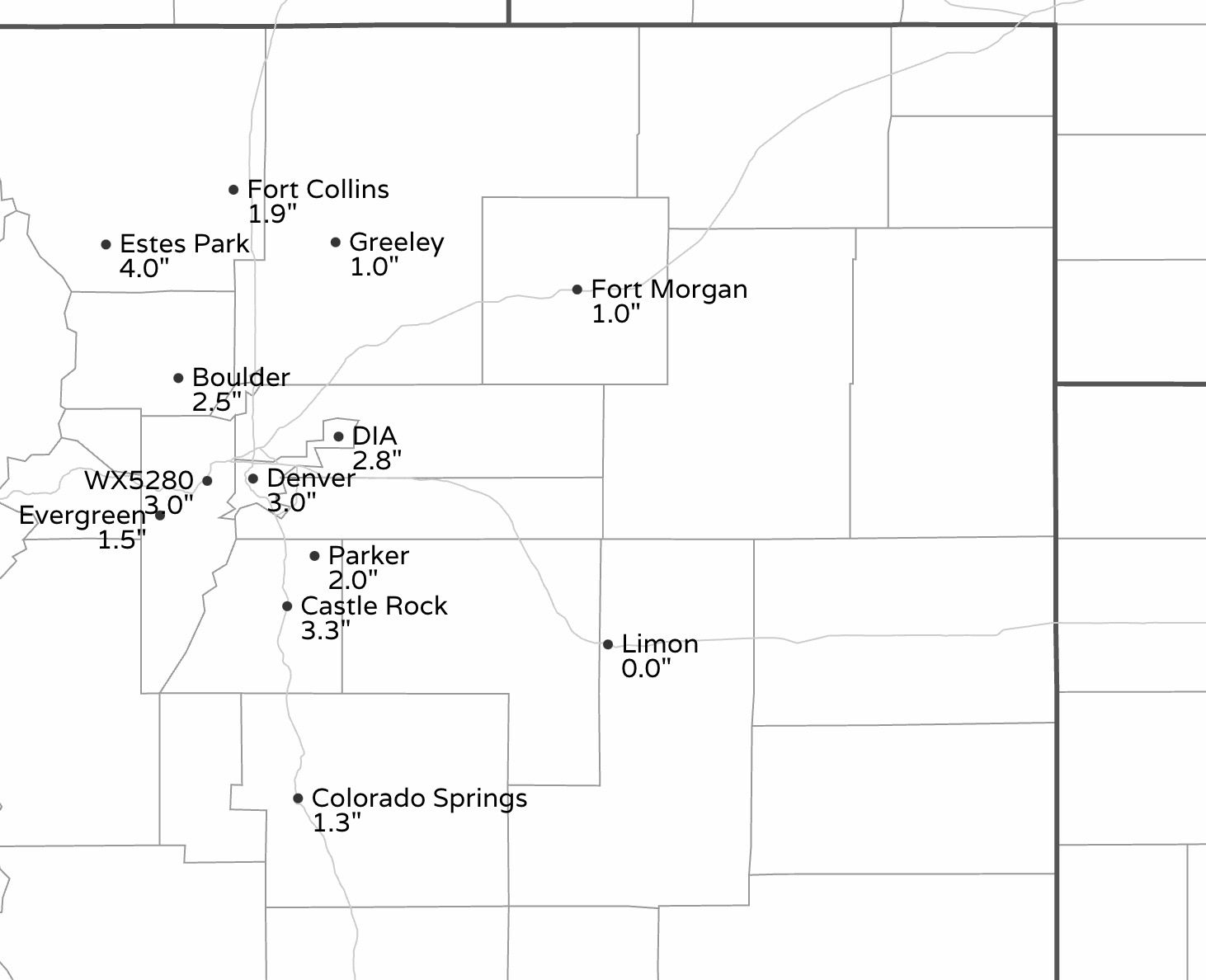
Yesterday's snowfall brings the month-to-date snowfall total for Denver to 13.4", just about twice the average of 6.5" for the month of January. Pretty darn good for any January, especially given the largely snowless prior months.
We picked up 3.0" at our station in Denver West, with most of the metro coming in nicely in our T - 3" and 1 - 4" forecast ranges. Here are additional totals from across the region:
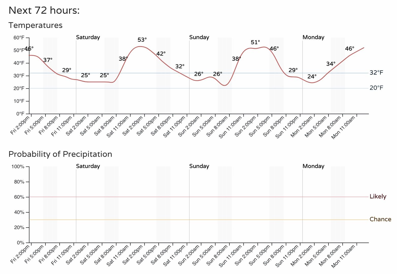
The focus for weather this weekend shifts away from Colorado as mostly dry and mild weather is on tap for the state. The hourly planner for Denver through Sunday is dry, with highs in the low 50s across the urban corridor:
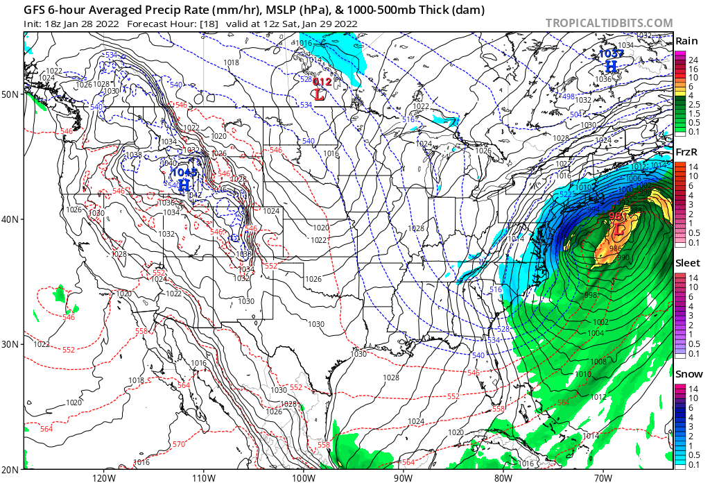
For the Northeast United States, a different story altogether as a potent winter storm will bring feet of snow to some areas, and blizzard conditions to coastal New England. A look at the current NWS hazards map shows a mostly quiet West, with the eastern seaboard covered in winter weather highlights:
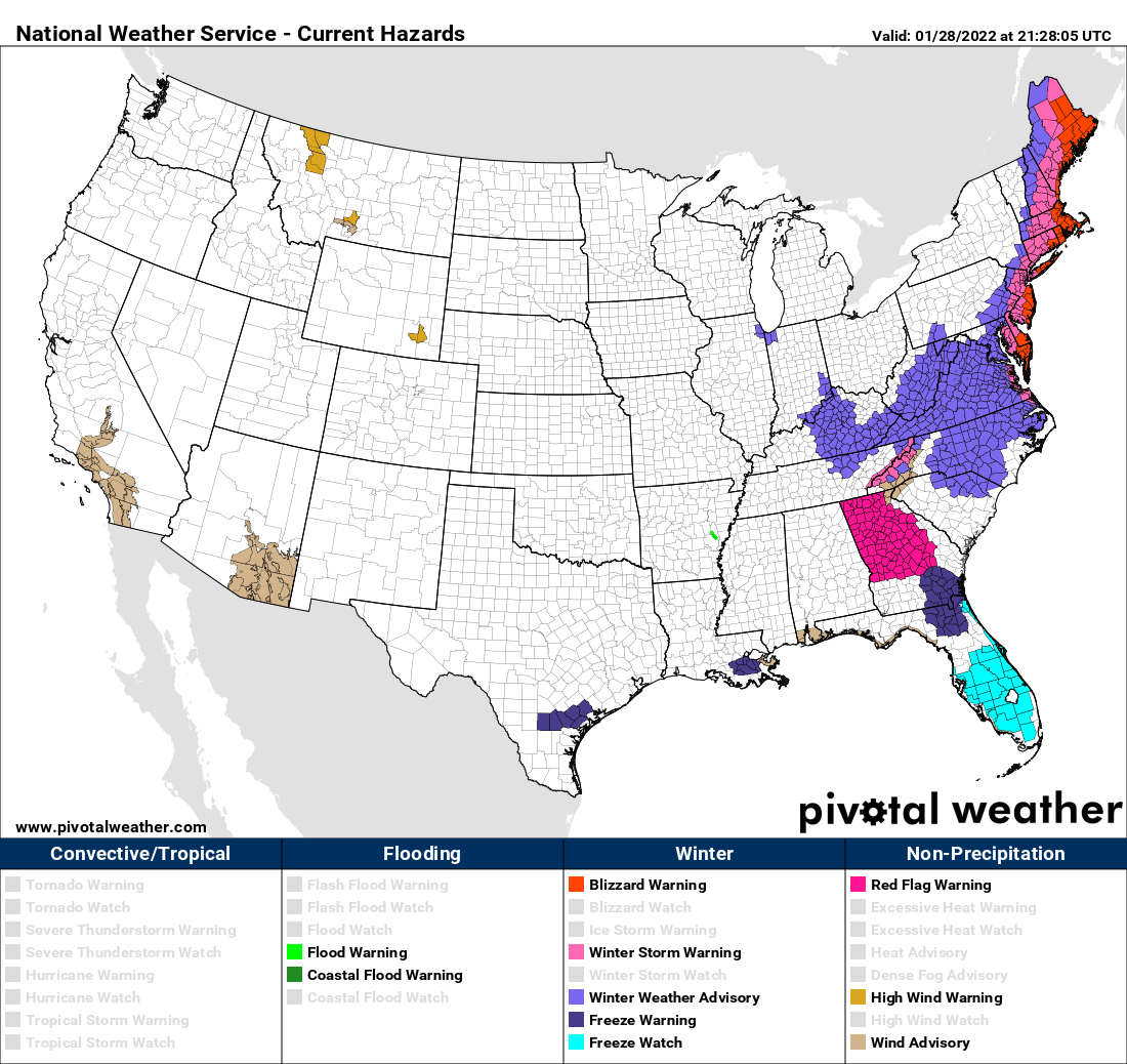
While details have been exceptionally hard to pin down, this will be a remarkable storm, and while under some scenarios the worst of the impacts could end up just offshore, it looks likely that areas from Delaware to Maine will experience very heavy, wind-driven snow this weekend. Travel will be difficult if not impossible for many of these areas through the weekend.
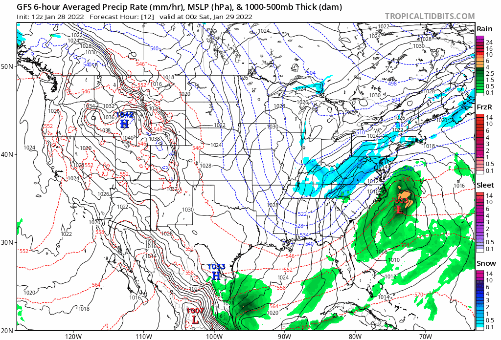
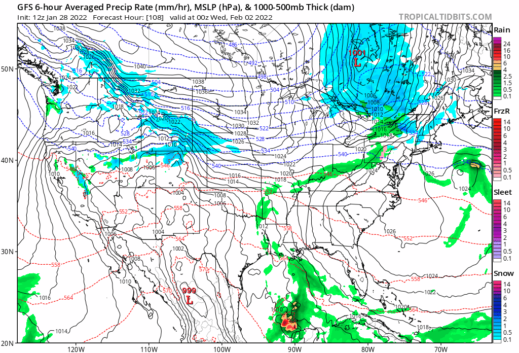
For Colorado... the next system to watch will move through next Tuesday and Wednesday, with what looks like a widespread (perhaps light) snow event for the state, and a sharp drop in temperatures as well. The animation below takes us from Tuesday evening through Wednesday night, you can see the snow develop to our north then pass over the state Tuesday night and Wednesday, before moving south and east Thursday:
The cold shot with this next system looks like the real deal too, and will come in sharp contrast to the warmer weather we are tracking for the weekend. Here's a look at the cold as it drops out of western Canada late in the weekend, then crashes south down the plains:
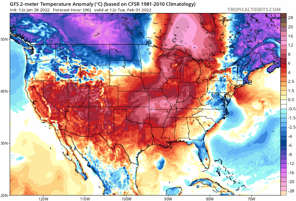
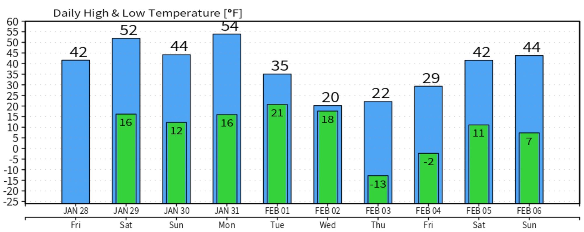
Models show highs in the 20s Wednesday and Thursday for Denver behind this cold front, with lows below zero possible:
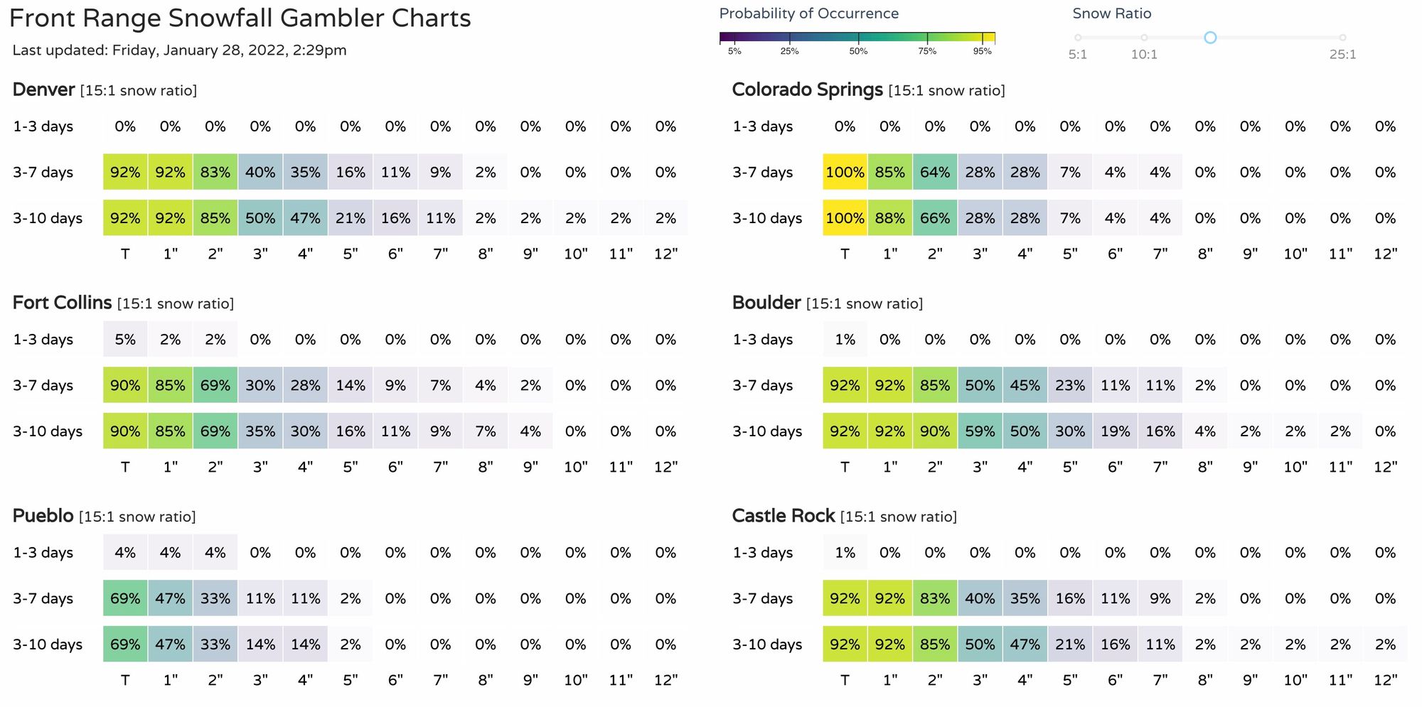
As for how much snow we might see? It's too early to speculate all that much. The signal for this system has been in the data for quite awhile now, so some snow looks likely, but whether that's a 1 - 3" event or perhaps something a bit more impactful remains to be seen. Right now, most models are in agreement on the cold, and are hedging toward a light snow event for Eastern Colorado vs something more.
Still, even without huge excitement in the operational models today, our gamblers are showing some potential for next week... so enjoy the weekend, but keep an eye on the forecast!