Parts of the Front Range blanketed in heavy snow, more on the way next week?

Happily we hit on the fact yesterday's storm had the potential to deliver (and over deliver) as heavy snow moved through the greater Denver area on Friday and brought another round of accumulating snow to the region.
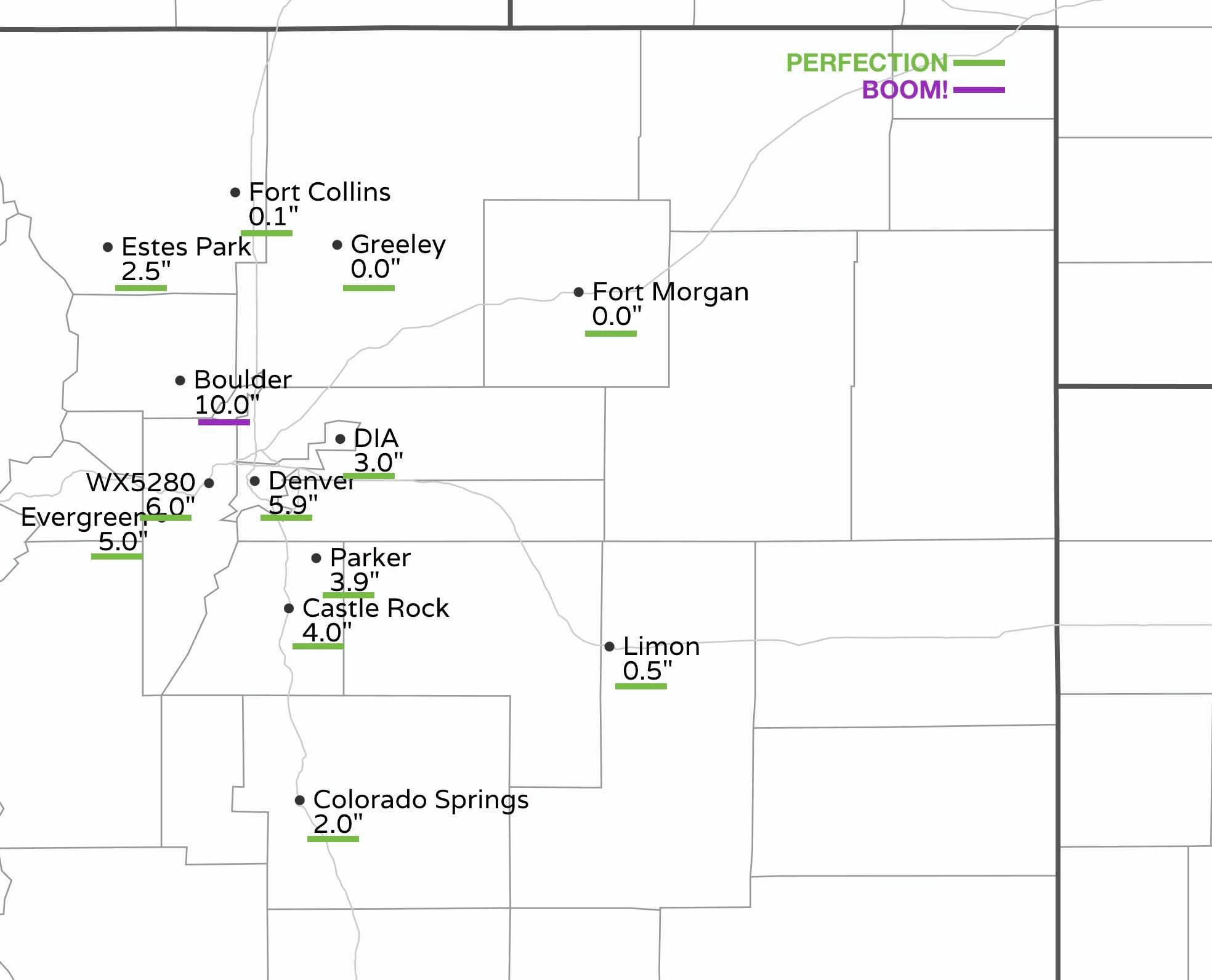
This was not the case everywhere, with Fort Collins notably left out of the fun on Friday, picking up from just a Trace to a few tenths of snow.
In Boulder, and portions of Boulder county we saw💥 BOOM💥 snowfall totals, with upwards of 12" of snow reported at higher elevations between Boulder and Nederland! Boulder itself picked up 10" of snow, beating out our 3 - 7" range easily.
Denver (central), Lakewood, Golden, Evergreen... were all cities in our hashed 3 - 7" hashed snow potential area, and all picked up from 4 - 7". Our station ended up with 6.0" on the day. Officially, Denver recorded 3.0" of snow at DIA, nicely within our 1 - 4" forecast for the airport.

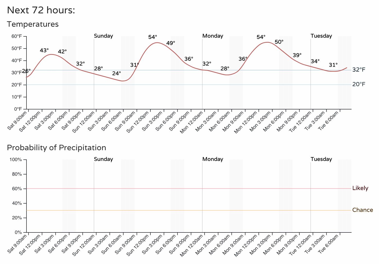
Quieter weather settles in for the remainder of the weekend. Today's highs will be blunted a bit with the new snow in place, but highs will climb into the mid 50s for Sunday and Monday with dry conditions across the region.
By Tuesday our next system will be taking shape to our west, as an upper level low moves into the Great Basin and closes off:
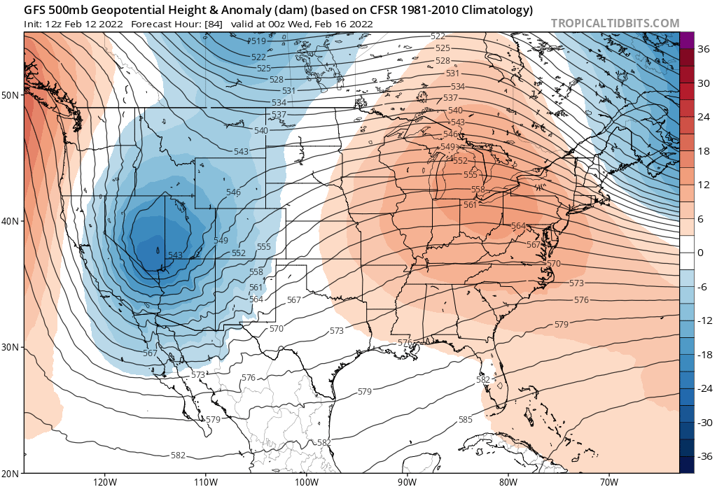
This system will be a bit of a of a different animal than we have seen of late, with more of a classic track for us to see snow. The evolution of that low, however, remains in question – with models tending to move it through as a positive/more progressive trough rather than keeping it closed off as it moves through to the south, thanks in part at least to a trailing shortwave which will interact with the main system as it moves through Wednesday and Thursday.
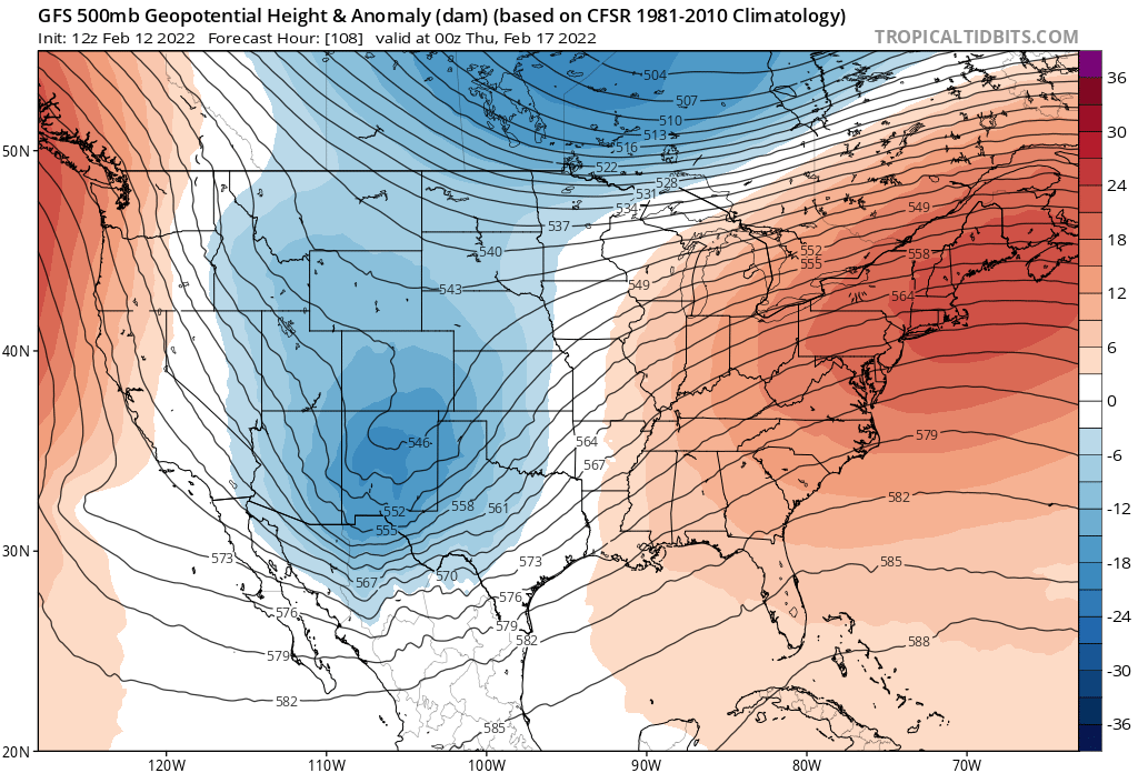
Still, another round of snow for the Front Range looks possible, if not probable, with the most likely timing for snow being in the Wednesday day/evening period.
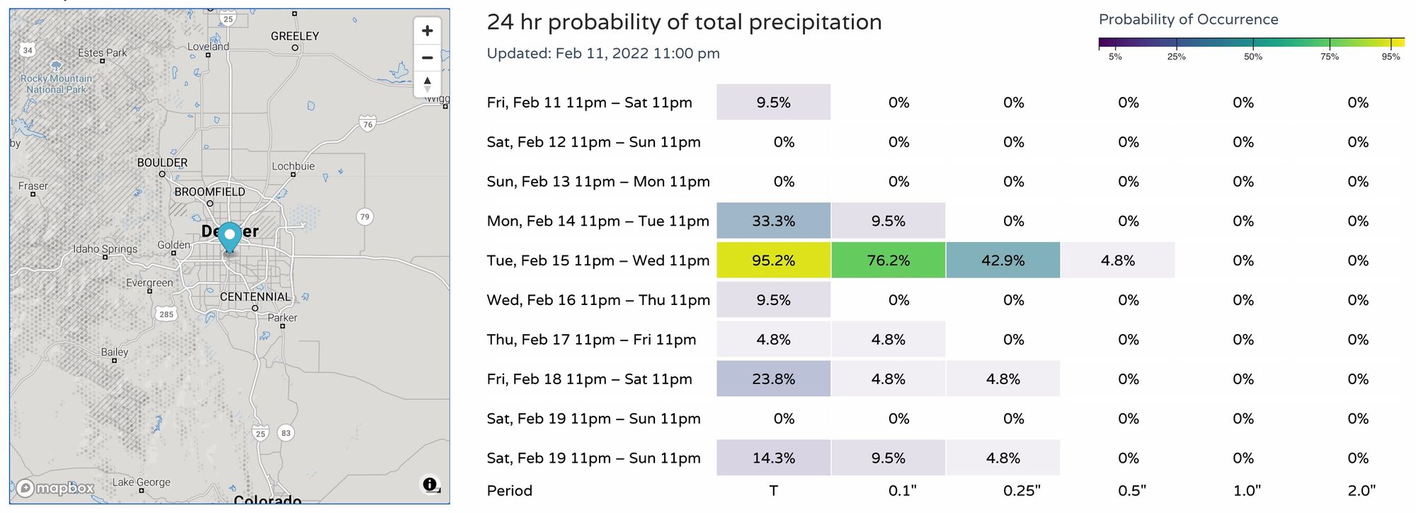
Precipitation probabilities reflect this:
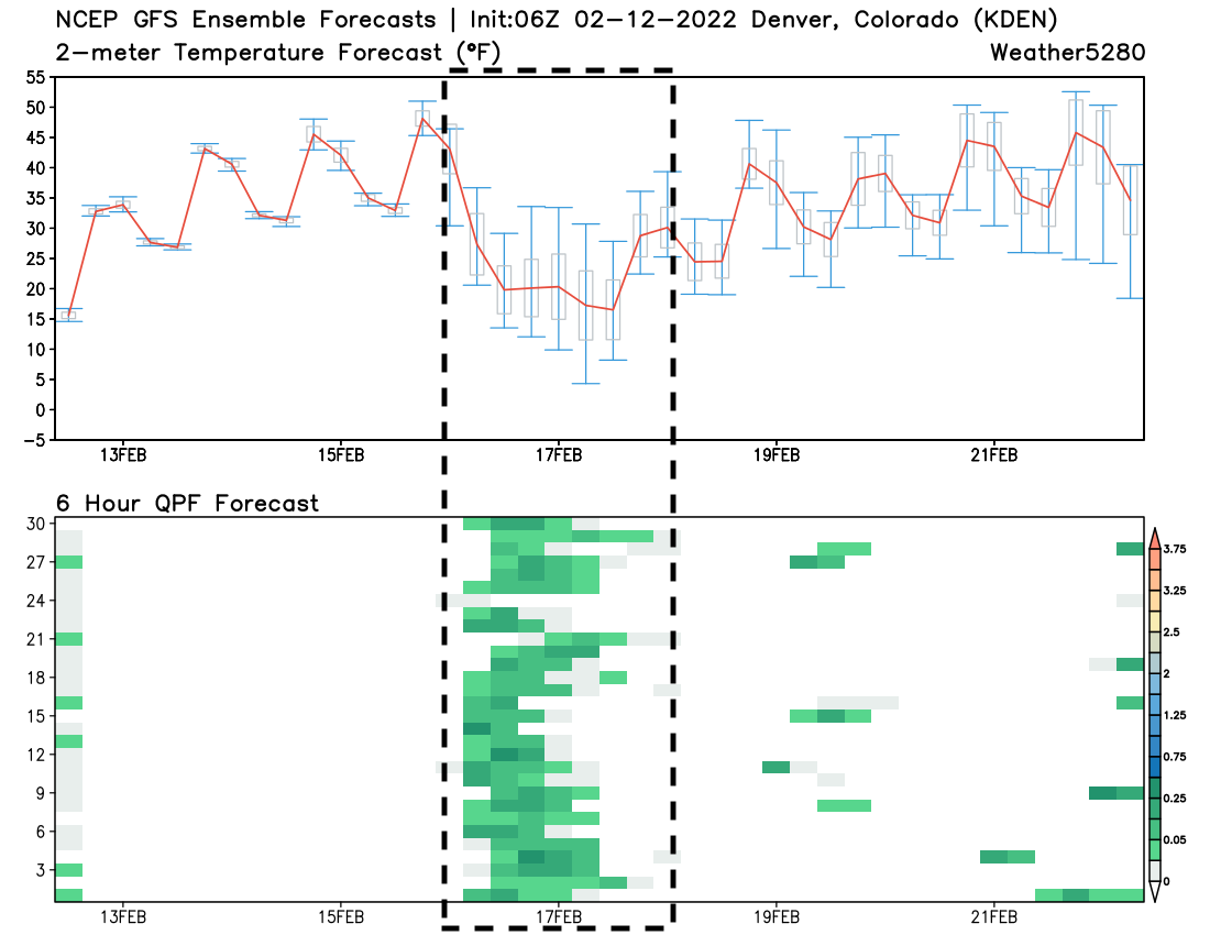
With pretty good agreement from the GEFS on timing and precipitation:
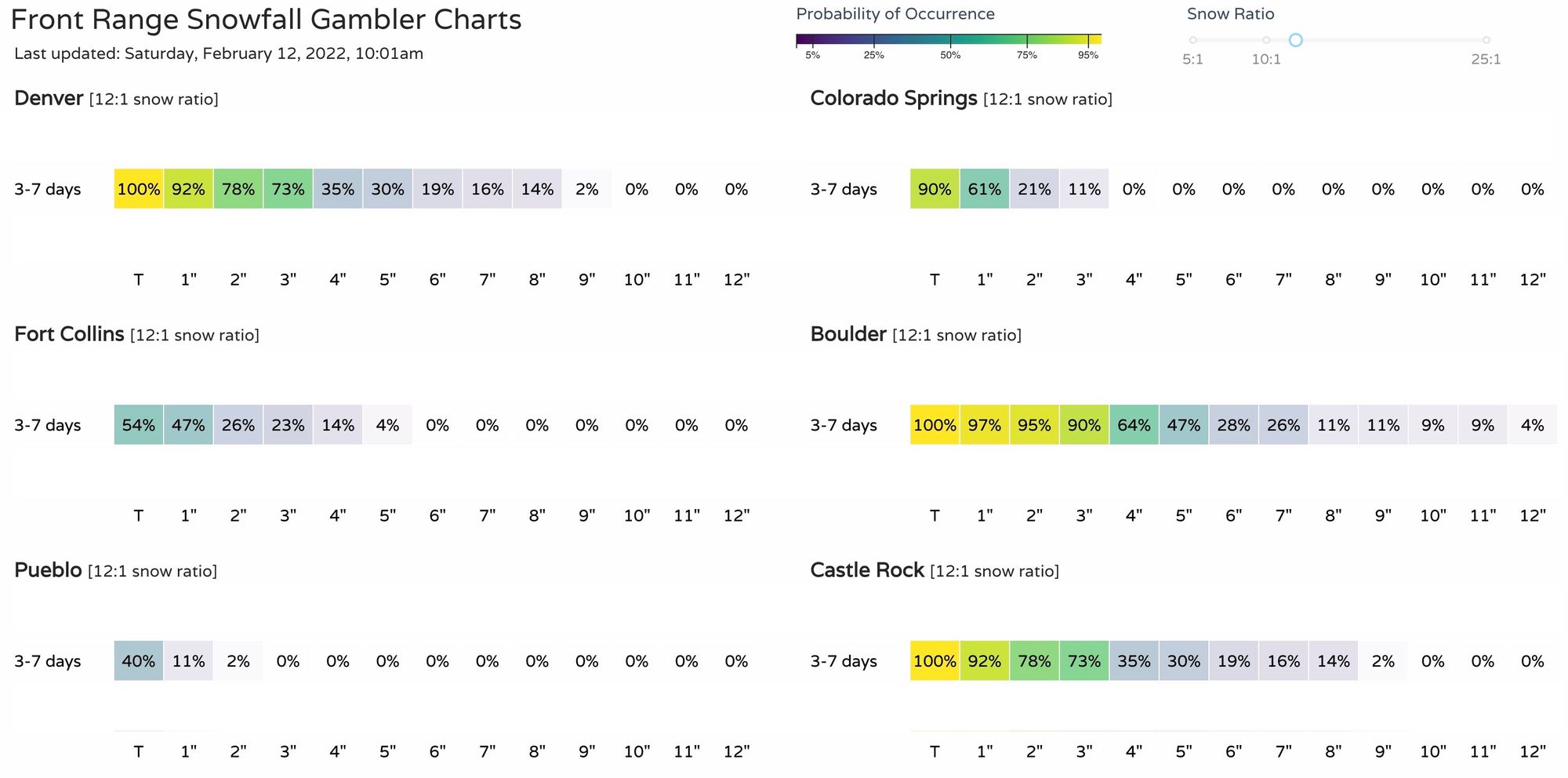
And finally, our gamblers showing a bit of life in the 3 - 7 day range:
Of course plenty of time for things to change and details to be worked out, but for now plan on some quieter and warmer weather for a couple of days, but keep an eye on the forecast for the middle of next week as another round of cooler temperatures and snow looks like its on the way.