Snowfall totals as Front Range begins gradual warming trend

We aren't completely done with the cold and snow, but we're getting there. The worst of both are behind us, with just isolated to scattered snow showers in the forecast through the end of the week, and temperatures gradually warming into the weekend as well.
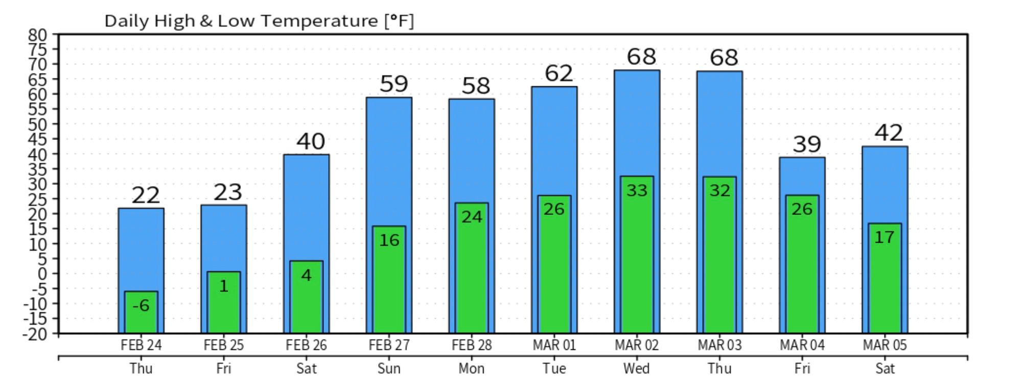
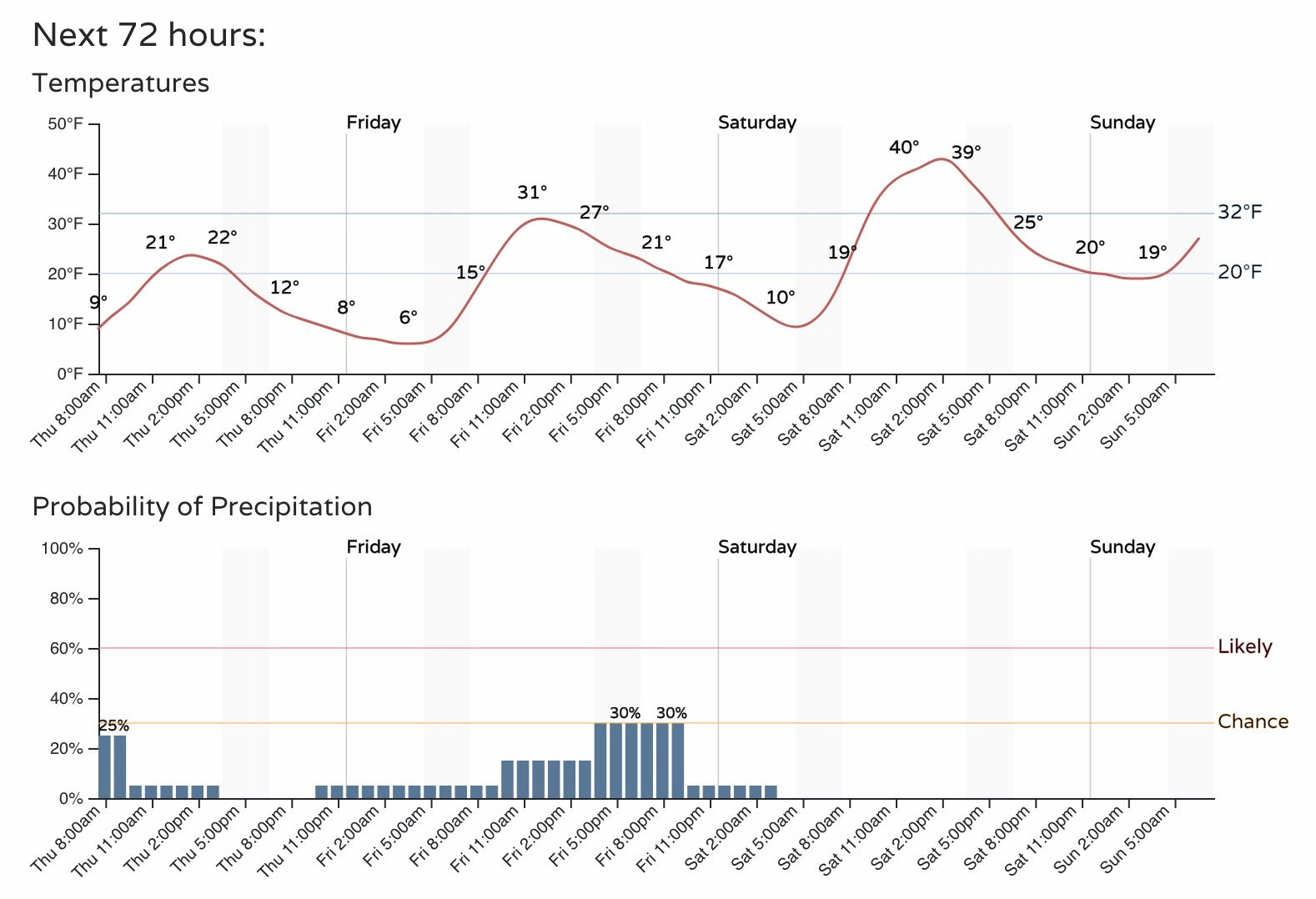
The planner shows highs in the low 20s today, near freezing on Friday, then to around 40F on Saturday. We could see some snow showers and flurries today, as well as Friday, before a drying trend kicks in for the weekend as well.
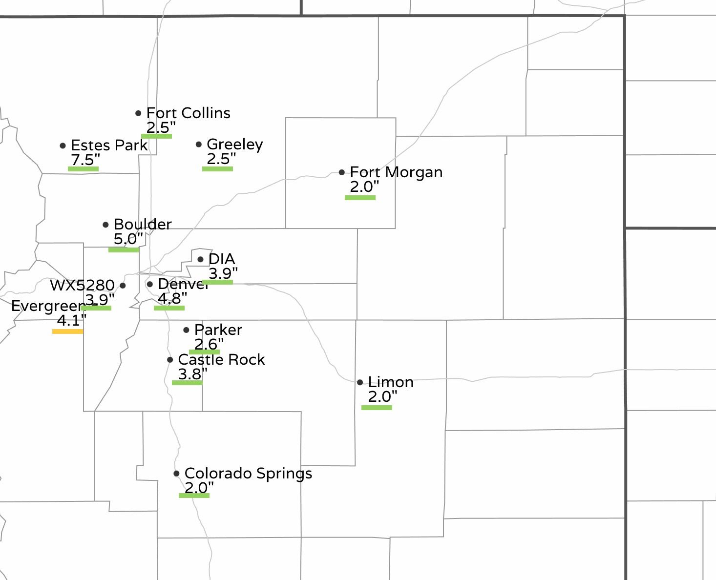
Snowfall totals over recent days have come in within range for the most part, though at the low end of our forecast range in most cases. Reports around Evergreen are in the 4 to 5" range, with the forecast being 5 to 10".
DIA picked up 3.9" inches of snow, with the city-center seeing totals around 4 to 5". Not too bad, and coupled with the bitter cold it sure has been wintry around here this week.
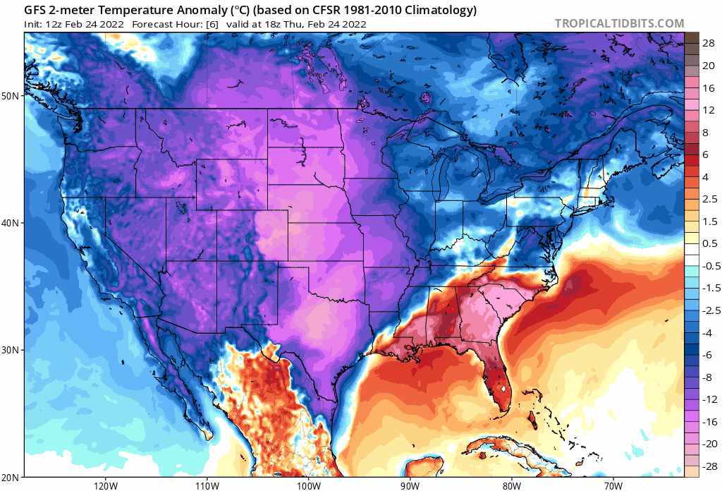
The weekend marks the start of a gradual warming trend into next week. The coldest air is now behind us, but it'll take a few days before it starts to feel all that warm around here. You can see in the animation below the cold gradually departing, and warmer than average temperatures returning to the West and central U.S. next week:
The European model, for what it's worth, shows highs in the 20s today and Friday, 40 by Saturday, then climbing into the 50s and 60s for next week. It has, at times, shown Denver hitting the 70F mark by the middle to latter half of next week – which would be quite the change from our weather pattern this week!