Snow storm brings travel mess to the High Plains; improving conditions for Denver area Tuesday

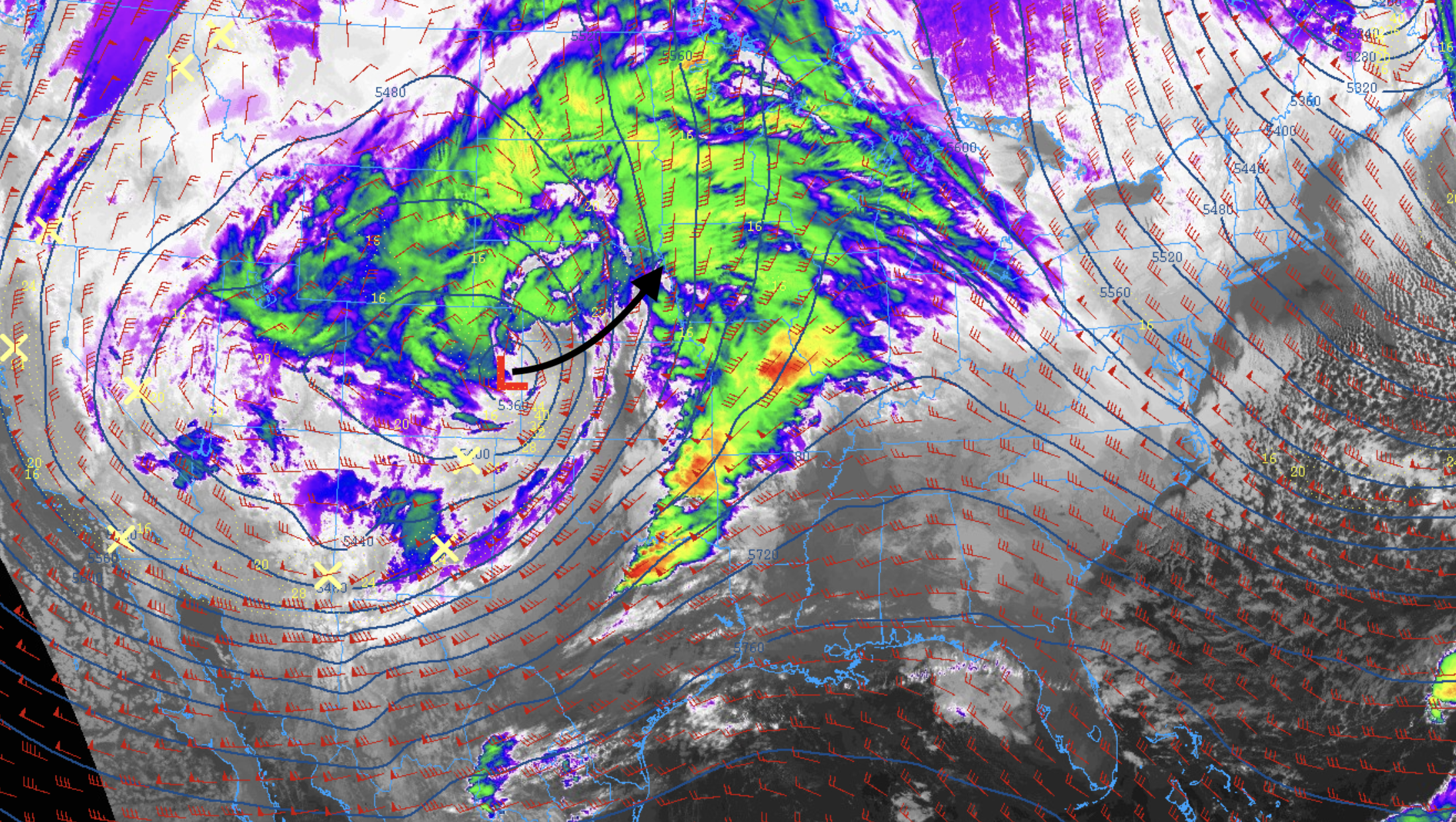
After plenty of anticipation with this system, and for Denver-area snow lovers a lot of hoping for a slight shift in track, the storm finally moved in last night and did so without really any dramatic changes to our outlook. This morning, the storm remains on track, currently centered over east/northeast Colorado and gradually ejecting north/northeast through the day.

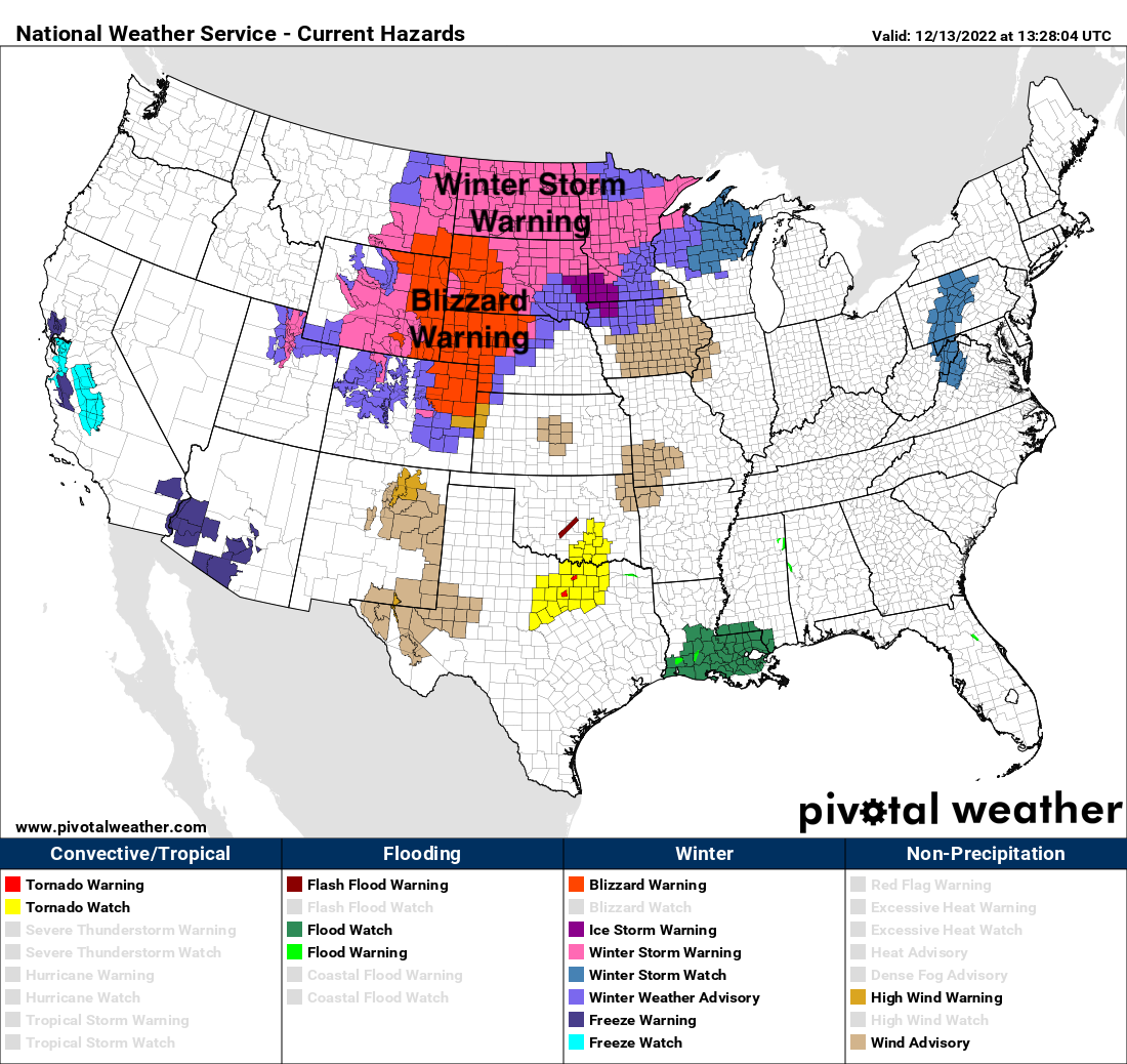
As it does, look for conditions to continue to deteriorate across the northern High Plains, with Blizzard Warnings in effect from Northeast Colorado through western Nebraska, Wyoming, and South Dakota.
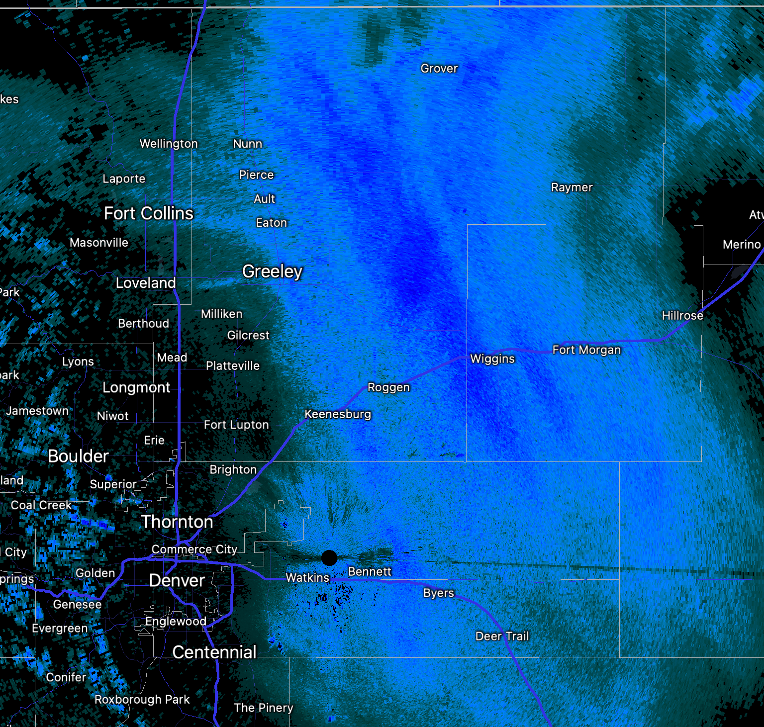
This morning, we see some of the heaviest snow from this system focused across the plains of Colorado northeast of Denver.
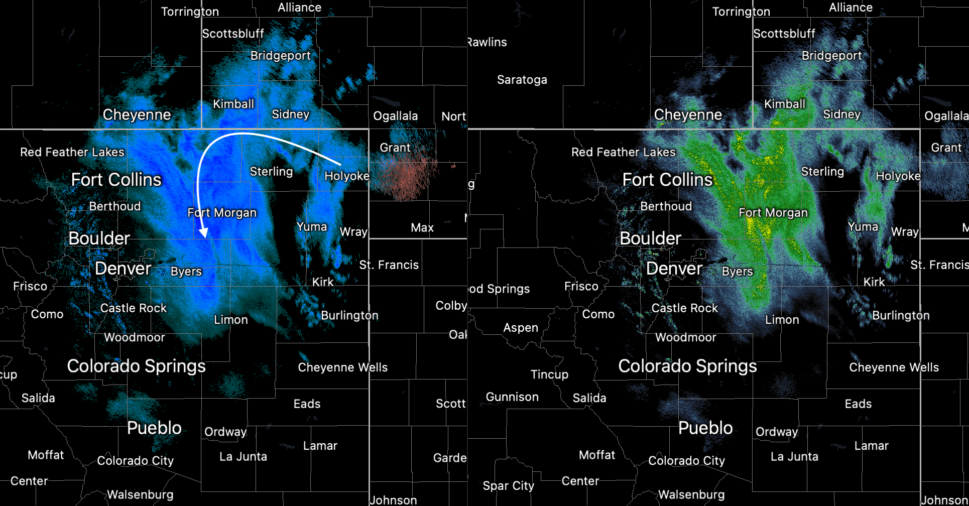
And zoomed a bit closer to the urban corridor, not the rather dramatic cutoff from heavy snow east of I-25 to just pocked of light snow along the interstate. This should largely remain the case through the morning hours.
Given the above, it won't come as a shock that I-76 is closed this morning, from Fort Morgan to the state line. Here we can expect snow accumulations of 5 - 10" (though it'll be quite hard to measure) and winds gusting as high as 60 mph through the afternoon. The Blizzard Warning is set to expire at midnight tonight.
While some of the metro areas did see some snow overnight, and in some areas enough to make for a slick commute this morning, what additional snow we do see this morning isn't expected to amount to much as the system continues to pull east/northeast of our area. Most of the metro area can expect less than an inch of additional accumulation today.
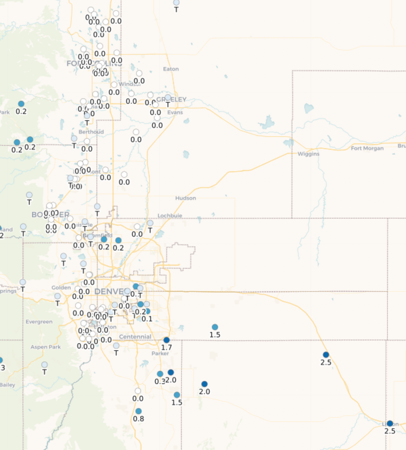
A look at initial CoCoRaHS reports from this morning, shows the urban corridor coming in right as expected, most areas reporting little to no snow, with a few 1 - 3" reports south and southeast of Denver:
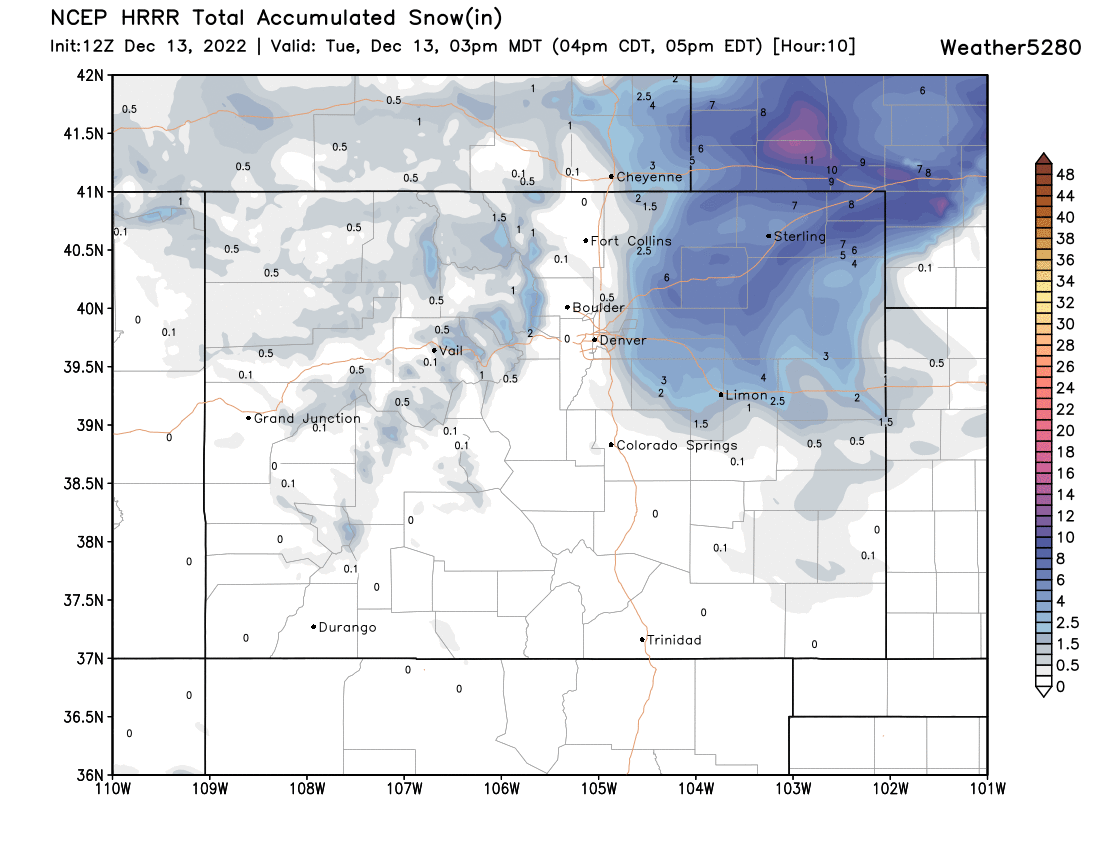
The latest HRRR model likely has a good idea of what to expect through mid afternoon, with those folks living along and east of I-25 seeing the best chance at picking up some additional snowfall through the morning, but the bulk of accumulating snow today ending up well northeast of the metro area. Again, with interstates now closing this morning, we don't expect travel conditions to improve across the plains until late tonight/Wednesday, so if your travel plans take you northeast of Denver – best to sit tight today and wait.
As for the hourly planner, again, what snow we are seeing around the metro area this morning is not likely to amount to much outside of a rogue band or two. Instead, look for snow chances to gradually diminish through the morning, and for us to be left with some wind and cold weather for the remainder of your Tuesday.
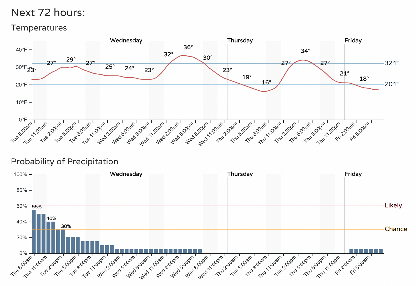
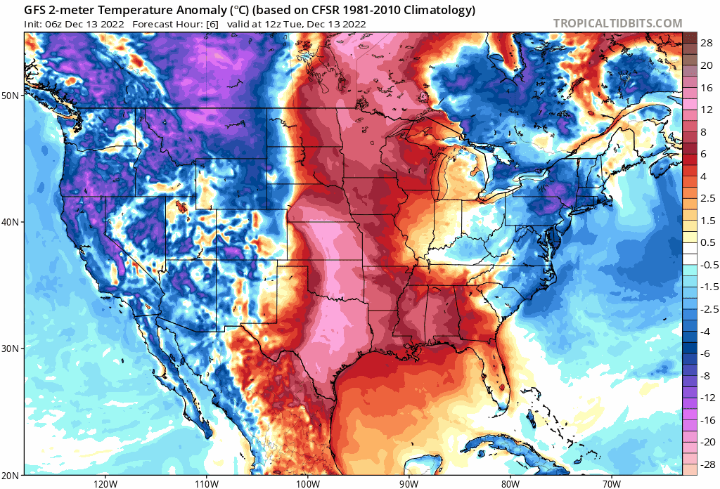
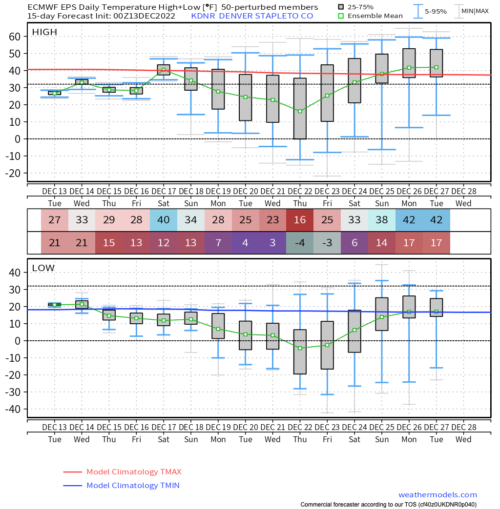
Speaking of cold weather, the arrival of this system marks the start over rather chilly weather pattern for our area from now through Christmas. Highs in the 20s and 30s are likely through the remainder of this week, with perhaps a milder afternoon Saturday, before more cold arrives next week. It's worth noting that some operational models show a push of very cold air arriving in the days just before Christmas, with even hints of this in the European ensemble mean (below), which has a high of just 16F in Denver on the 22nd. We shall see!
Details aside, it's hard to find much warmth in the upcoming pattern. I'll leave you with this animation from the GFS through December 27th, showing our mild air from yesterday being pushed east today, followed by a prolonged period of blues and purples push south out of western Canada before perhaps finally breaking after Christmas.