
Colorado weather: More snow in the forecast across the state as we head into the weekend

Areas near Denver and Colorado Springs are in line for a possible snow event this weekend, as are many of us across Colorado.
A bit of a messy forecast in store as we head toward the end of the work week and into the weekend. As we discussed with our Insiders yesterday, the next system to swing through could lend our best chance for snow along much of the urban corridor as we've seen all month, but there remain some pretty big obstacles to overcome for that to happen.
Before we get into the outlook, a quick look at snowfall over the last seven days across the state. And goodness, what a seven days it's been for parts of the high country! Also a few nice totals up across northern Colorado from yesterday's snow band, but a notable lack across the Denver area and southeast:
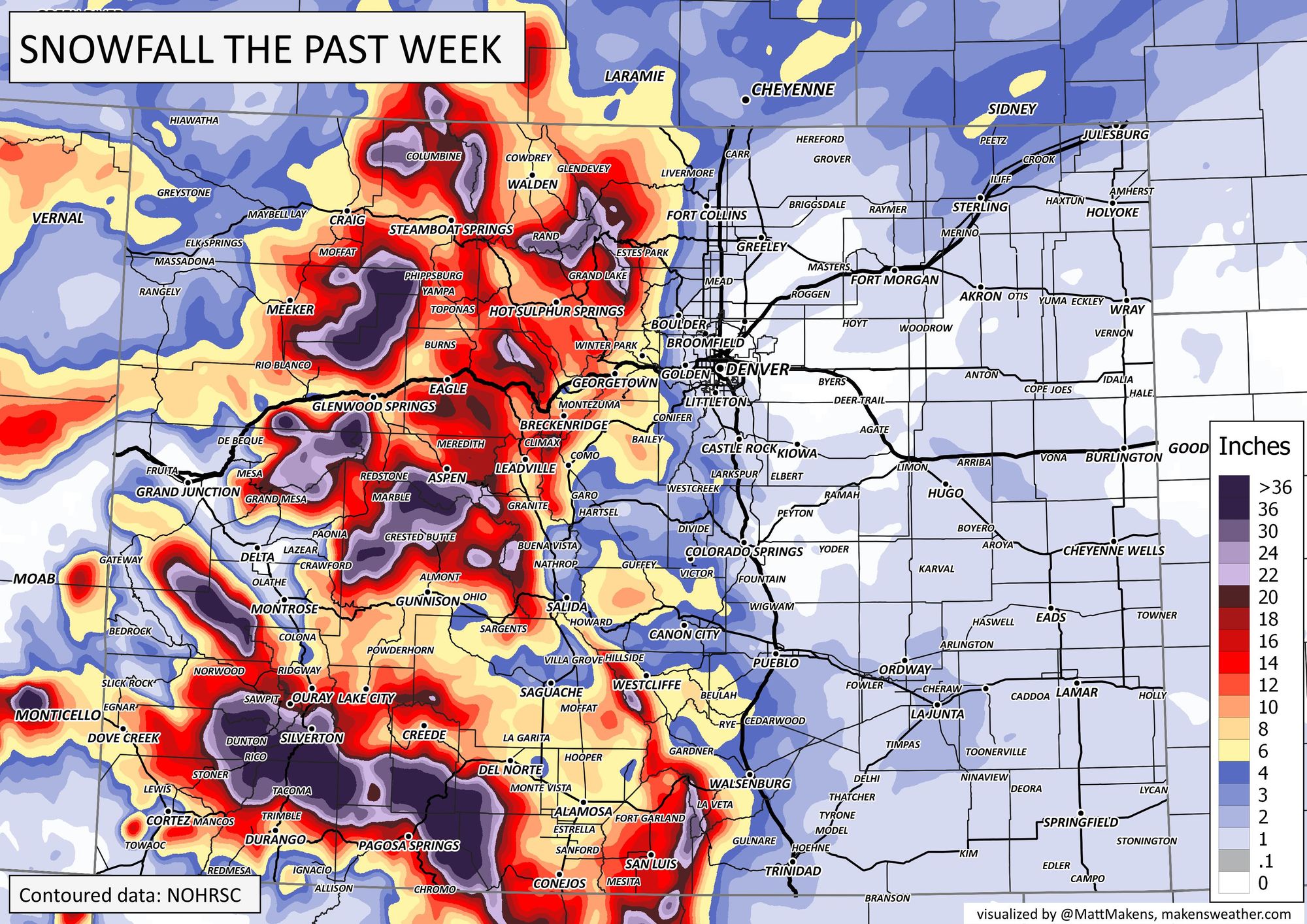
Wolf Creek ski resort is boasting 68" over the last seven days, with a midway snow depth of 178" and more than 450" of snow so far on the season. Just absolutely fantastic news for a part of the state that has really struggled in recent years to put together a good snow season.
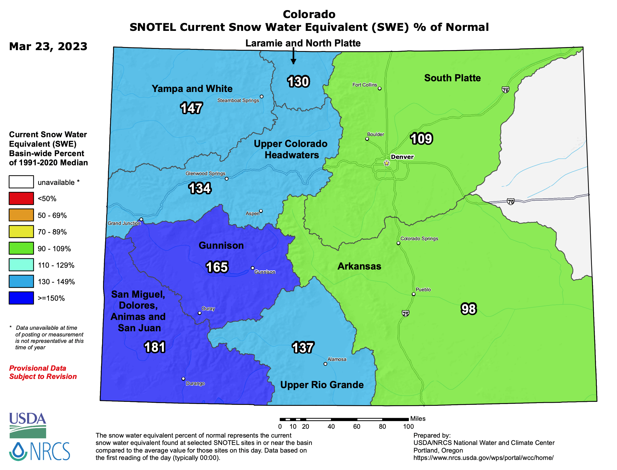
No surprise that all this snowfall means snowpack is running well above average across the state. Across the San Juans we see snowpack as of today sitting at 181% of median, with even a tick-up for eastern Colorado basins since our last update.
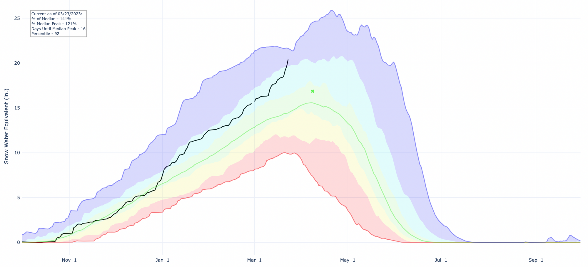
With statewide snowpack sitting at 141% of median, this puts our current snowpack in the upper percentile for SWE for this time of year (black line is current year):
We'll see more rain and snow across the state Friday and Saturday, with some more appreciable snow for much of the high country over the next couple of days.
While no winter weather highlights are currently in effect for the state, that could very well change as we go through the day, especially for the northern and central mountains that could see upwards of 10" of additional snow between two waves of moisture set to move in – first Friday, then Friday night into Saturday.
As for how much rain and snow we see across the plains... well, that remains very hard to pin down. We see a window for snow, mainly late Friday night into Saturday, and during that window we could see a couple inches stack up. It won't be for everyone, and uncertainty is high, but looks increasingly like someone will see a period of snow from Friday night's/Saturday's system.
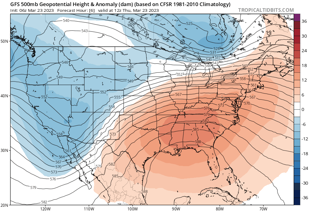
Watching a loop of the 500mb pattern over the next few days shows why there's so much uncertainty. Quick-moving waves of energy moving through, generally all weakening as they do, and just a real lack of notable organization. Instead, chilly, damp, and perhaps sporadically snowy.
Best guess for where the most meaningful snow will setup Friday night/Saturday morning for eastern Colorado looks like it may be just east/southeast of the Denver area, along the Palmer and extending east along the I-70 corridor into Kansas. That's not to say Denver/Loveland/Fort Collins won't see any snow, but the best potential for 3" of snow or more at this time appears to be south and east of these cities. Let's see if that idea changes today.
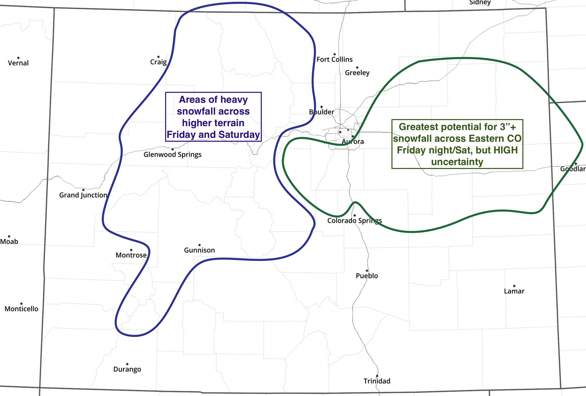
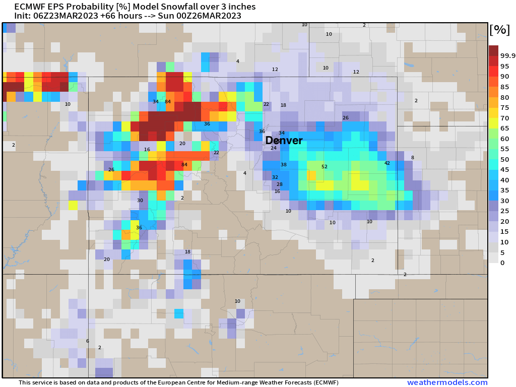
A quick look at the European probabilities confirms this idea, and suggests we might even be too far north/northwest with the outline above.
If you live in Denver, Castle Rock, Colorado Springs, Elizabeth, and points east/southeast... you'll want to really track the forecast over the next couple of days. If you live further north, not a bad idea to as well, but probabilities for impactful snow there is lower.
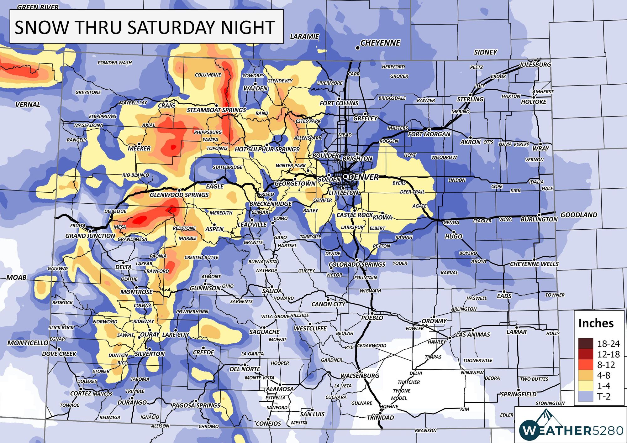
And finally, some rough numbers to give you a better idea of what we are tracking, it's likely this map will be tweaked a bit as we head into Friday.
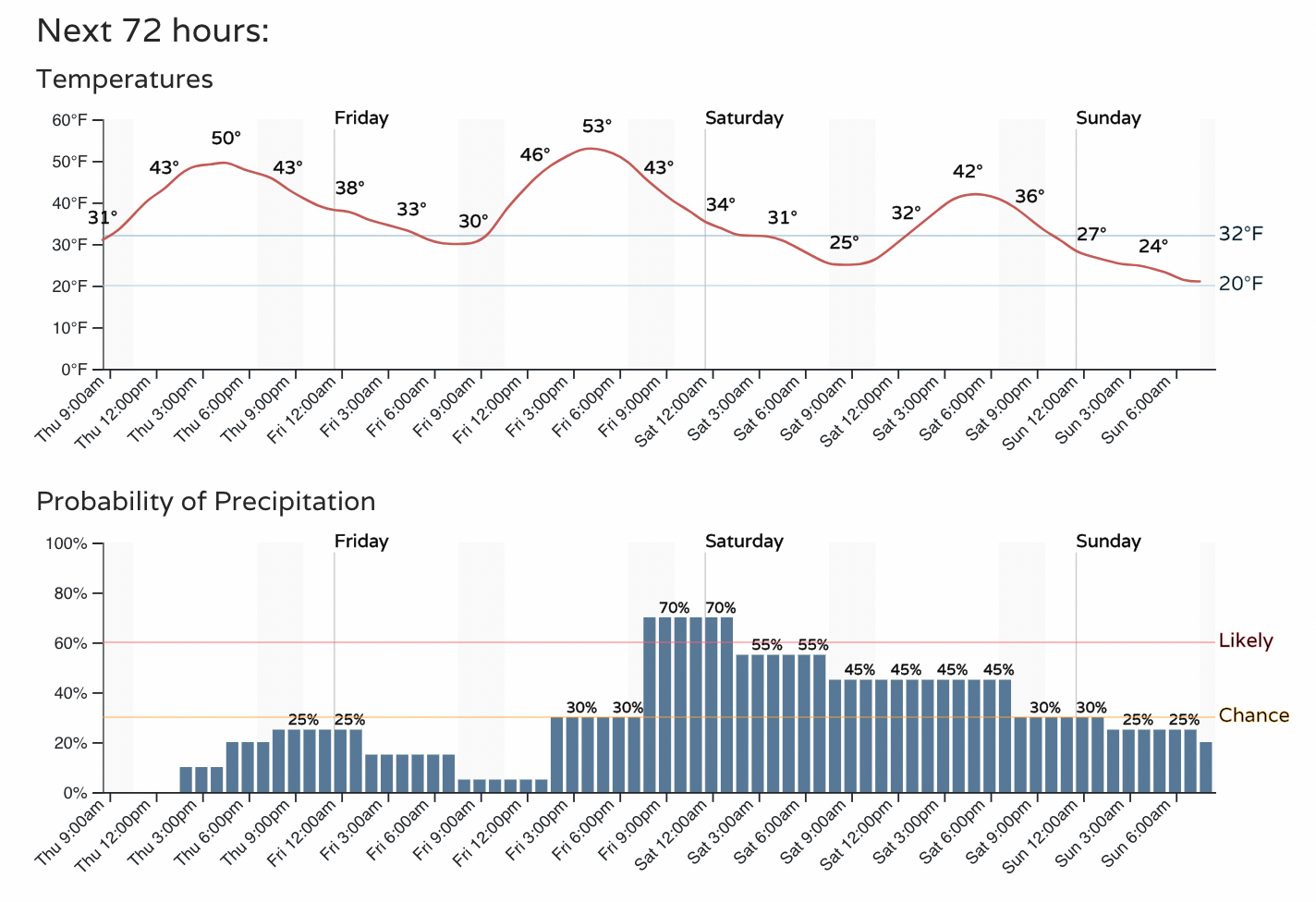
As for the timeline for the greater Denver area... Look for some rain and snow showers as early as this evening, but the main chance for wet weather arrives tomorrow evening and Saturday (first as rain, then as snow). IF Denver is going to see accumulating snow, it looks like the window for that will come Friday night into Saturday morning.
As we like to say here at Weather5280, "Don't get left out in the cold," – subscribe to our email list today – we send you an email when there's important information and Colorado forecasts to deliver.