Fires break out Thursday with high fire danger to continue

Fire danger remains critically high today and Saturday for parts of Colorado in similar conditions that allowed dangerous fires to spread Thursday.
You may have noted the views of smoke, or even smelled it as my kids did leaving school yesterday, but fires in Park, Teller, and El Paso Counties spread in the strong wind and dry tinder.
DFPC assisted across the state with several wildland fires:#403Fire-Park County (DFPC will be assuming responsibility for the fire at midnight tonight)#125Fire (aka #SimlaFire)-El Paso County
— Colorado Division of Fire Prevention and Control (@COStateFire) March 31, 2023
La Junta Fire-Otero County
Multiple Alamosa calls
Full details on Facebook! pic.twitter.com/239dtmw4ts
Radar picking up smoke from a big grassfire near Simla. Southwest wind 30-45 mph will keep the fire fight dangerous #cowx #cofire pic.twitter.com/vc50CqClbN
— Brian Bledsoe (@BrianBledsoe) March 30, 2023
Elizbeth Fire reports the Fire South of Simla is 90 % contained. pic.twitter.com/zNfjMyIY1R
— Elbert County OEM (@ElbertCountyOEM) March 31, 2023
The gusty wind and low humidity of yesterday will continue for parts of Colorado today and tomorrow.
Here's the current alert map highlighting the counties with the most critical conditions.
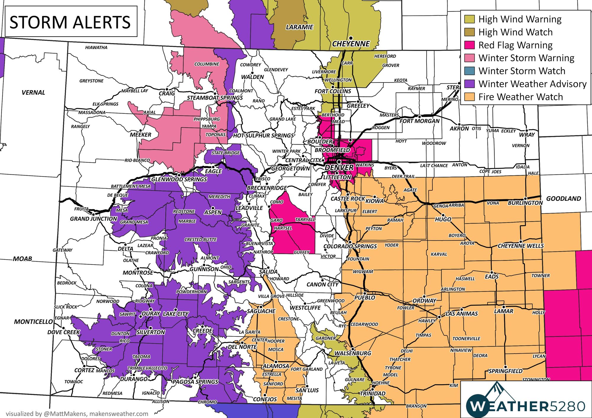
For Denver, the city and metro area is in a Red Flag Warning:
* Affected Area...Fire Weather Zones 214, 239 and 240.
* Timing...Noon to 7 PM
* Winds...West 25 to 35 mph with gusts up to 60 mph.
* Relative Humidity...As low as 15 percent.
* Impacts...Conditions will be favorable for rapid fire spread. Avoid outdoor burning and any activities that may produce sparks.
-NWS BOULDER
There's a lot going on with the alerts, so let's break it down into some zones. Those north of Denver, from Loveland and Fort Collins to Wyoming are in a high wind warning for wind gusts upwards and stronger than 60 mph.
Critical fire weather conditions due to gusty wind and low humidity spread from the south Denver metro and cover all of the southeastern quarter of the state plus within the San Luis Valley.
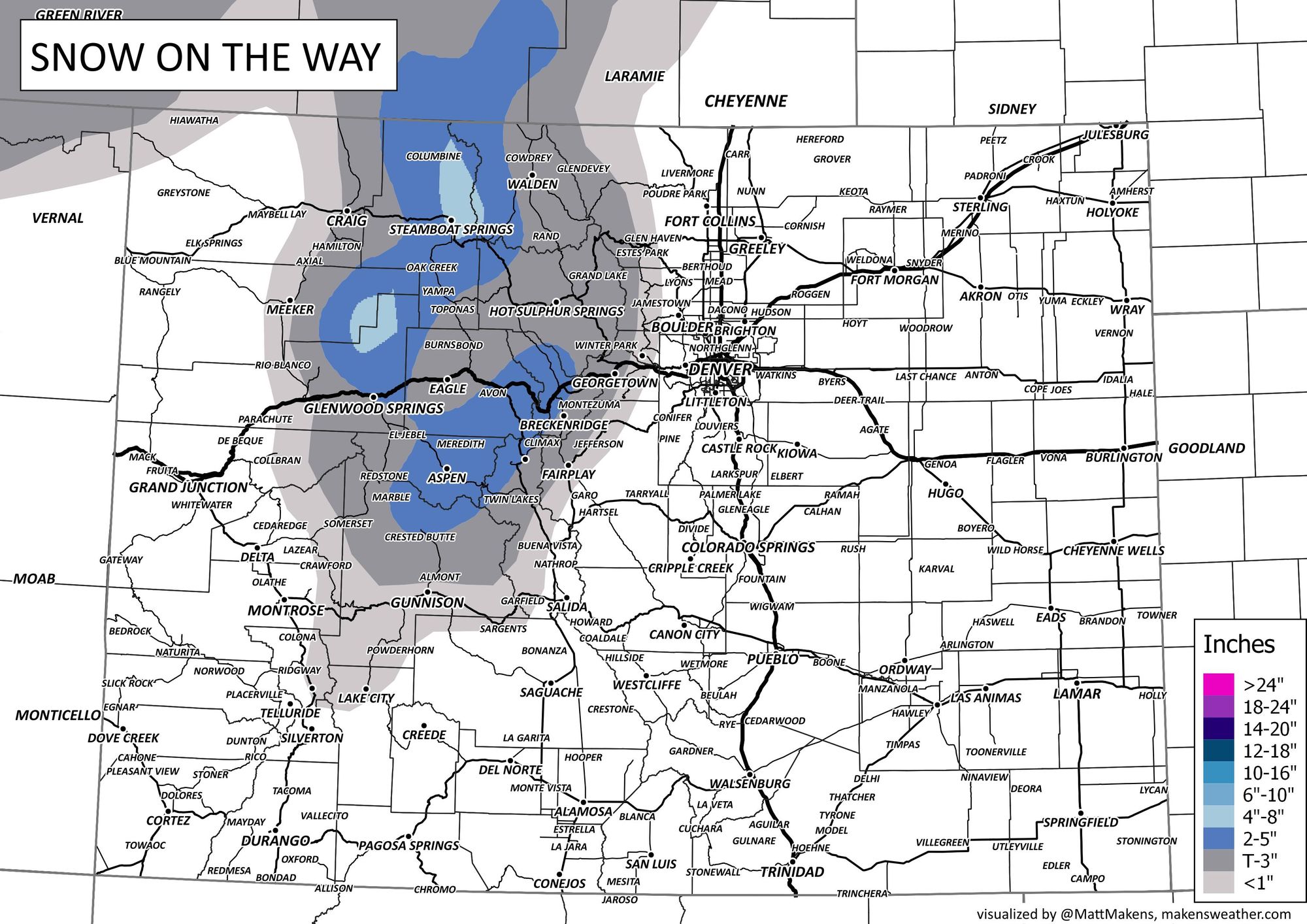
We could use moisture in the east, obviously, but that's pretty much going to be trapped in the high country and west; through this evening, snow showers across the mountains will blow through with strong wind - expect winter driving conditions on the passes.
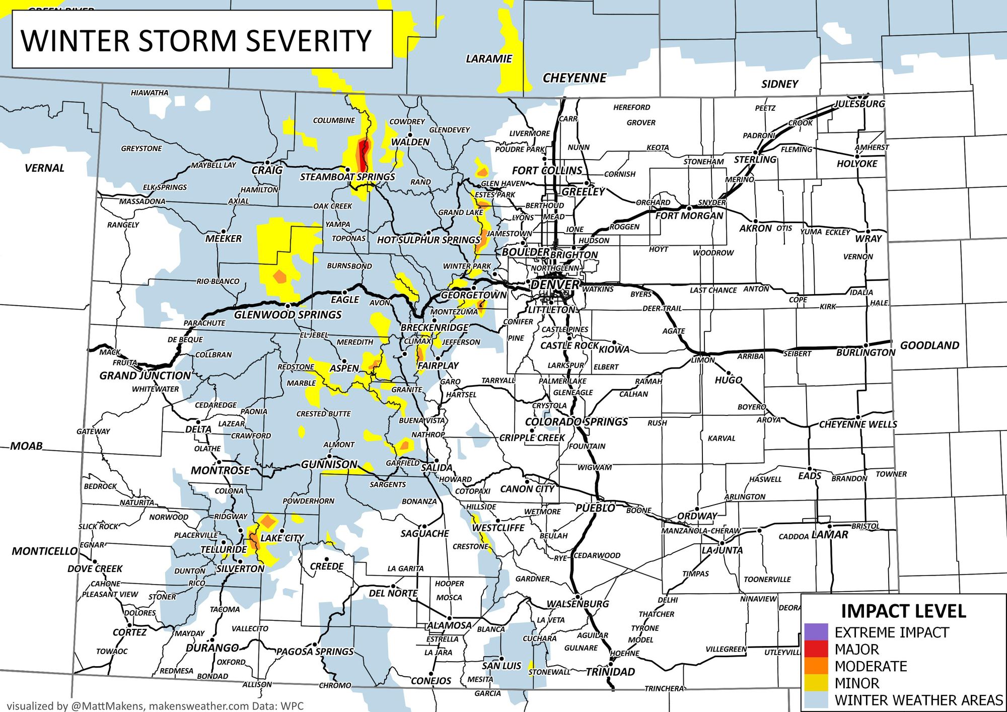
Snowfall totals warrant the alerts and a warning to drivers.
Don't think that wind is just for today. Winds will gust to 70 mph and stronger Saturday, especially strong in the mountains. Fire danger will continue for both Saturday and Sunday from Castle Rock to Burlington (east into Kansas, too) and south to New Mexico and Oklahoma.
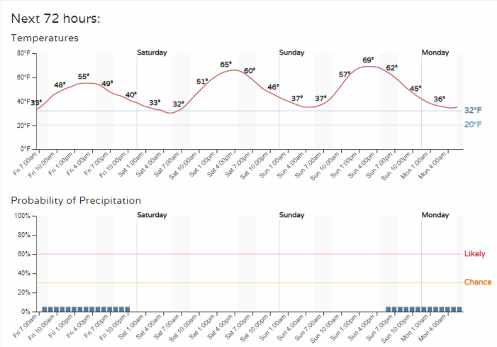
The weekend planner for Denver is broken down hourly in terms of temperatures and precipitation chances but little shower activity is expected as mentioned previously.
The next best chance for some moisture for the plains is early to mid next week, although that system does not look to give us all a "drink." So, sadly, the wind and fire danger will take away from an otherwise warm early spring weekend for the metro areas before we cool down with that next chance of moisture coming next week.
Speaking of moisture, it's been an epic snow season across much of the Western U.S., this is just a tiny dent in the water supply issues for the Colorado River system, however. More on that here: