Colorado weather: Strong winds, high fire danger, and another winter storm moving into the state

A rather turbulent, and deadly, weather pattern across across the United States persists as we kick off a new week on Monday.
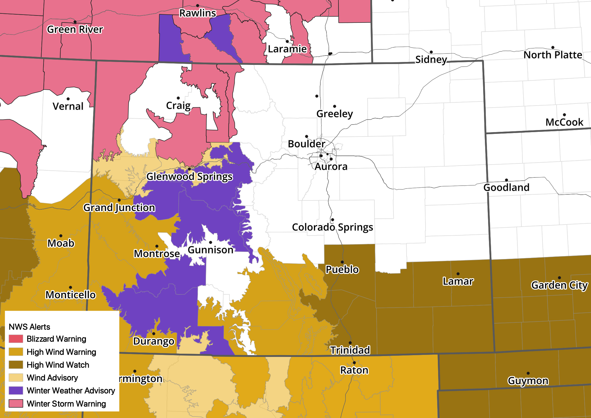
Our next weather-maker will begin bringing an increased chance of snow to the high country tonight, with Winter Storm Warnings and Advisories in effect for Monday and Monday night for much of Western Colorado.
The storm will eject northeast during the day Tuesday, during which point the Front Range will see its best chance of rain and snow (albeit perhaps not a great chance), and move into the midwest Tuesday night and Wednesday.
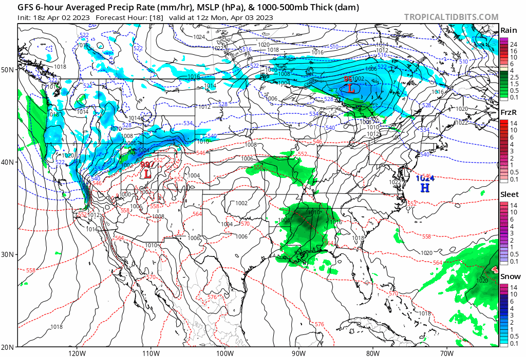
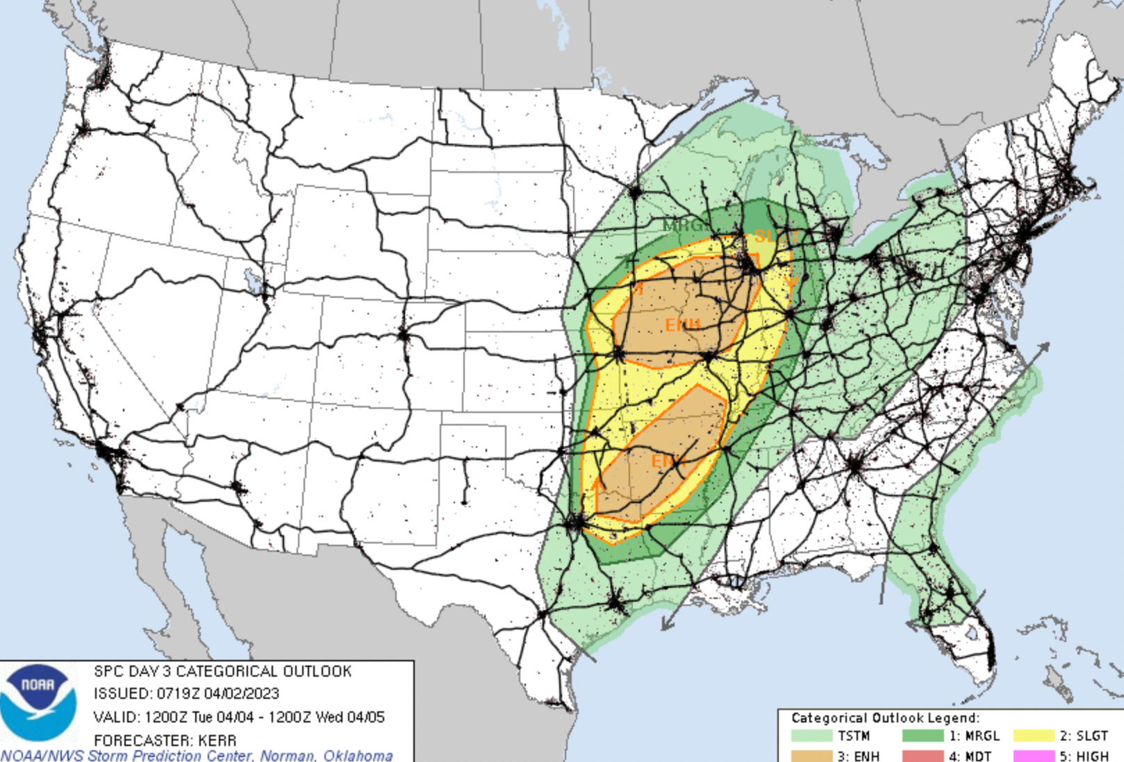
After another active severe weather threat tonight across Texas, we'll see a brief lull in the activity Monday before our system gets east of the hills Tuesday and brings an Enhanced threat of damaging storms from northeast Texas north through Chicago.
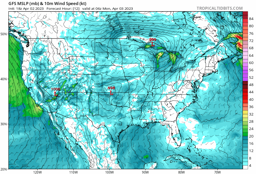
While the front half of the incoming system will produce strong storms and heavy rains across much of the country's midsection, on the backside we'll see a heavy late-season snow and wind event. Winter Storm Warnings are in effect from the northern Colorado/Utah mountains, through Wyoming and into Nebraska and South Dakota, with even some Blizzard Warnings being issued ahead of Monday night/Tuesday's snow across the Dakotas.
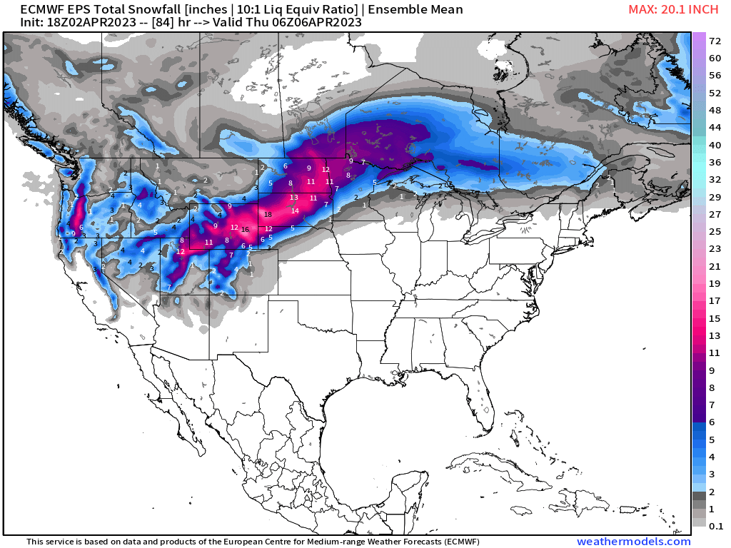
Impressive snowfall totals forecast here from the European ensemble mean model with this upcoming storm, with the Blizzard Warning in place from the NWS calling for 1 - 2 feet of snow across Western South Dakota, and winds to 65 mph!
A look at current highlights across Colorado shows little surprise for the Denver area as it looks like we'll largely (though perhaps not completely) miss on yet another system. The favored storm track will equate to more wind than anything else around here, but some rain and snow will be possible by Monday night along the urban corridor.

For Southern Colorado, a lot of wind related alerts in place, with gusts upwards of 60 mph at times over the next couple of days.
An animation of winds from the GFS through Wednesday shows the worst winds will be across the Four Corners and New Mexico Monday and Tuesday, but Colorado will have its fair share of wind to contend with as well, particularly southern Colorado and across parts of the Palmer on Monday and Tuesday.
While a blizzard isn't looking likely for the Denver area, plenty of wind and a big change to our temperatures certainly looks like it's in the cards.
The planner shows a mild afternoon Monday before rain and snow chances increase Monday night into Tuesday for the metro area – with about a 60% chance we'll see some wet weather around here on Tuesday, and daytime highs only in the low to mid 30s for most of us.
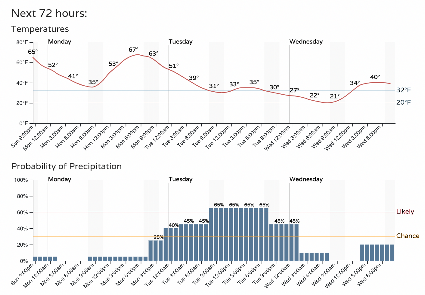
As for how much snow we'll manage with this event? We'll give it another night before putting out any final numbers, but for the most part it doesn't look like a huge snow event for any of us.
The Front Range foothills will see some potential for several inches, as well as the Western Palmer between Denver and Colorado Springs. A few high resolution models are hinting at pockets of heaver snow delivering isolated higher totals across the easter/central plains, but we'll see if that comes to fruition. For Denver/Erie/Loveland it's probably a Trace to 3" event, with a slight bit more upside for Boulder and Fort Collins.
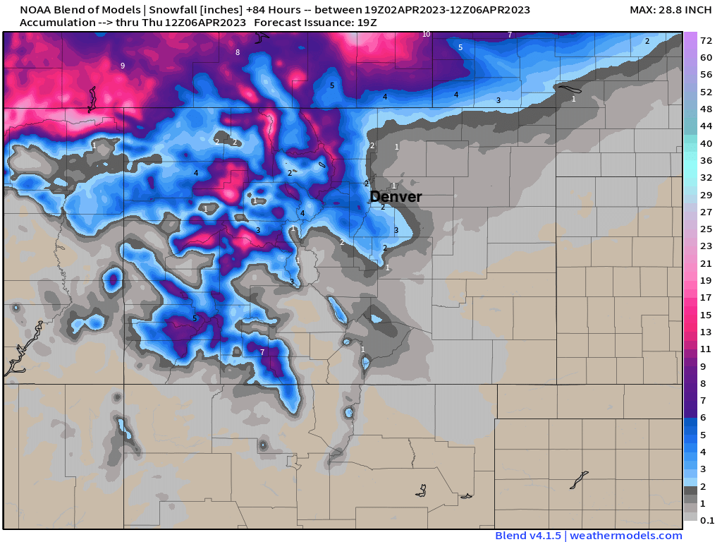
A blend of models likely gives a good idea of what to expect from this system, with a bit of wiggle room in the details to come. These totals are through Wednesday.
We'll touch base with you tomorrow and give an update on how things are shaking out. For now plan on snow ramping up in the high country late tonight and Monday, with lots of wind across the state over the next couple of days as well. Again, for the Front Range, the best window for precipitation will come Monday night through Tuesday.