The State of the Atmosphere: Sunday, May 28th, 2023

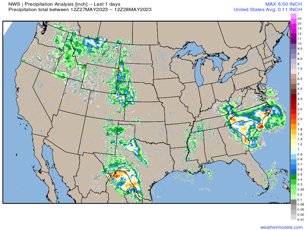
Yesterday was another big day for storms along the lee side of the Rockies, with severe weather from the Mexico to Canadian border on Saturday, and some big-time rain makers to boot.
Precipitation totals over the last 24 hours shows the pattern continuing to favor areas along and adjacent to the Rockies as we've seen over the last week:
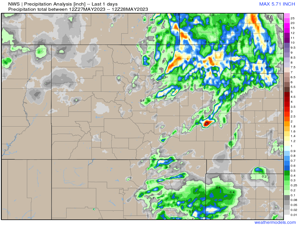
Zoomed in on Colorado we see it was an active weather day for the Northeast Plains, with an isolated (strong!) storm down over Bent/Kiowa counties.
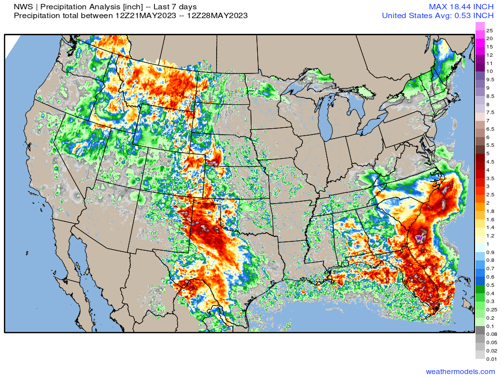
Precipitation totals over the last week show great moisture over large swaths of Eastern Colorado, with the same holding true for much of our region from north to south:
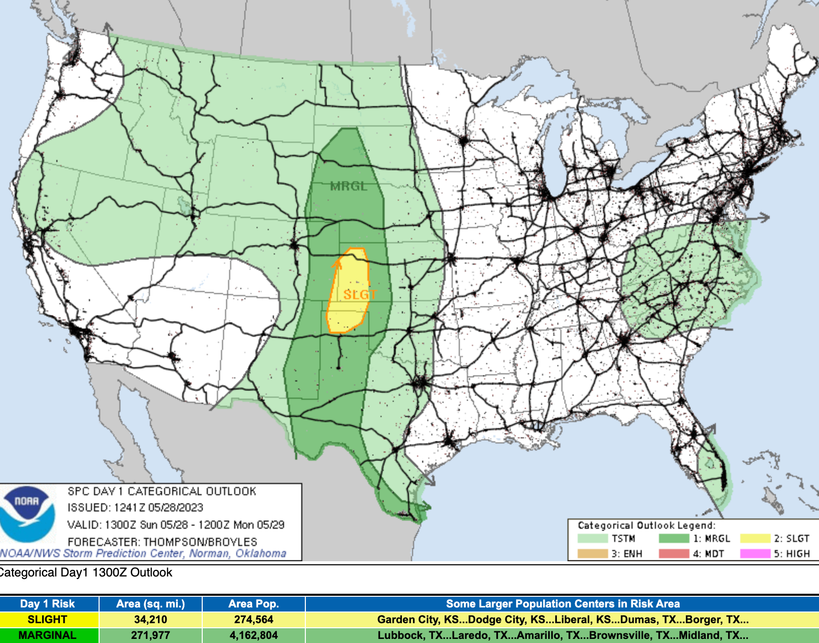
Not much change in that overall pattern today. We'll see a chance of storms up and down the Rockies, with a Marginal to Slight Risk for severe storms across the central high plains this afternoon. The severe threat is a bit lower for Eastern Colorado today, but by no means zero – so if your plans take you outside today, please stay weather aware.
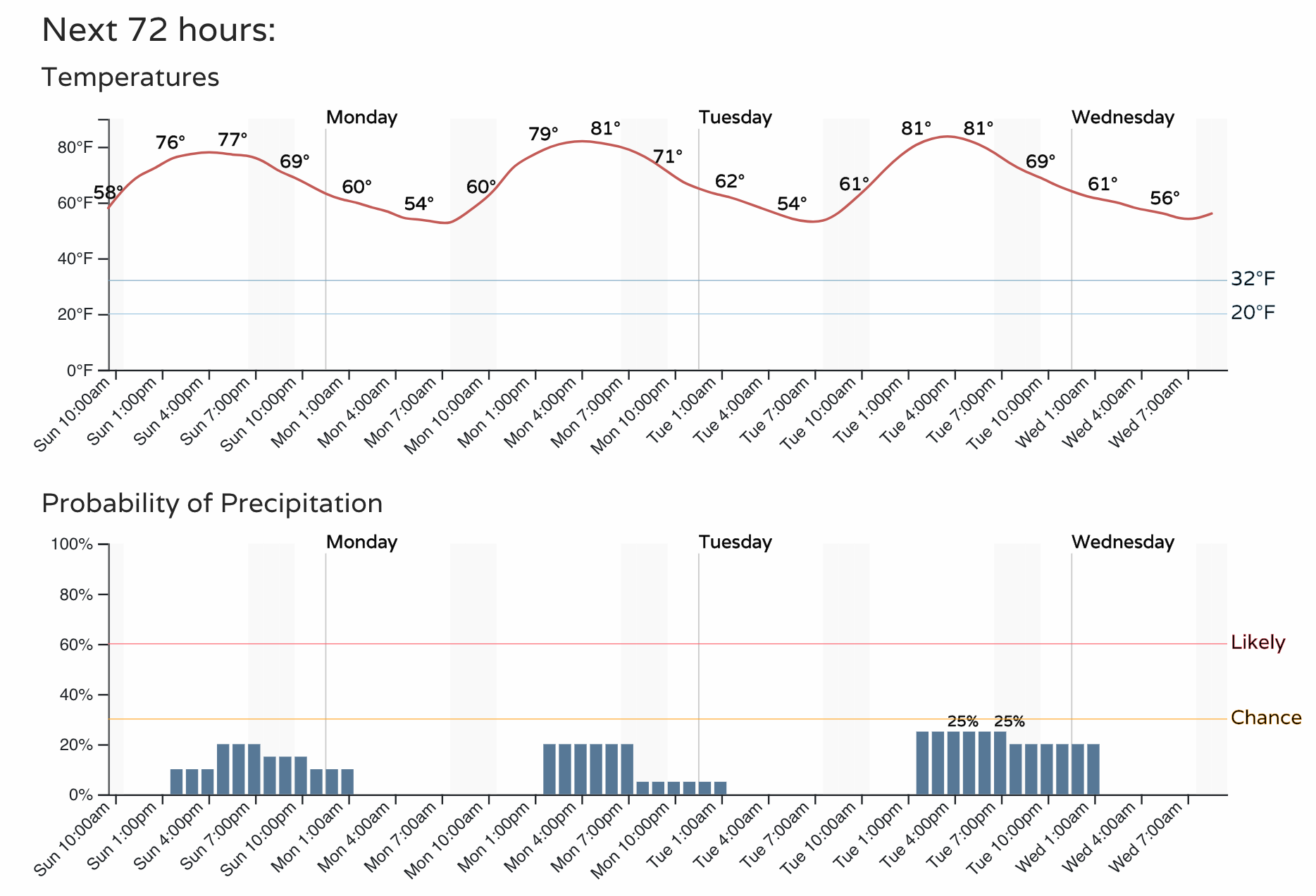
Storm chances too will be a bit lower today, particularly along and west of I-25. For the Denver area, just a slight chance of afternoon storms and highs in the upper 70s this afternoon, warming into the low 80s for your Monday with similar storm chances.
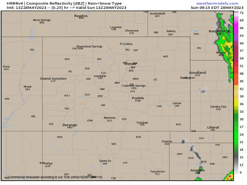
A look at the latest HRRR model for the forecast today shows a generally quieter day for our area today as compared to recent days (particularly along the urban corridor), but regionally expect a few strong storms to develop once more before quieting tonight.
The week ahead
For Denver today marks the start of a couple of days with relatively quieter weather (though again, do not rule out an isolated storm or two changing that for your specific back yard).
Data indicates as the week progresses we could see storm coverage increase once more, however, with some models showing some pretty wet weather across the region by Friday and into next week. A ways out still.
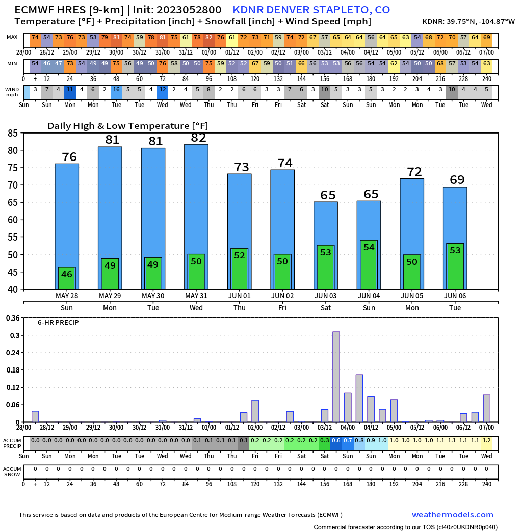
For its part, the European model shows highs in the low 80s for Denver through Wednesday, before a cooler and more unsettle pattern arrives for the latter part of the week and next weekend:
It's not just the Euro showing this idea either, with a bias toward wetter weather showing up in our probability charts later in the period as well, after lower odds for appreciable precipitation over the next couple of days.
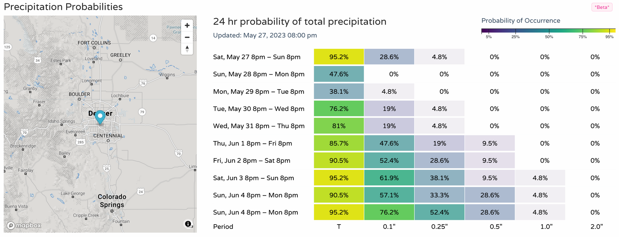
Through Friday evening the European ensemble model shows near-average precipitation for the urban corridor (I'll take it) with the focus of the wettest anomalies to our east, over Western Kansas, the OK/TX panhandles, and into the northern western high plains. All great news for the ongoing drought, frankly.
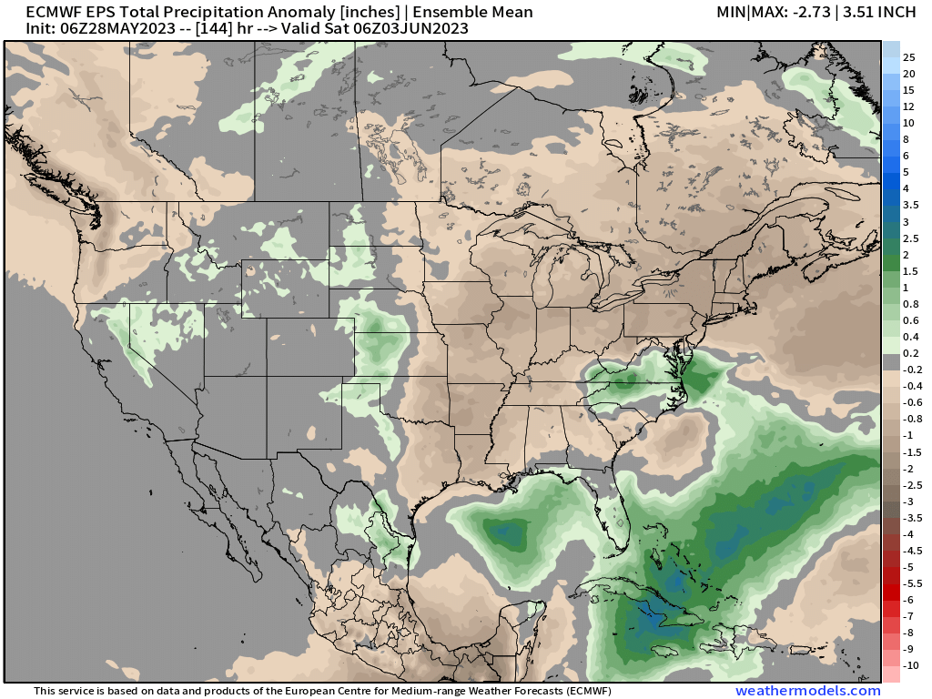
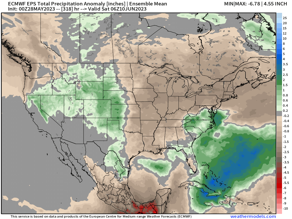
If we extend this map through the following Friday we see the wet signal for grows to cover much more of the region, which could mean we are in for a stormy at times start to June should this idea hold.

Enjoy the weather this Memorial Day, and as always keep an eye to the sky and stay safe!