
Colorado weather: Drying out, watching fire danger, next round of thunderstorms

Denver and the Front Range have had a few drier days, and warm ones too. Meanwhile, dryness has continued in the mountains and west, which is where we will see fire dangers spread. The next best chance of rain arrives Thursday.
Let's begin with daily rain chances for the next several days in Denver (you can find these probabilities for all of Colorado here):
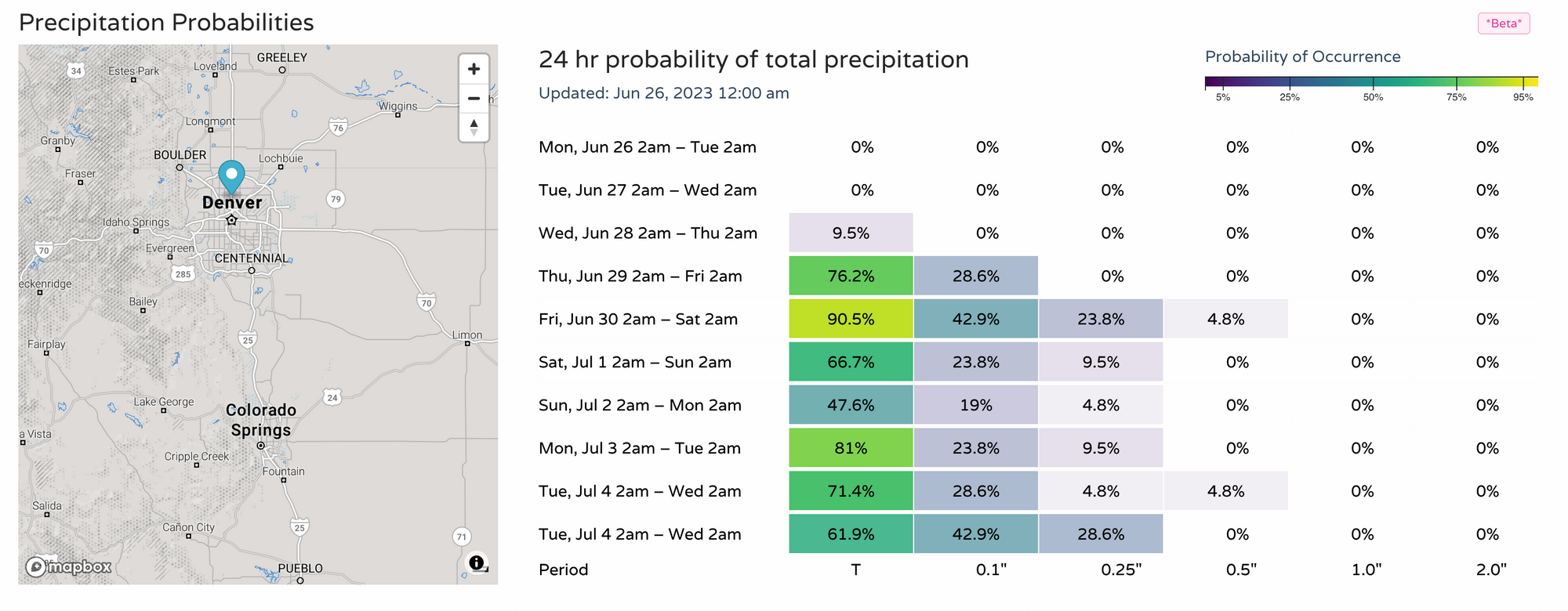
You'll see the bump in chances Thursday and beyond, but these remain well below those chances we've seen the past several weeks.
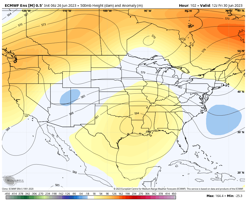
The persistent ridge (high pressure area, summertime = hot and dry) that has been centered over Texas will remain, although over Colorado there will be a slight weakening to allow some unsettled weather to return. Given the strength of the ridge, I'd anticipate most of the activity to be across Western and Northwestern Colorado.
In the short-term, isolated strong to severe thunderstorms will remain over Northeastern Colorado. Although there could be a storm in Denver early this week, the chance is clearly low. This, along with hotter temperatures.
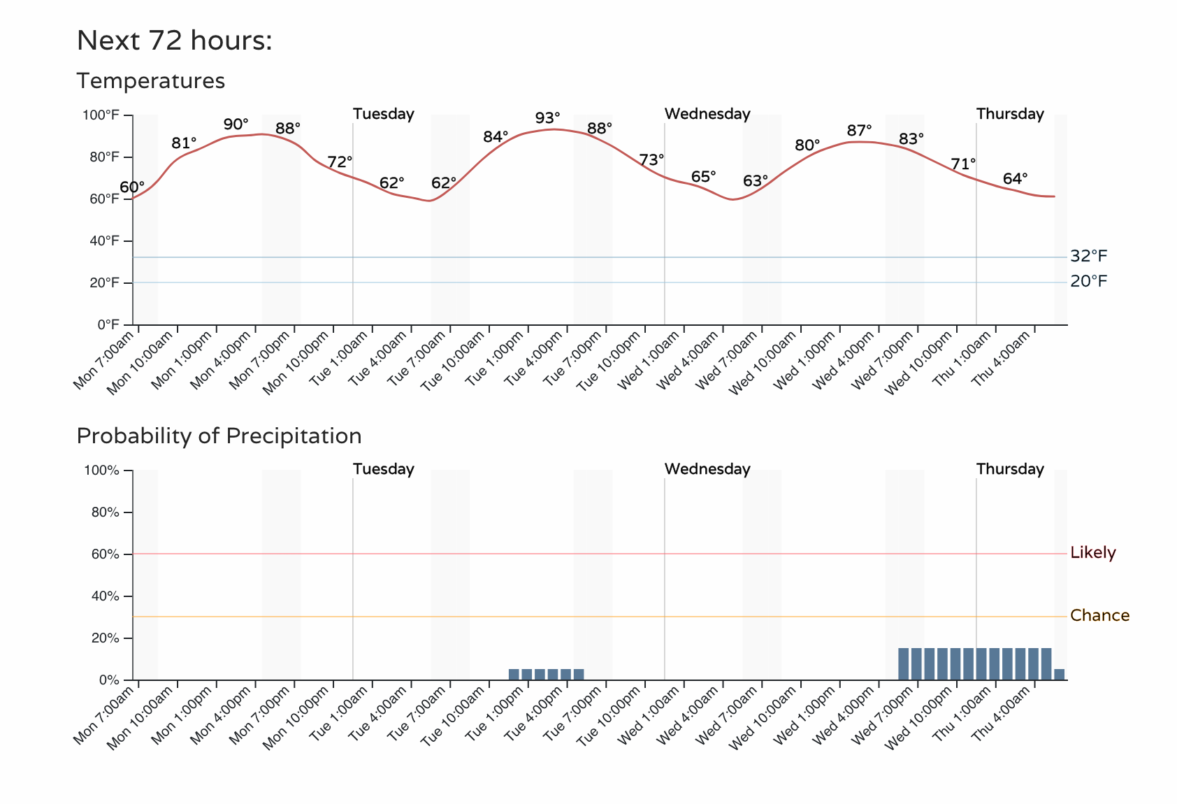
The last time Denver has hit the 90s was September 20th, 2022. So, clearly the hottest we have been so far this year. Temperatures are not record setting (low 100s) but are two to six degrees warmer than average through Wednesday.
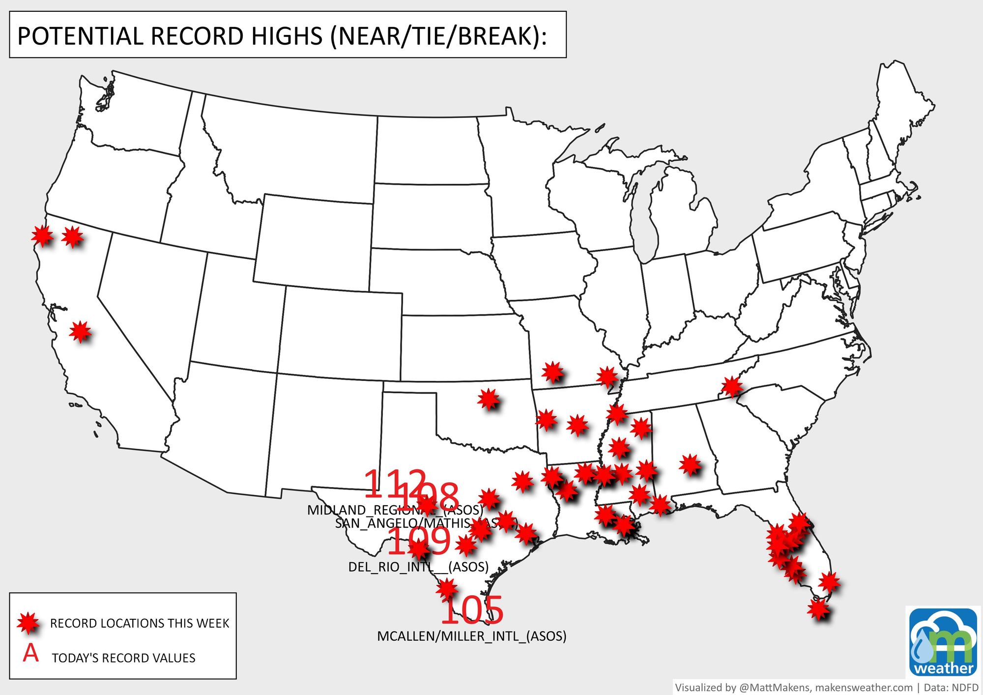
Sure beats the 105-112 degree record highs that will be set in Texas today underneath that ridge we discussed. The week's potential record-setting heat locations are shown here:
Now, looking far ahead, the ridging does weaken toward the July 4th weekend which may allow temperatures to drop and rain chances to increase. Let's take a look at Colorado Springs this time for the long-term temperature trend.
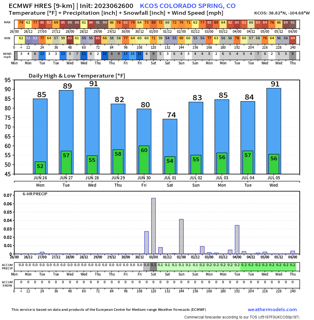
However cooler for a moment, a strong ridge looks to setup into July and that'll mean hot, mostly dry days, and increasing fire danger.
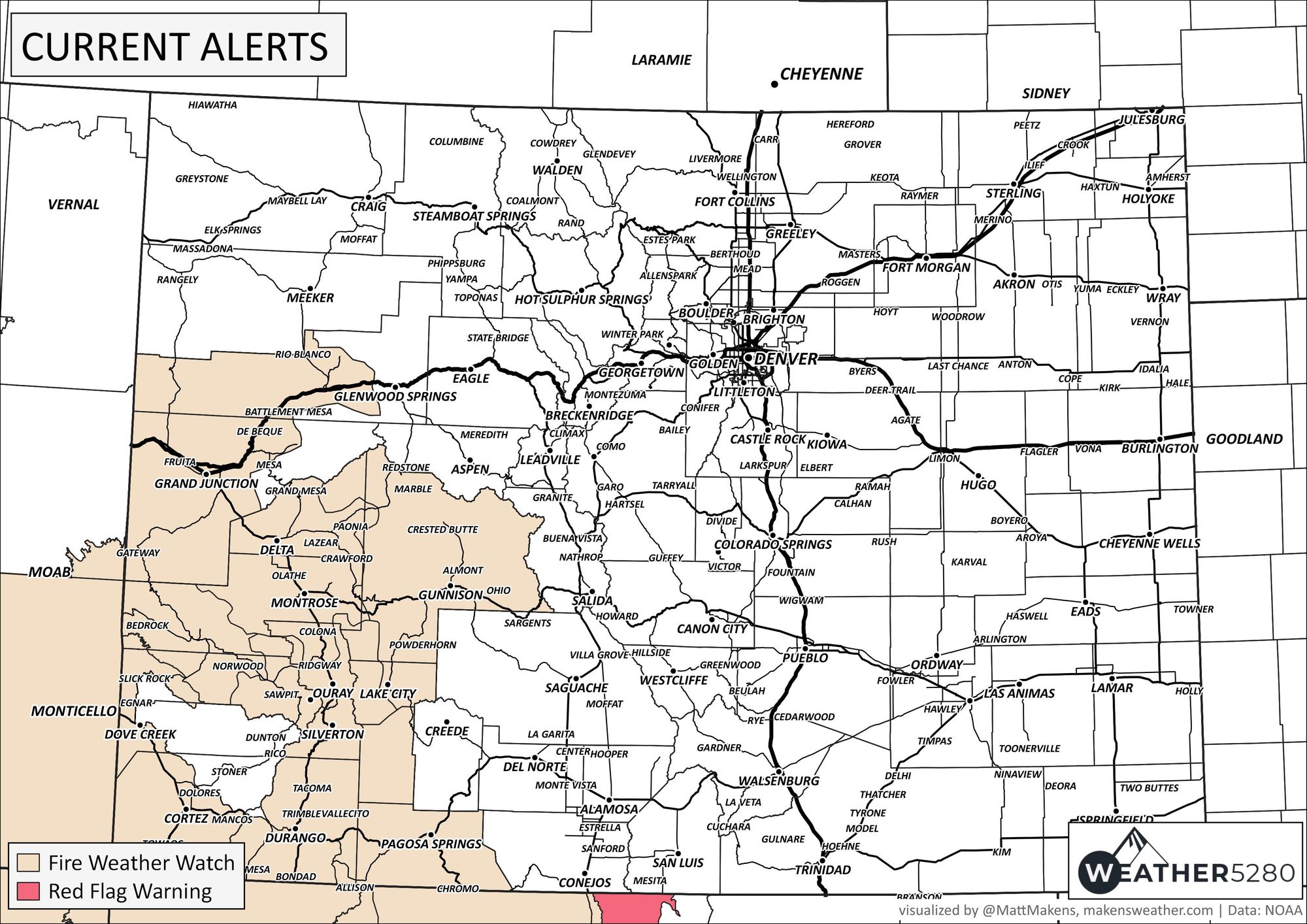
For today, the highest fire danger is over the Western Slope and San Juans.
We fear that although the spring moisture was awesome, it also created a lot of growth that will dry out quickly across the region and we could face a significant fire season if the monsoon indeed fails to deliver.
We classically dry out a bit this time of the year anyway, but need the monsoon to kick in to deliver moisture in late July through August to keep fires at bay. We discussed concerns with the monsoon for some time with our members, most recently here:
Stay tuned, stay weather aware, and stay cool!