Denver Weather: Tornado risk today covers city and Front Range

There's a risk of damaging thunderstorms today, July 4th, including the highest risk of tornadoes in the country will be along the Front Range and Plains, including Denver, Fort Collins, and Cheyenne. The threat for storms continues throughout the day in several 'waves' of storms that may try to move through.
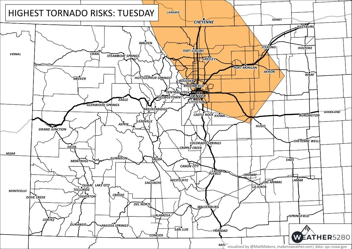
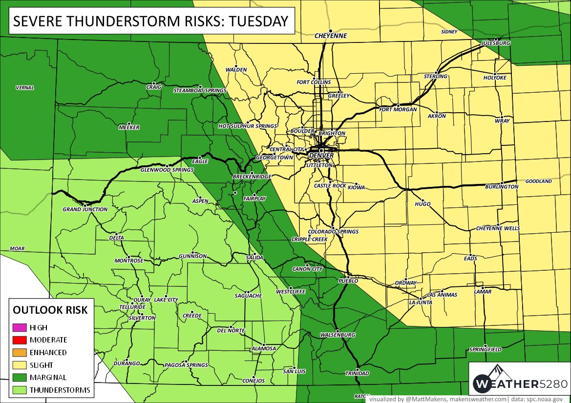
The above image is the environment where tornadoes are most likely to form, but other areas carry a lower threat, not a zero threat. Look at the overall threat of damaging thunderstorms, and you'll see a broader area covered. This includes not only tornadoes but large hail and wind over 60 mph.

That's quite a swatch of slight risk over the state. It is safe to say many/most of us will see a thunderstorm today - whether or not one hits us directly. Across Colorado there is quite a high chance for thunderstorms - albeit the strength of storms is likely lower for those in the mountains as was shown in the above damaging potential threat levels.
Let's go through a time-series forecast of where the storms will be.
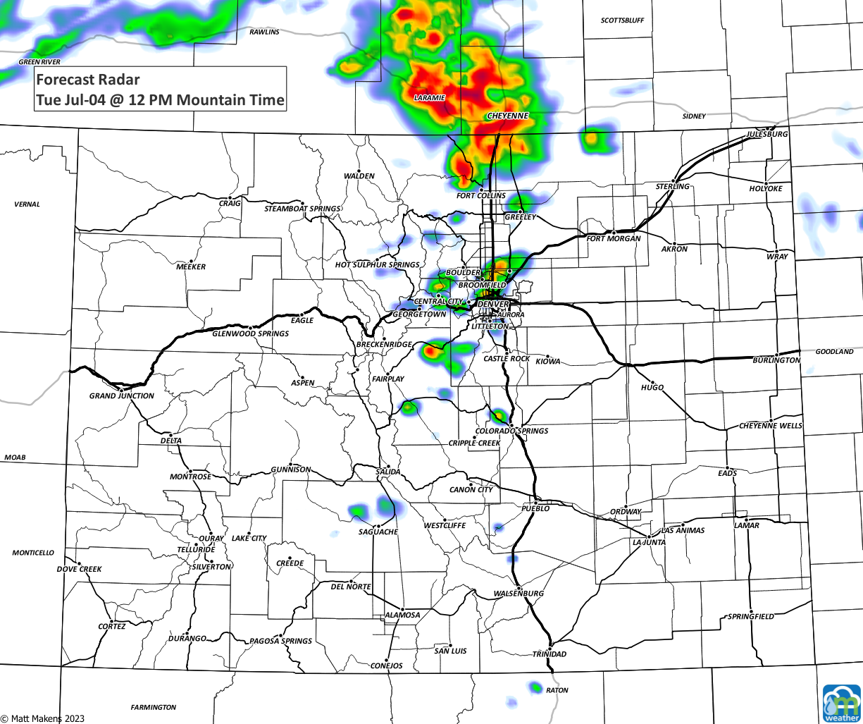
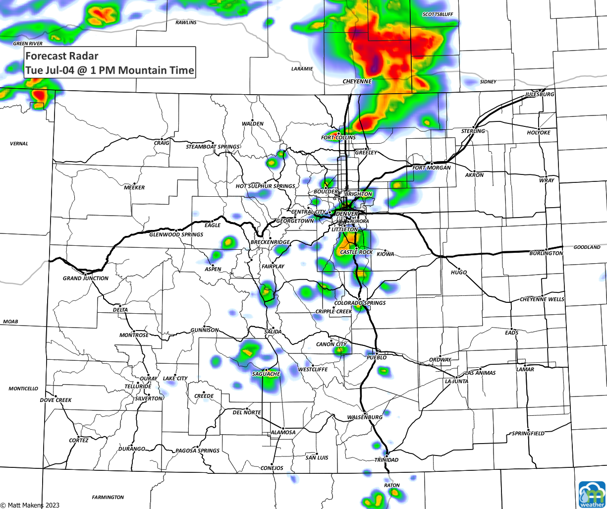
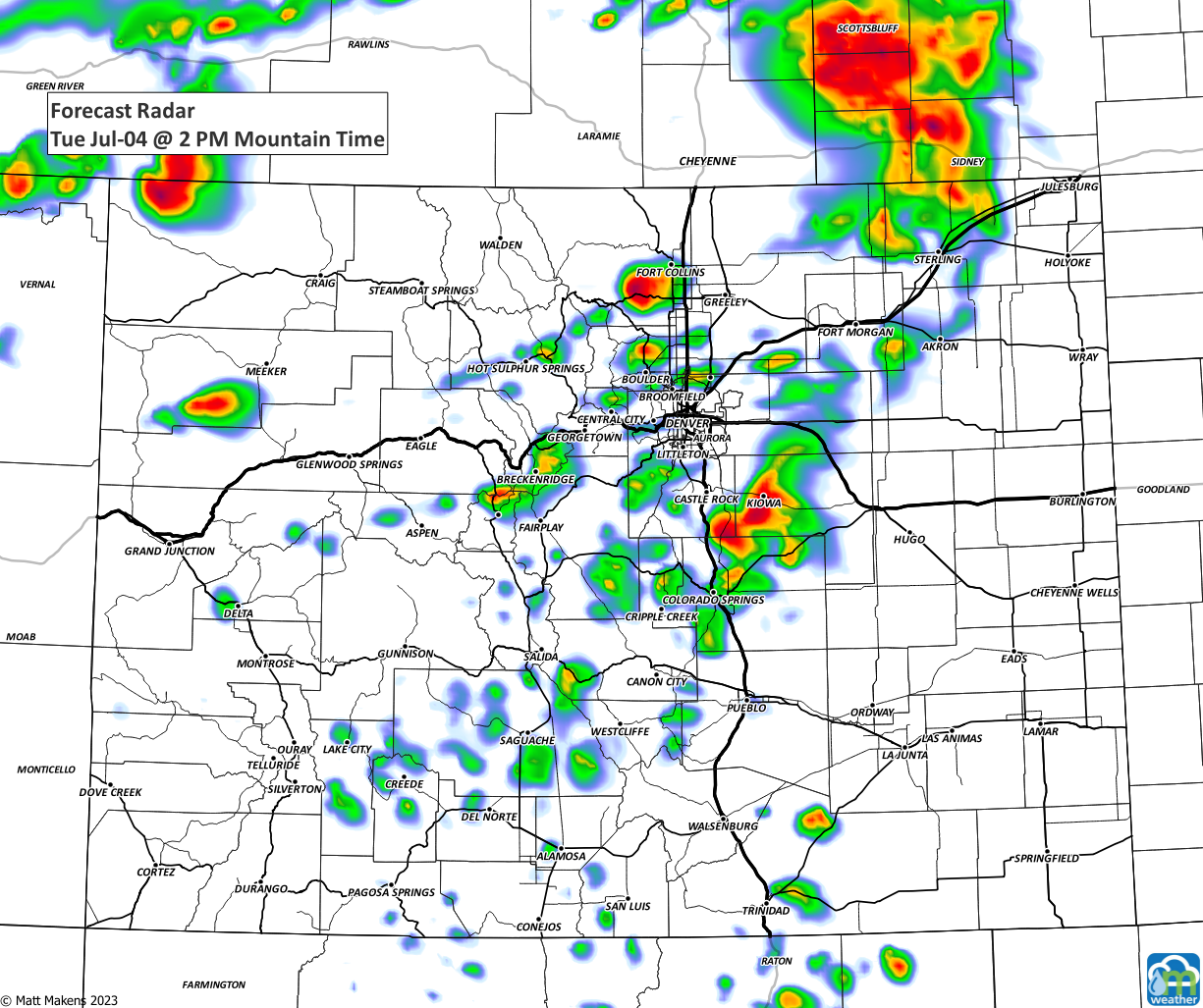
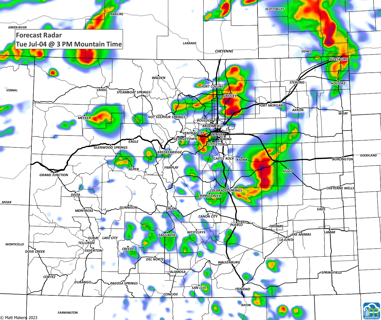
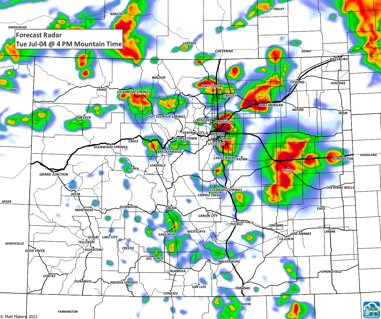
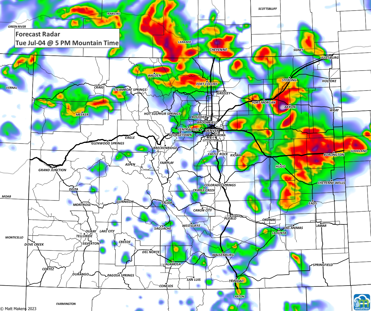
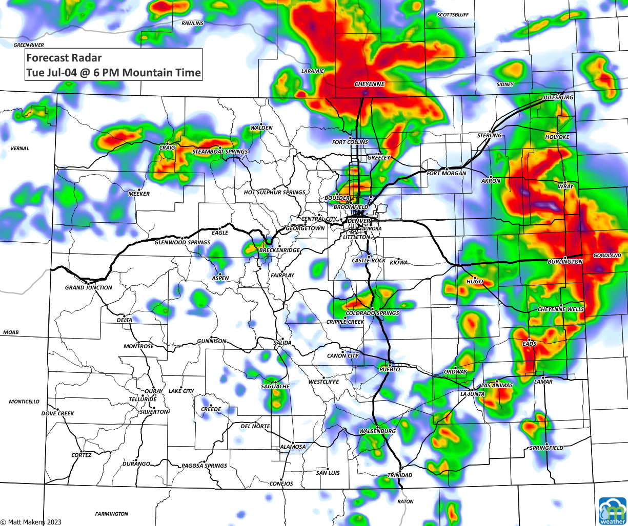
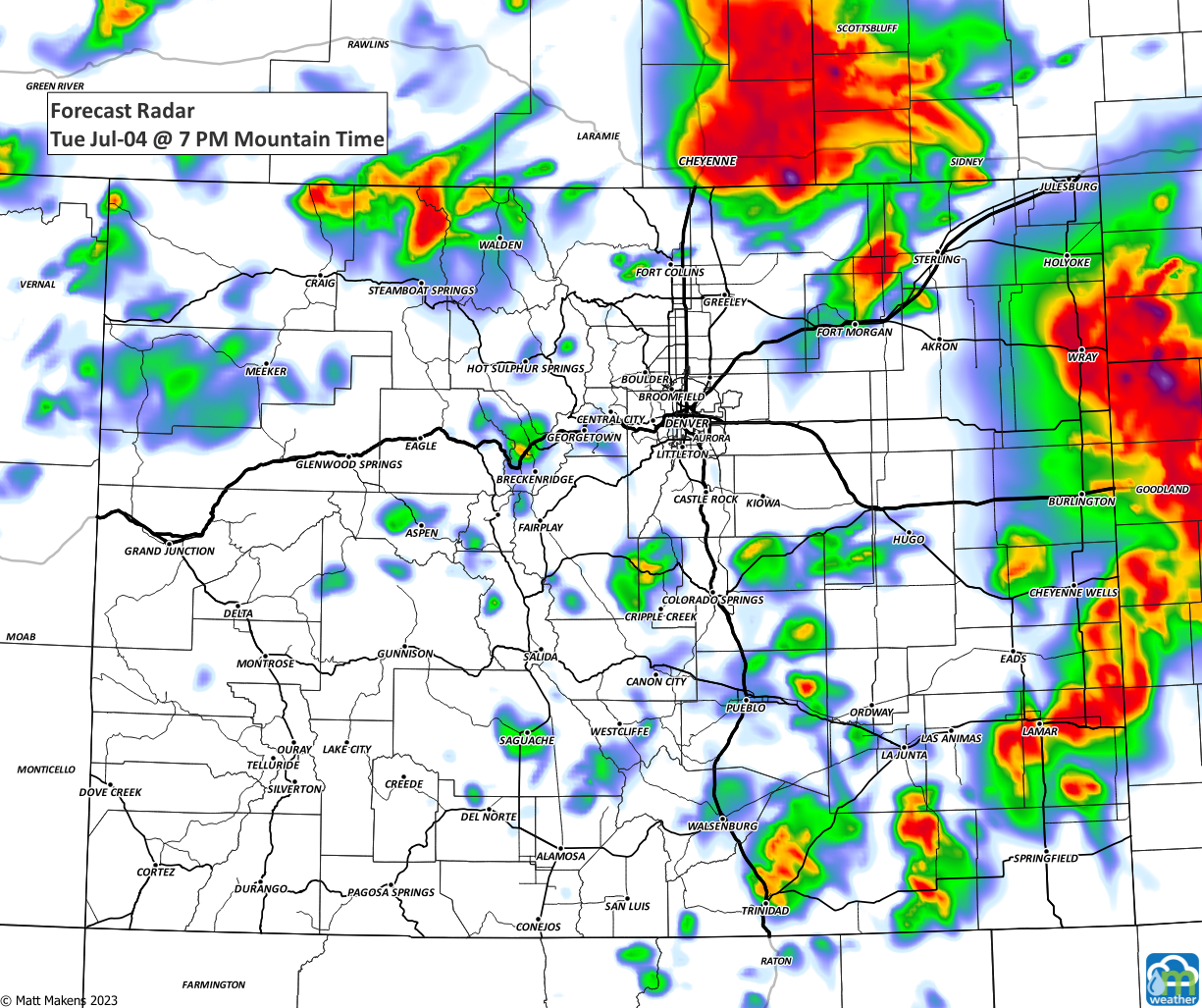
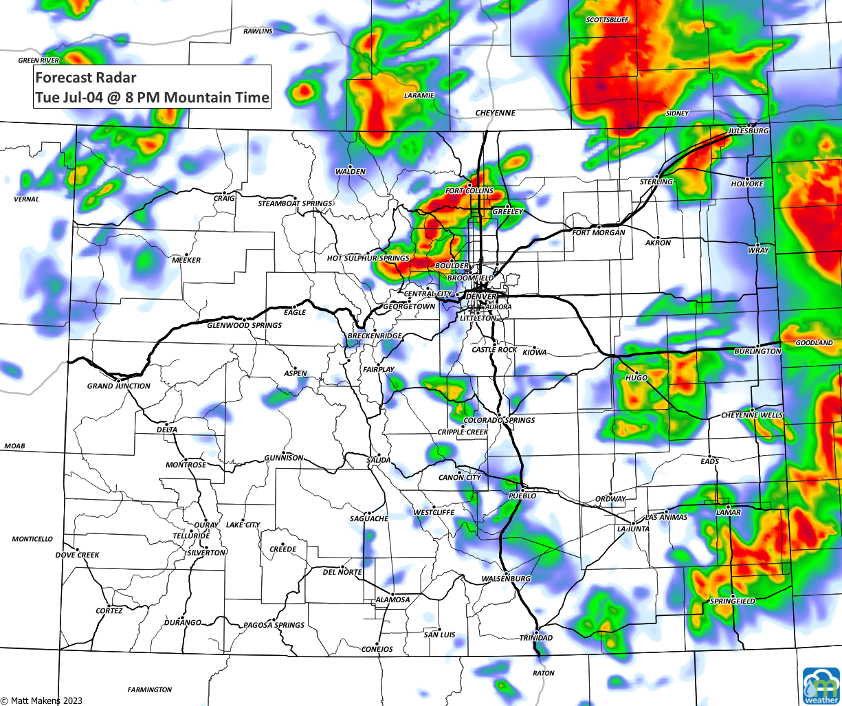
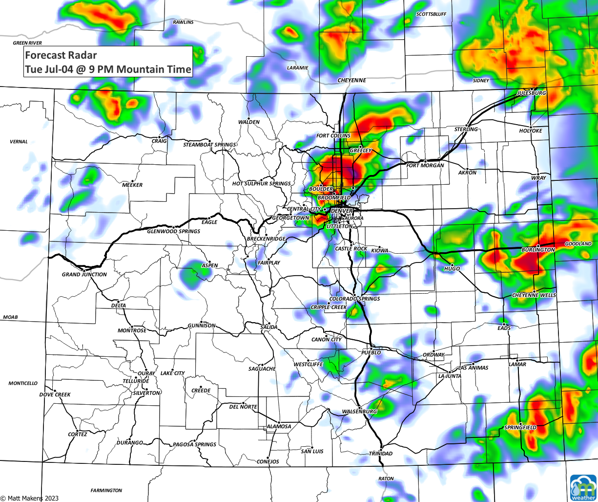
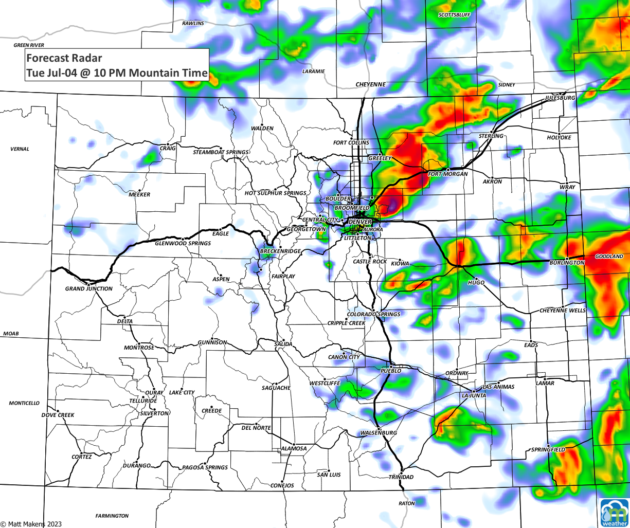
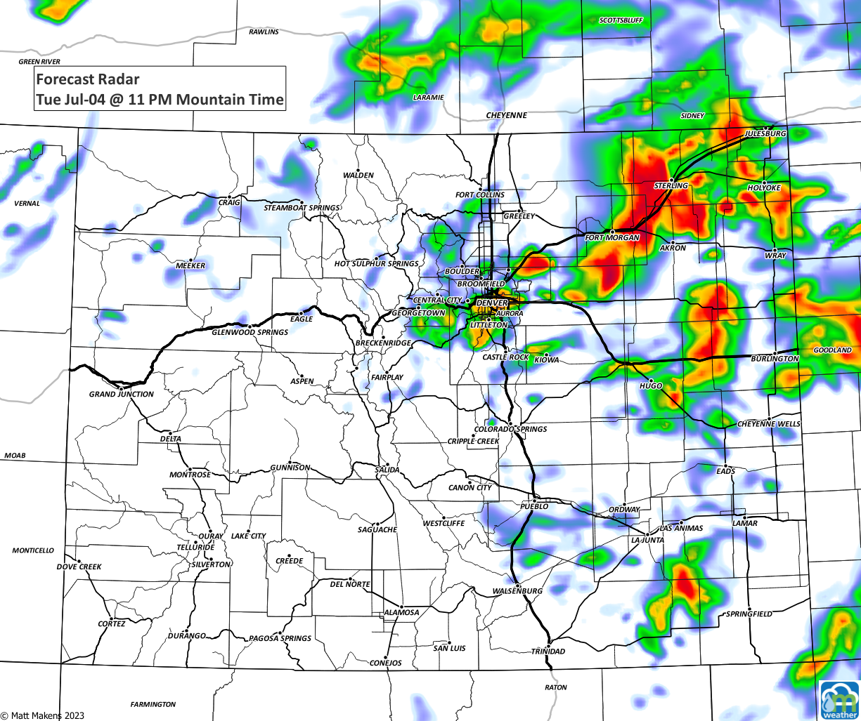
As you can see from those images, there is a chance some fireworks shows will have a lot of lightning nearby, too. What a photo-op!
The threats are not only limited to Colorado, we discussed the national hazardous weather elements in yesterday's Daily Shower:
As that video points out, Wednesday will also have a risk of damaging thunderstorms, more on that to come.
We hope you have a wonderful and safe July 4th! If you'd like to be getting the "heads up, hey there is a forecast to be aware of" style emails from us, you can sign up for those for free by clicking here.