Colorado weather: Record heat moves in from the South and West

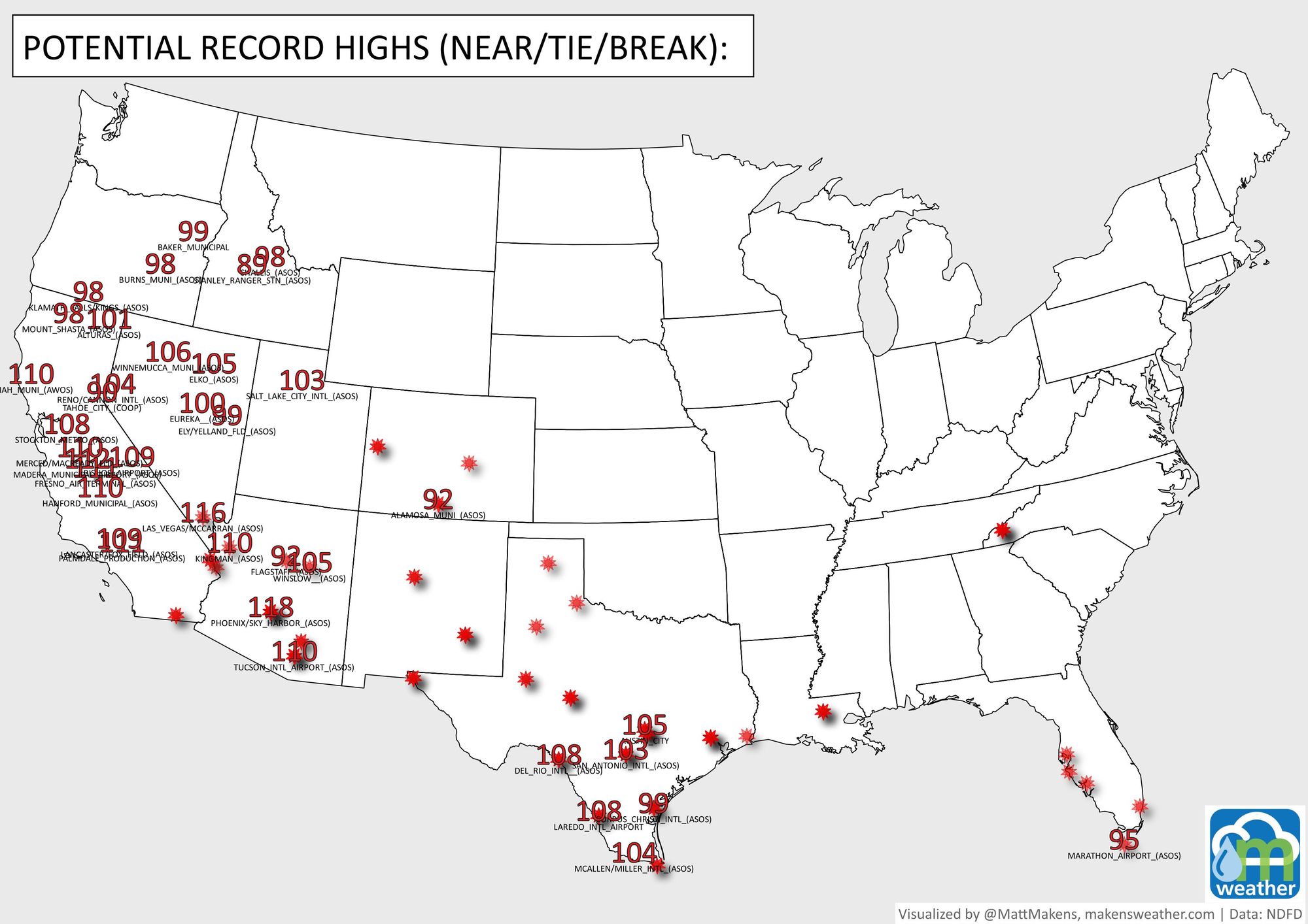
Record temperatures for parts of Colorado will move in the next few days; of them, Grand Junction will be the hottest with the daily record of 104°F in jeopardy on Monday.
Here are the daily highs for a few locations within the region.
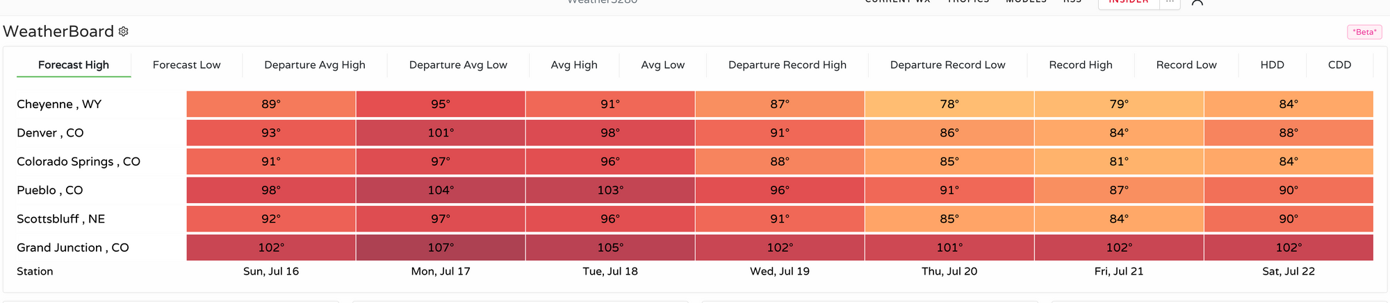
For Denver, we are within a degree of record highs as currently forecast for Monday (record 102°F) and Tuesday (record 99°F), so needless to say both days have the potential to tie or break the record high for the date.
This is part of the extreme heat that has had a stronghold on the West and South. Today's records are indicated by the numbers, whereas red stars indicate locations that can expect potential record highs throughout the week.
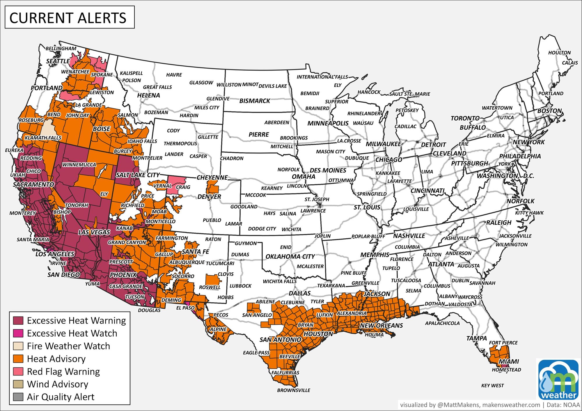
As such, there are a number of heat related alerts in place across these areas and alerts have been issued for Colorado's Front Range and Western Slope, too.

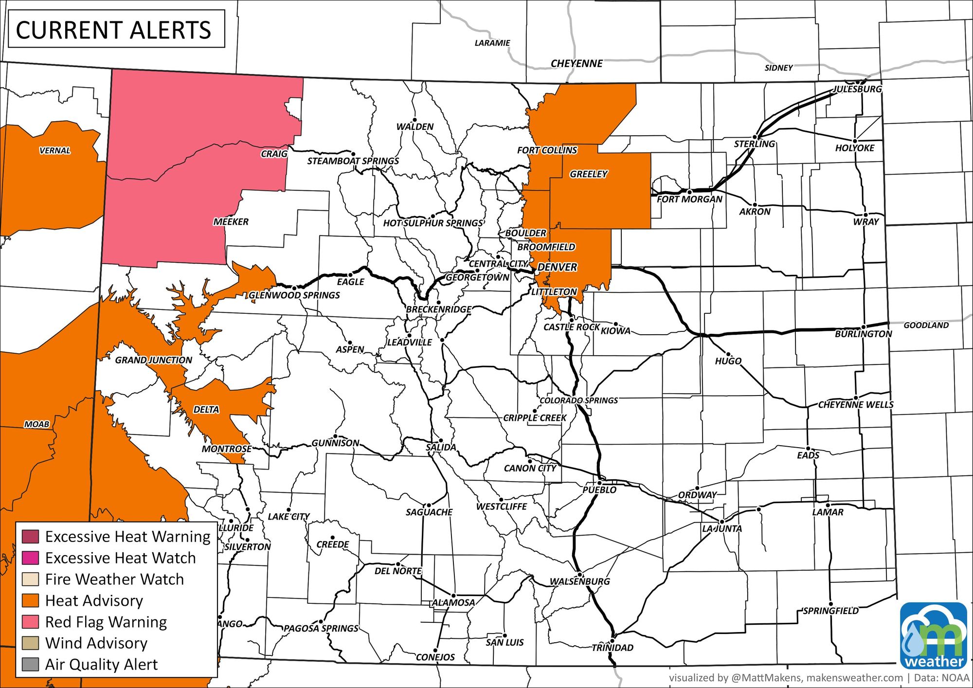
Per NWS for Monday and Tuesday:
Drink plenty of fluids, stay in an air-conditioned room, stay out of the sun, and check up on relatives and neighbors. Take extra precautions when outside. Wear lightweight and loose fitting clothing. Try to limit strenuous activities to early morning or evening. Take action when you see symptoms of heat exhaustion and heat stroke.
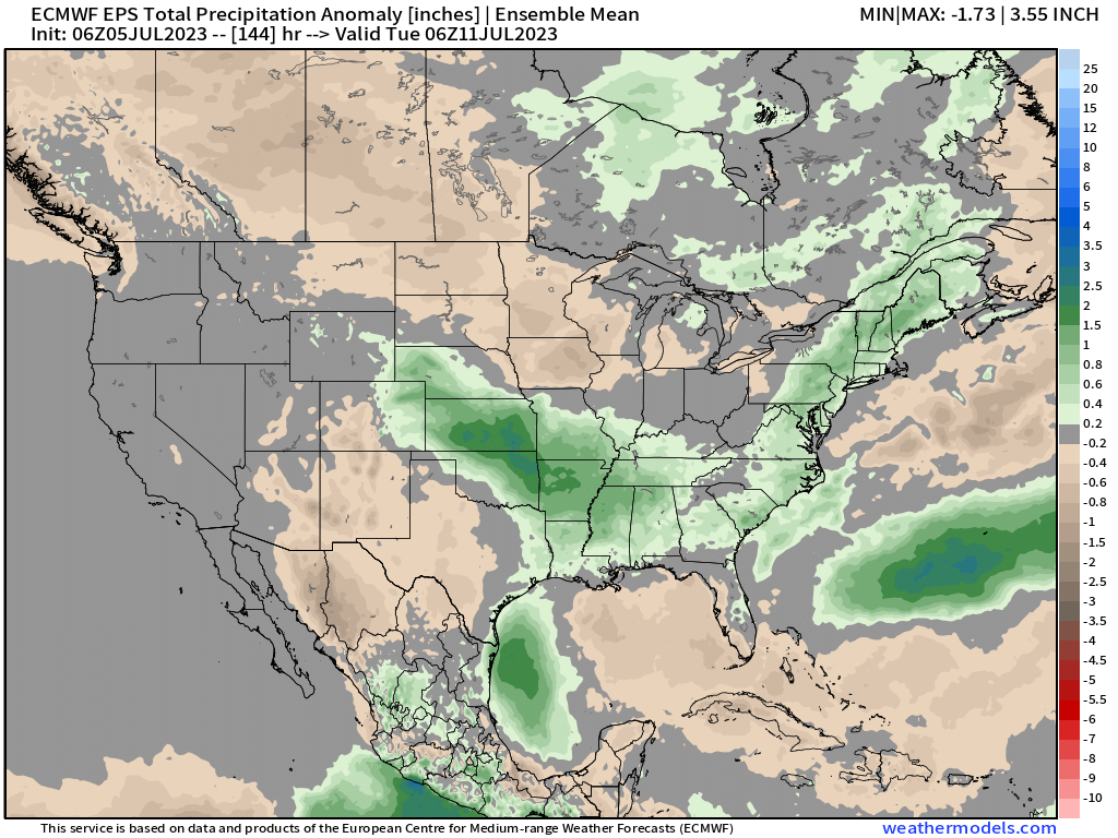
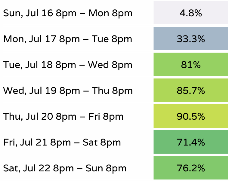
As we get closer to Wednesday, however, rain chances begin to increase again. This will come with slightly cooler temperatures once again. Here are the rain chances throughout the week.
And the resulting temperatures as daily highs and lows for the week:
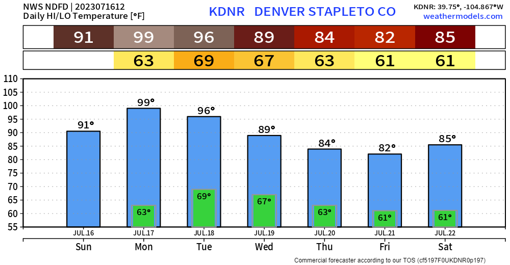
This is the hottest forecast we've had in almost a year; September 8th was the last time the city recorded a temperature of 99° or hotter (99°). 93° has been the city's hottest y-t-d temperature. And, so far this summer, Denver is 19th coolest to date since 1872.
This heat does fit the overall pattern that we discussed for June as well as July with our members. A pattern that has a blocking ridge to the east, and a developing ridge across the southern U.S. Typically we begin to look for the monsoon to kick in about now to bring us increased rain chances - the monsoon is greatly delayed this year which is not atypical of an El Niño pattern.
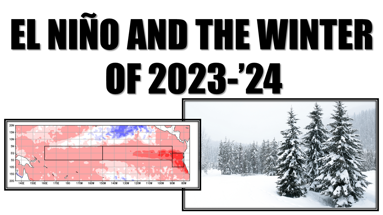
Speaking of El Niño and the monsoon, here are a couple of additional articles we have published that will be of interest to you.