State of the Atmosphere: Denver and Colorado's weather for the week

Let's help get you ready for the week ahead with a weather pattern that became cooler and wetter this weekend as a weak monsoonal flow collided with a cold front. The trend this week will be drying and warming...
That cold front moves through eastern Colorado Sunday with some areas of gusty winds and lower-level clouds. Here is the temperature outlook from Sunday through Tuesday. Notice that Sunday and Monday feel the impact of the cold front which clears out Tuesday when temperatures return to the 90s. Plan on 90s for the remainder of the week.
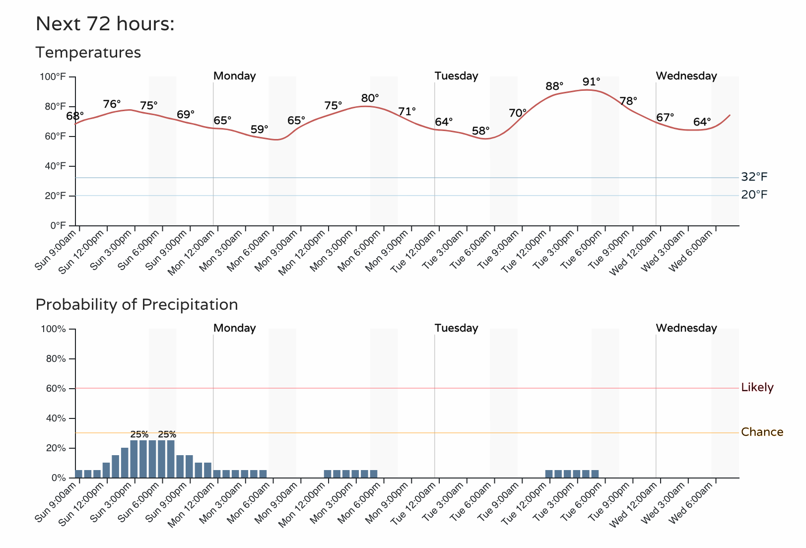
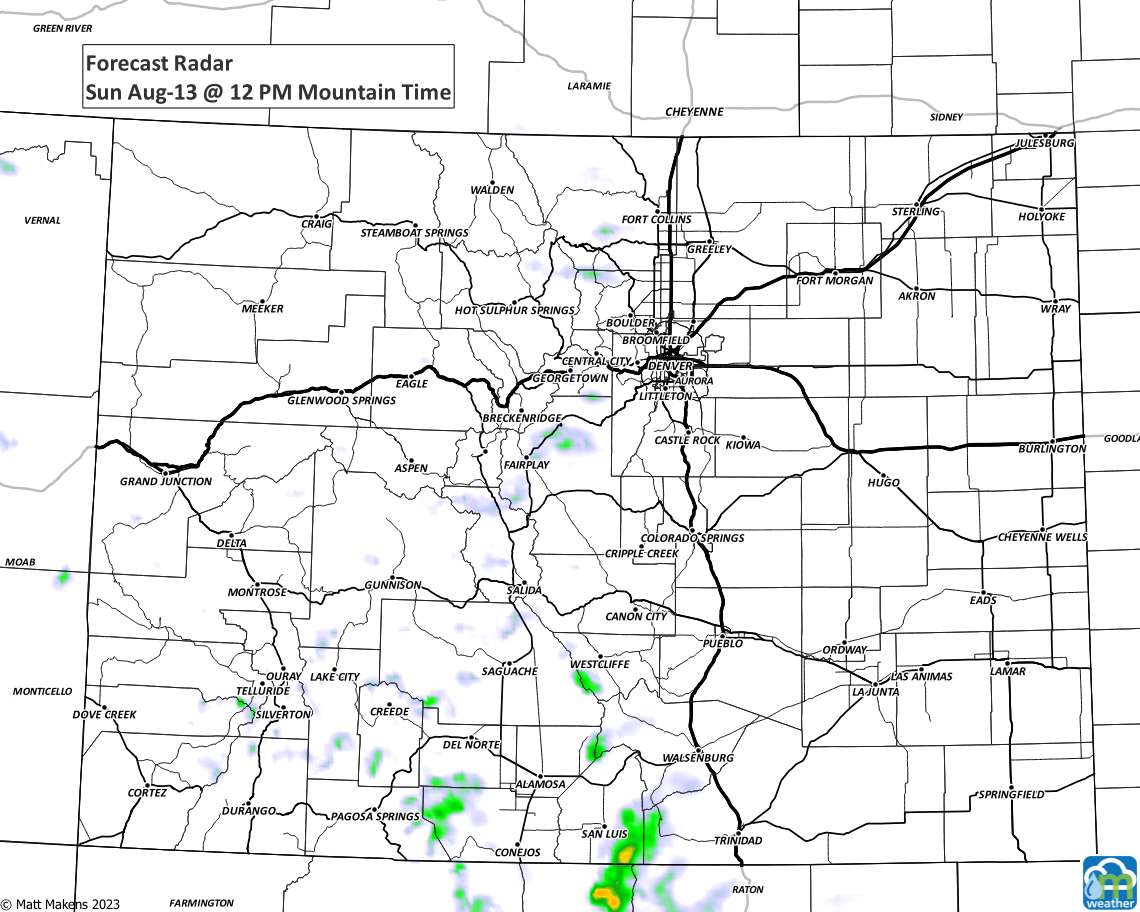
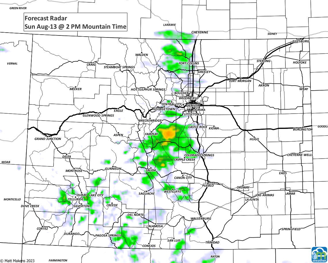
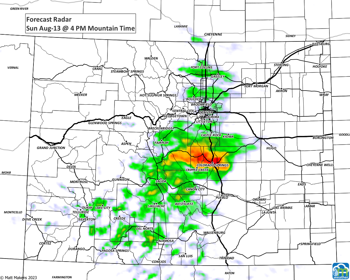
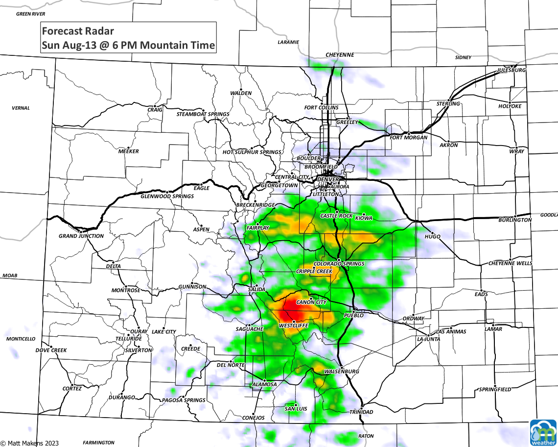
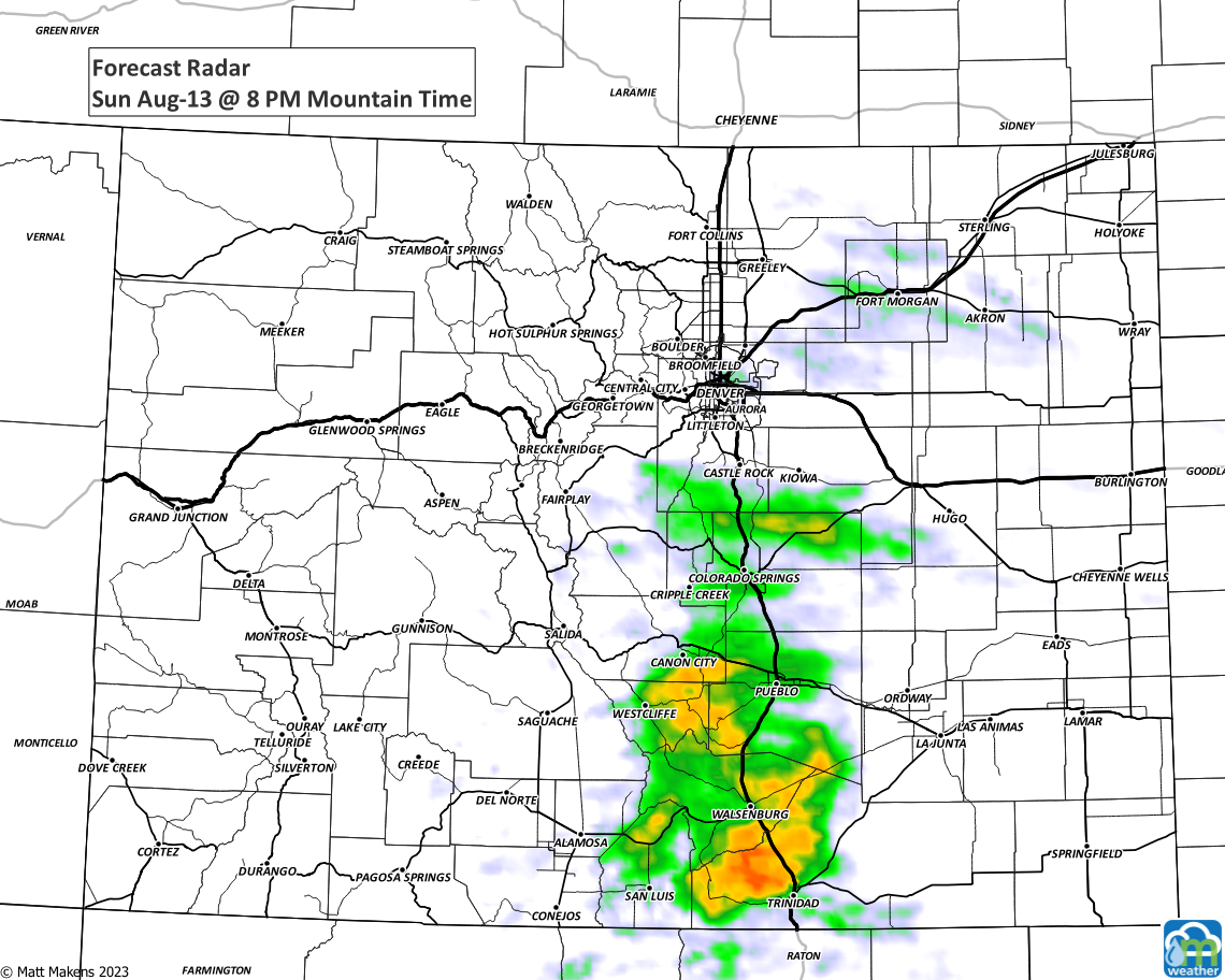
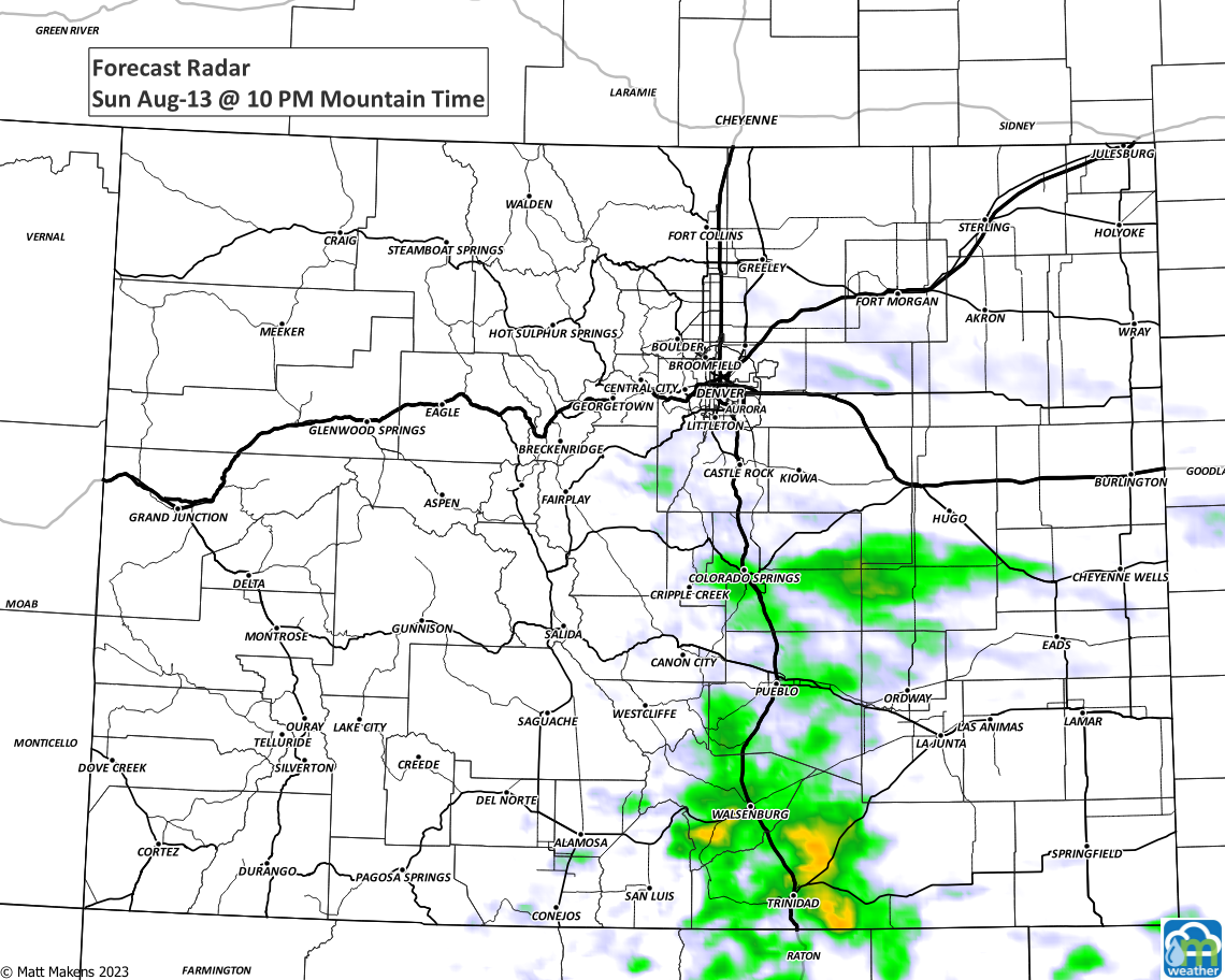
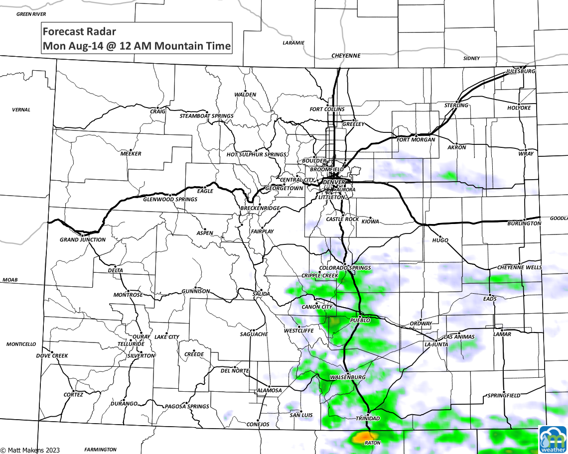
Also on that planning graphic is the chance for rainfall. It isn't much for the Denver area, but there is a bump in Sunday's chance for some showers. Showers and storms will form mainly in the mountains and between Denver to Colorado Springs on the Palmer Divide.
Although hail and flash flooding are possible with these high country storms, the overall risk of severe weather is low. Here's a time series of images for Sunday.
When it comes to rainfall this week, the best chances are through Tuesday. The monsoon isn't much of one this year so the totals are not what I call impressive and, again, most of this is early this week with drier air for the second half of the week.
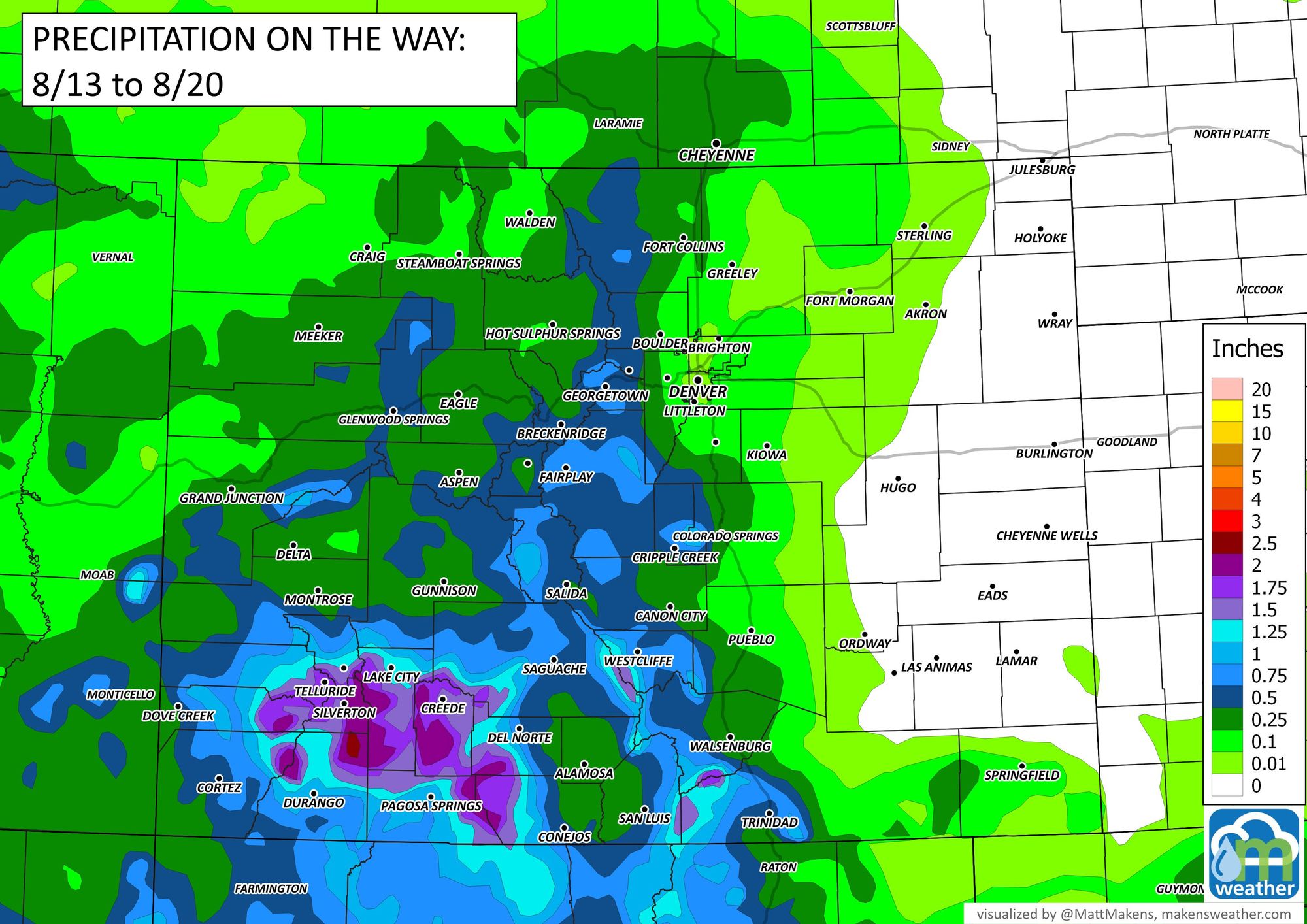
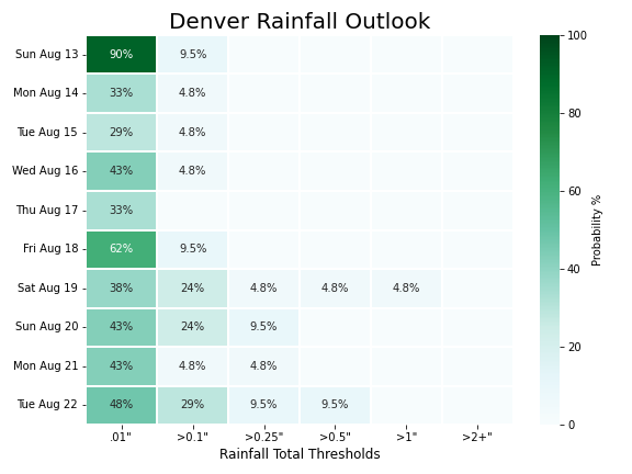
Next weekend, well we may see another surge of moisture...remains to be seen but chances do increase again. For Denver, here's a rainfall gambler chart showing the daily chances of reaching 0.1" or higher totals.

Bottom line: Although early this week is cool with some clouds and a few showers/storms, we return to 90s and drier days for much of the workweek until we approach next weekend to see if the monsoon can deliver another increase in moisture.
Stay safe, stay weather aware, and of course stay one step ahead of the weather by subscribing to our email list today! Did I mention it is free ;-)