The State of the Atmosphere: Monday, September 18th, 2023

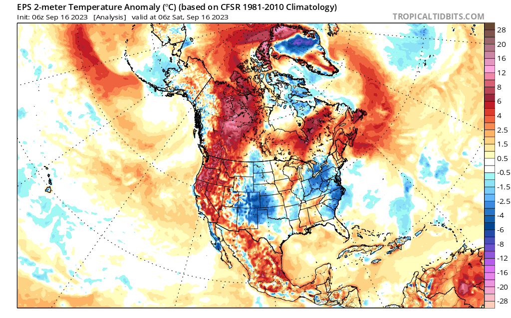
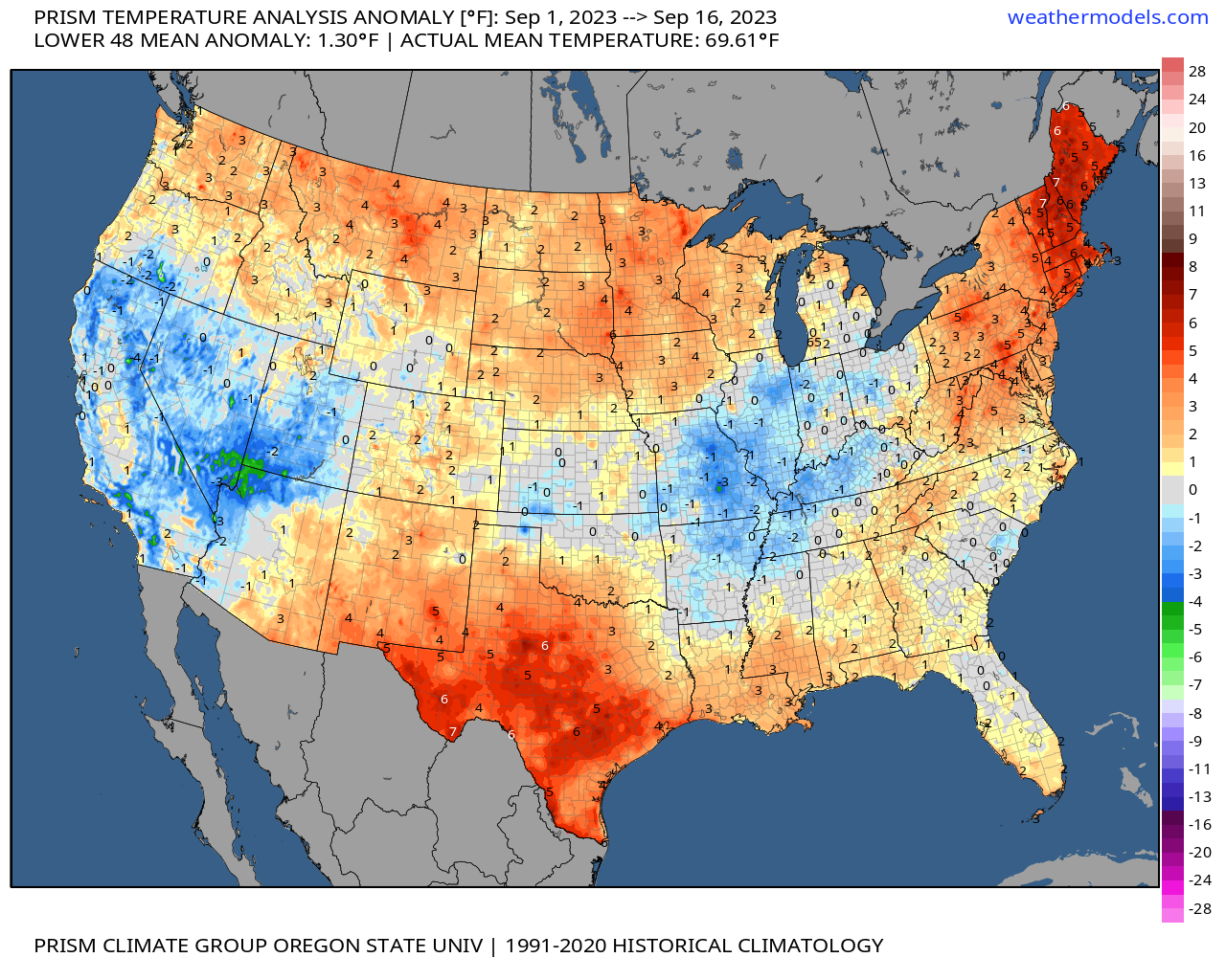
Month to date temperature anomalies across the CONUS resemble the prior months in so many ways. Texas remains hot. A split bag through the middle tier. New England has also been quite warm over recent weeks.
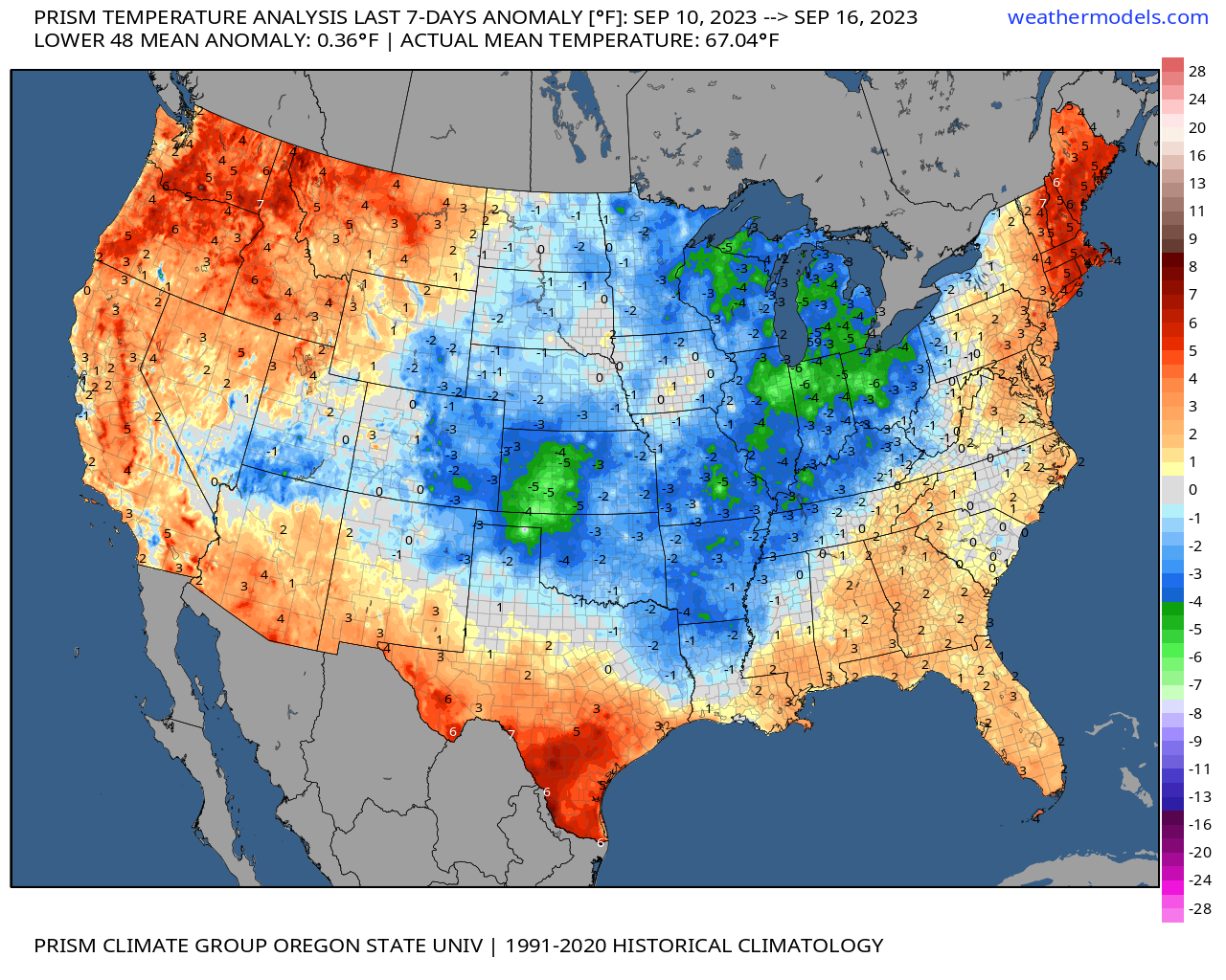
The last 7 days of course have been a bit different, with fall-like weather across the region much of last week, with below average temperatures for the central plains and extending up the Ohio Valley and Great Lakes:
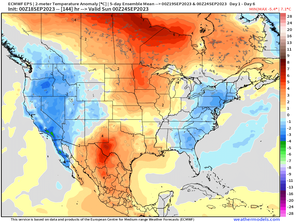
For the upcoming week, we flip things back a bit, with some September warmth for the middle of the country and cooling off along the coasts:
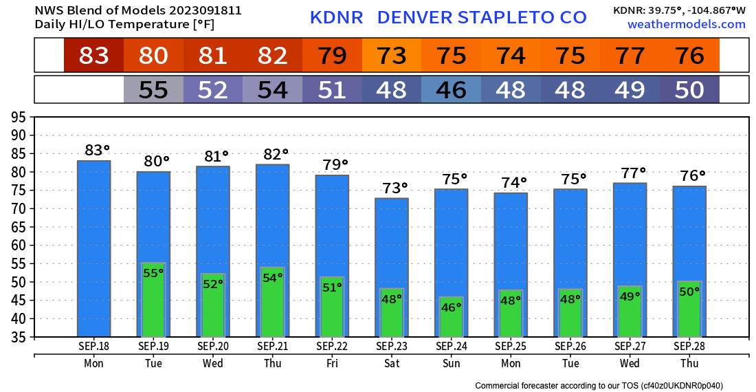
For the Front Range, temperatures will be at or perhaps a few degrees above average for the next week. The average high this time of year in Denver is 80.9°F, and we expect to be just at or a few degrees warmer than that through Friday before temperatures cool a bit headed into next week.
The blend of models supports this idea, not a bad looking September week on tap if you ask me!
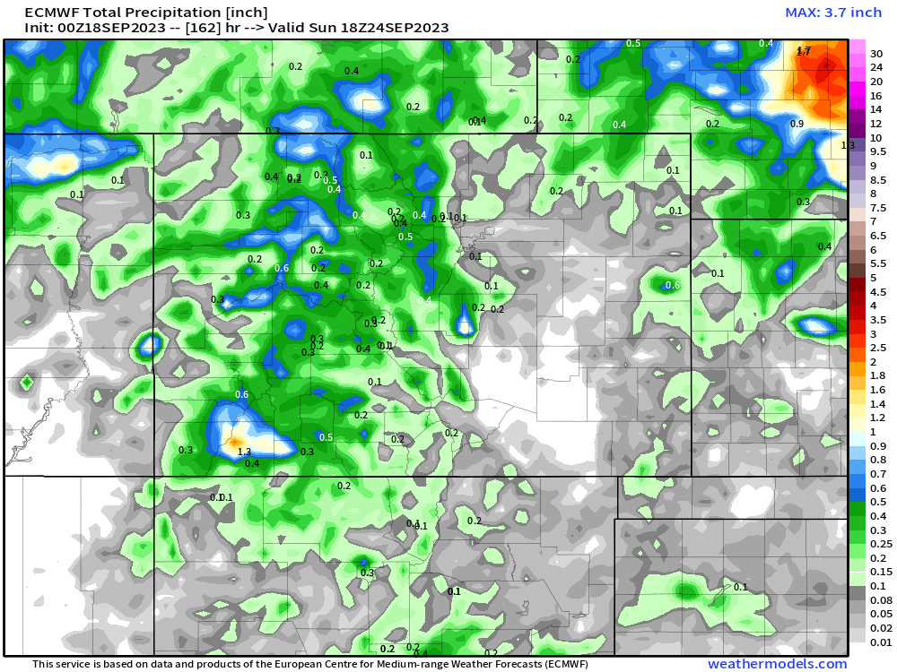
As for precipitation? Well, it looks relatively dry across the eastern half of the state through the week, but perhaps a bit wetter for the mountains and west.
This aligns well with the temperature outlook above. As you can see, the western half of the state is forecast to be cooler than average for the next week, while the eastern half warmer – with the urban corridor somewhere in between, or near average.
For overall precipitation we see some of the high peaks set to pick up perhaps a 1/2" of liquid or more through Saturday, but only spotty coverage east of the hills until you get up into Nebraska:
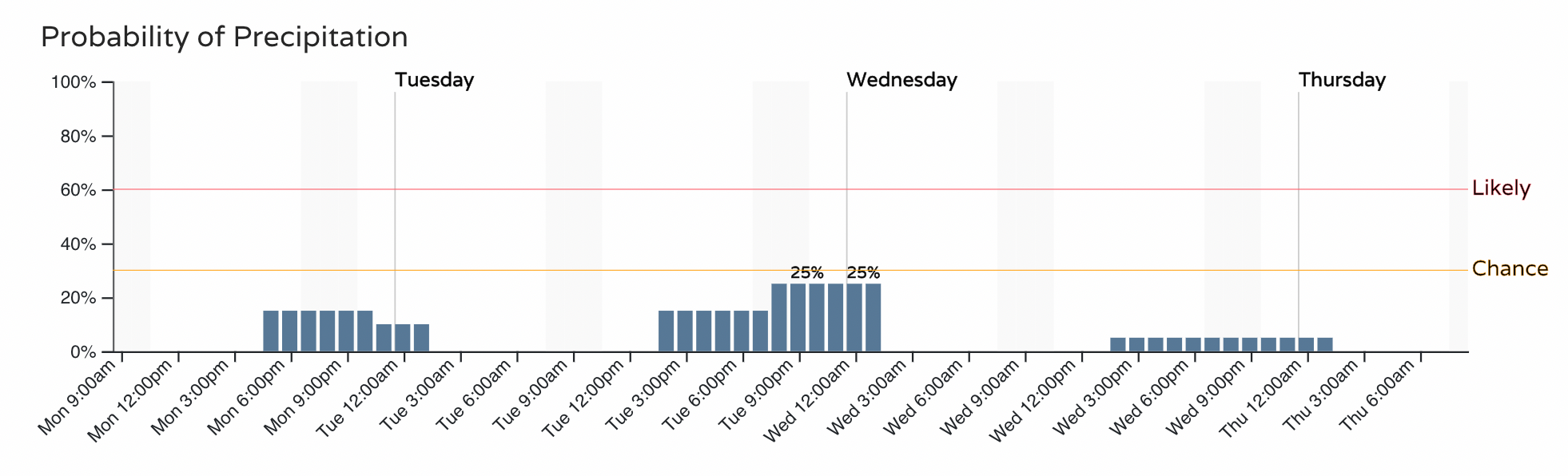
For the Denver area specifically, we could see an isolated shower or two really each afternoon this week, but overall odds are on the low side. For the next 3 days, look for Tuesday to feature the "best" chance, with about 25 - 30% chance of showers Tuesday evening:
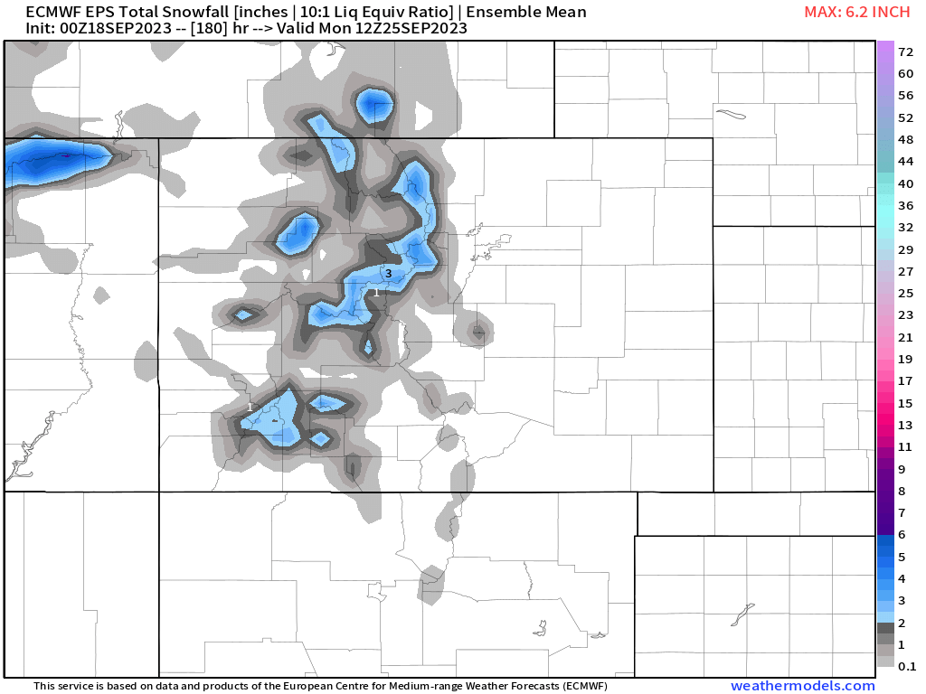
September? Precipitation? Cooler than average temperatures? You guessed it – that means a bit more snow will fall across the high country this week. The European ensemble is particularly bullish on this front, perhaps a bit too much so, but it does seem likely the highest peaks of Colorado will see off and on snow showers through most of the upcoming week, with an occasional burst of accumulating snow possible.
Ah, seasonal change.
As for things to watch for? Well, late week/early next weekend for one. A system moves through which will likely cool temperatures along the Front Range as we head into Friday and the weekend – but will we see precipitation? Right now, the best chances for meaningful precipitation looks like it'll stay north of our area, focused across Wyoming and Nebraska, but let's keep an eye on the forecast just in case.
No crazy cold in the forecast just yet, but it's the time of year that eventually a stronger push of cold air will arrive. A few models pointing at some chilly air next week, so we'll see, but for now plan on near average to above average most of this week, cooling to near and below average next week.