Denver weather: 30-degree drop in the next 24 hours

Enjoy the 70s of Tuesday, Denver will be in the 40s for highs Wednesday with a cool-hitter on the way that will deliver areas of heavy snow and travel issues to some of the mountains.
To start, here's the hourly planner for Denver and Colorado Springs, note the drop in temperatures tomorrow with increased chances for precipitation.
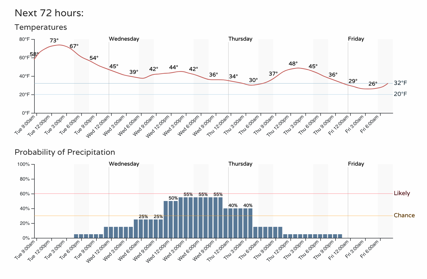
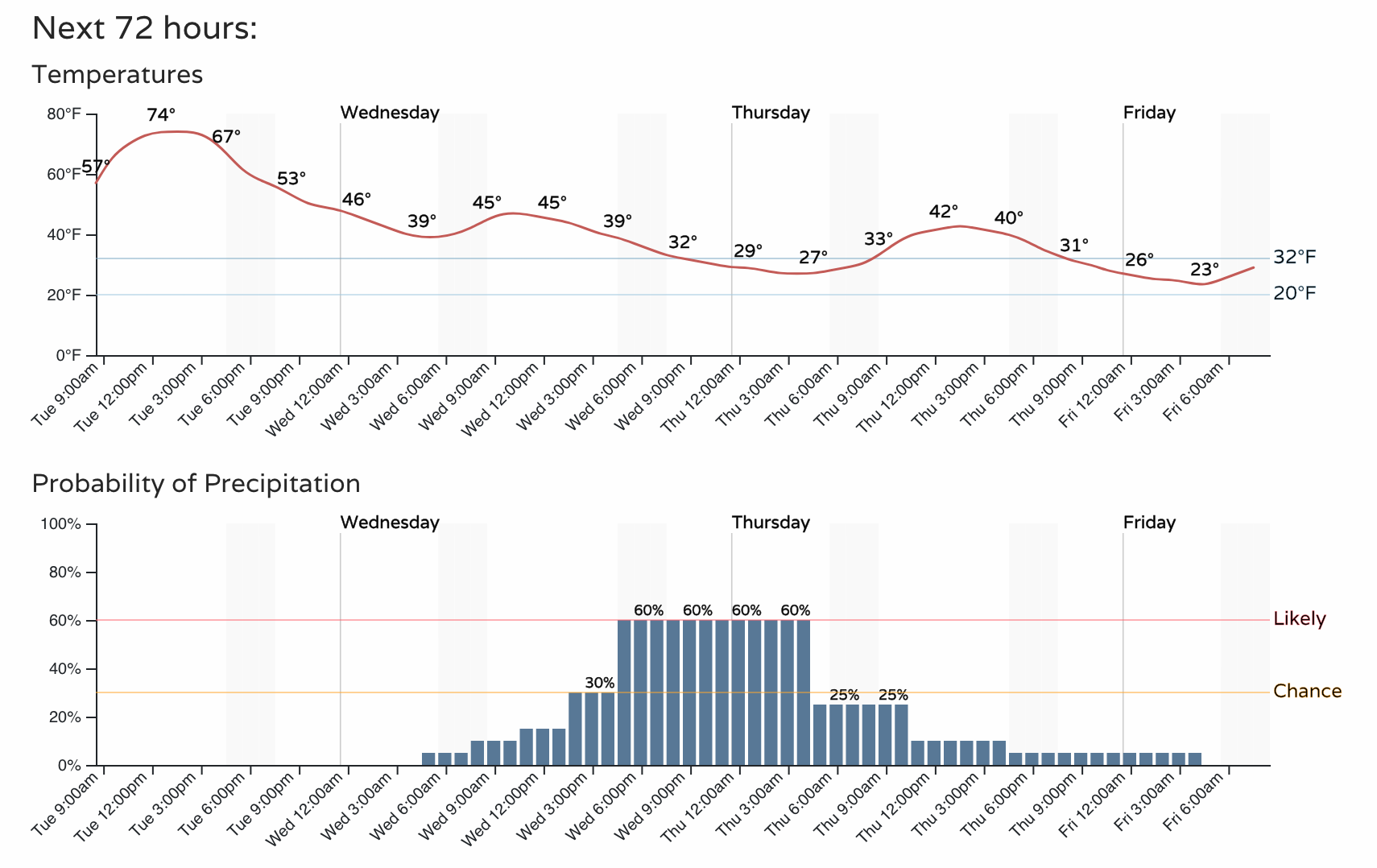
Yes, you will feel cooler temperatures Wednesday morning, but the biggest "feel" difference will be that we just can't warm-up for the day, or even Thursday for that matter. Quite a bit of cloud cover and a stiff breeze from the north will keep us in a chill.
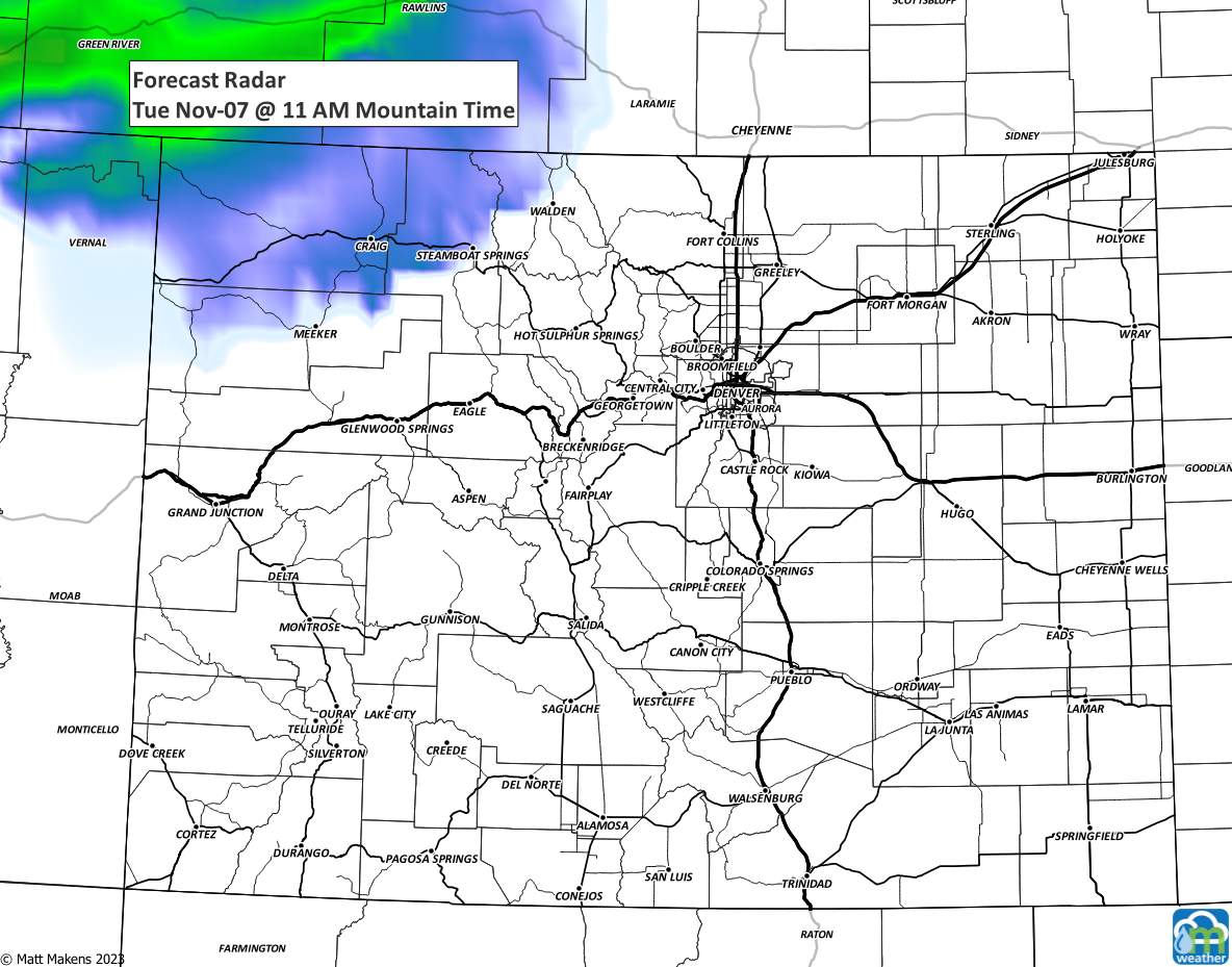
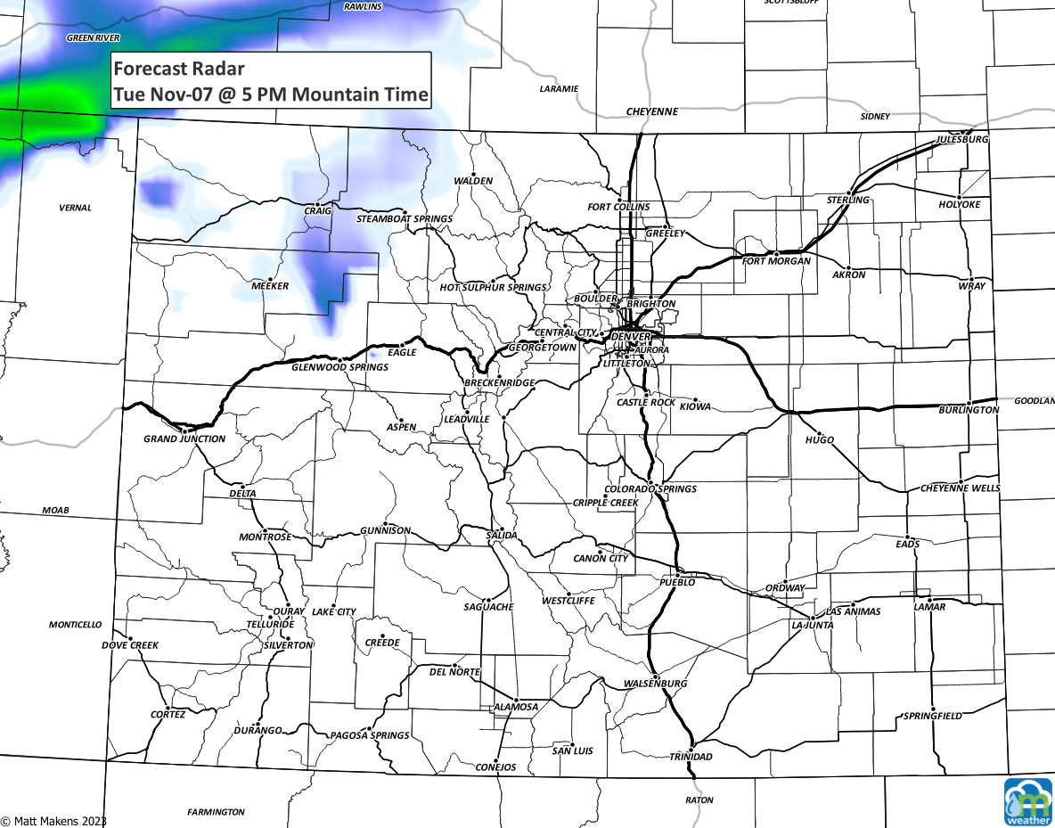
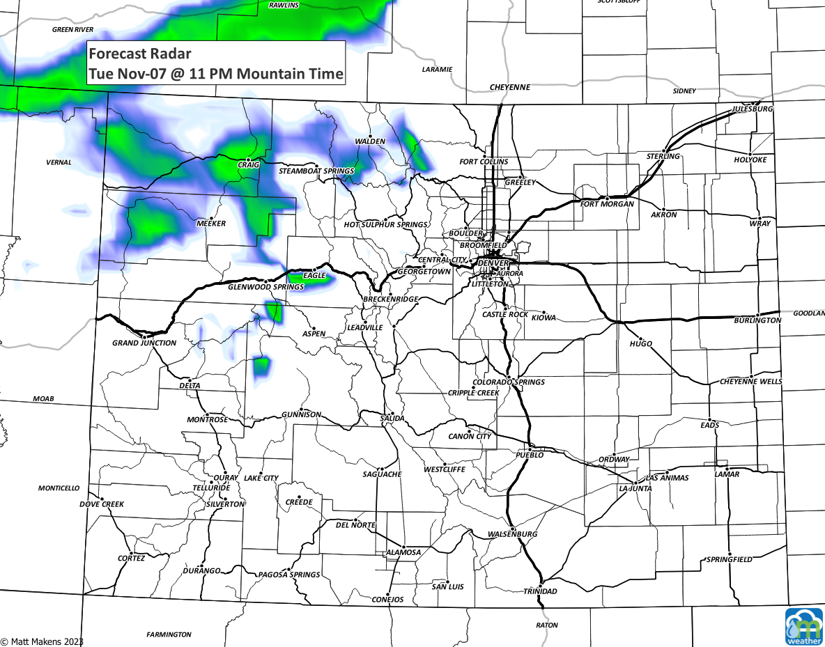
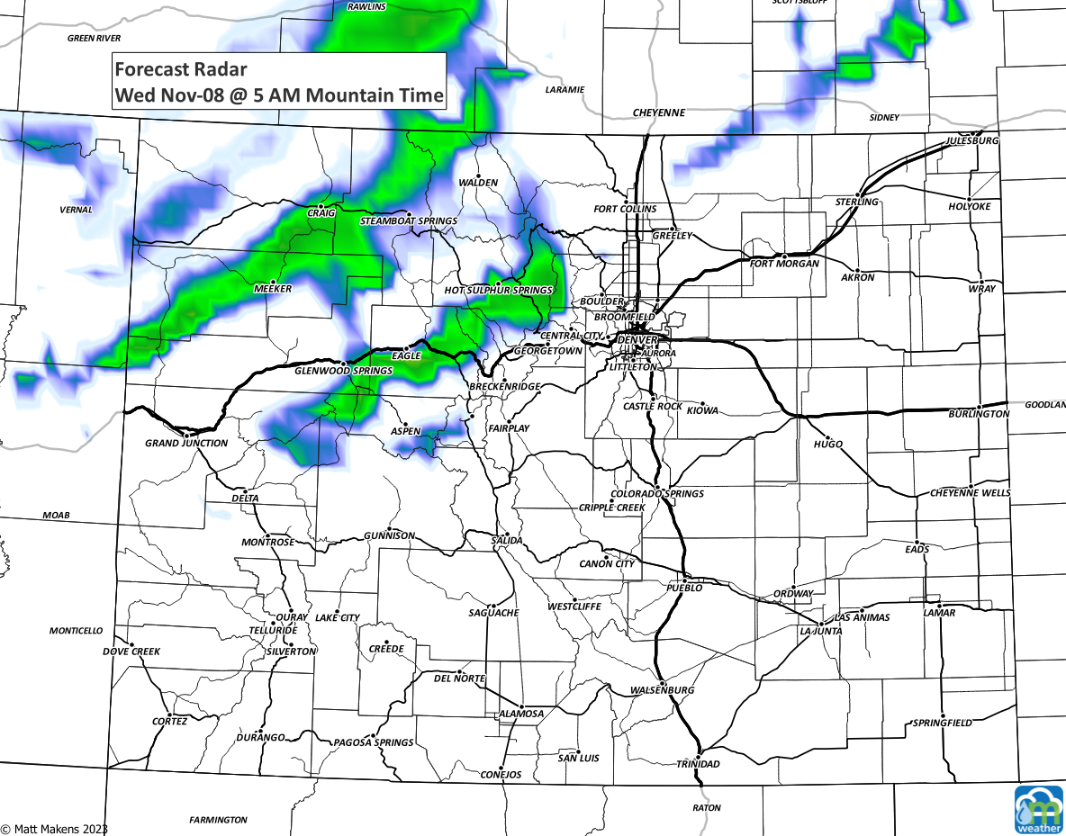
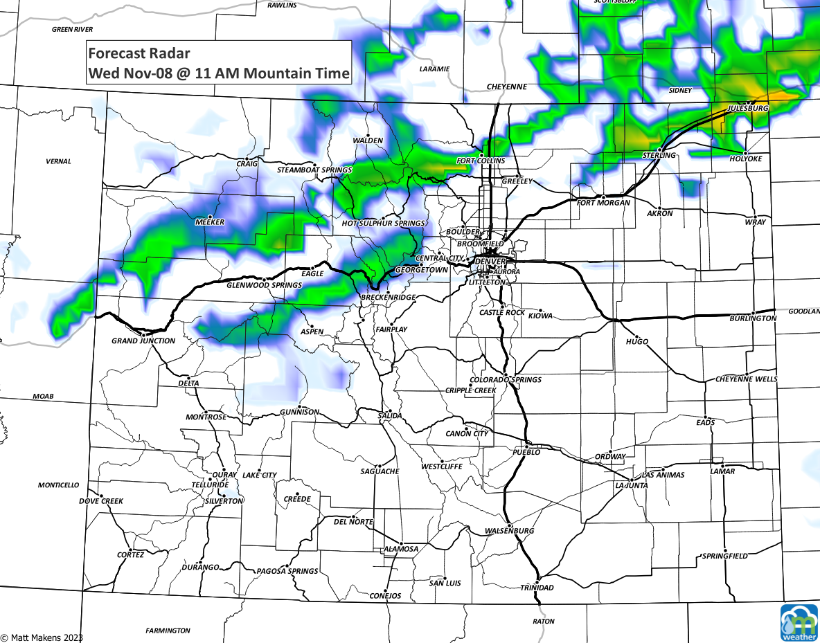
What about that chance for precipitation? Here is a timeline (steps every six hours) of maps showing you the location of showers through the next 48 hours or so.
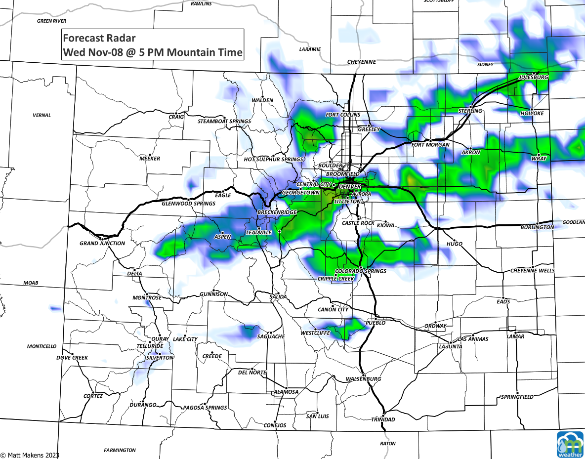
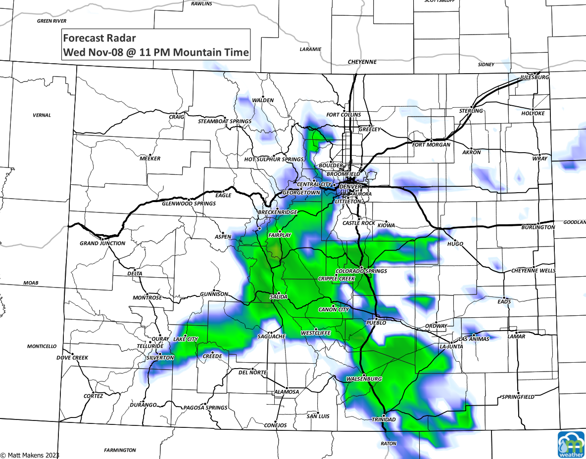
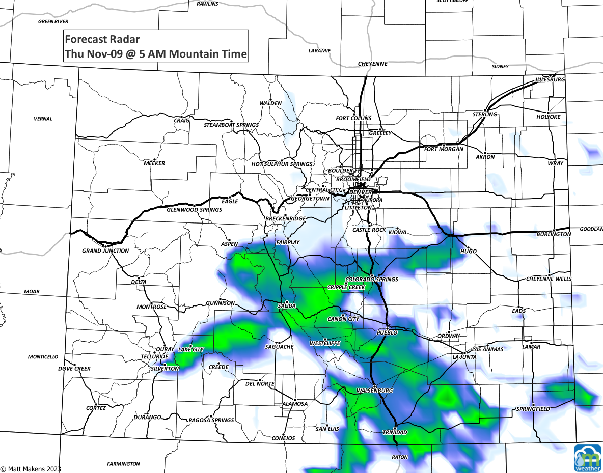
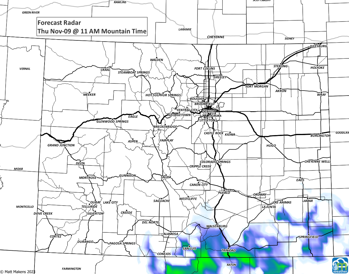
With that in mind, how much will these showers (or simply the chance of showers since this isn't "locked in") provide in terms of total water? Here is the total precipitation - combo of rain and snow - to fall in the next three days.
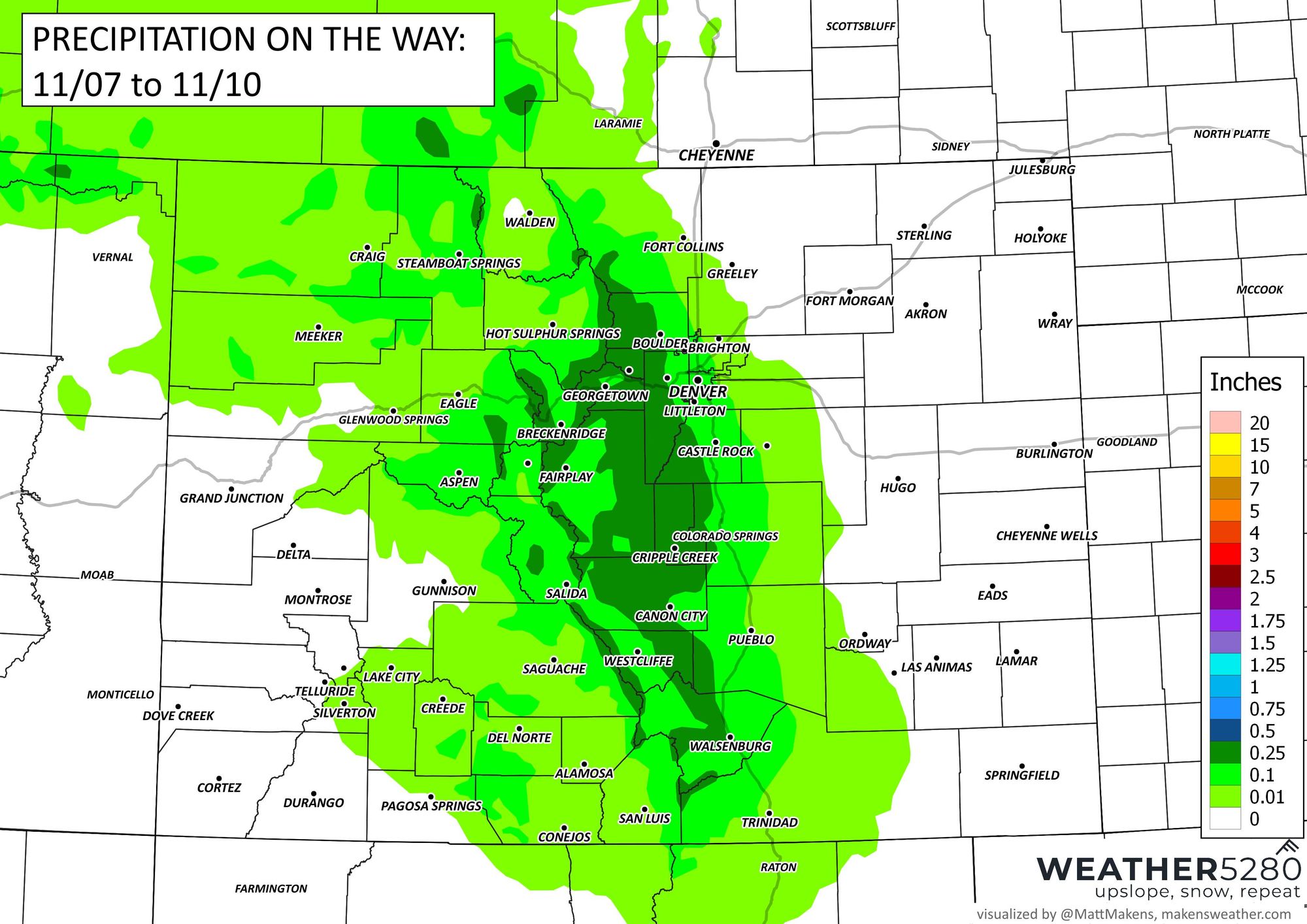
You can see those lightest greens representing up to a tenth of one inch cover most of the Front Range metro locations. The deeper greens represent moisture of at least a quarter-inch, and being on the foothills and mountains, we'd better turn to the snowfall map as those areas will be snowy, not rainy.
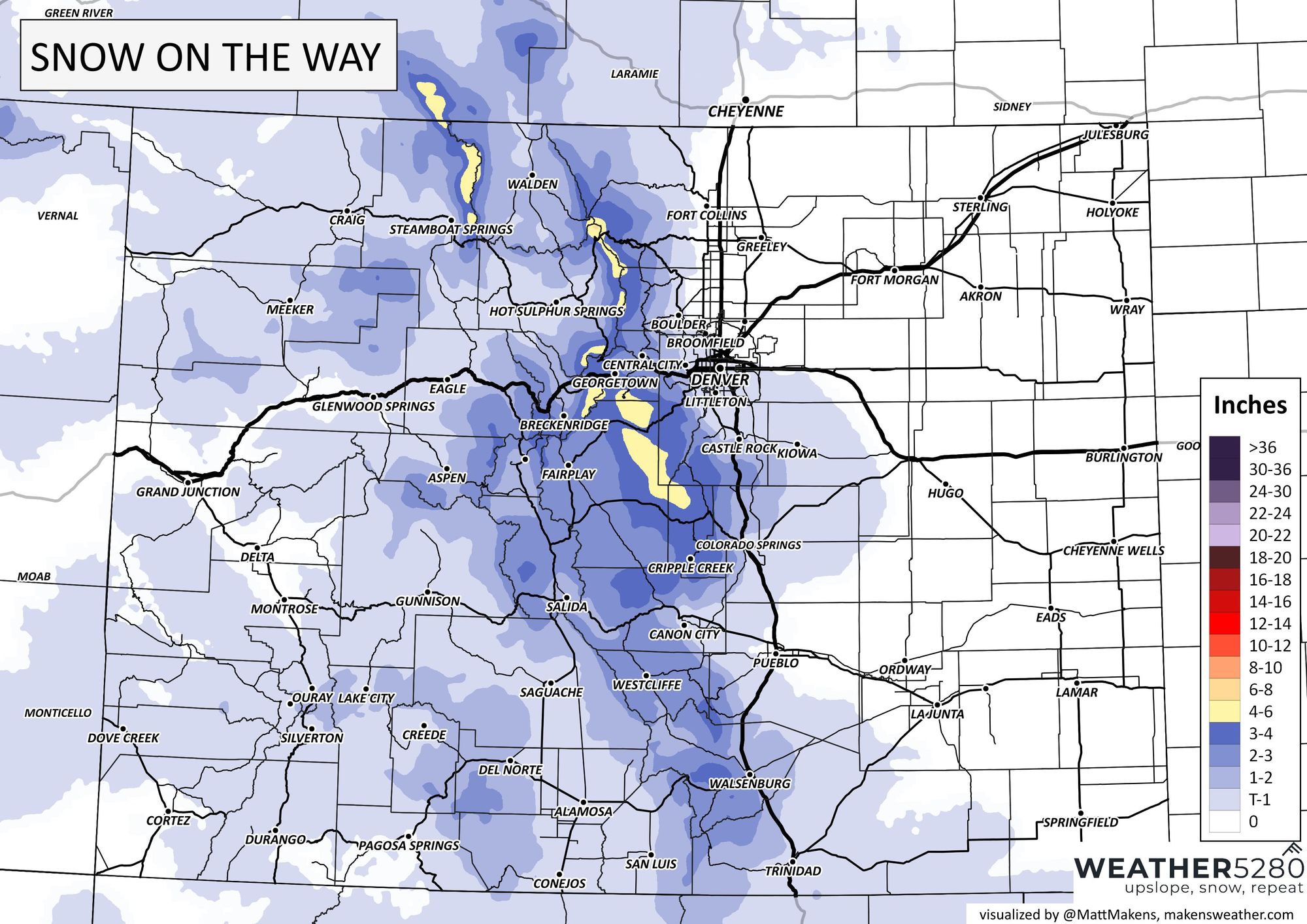
A wet snow may tally up to more than six inches for most of the Front Range Mountains, closer to ten to twelve on the very highest peaks is possible.
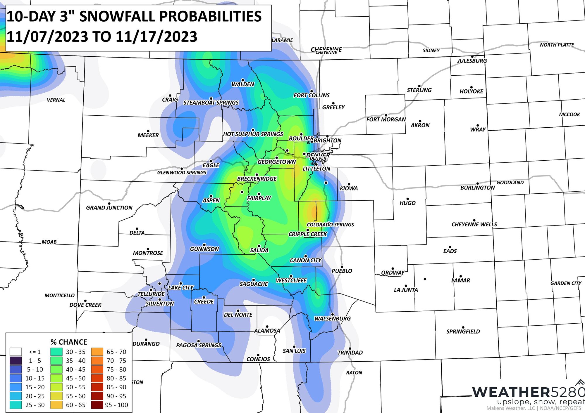
For the metro areas, you do see some color there. From Denver to Colorado Springs over the Palmer Divide there is the highest chance for some snow. Spots near Castle Rock can see a bit of accumulation.

We can see the probability or odds of that area receiving three inches or more is not the most confident, less than a 50% likelihood as of data through Tuesday morning. Still, a bit of snow is possible in parts of the metro area.
From a travel standpoint, we can't seem to avoid delays on dry days anymore, so you guessed it. Look for some delays on the roads, with impact levels something like this.
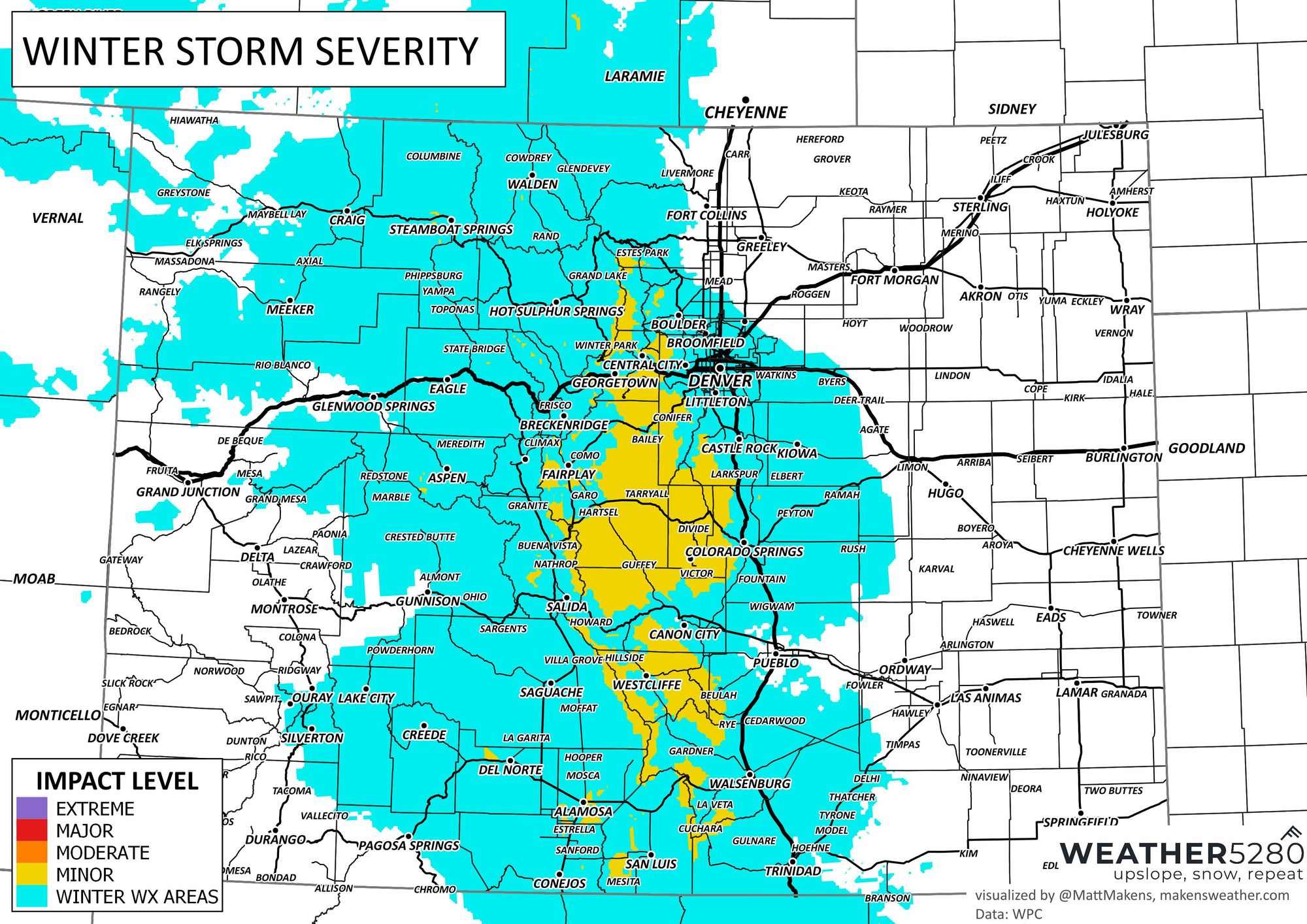
The long and the short of it is, cooler weather hits Wednesday with some areas of showers - both rain and snow for parts of the Front Range. The most likely area to see snow accumulate is on the Front Range mountains, foothills and Palmer Divide.
We'll keep tabs on the data and send you an updated snowfall forecast if need be. Until then, make sure to stay one step ahead of the changing weather by subscribing to our email list today!