
Tracking a pattern change for Thanksgiving Week?

So far, November has been pretty quiet following the Halloween Weekend snow, but we will see a more active finish to the month across the region starting in waves this week into next.
For the Denver Area, the month to date is 16th warmest and 16th driest (period of record starts in 1872). The city has only recorded a trace of precipitation to this point.
If you look at historic patterns when the atmosphere was acting like it is now, they all lean toward colder shots of air from Canada making their way along and east of the Rockies. Parts of the West also hit some cooler spells. Those patterns also saw increased chances for moisture, primarily east of Colorado but we have a chance to get some water too.
These changes are not immediate, but you'll see them arrive in waves during the late week, weekend, into next week.
Here is an example of what I mean by changes coming in waves. Temperatures during the next couple of weeks may take a couple of gradual hits. with the first being this Friday, another by Monday, and a third by Wednesday.
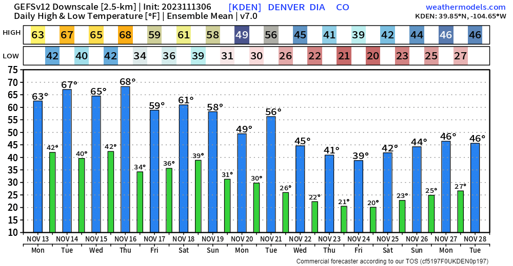
Those numbers offer some guidance, but I wouldn't lock them in as an official forecast. However, use them to give a sense of trends.
Overall, the second half of the month is looking more colder and stormier than what we have now.
For those looking to hit the slopes, the mountains are calling for snow - it's definitely needed for the resorts as it's been a slow start so far. We can take a look at the current snow-water equivalent map across the west. Outside of Washington state, most basins are seeing below normal snowfall so far.
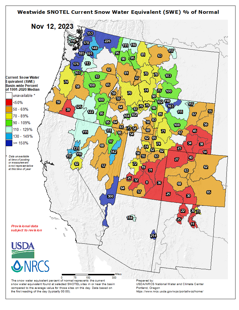
To be clear, this isn't necessarily a bad sign this early in the season. All it will take is a couple good storms to get back on track... and certainly the more, the better. The trend is in the right direction over the next few weeks.
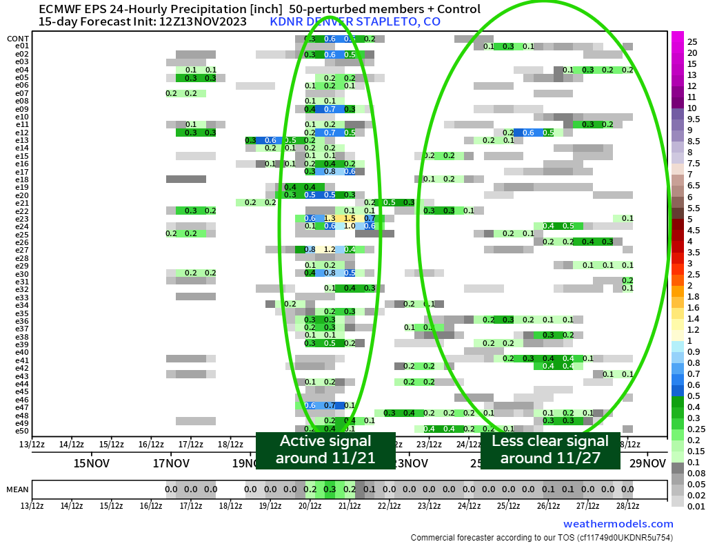
In terms of precipitation, there are some chances between now and early next week. For now, Sunday to Tuesday (11/19 to 11/21) is a window of time we may catch some water.
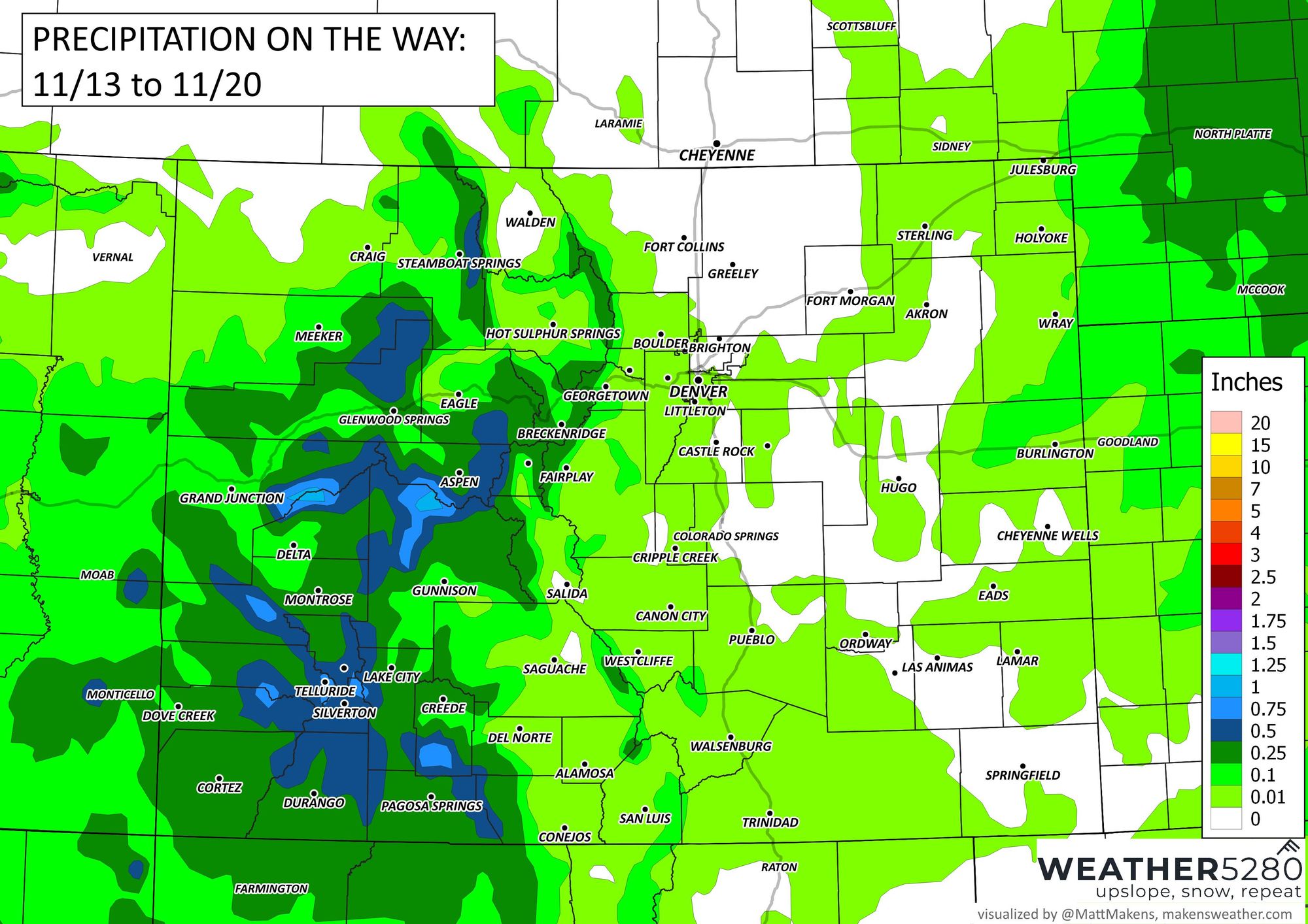
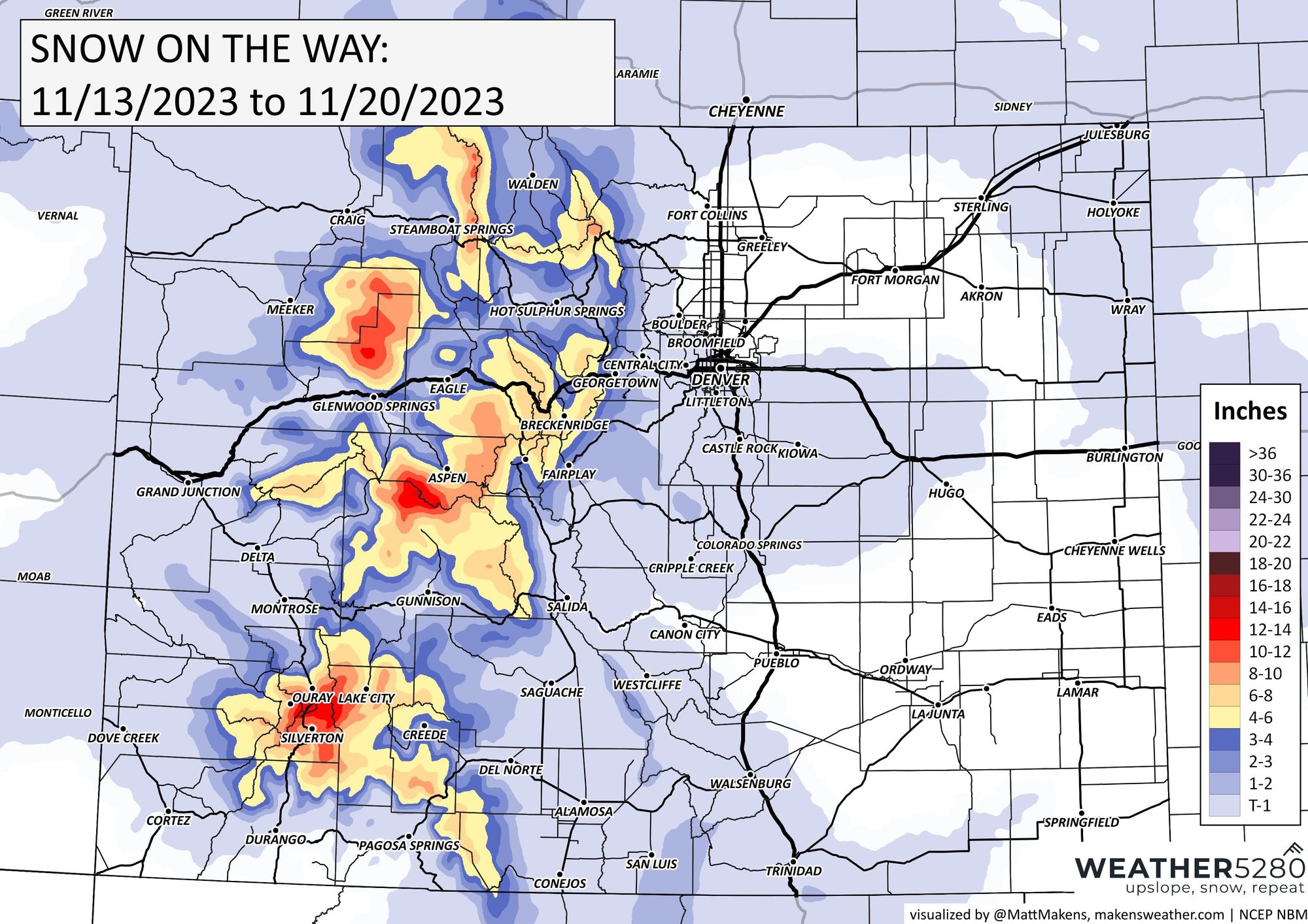
During the next week, here is the estimated total precipitation on the way. Precipitation will favor the high country, and again areas well to our east, but let's see if we can catch some along the urban corridor as well.
Of that, here is the total snowfall estimate:
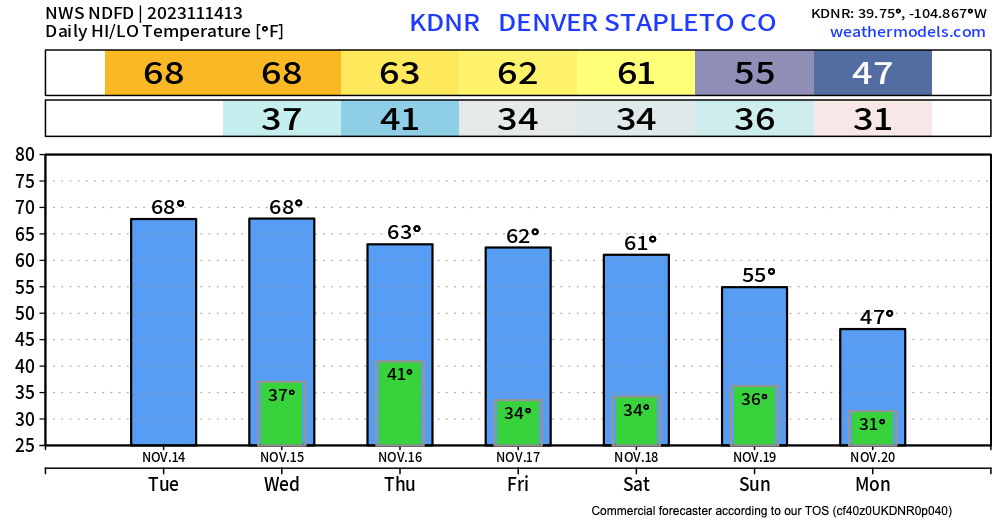
For Denver this week, here are some forecast numbers for you.
No, not a huge change on the horizon yet, but the atmosphere is trying to get us some activity into next week and through the end of November. Time will tell, and so will we ;-) Make sure to stay one step ahead of the changing weather by subscribing to our email list today!