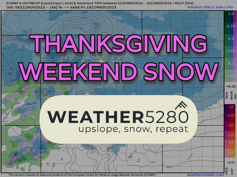
Colorado snow for Thanksgiving Weekend

The first truly widespread snow for the state of Colorado is headed our way. Not a lot has changed with the forecast from the snippets we've given you thus far. In this blog, we'll focus on timing, totals and impacts of this storm. We'll also outline some national travel trouble spots for folks heading home this weekend.
Let's time it out
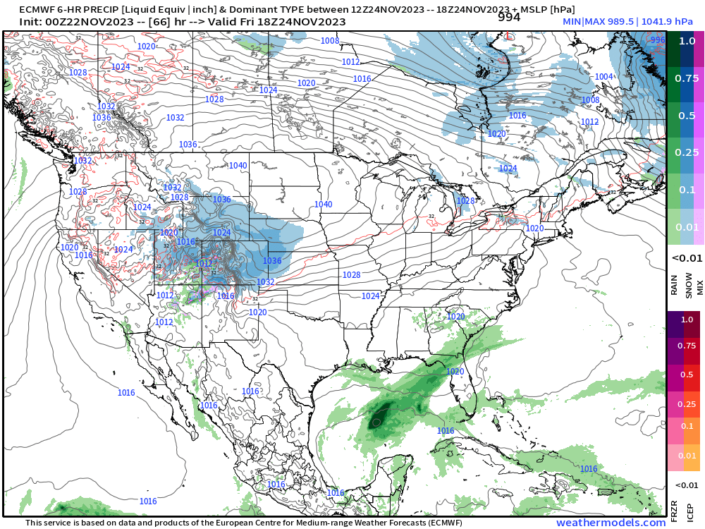
A strong cold front will slide south Thursday afternoon bringing increasing clouds and colder temps for Thanksgiving. By sunset Thursday, snow showers will start to break out along the northern foothills. Snow will increase along the lower elevations of the front range closer to midnight as we turn the page into Friday morning.
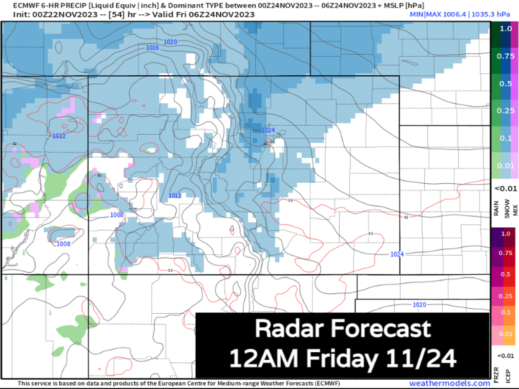
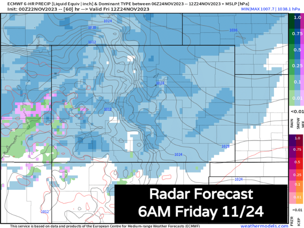
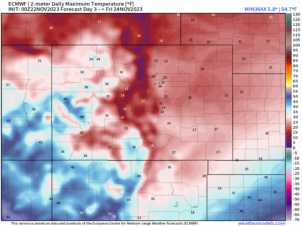
Friday morning around sunrise looks like it will be the height of the storm for areas like Denver, Boulder and Fort Collins. We'll also have steady snow over most mountain locations. I-70 from Burlington to Grand Junction will be slow and snowy. We'll also have temps will be in the 10s and 20s at this time, so snow will have no problem sticking to the roads.
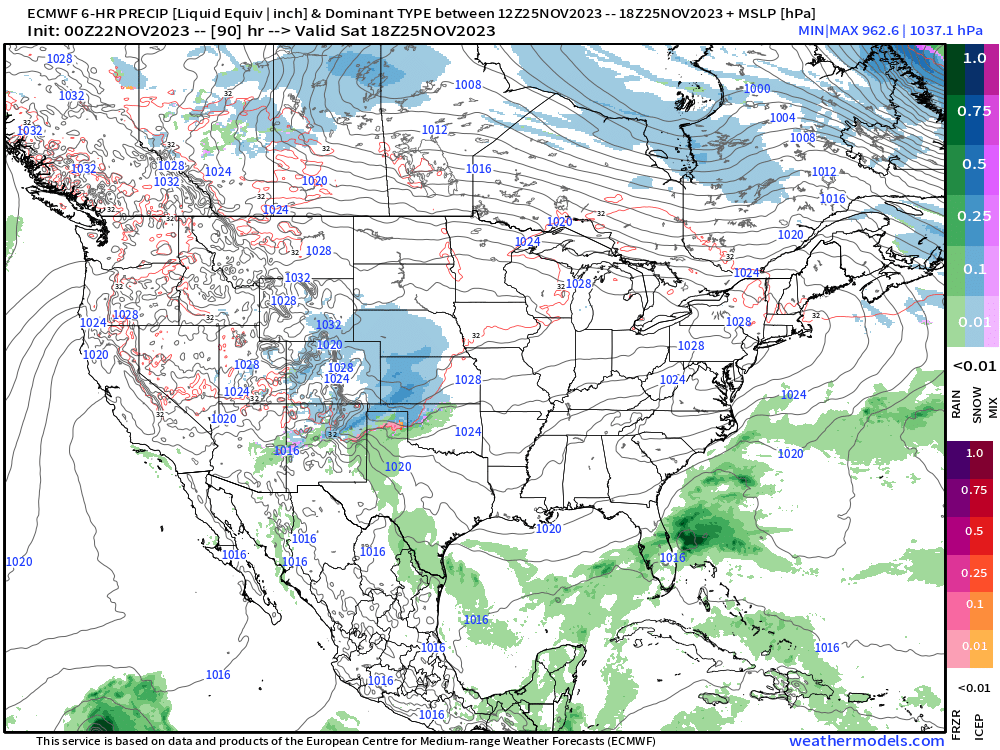
By Friday evening, heavier snow from the morning pushes east over the plains into Western Kansas. At the same time, the storm looks like it will send another piece of energy into the San Juans, increasing snow over the southwest mountains.
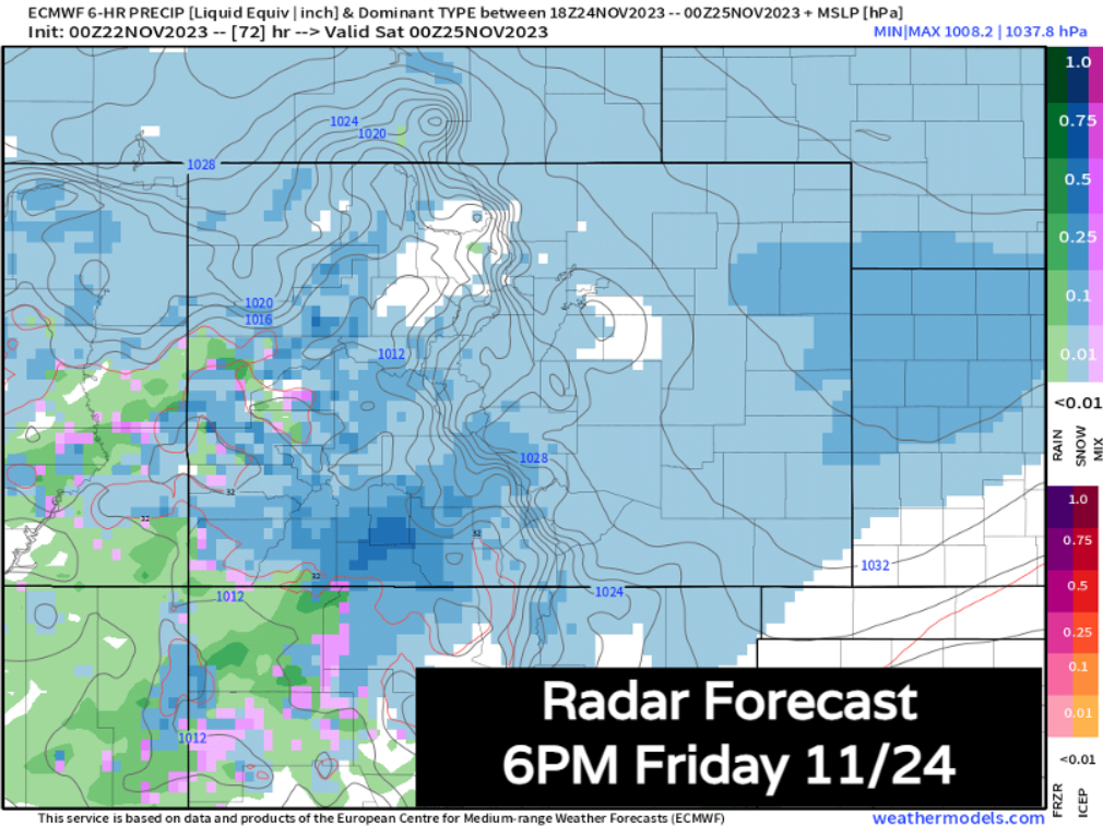
Temps on Friday will be very cold for most of the state. Temps in the 10s and 20s through the afternoon will keep roads nasty for most along the Front Range, especially those that aren't treated. Road crews will likely have to focus on major roads much of the day Friday... if you can wait to travel, do so. We will see snow CONTINUE for much of Friday night.
As the storm exits, it looks like it will bring another wave of accumulating snow over the southeast plains, with snow slowly tapering off along and north of I-70. Notice how many folks are STILL seeing snowfall for Saturday morning. Granted, it shouldn't be AS heavy, and we'll see it slowly taper into Saturday afternoon... but this isn't some quick event that's in and out. We'll see waves of snow over a 24-36 hour period.
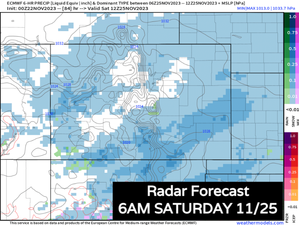
By sunset Saturday, most snow along I-25 and east has ended... Light snow will be left over for the continental divide.
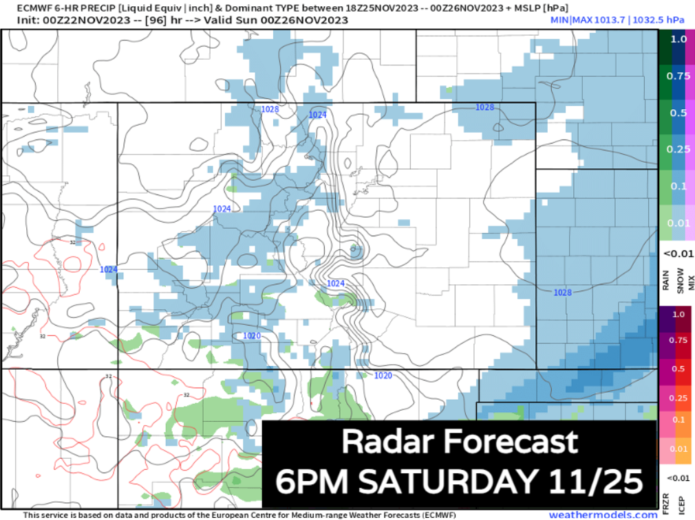
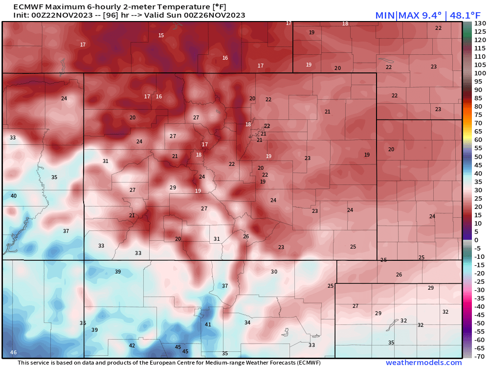
High temps across Colorado Saturday will be in the upper 10s and LOW 20s at most. Winter cold continues. Sunnier skies with 30s and 40s return on Sunday
How much are we going to get?
Here's a first pass at totals. Foothills are in line for 4-10". From Loveland to Fort Collins, 3-8" can be expected. There's a bit more uncertainty for the Denver Metro, especially as you head east. A general 2-6" is a good look for downtown to DIA at this point. Areas over the Palmer Divide have a chance for 3-6".
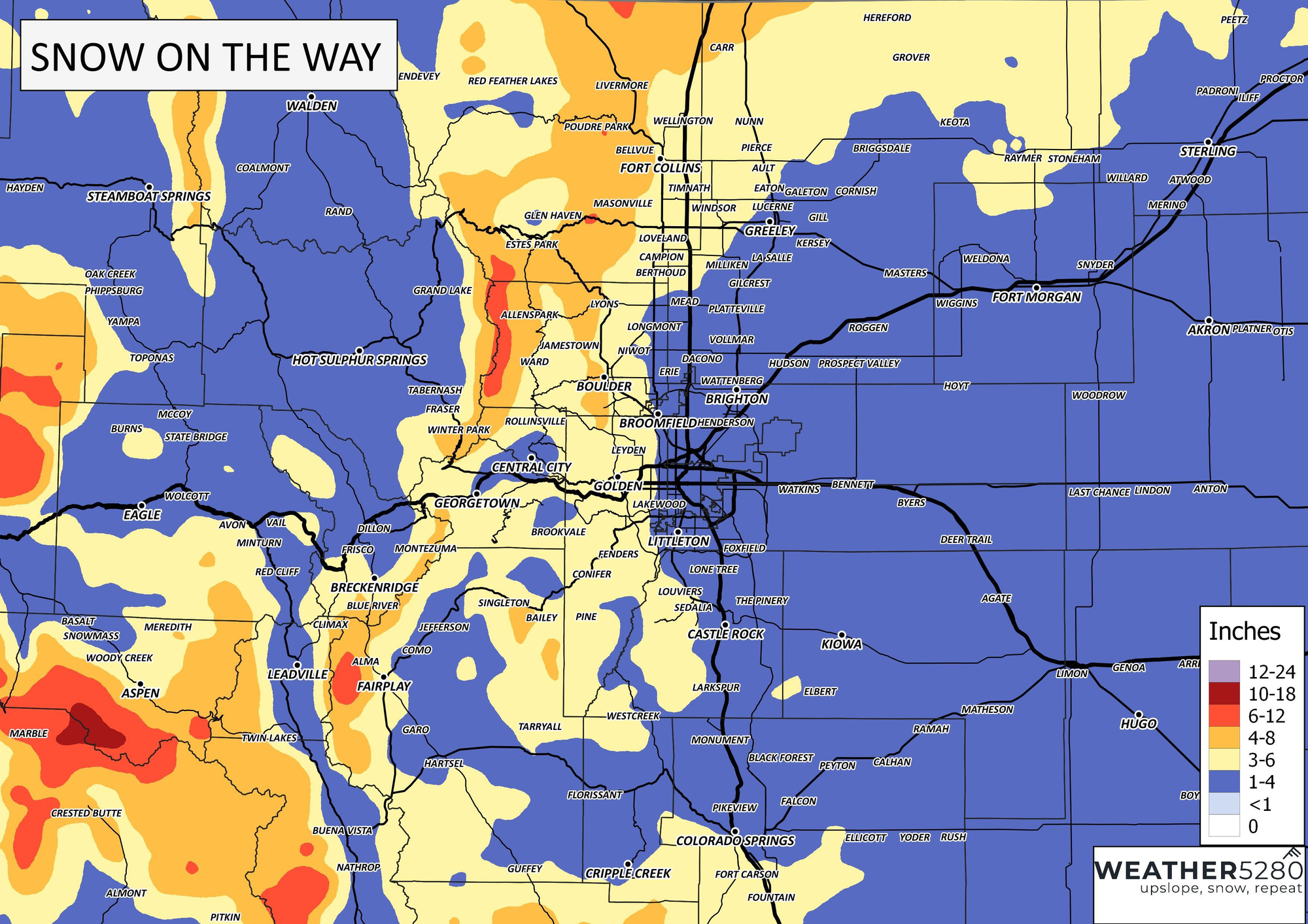
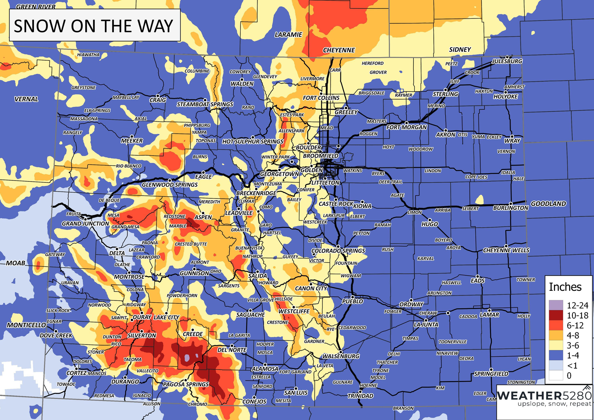
A wider view shows some more hot spots, especially in the hills. The major ski resorts will do really well. Many pushing 6-18". 1 to 2 feet will be possible around the Wolf Creek Ski Area.
Fremont, Custer and Southern El Paso county will benefit from the secondary burst of snow into Saturday too. Canon City, Westcliffe and Fountain could push 3-8" of snow. For Colorado Springs and Pueblo, 2-6" of snow will be possible.
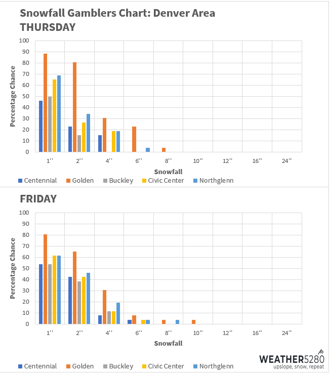
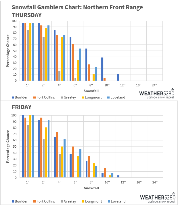
Snowfall gamblers charts are below:
What will the impacts be?
Due to cold temperatures, road conditions go downhill quickly into Friday morning for most across the state. We'll remain slow into Friday evening as snow continues. Snow will taper for the northern front range into Saturday afternoon, road conditions should improve a bit in those locations. Heavier snow further south and over the mountains will keep travel slow through Saturday evening.
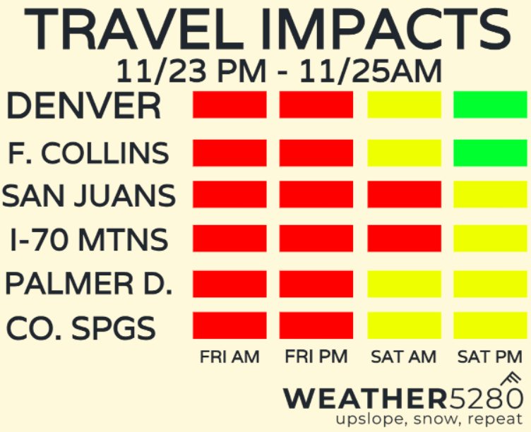
All things considered, this a major-impact system, but we will have plenty of cold air to work with, leading to slicker road conditions. Snow will also be pretty widespread across the state, so travel will be tricky for long periods of time in some cases.
We'll also probably see airport delays Friday and Saturday too... plan accordingly!
What will national travel look like?
Friday is Colorado day, apparently. Most travel across the country should be OK outside of the state.
By Saturday afternoon, the storm moves east. Still looks like most travel nationwide is ok. For folks driving towards Colorado from the east, western Kansas travel is looking pretty nasty Saturday.
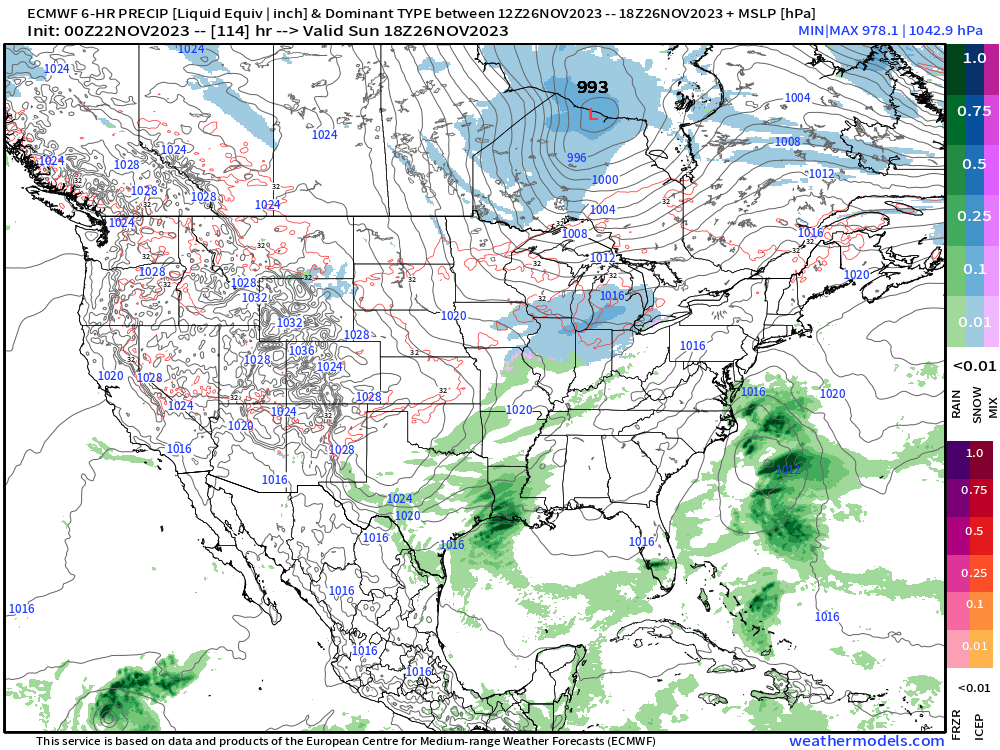
By Sunday, the storm will exit towards the Midwest. There may be delays around Chicago or Detroit with some light snow, some thunderstorms around Houston. Most other major hubs should be ok, including Colorado.
We'll continue to keep tabs on this storm, but plan on travel trouble across Colorado both on the ground and in the air Friday and Saturday, stick with Weather5280 and keep yourself ahead of any weather changes by subscribing to our email list today!