Slow start to the season for Western U.S. snowpack, will that change in December?

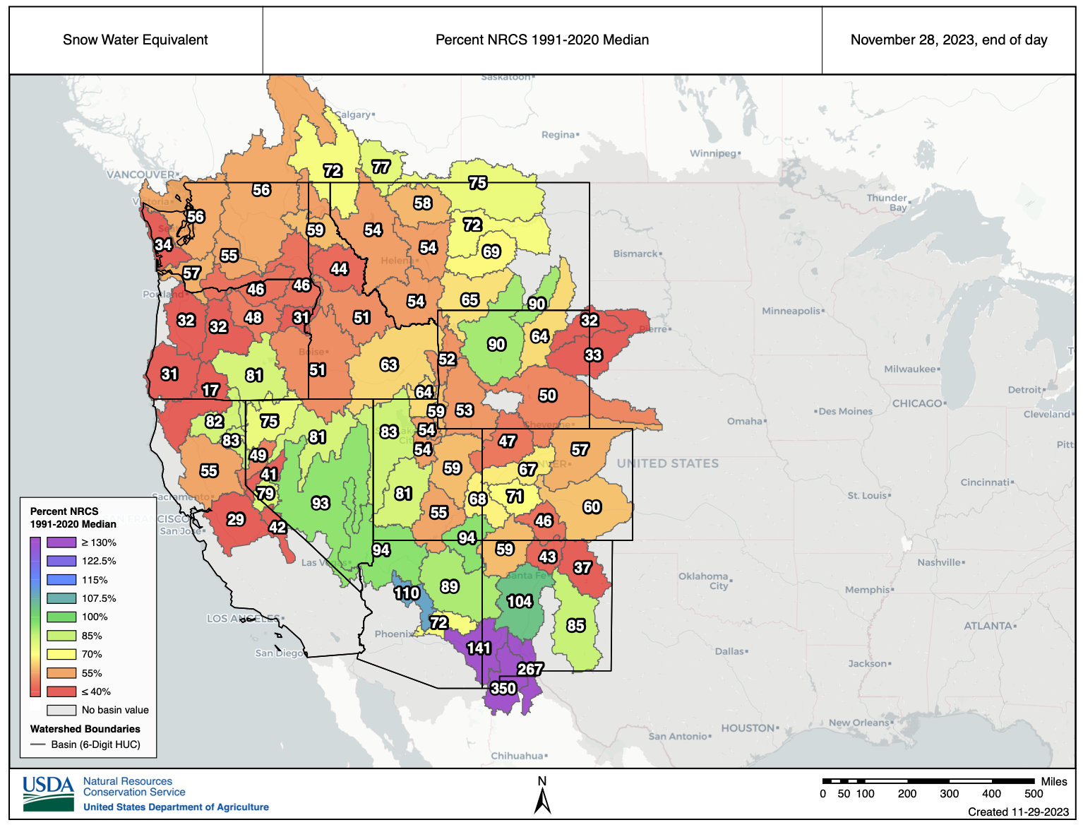
It hasn't been a great start to the snow season across the Western United States, with the majority of basins from Colorado to California reporting (well) below average snowpack through the last days of November.
The season is young, so today's numbers aren't necessarily a harbinger of what's to come, but as we get into December we start to really hope to see those numbers climb across the board.
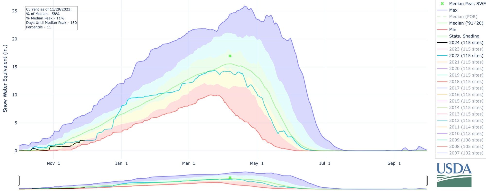
For Colorado specifically, the statewide median snowpack is sitting at just 58% as compared to the long-term average for the date, which interestingly enough is almost identical to where we were last year at this time. An active end to December pushed the state above average as we moved into the new year last year, with a relatively average snow season thereafter, and fairly quick melt in the spring.
The slow start isn't unique to Colorado, however, with nearly all basins across the West running below average to date, the exception being across the far south, with above average SWE for parts of Arizona and New Mexico.

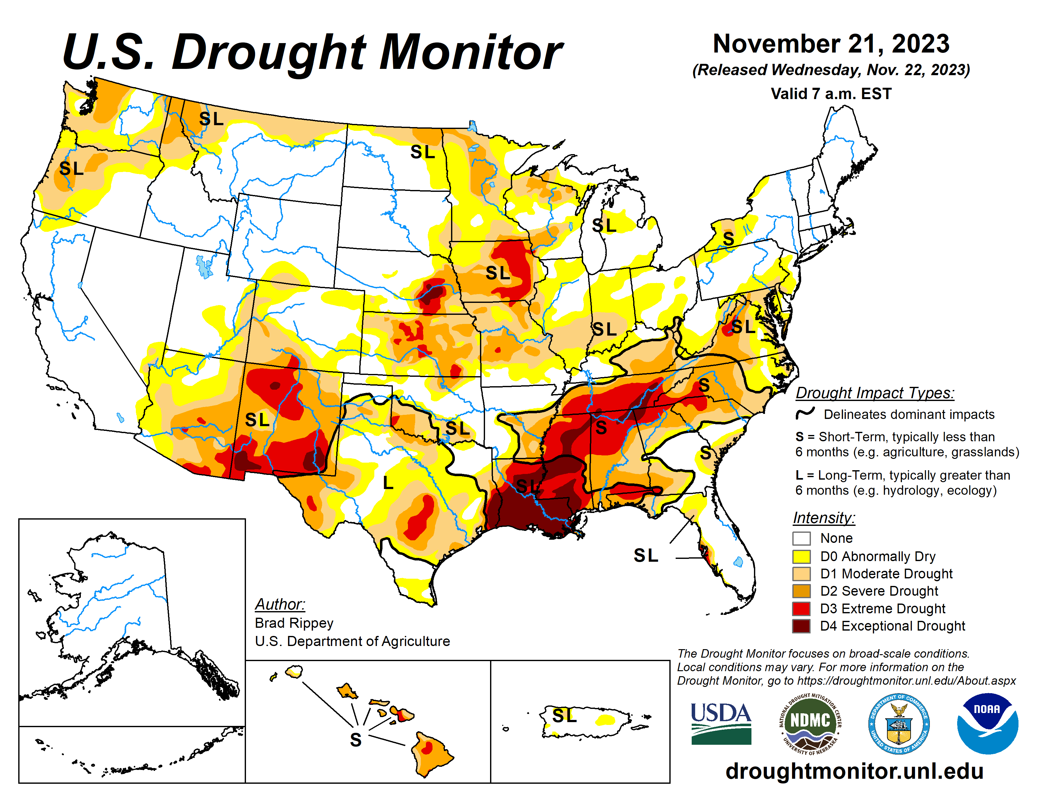
Of course snowpack is hugely important across the West, and given the fact California is finally drought-free one hopes that we don't just immediately erase that good fortune with a poor winter for snow across the West. The latest drought monitor shows the worst of the drought conditions have moved south and east in recent months, a trend you might expect to slow or reverse given the ongoing El Niño.
December at a glance
So, will things change in December? We'll see. In theory, yes. We'd expect a much more active December given the atmospheric setup. In reality? It's a bit of a waiting game – models have been just awful in the medium range, and it's a bit of a believe it when we see it kind of scenario here.
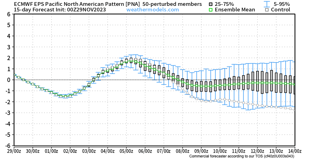
One teleconnection we watch for indication of active weather across the western U.S. is the PNA. Generally we want that to be negative, or at least not strongly positive, if we want troughing (storms) to visit with an regularity or staying power. The latest outlook from the Euro ensemble suggests we'll be negative to start December, and spend the first half of the month near neutral, or oscillating slightly.
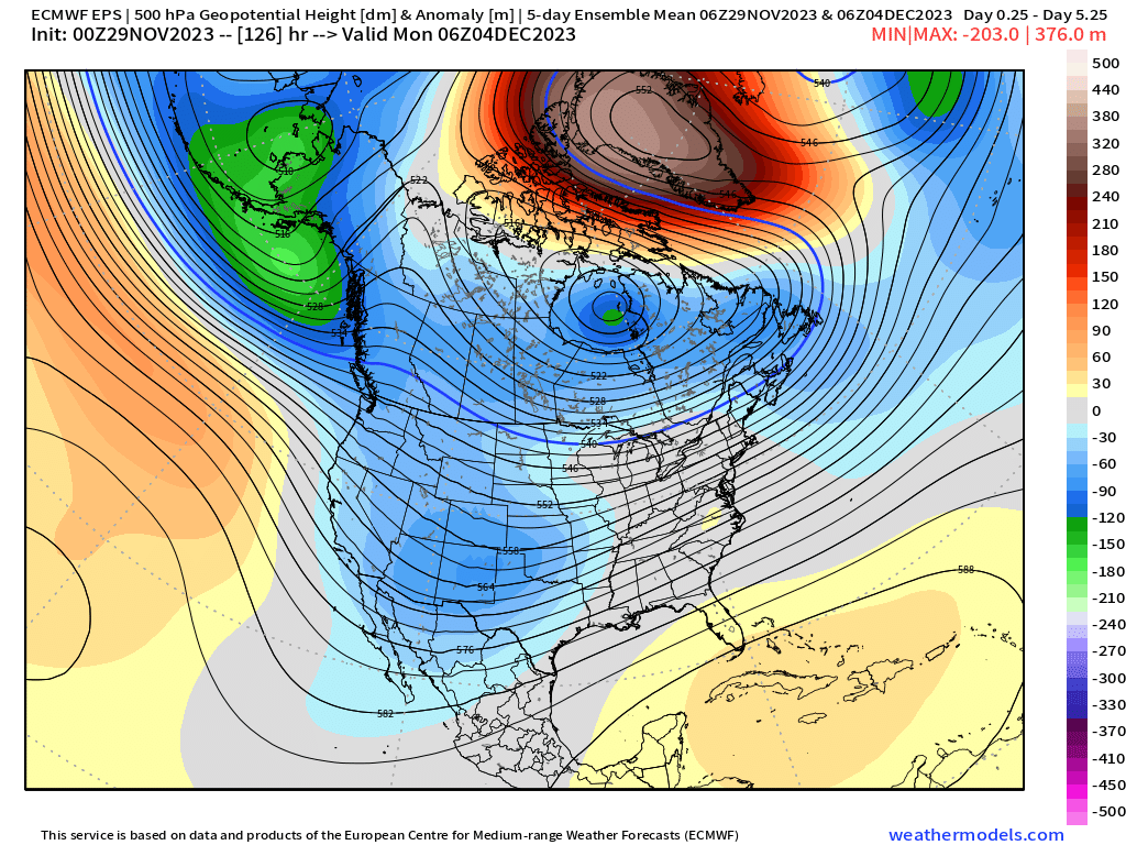
Given the lack of a strongly positive PNA, the 500mb pattern for the next 15 days or so largely makes sense.
We see troughing in the means over the next 5 days across the West (and yes, some decent mountain snow on the way!):
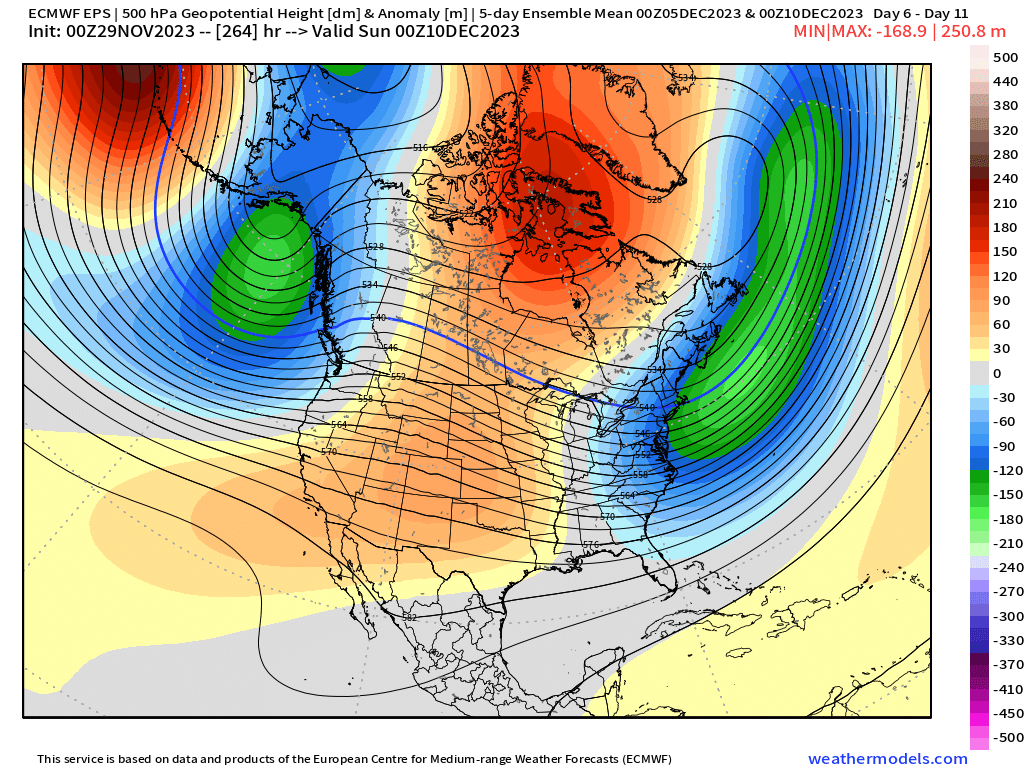
With perhaps some ridging for a time after the 5th:
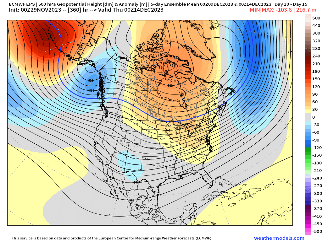
Before the ridge tries to break down again after the 10th (or so):
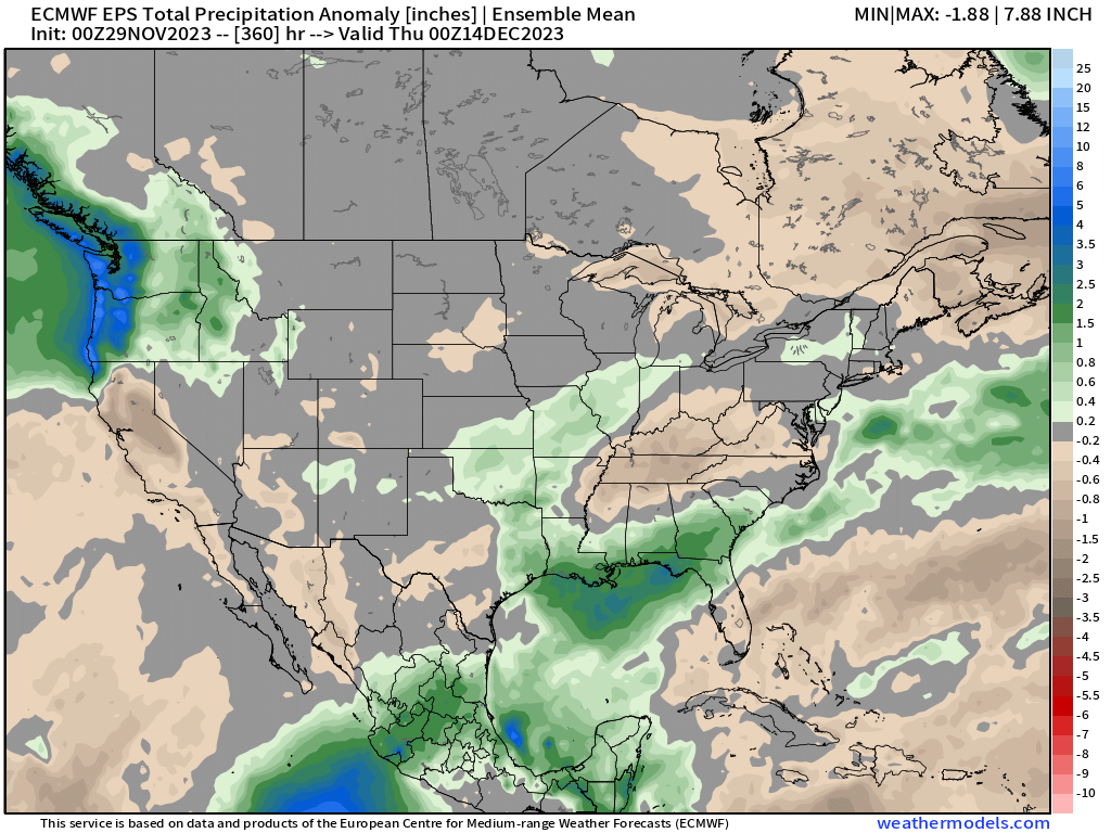
With no crazy strong signal for persistent troughing or ridging, we don't see a crazy strong signal for wet or dry across Colorado either. Perhaps a bias toward dry in this model, but mostly "near average" and I wouldn't be shocked if those dry signals across the high country end up being wrong.
For California, still a bit of a struggle to get a sustained storm track to take hold, at least for the near-term, but things are looking quite wet across the Pacific Northwest to start December:
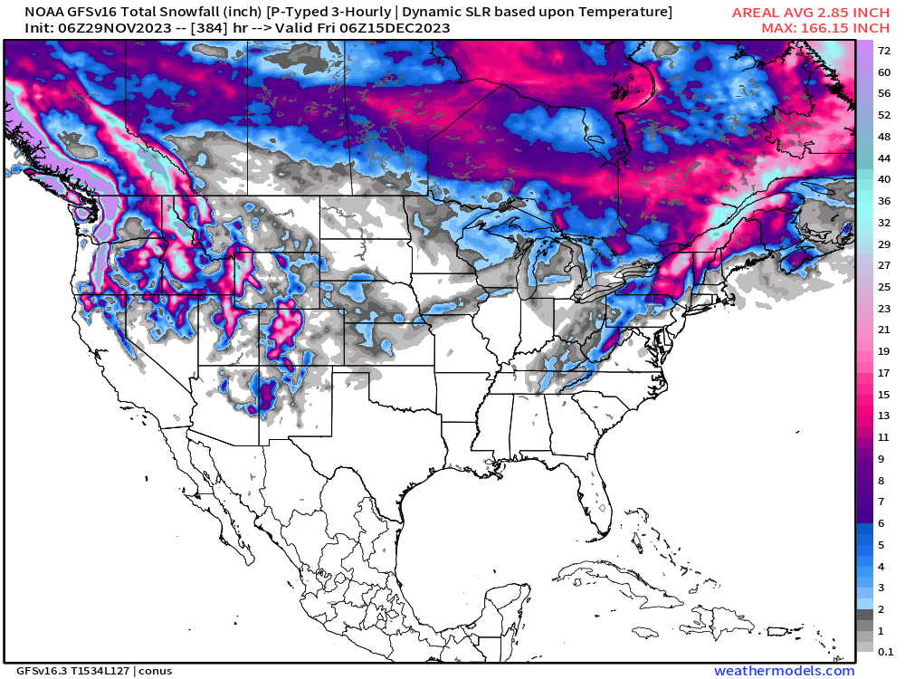
The GFS would certainly support this idea. Pretty good snow on the way for the Pacific Northwest and northern Rockies (including Colorado!) over the next two weeks, but might have to get lucky across California and the Great Basin:
You'll note east of the mountains in Colorado not much of a signal for snow. What we do see on the map may come later this week, and it doesn't look like much.
That said, not a pattern to sleep on either. Some data suggests what moves through around the 10th of December could end up with a bit more of an impact east of the hills than the maps above indicate today. We shall see!