
Colorado weather: More mountain snow and Front Range wind on Sunday

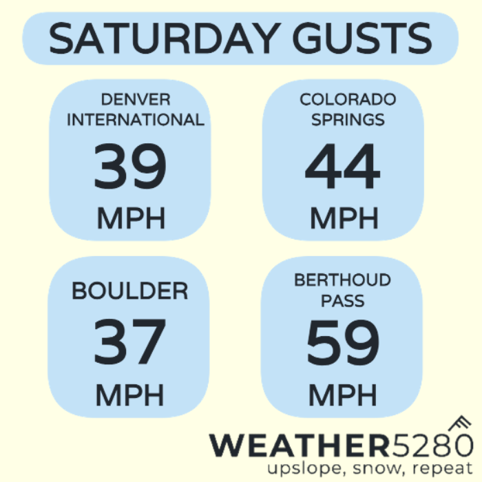
It was a snowy Saturday over the continental divide, with strong winds in the mountains, passes and along the front range.
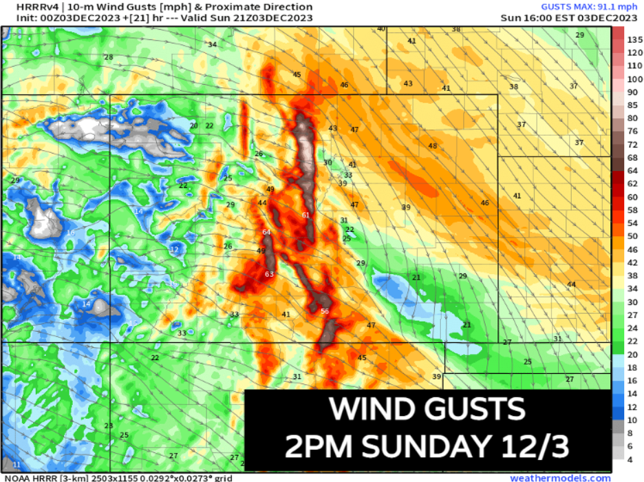
Here's a look at some of the gusts across the state today:
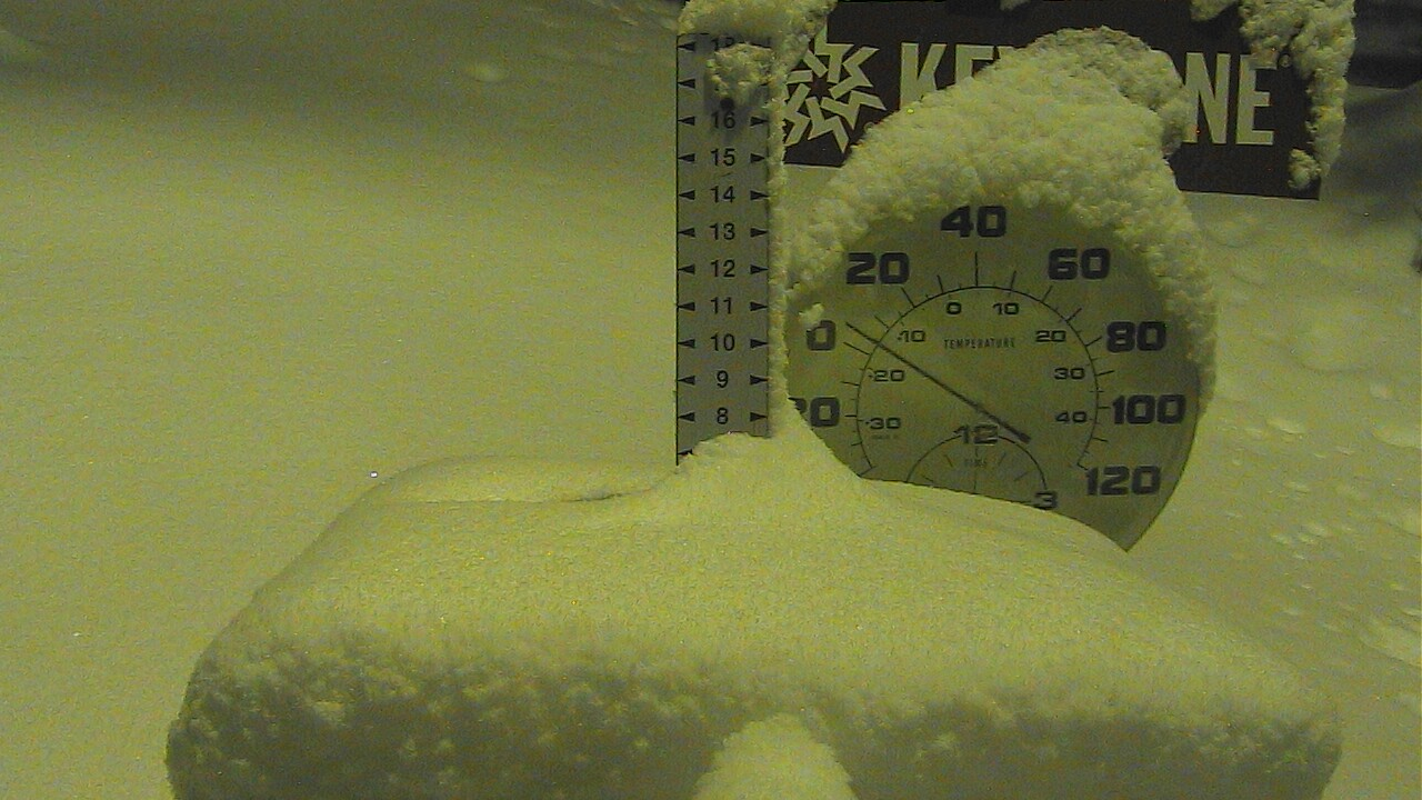
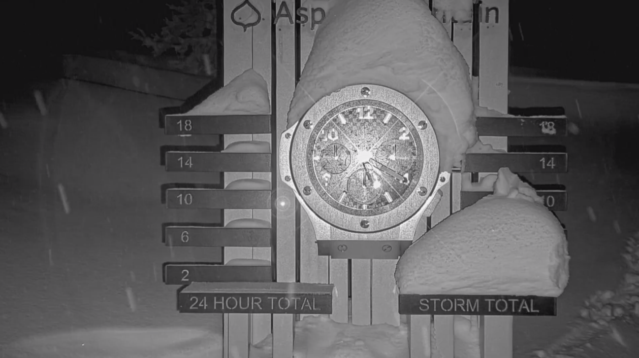
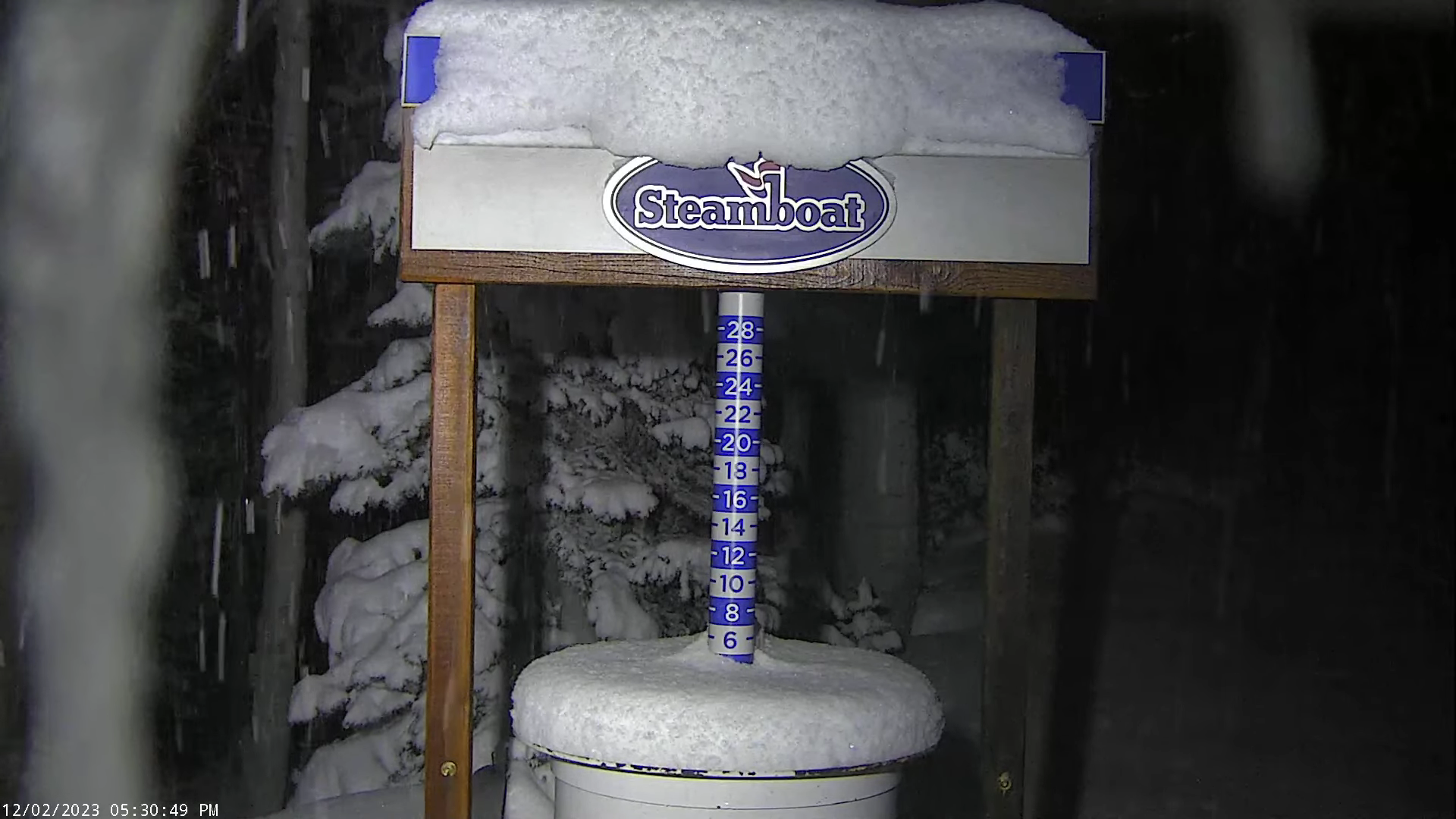
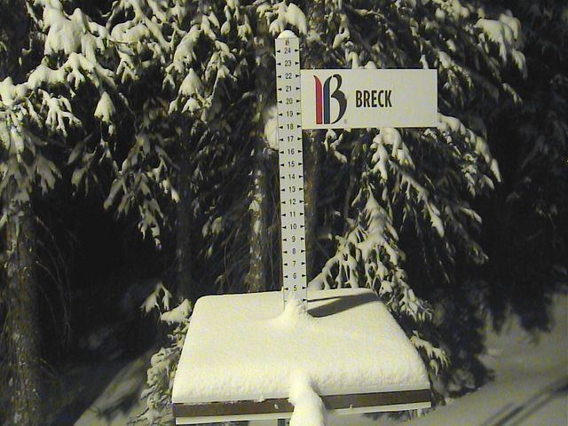
Snow stakes looking good (Imagery from 5:30pm)
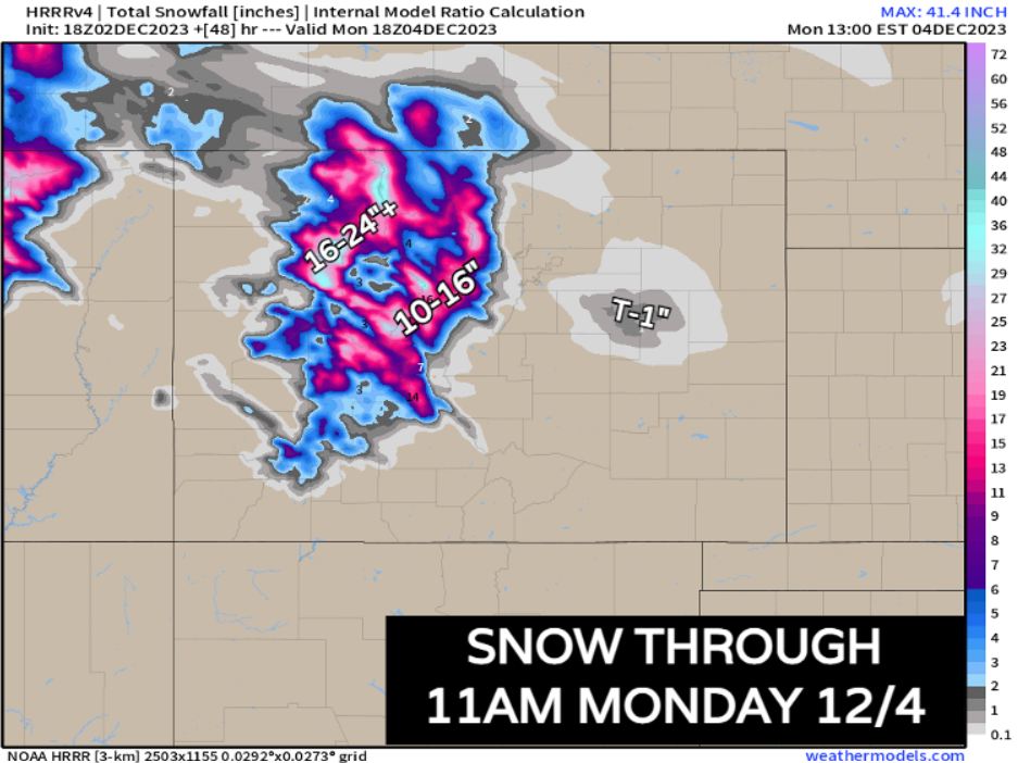
Many locations already seeing 5-10" of fresh powder. For some resorts, this event is just getting started with another 10-16"+ possible in the central and northern mountains.
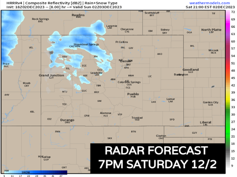
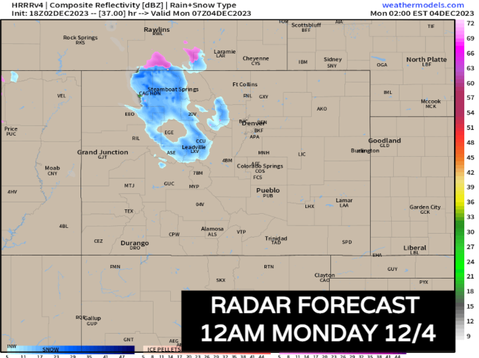
Multiday snow and wind event continues into Sunday
We're in a bit of a lull for some right now this evening, but that isn't going to last long. Snow will pick up after midnight and become more widespread over the hills by sunrise Sunday.
Snow will be heavy at times and mountain travel will be very tough. Winds will be howling at 30-40 mph creating zero visibility at times.
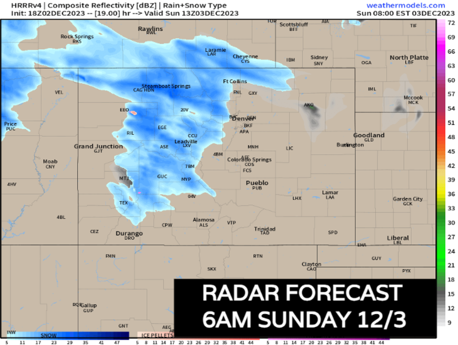
By mid-to-late morning we're going to see an advancing boundary move through Denver which could bring a few snow showers along and east of I-25 – this looks really minor at this point, but a dusting or so on the east side of the Palmer Divide won't be impossible.
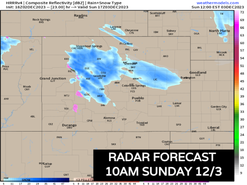
Snow continues for most of the day Sunday, slowly down after sunset. Areas between Steamboat and Leadville will see moderate snow continue through Monday morning.
This is a pretty setup from heavy mountain snow and exactly what resorts needed. An addition 10-16" is possible for the central mountains, especially along I-70, with 16-24"+ along the northern mountains. Anything above 24" is will be over the highest mountain peaks.
Keep up with the latest from CDOT for the latest on road conditions if you have to head back tomorrow.
More wind into Sunday too
While it will be snow up high, it's mostly about the wind down low. Expect another really windy day out there along across eastern Colorado. 30-50 mph gusts are expected into the late morning and afternoon along the urban corridor. With temps still in the 30s and 40s, it's going to be another really cold-feeling day.
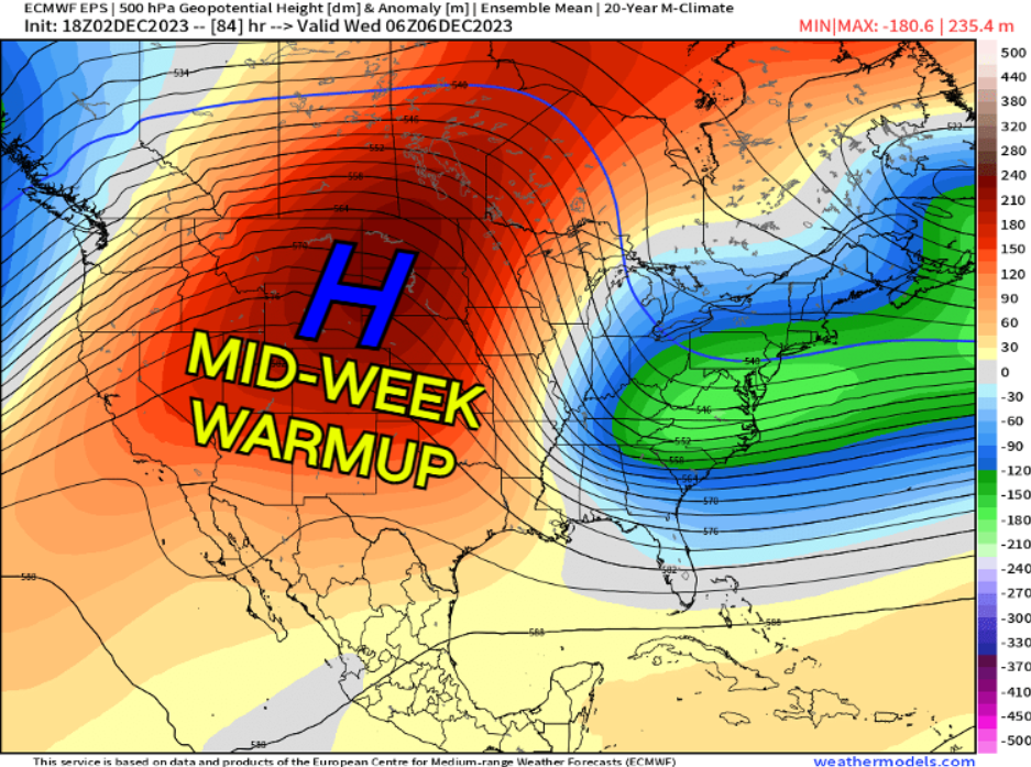
The week ahead
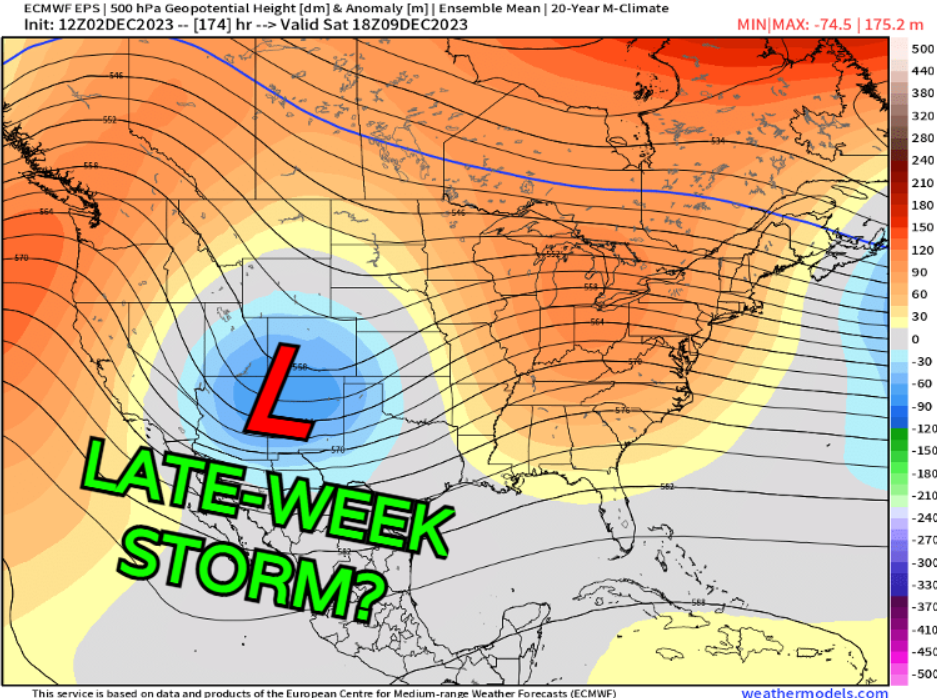
We're going to snap out of the cool snap quickly into the work week, 50s and 60s will make a quick comeback. Just as quick as it comes thought another storm looks to be lurking in the distance...
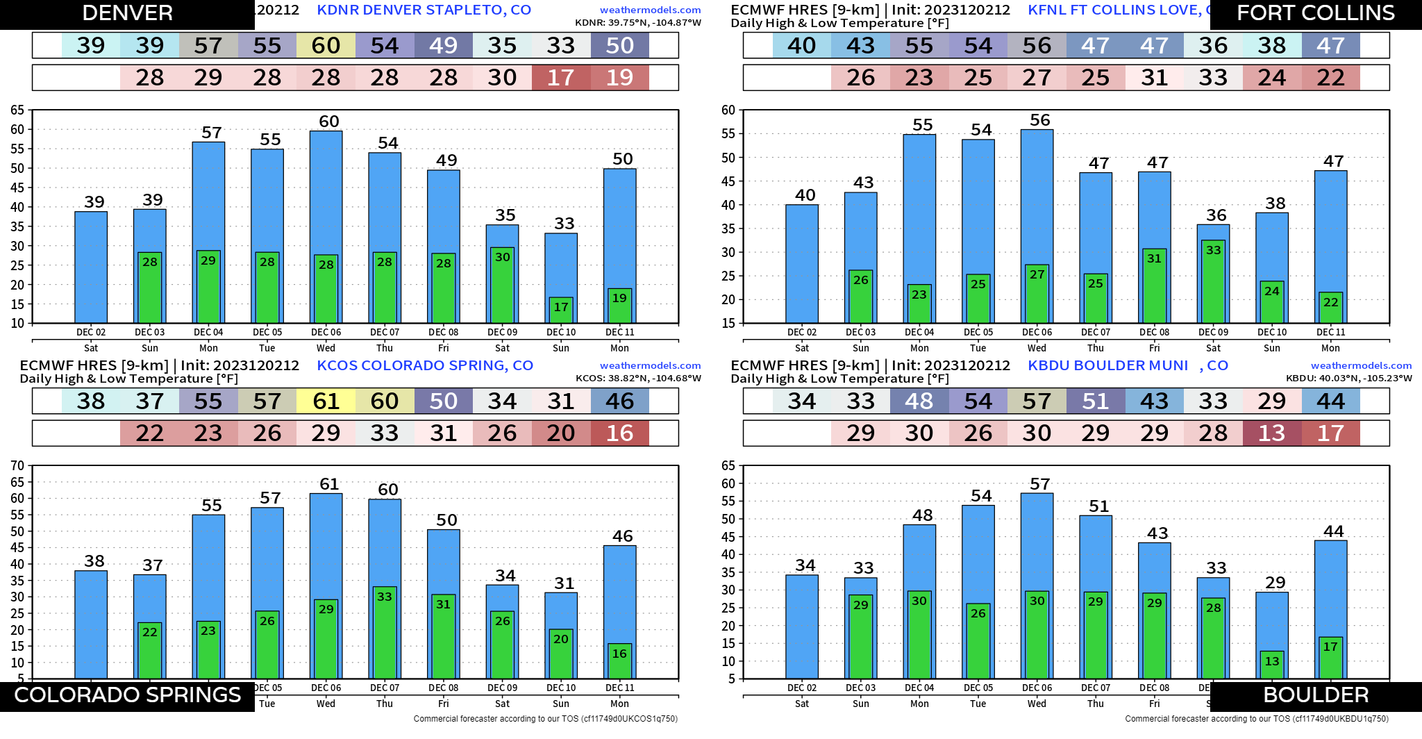
This next storm... could mean something a bit more around here. It's a bit tough to line these things up, even a few days out, but right now, most data is pointing towards a potentially disruptive storm across the state by next Saturday. As always with something that's 7 days out, expect changes! We'll stay on top of things for you.
Stay ahead of those forecast changes by subscribing to our email list today!