Colorado Weather: In the warm before the storm, a peek into the MJO

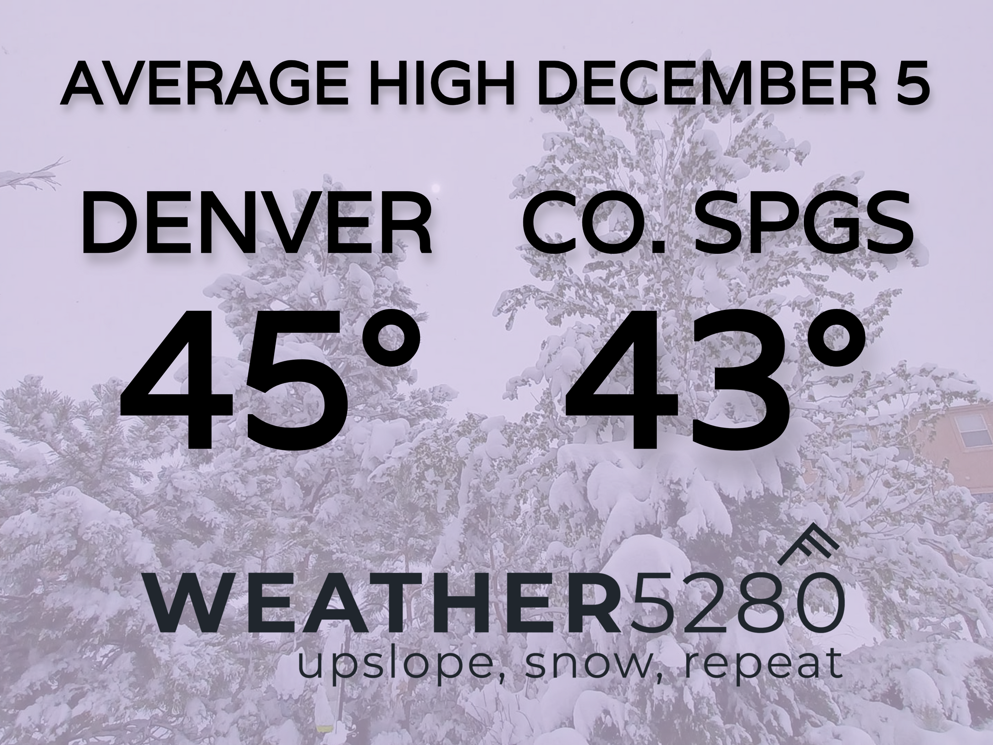
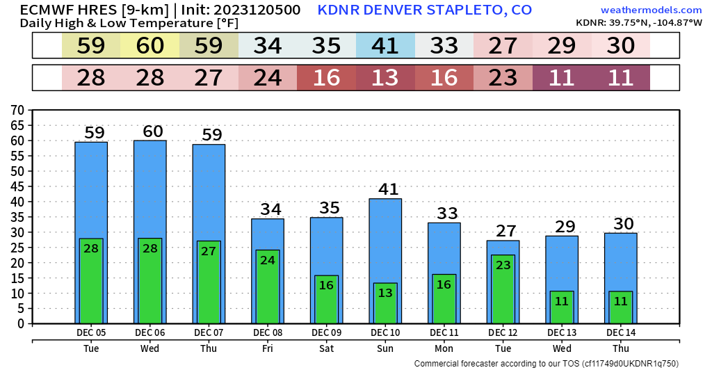
After a chilly, windy and snowy weekend across the state of Colorado, the work week has landed us in a pretty good spot. Monday featured a bit of wind and leftover snow in the mountains, Tuesday is looking great with widespread 50s and 60s along the Front Range, and Wednesday should be one of the warmest days of the week with most getting into the 60s along and east of I-25.
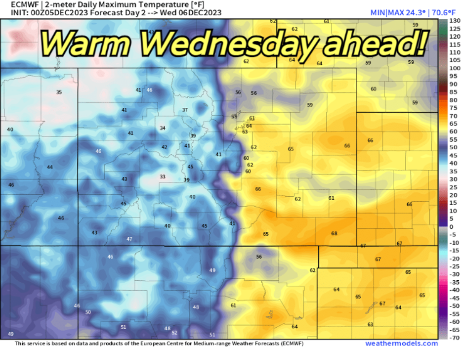
Clearly we're going to be working with stuff well above normal the next few days. The good news is that we won't have much wind to deal with. As our next storm approaches Thursday, that may be our breeziest – even then it shouldn't be nearly as bad as this last weekend was.
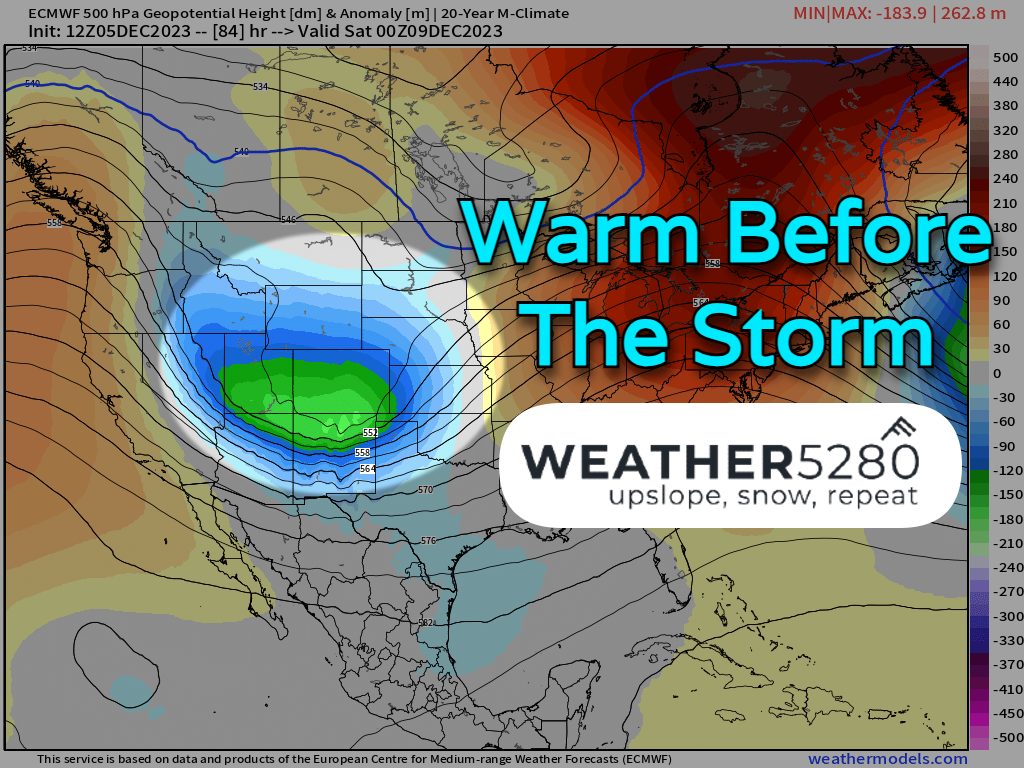
BIG CHANGES MOVE IN ON FRIDAY
Notice on the map below – we start with the ridge overhead, it moves out quickly and is replaced by potent area of low pressure. Right now, the storm track is positioned decently, but the system is moving really quickly and doesn't have time to "set up shop" in our neck of the woods.
That being said, the overall pattern is promising, even if this storm doesn't deliver a huge wintry blow. The fact that we're seeing the atmosphere move like this is a good sign (read more on why it's a good sign in the MJO section below!)
During La Nina the past few years, it was easy to get stuck in unfavorable patterns that wouldn't budge. In El Nino years, it's more favorable to see weather regimes that see bursts of westerly flow, keeping things moving – e.g. giving us more shots at stormy weather.
A quick peek at 10-day temps for Denver show a lasting pattern change possible starting on Friday.
If we do see snow, it probably starts Friday afternoon in the northern Front Range, moving south through the overnight and eventually exiting on Saturday morning.
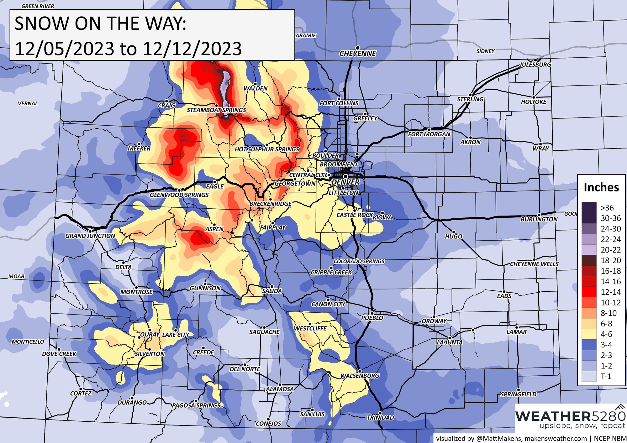
We'll dig a bit more into timing later this week, but here's a broad-brush look at possible snowfall totals. Looks like another good mountain storm, and as always, some questions about the way the Front Range pans out. Your usual suspects over the Palmer Divide, and the Sangre de Cristos.
For now, a few inches isn't out of the question for places like Denver, Colorado Springs and Fort Collins.
AND SOMETHING EXTRA...
A bit into the weeds with the graphic below - It's called an MJO Index. It's kinda like a pie, split into 8 different pieces. Each piece represents a different part of the globe.
For example:
Zone 1 & 2 is from Africa to the Indian Ocean
Zone 3 & 4: from Indian Ocean to the Maritime (areas around the Philippines)
Zone 5 & 6: Maritime to the Western Pacific
Zone 7 & 8: Pacific, through the U.S., back to Africa (This is the zone we want to be in for a higher potential of active weather in Colorado)
All the "spaghetti-like" lines show where the potential for a more active weather pattern is moving. The further the lines are stretched out from the center, the more pronounced the "active" signal is. (The red crayon and Dec 5, 9, 15 are added annotations to help you follow the graph better.)
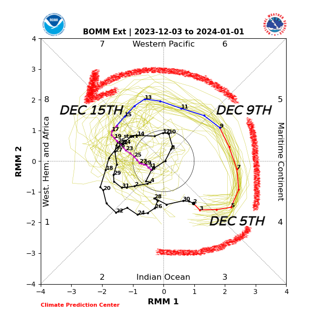
Notice the burst of weather that starts in the Maritime today, on the 5th, and see how it circles the globe, all the way through mid-month. A signal like this can be promising for us, because it indicates the atmosphere is moving. It's giving us more opportunities to cash something in.
But, as with all things weather, nothing is promised. A pattern is only as good as the storm that actually impacts you, which is, in the end, who we write these for!
Long story short: Even if this 9/10th storm doesn't work out, we still have the approaching MJO signal through mid-month. Sometimes during these westerly bursts, the first storm can act as a "warning shot" as the main pattern change is taking place, a way of saying "more might be on the way".
Unfortunately, with the purple line showing a possible collapse to the center towards the end of the month, maybe things slow down a bit.
We'll keep an eye out for you, as always and you can stay up to date on Friday's approaching storm by subscribing to our email list today!