Denver weather: Quick hitter to deliver wind, cold, and some snow to areas Friday

There's a rapid change about to move across Colorado and right through the metro areas Friday. You'll notice wind, a sharp drop in temperatures and many of us will see some snow to add potential icing to roads in time for us to start the weekend. Out of all elements, I think wind and the temperature change will be the takeaway. Snowfall, remains hit and miss for much of the metro areas with this one...but still a threat and a threat to roads before we get the day done Friday.
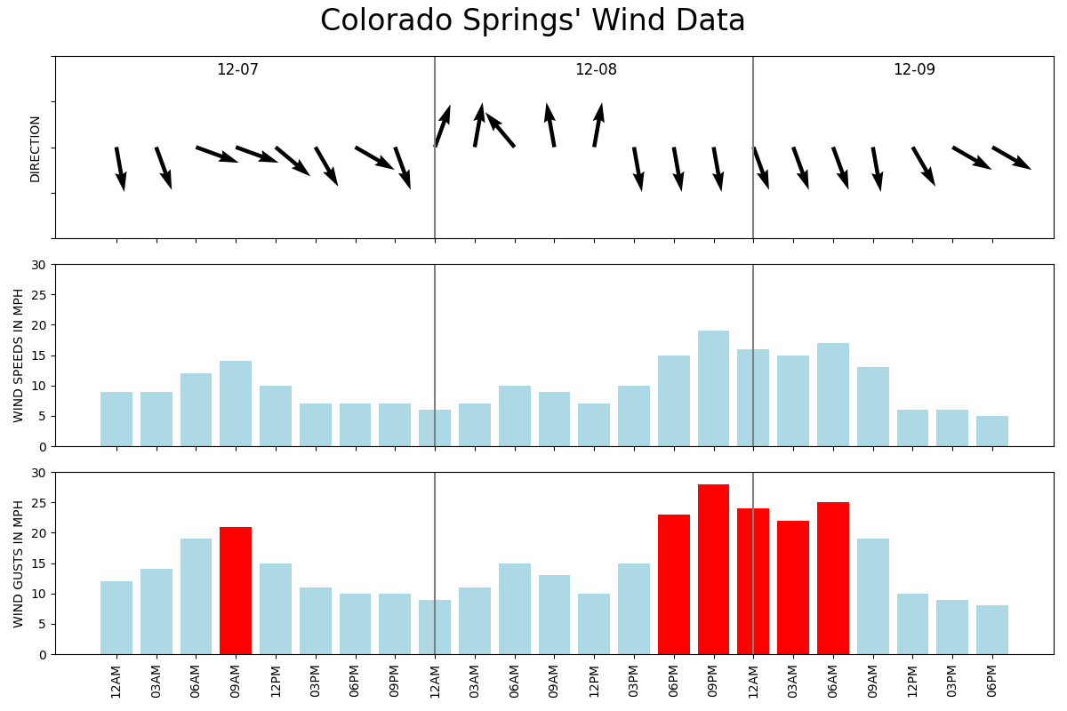
So, when does this thing hit? You'll notice changes throughout the day; as far as the front moving through with a wind shift and temperature drop you'll notice it first in Fort Collins, then Denver, then in the Springs. Out of the metro locations, Colorado Springs will have some of the gustiest wind arriving in the afternoon after the front has passed.
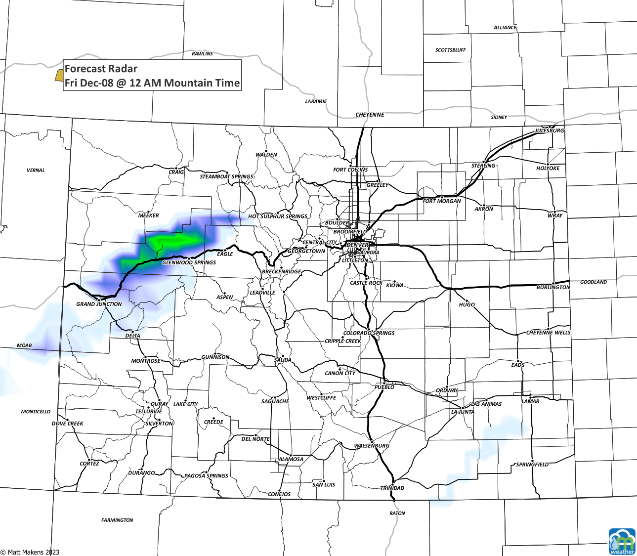
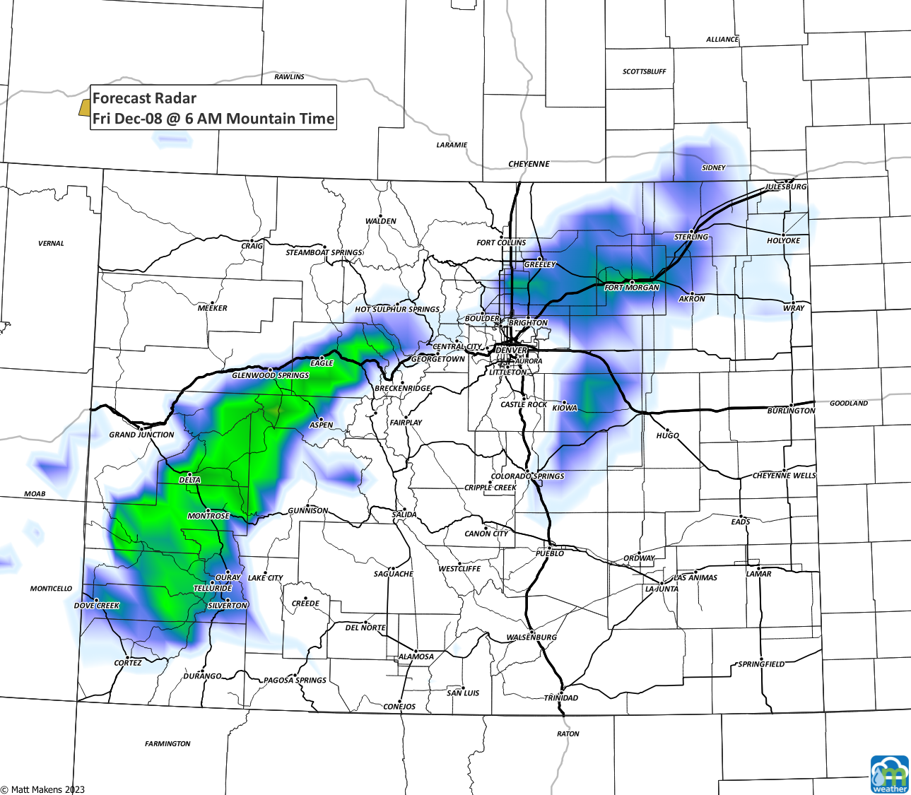
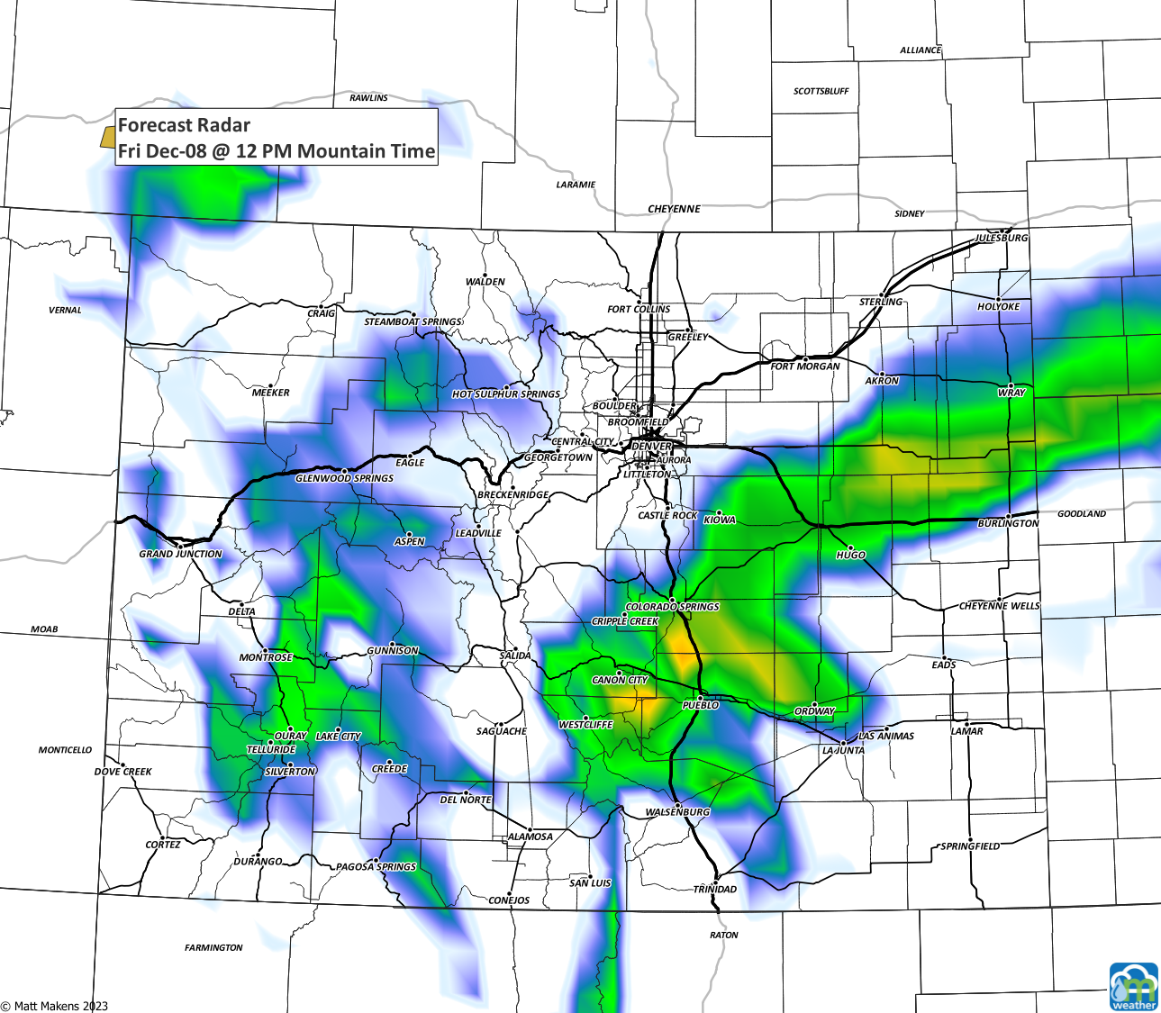
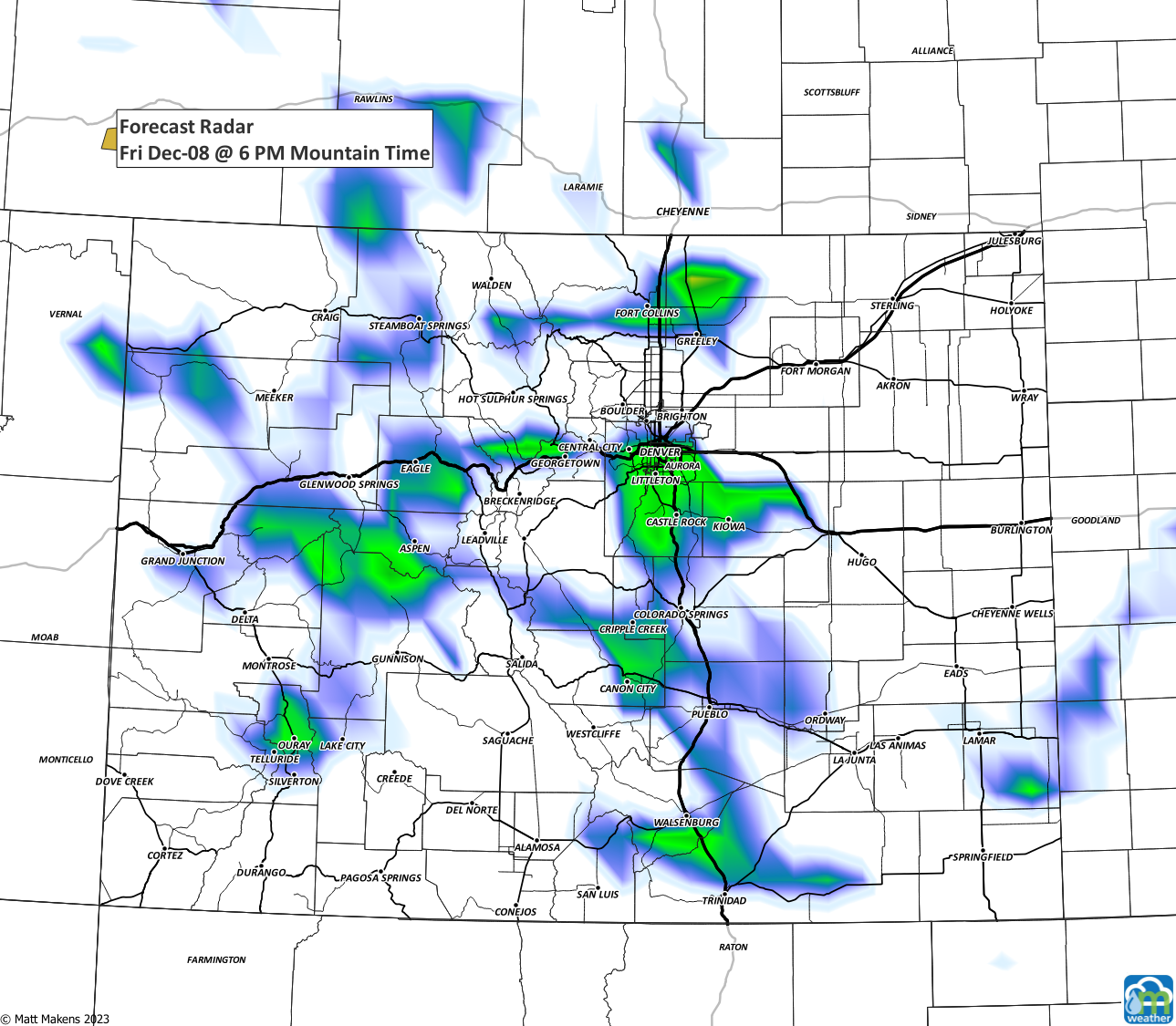
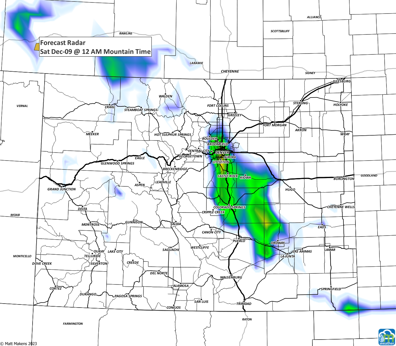
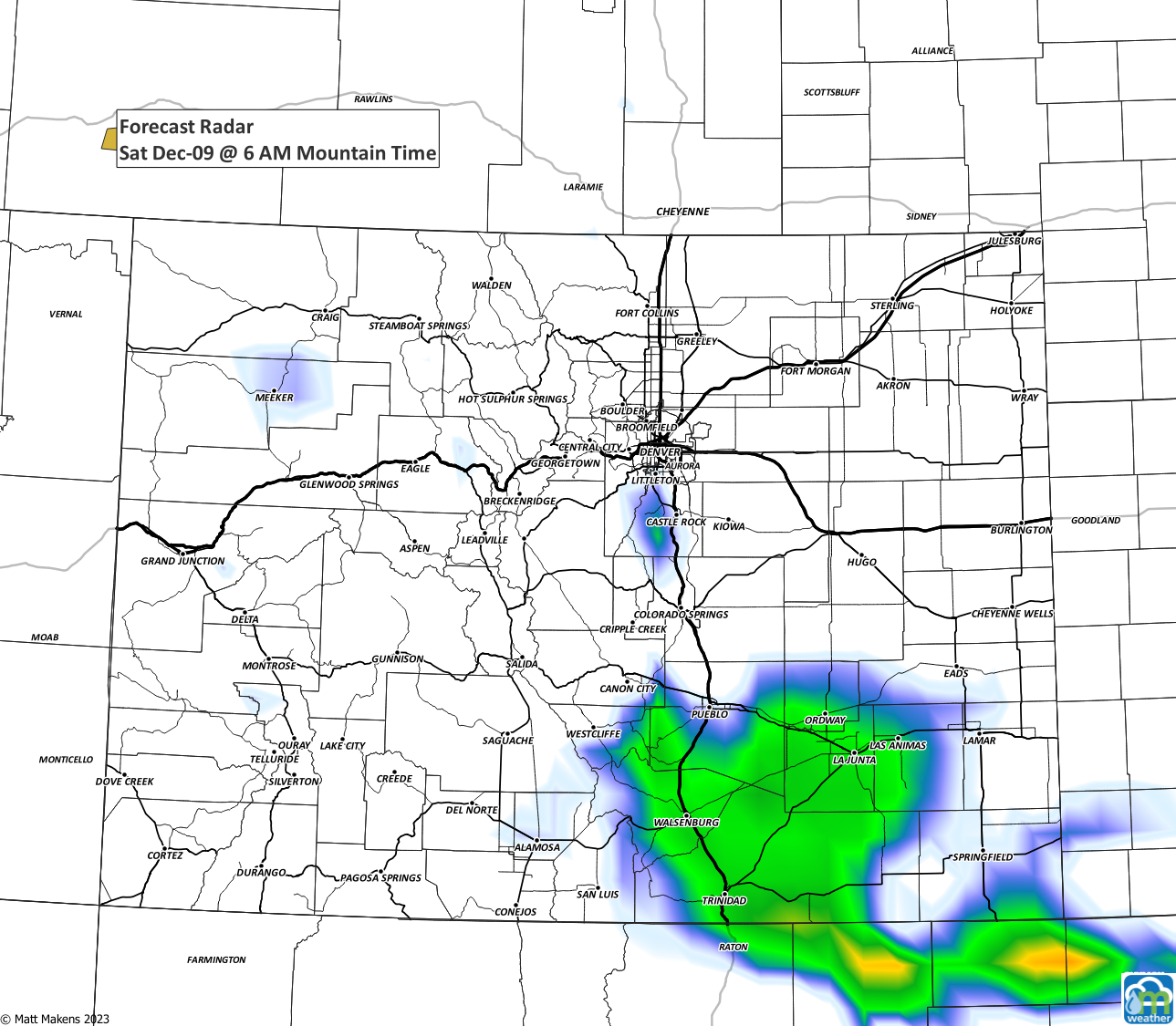
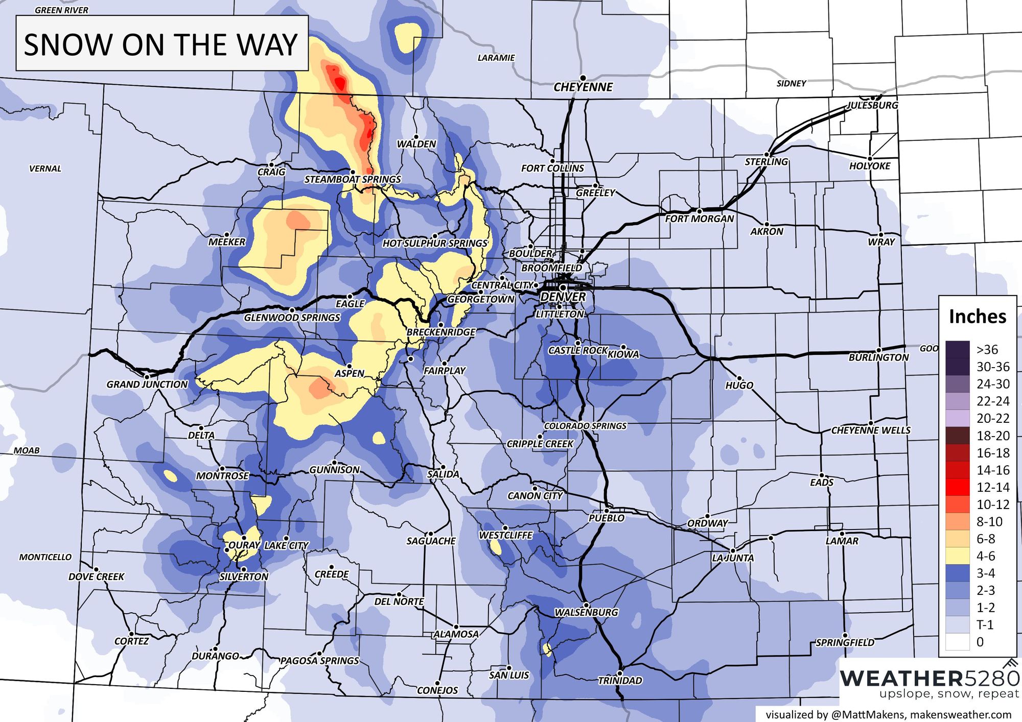
But, that's just the wind shift and wind gusts. We have chances to see snow before the wind change and well after. Let's look at a map version of snow showers and then hourly timelines.
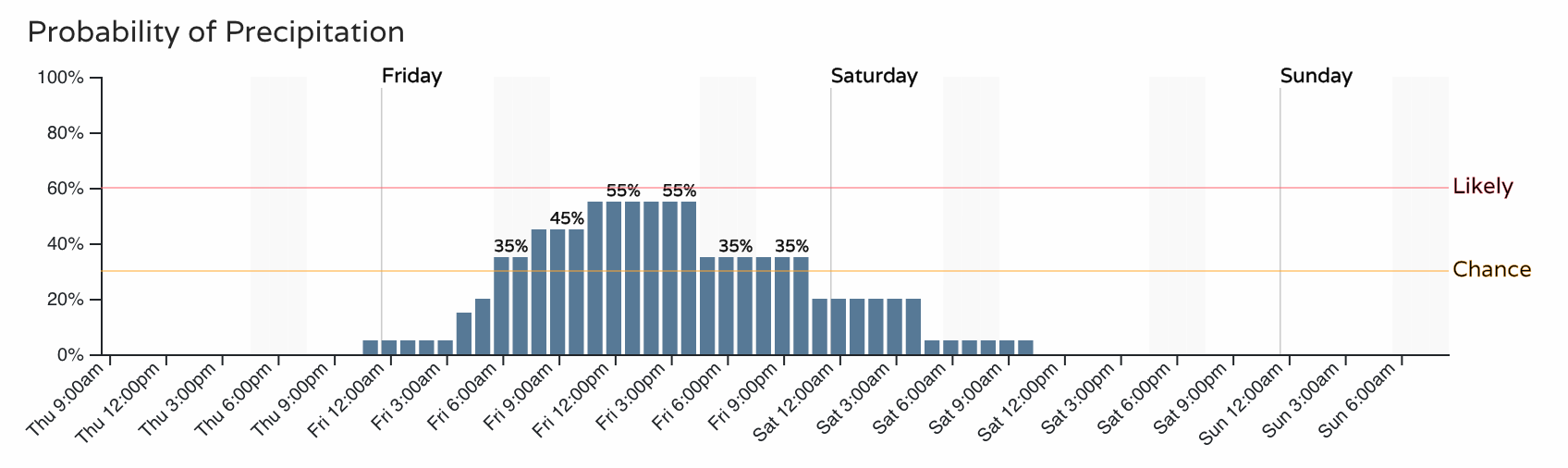
Fort Collins:
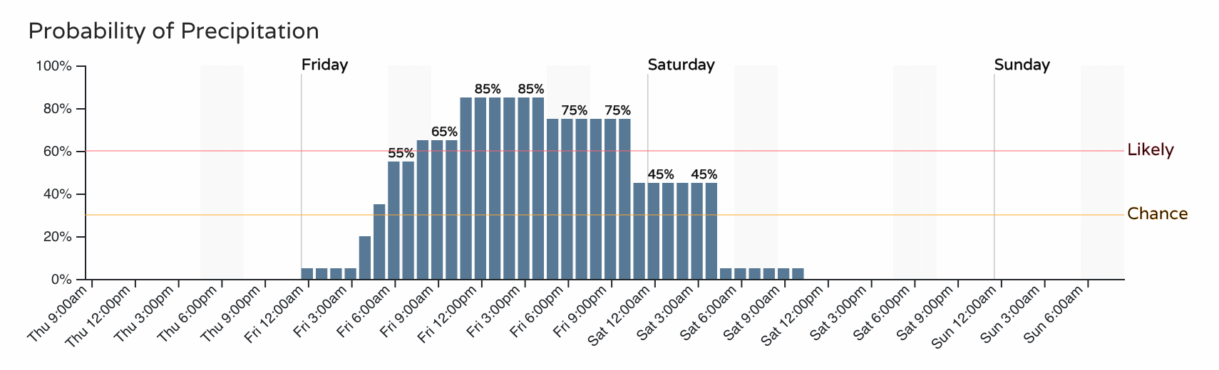
Denver:
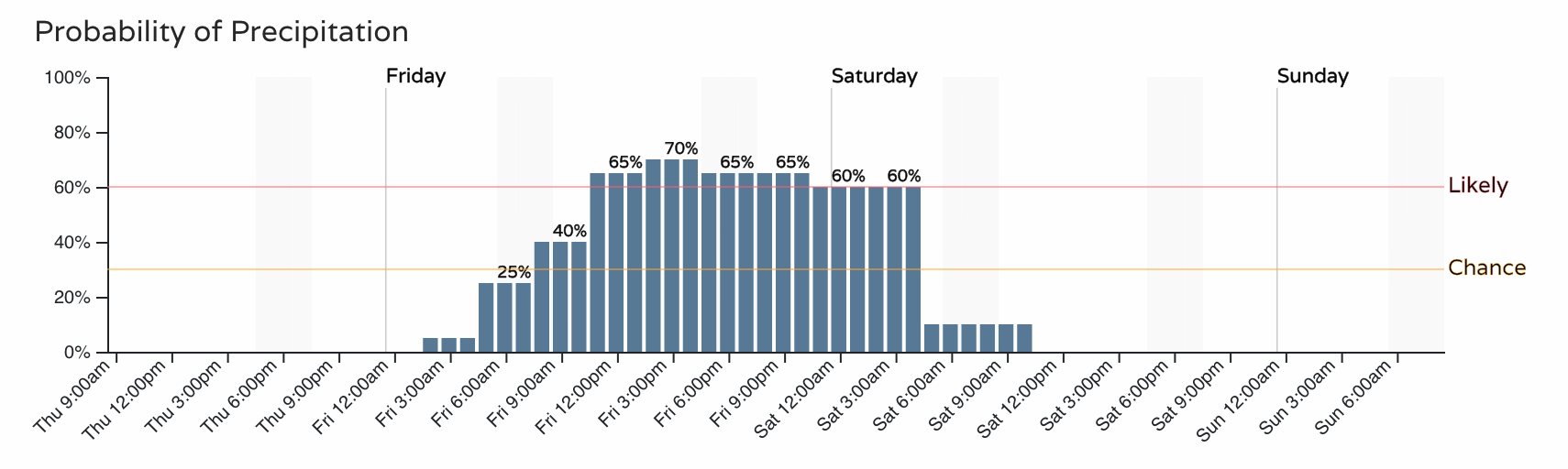
Colorado Springs:
So, by the drive home Friday through Saturday morning there will be a road impact for a lot of us, but who is likely to have the bigger impact? If you are to categorize threats and place them on a map, you'd have these impact areas. The mountains, and the Denver area to Colorado Springs have higher impacts than others. "Minor" - the yellow colors - indicate winter driving conditions. If only Denver traffic would actually act "minor" in these cases... you know how this city can come to a screeching halt sometimes. By midday Saturday and beyond, things will calm down and clear out.
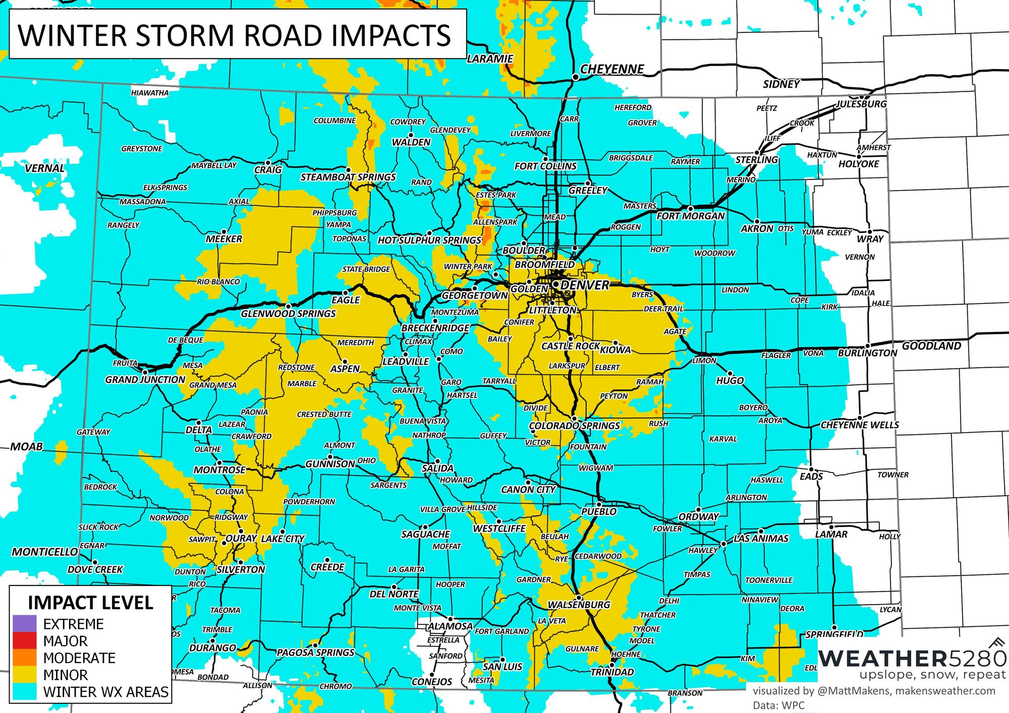
The threat level to roads is based on wind, temperature, and snow amount. Let's discuss snow amounts now.
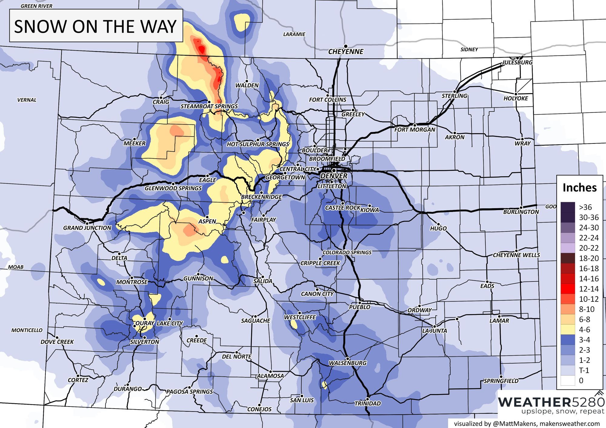
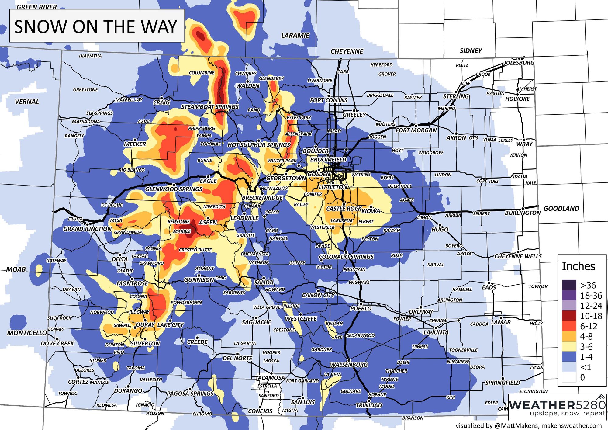
It's Thursday, and there is still some uncertainty as to the heaviest snowfall areas because of a few factors. One, the speed of the ground-surface front and limited duration of adequate upslope for deeper totals. The overall orientation of a secondary mid-atmosphere wave that will move through early Saturday. While, in theory, these features can produce some brief but very heavy snowfall to blanket areas under several inches of snow, these are speeding through and will only create isolated areas (bands) of deeper snowfall totals.
On the high end, these totals are possible but again on the higher-end of probability.
Data through Thursday morning is a bit less robust with that higher-end case. Gambler's chart data for Denver area total-probabilities:
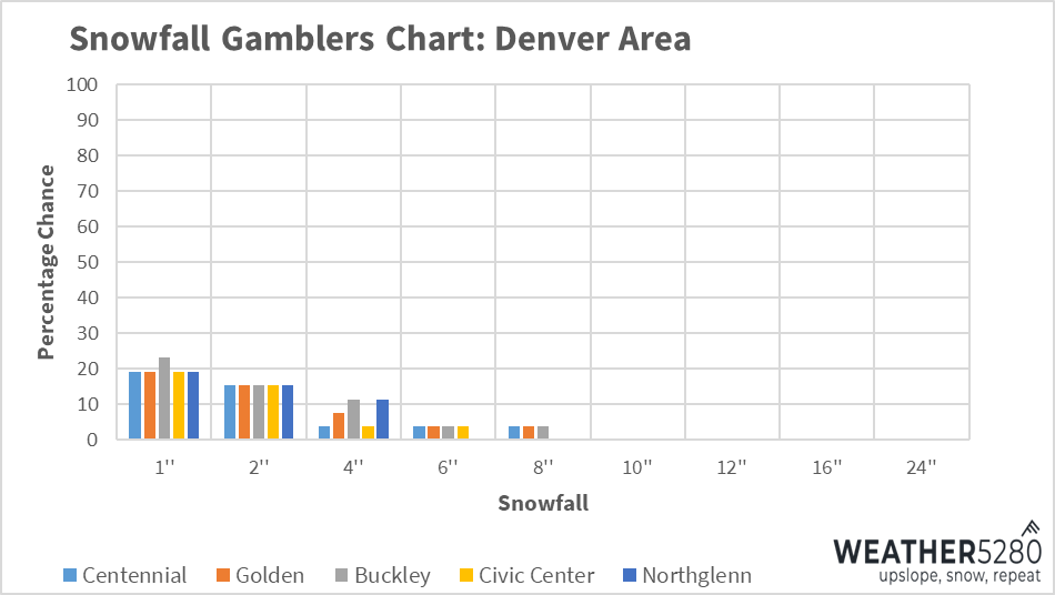
Those are not confidence inspiring probabilities, and lead to a more probable solution that looks to be:
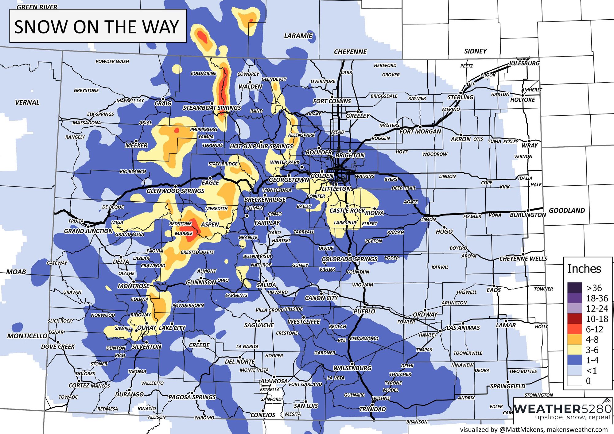
Even still, that may be overly done. Data from the past couple days has been cautious with widespread deeper totals, instead preferring very banded totals and a higher focus to the east. Take for example a short-range model updated this morning (HRRR) and you'll see how different that is versus the probable case just shown.
To us, the speed of the cold front, the initial change, and orientation of the secondary overnight system are not too favorable for widespread deep snows - impactful on the roads, but not necessarily a snow-lovers dream.
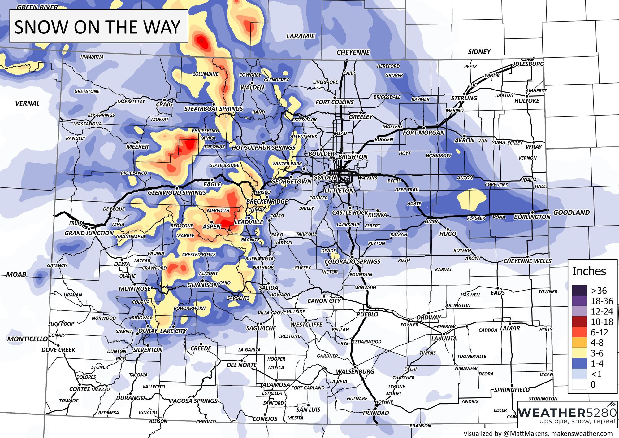
What'll end up being the final totals will be a highly isolated and banded event, a blend of that short-range model shown above and our forecast which follows is the most probably outcome at this time.
Our forecast:
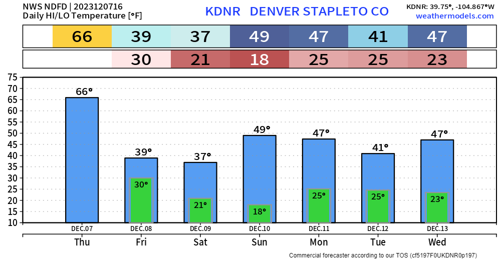
As far as the lasting impact of the cold, it does knock us down from yesterday and today's 60s, into more seasonal numbers for the week.
We'll keep an eye out for you, as always and you can stay up to date on Friday's approaching storm by subscribing to our email list today!