
Colorado weather: Snow hits south hardest, some showers in Denver metro by the evening

Colorado Springs is setting itself up to be snowier than Denver by this time tomorrow. A strong system, which we've discussed in the past few days, is headed through with its biggest impact on Southern Colorado.
For the rest of Wednesday in Denver: Look for continued low cloudiness and areas of fog. Mist/light rain is possible along with some snow from the late afternoon through the evening. Some roads may become slick, but overall not much of a chance to use snow shovels with this system.
For the rest of Wednesday in Colorado Springs: Heavy snow showers will be in the area late afternoon through the evening and overnight. Expect road conditions to deteriorate, especially this evening after sunset. Plan on some extra time Thursday morning to shovel before heading out for the day.
Here's a way to visualize the potential impact.
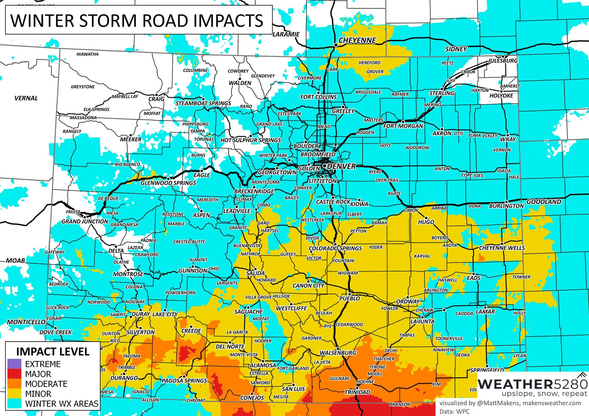
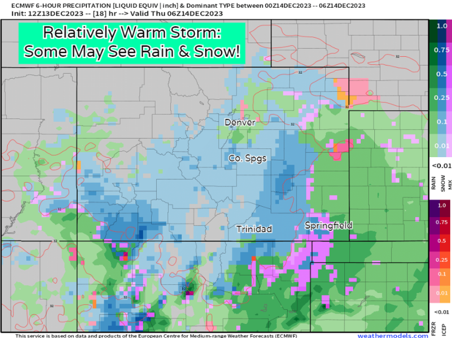
While there will be some road impacts south, we probably won't see long-lasting impacts much into Thursday. There is basically no truly cold air source for this storm, so we'll likely see melting pick up once precip stops.
Let's watch this animation, which is showing the showers increase in the next few hours and cover much of the state at times later Wednesday into Thursday.
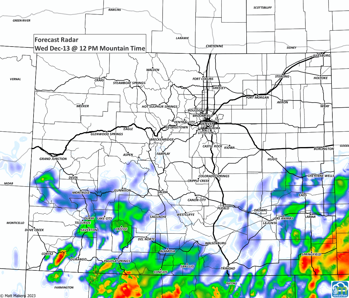
The trend here is increased moisture over Central and Southern Colorado, but a decrease in that moisture from Castle Rock to Denver and Fort Collins. NoCo has the least to worry about from this system. If you prefer the hourly timelines to show the chance of showers.
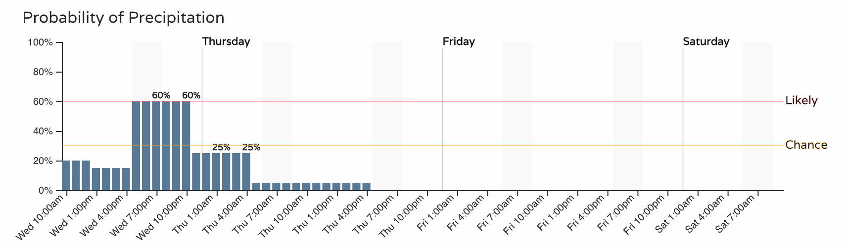
Colorado Springs:
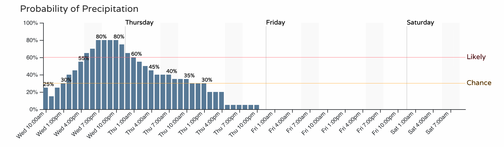
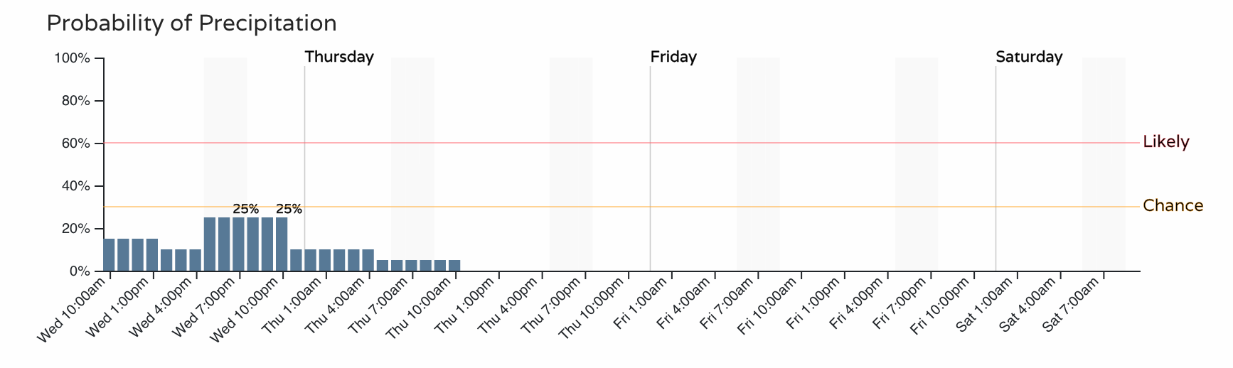
Denver:
Fort Collins:
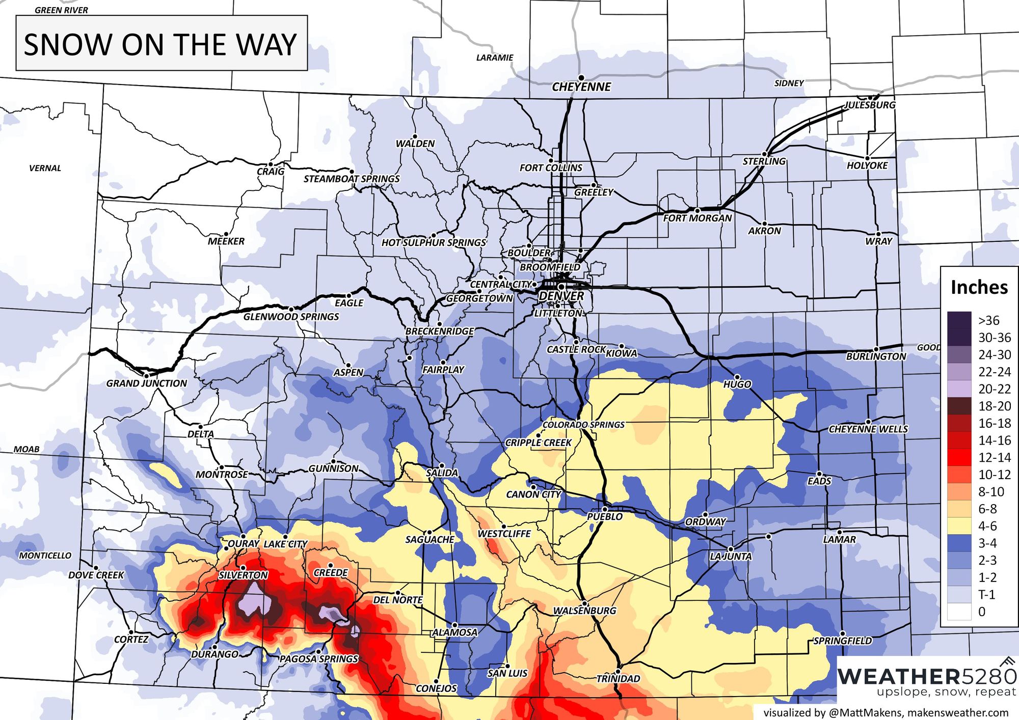
The snowfall potential is quite widespread for Southern Colorado - especially in Colorado Springs, which is one of the more uncertain locations. Should this storm stay just a county or two east of El Paso County, the Springs ends up with very little. Yet, a majority of models support heavy snowfall into the city and quite a bit of snow to remove by the morning and additional snow mid-Thursday. For Denver to Fort Collins, there isn't much of a margin...we aren't expecting too much.
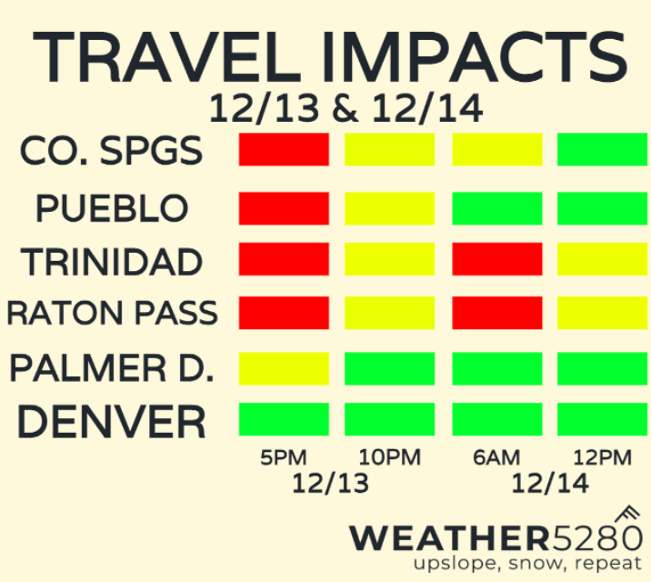
Travel impacts will be most apparent during the Wednesday evening commute and through the late night hours over far southern Colorado as well. Keep this in mind as you're heading home today.
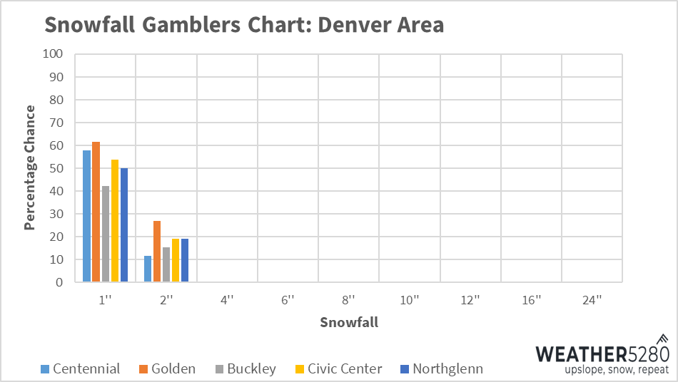
Snowfall forecast
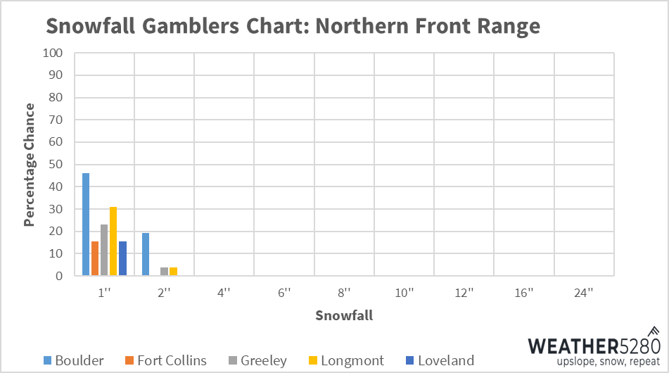
Snowfall gamblers charts showing the big differences from north to south with this storm. Measly numbers for most in the northern front range. Picks up a bit towards Denver. Big spread in numbers for Colorado Springs.
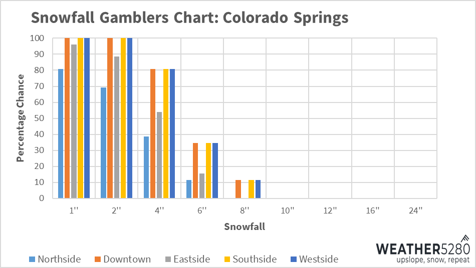
With that, here's the most probable snowfall outcome. Again, greatest uncertainty for us sits in Colorado Springs where we could see the heaviest snow setup just outside of the city. We've got some boom and bust potential with this system, but our official forecasts fall somewhere in the middle.
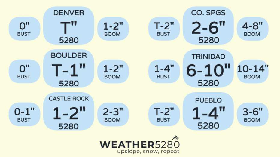
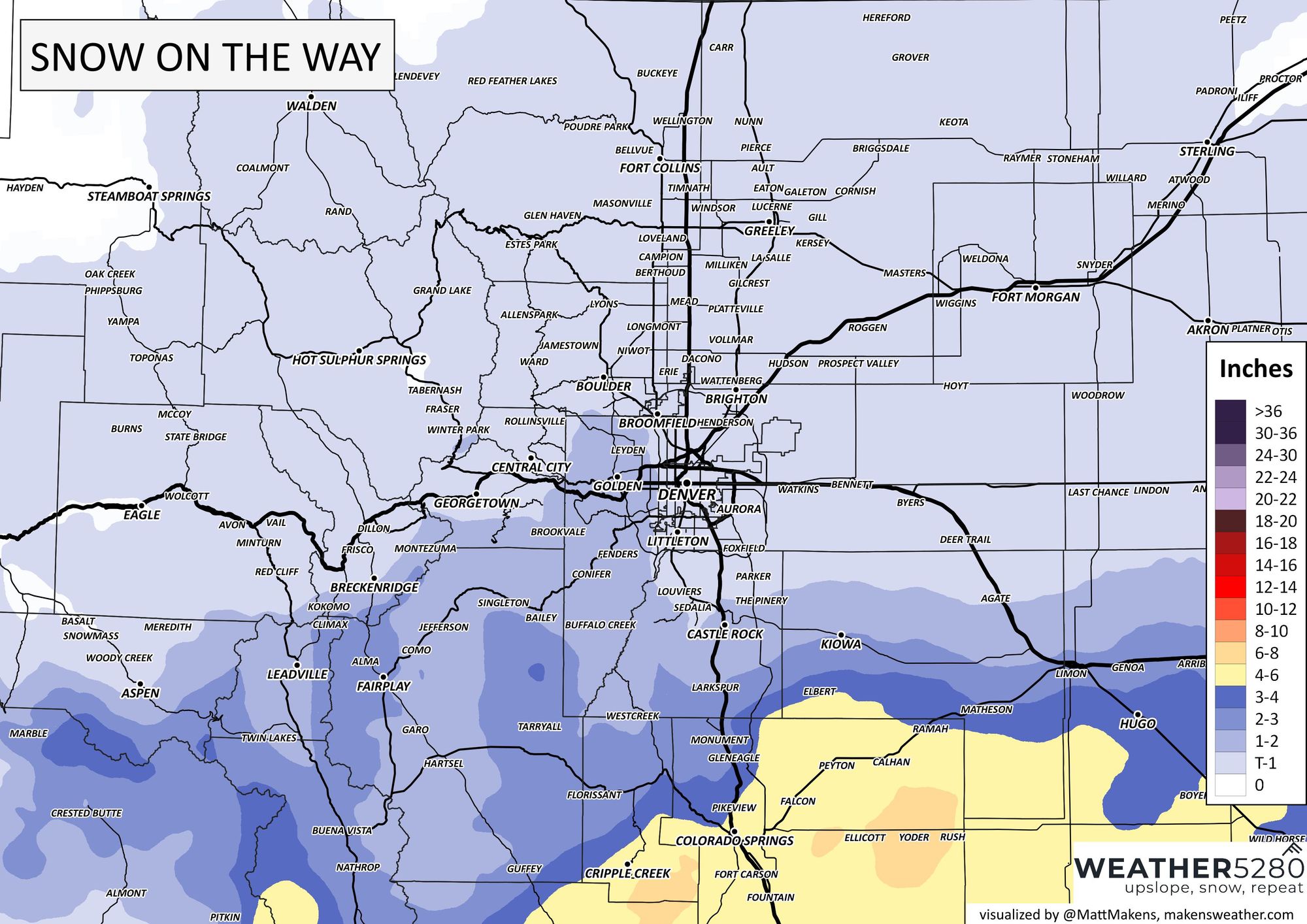
Here's a look at snowfall maps:
This storm finishes up for most of us by Thursday... with a fantastic looking weekend ahead! If you haven't done so already, subscribe to our email list, you'll get notified about our latest posts on these storms as they blow through Colorado.