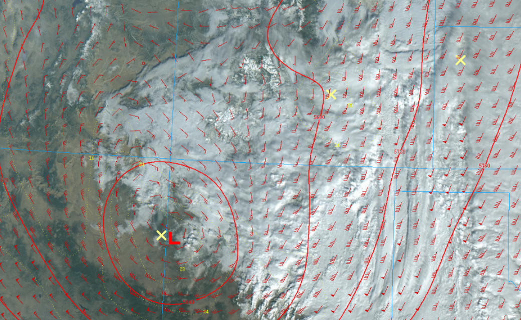
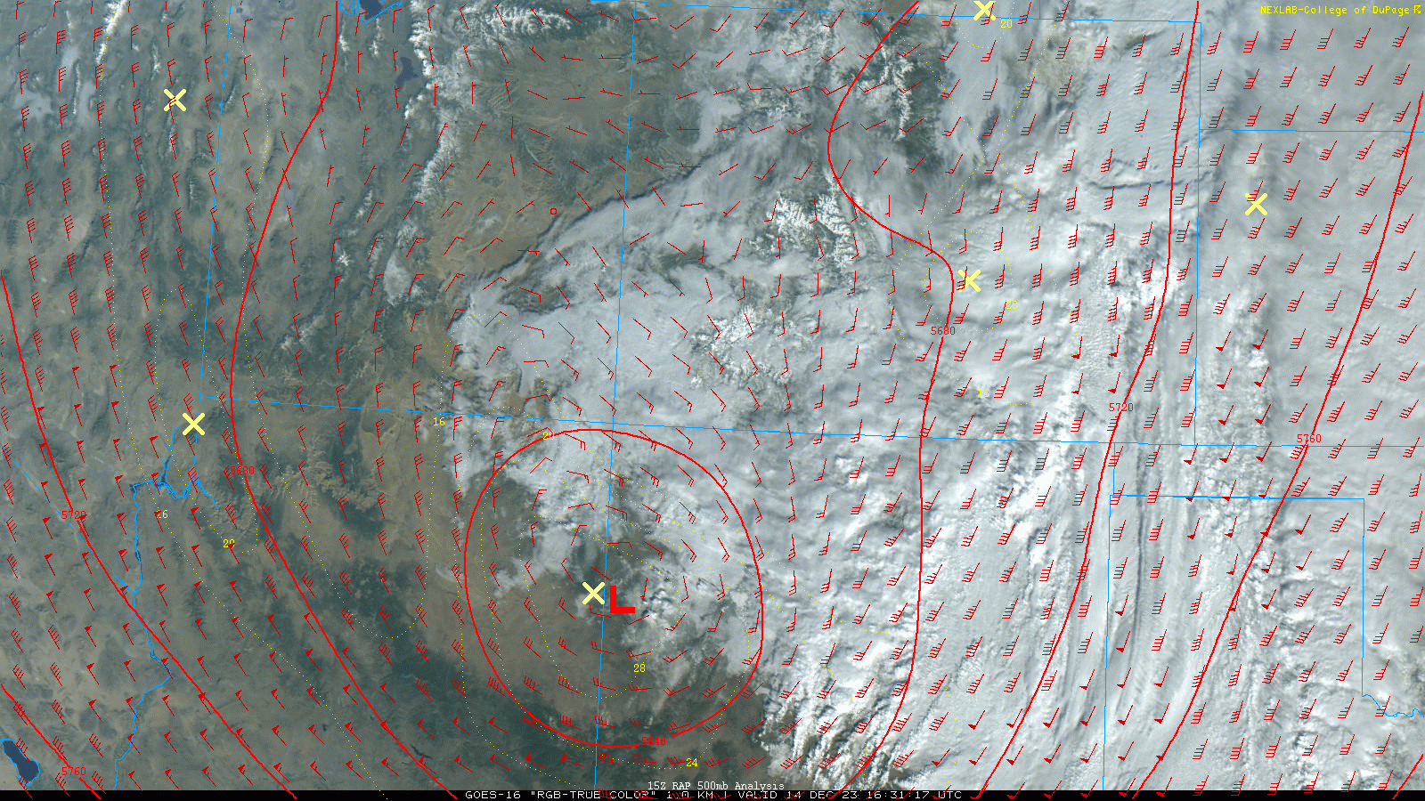
Colorado storm recap: Snow exits, clouds and fog linger

A slow moving storm with lots of moisture meant some of the biggest snowfall parts of southeast Colorado have seen over the past couple years. This area of low pressure is going to continue to scoot east across the southern plains, but for Colorado, this thing is quickly wrapping up this afternoon. Expect fog, clouds and cold temps to hang around the rest of the day for many of us.
Some impressive snowfall totals to go over with you:
9.8" - Gulnare, CO (SW of Aguilar)
8.3" - Cokedale, CO (W of Trinidad)
7.0" - Spanish Peaks, CO
5.0" - Pueblo West, CO
4.9" - Falcon, CO
4.2" - SW Colorado Springs, CO
4.0" - Manitou Springs, CO
And as we had forecasted, a sharp cutoff to the north. Many locations from Castle Rock northward received less than 1.5" of snow. And as you can see on the map below, a nice boost for the southwest mountains; areas around Wolf Creek Pass seeing 1-2 feet.
Below are maps of snowfall totals versus our forecast from early Wednesday morning 👇
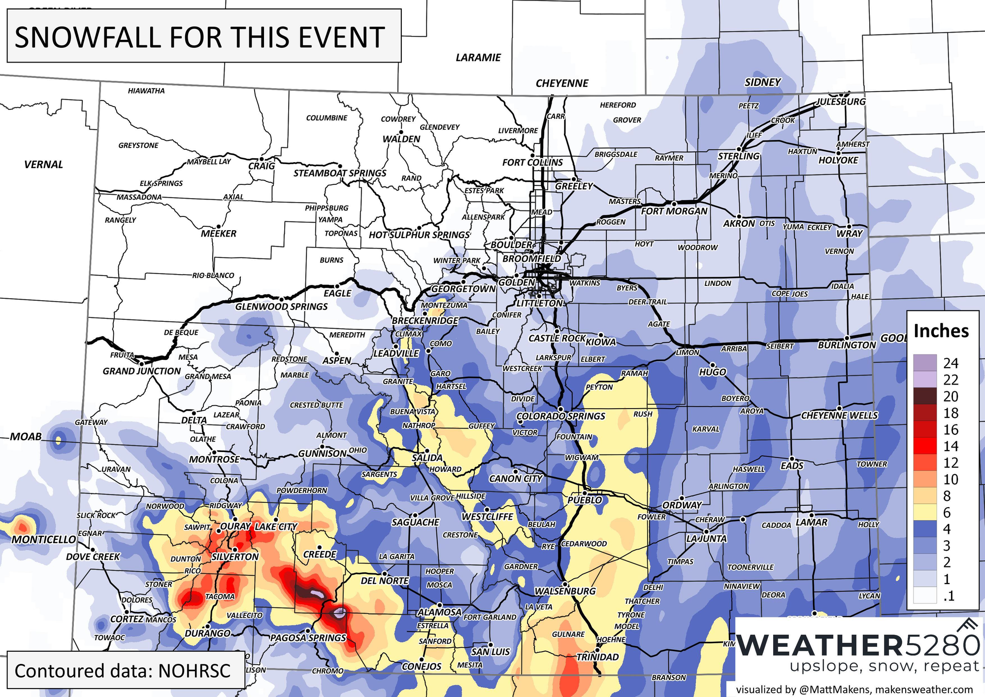
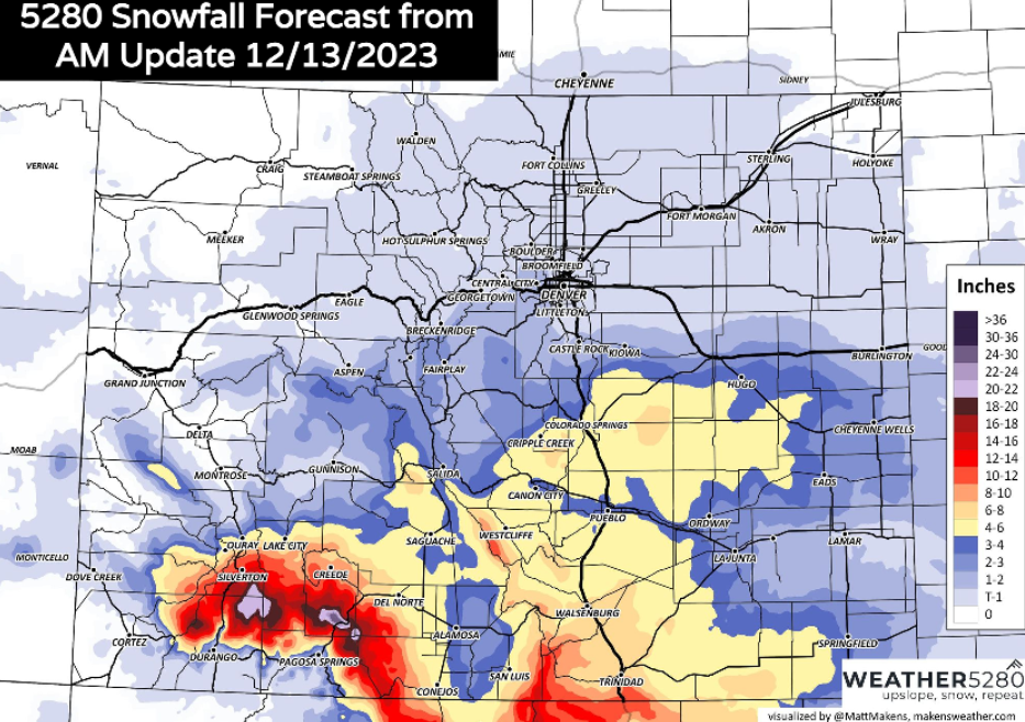
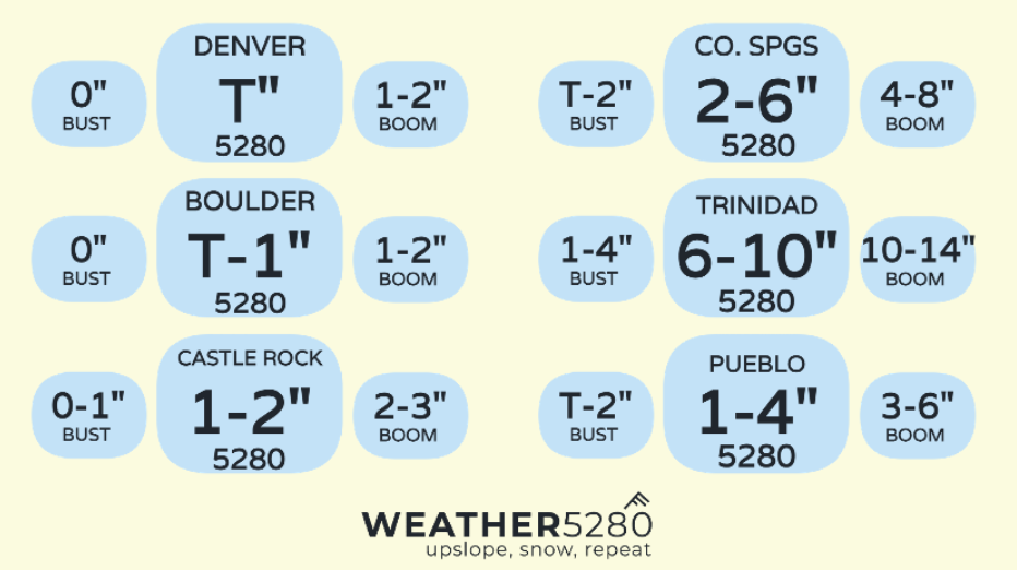
Overall a very strong forecast, however, with significant banding yesterday afternoon staying east of Colorado Springs proper, the city itself ended up in the middle of our 2-6" prediction (mostly 3's and a couple 4's around town).
We also saw areas around Salida and the Upper Arkansas River Valley over-perform too. Mixing and marginal air temperatures left most of the eastern plains between 2-4" of wet snow.
Our boom bust charts did really well too! Most everyone fell in their forecast range, outside of Pueblo who managed to just barely sneak into the 3-6" boom range. 👇
So... what's ahead? Well, this weekend is looking great.
Upper 40s and low 50s for most on Saturday, with upper 50s along the front range Sunday. Should see a lot of sunshine. Looks like we'll work in a dry cold front on Monday before we end most of next week above average in the temperature department...
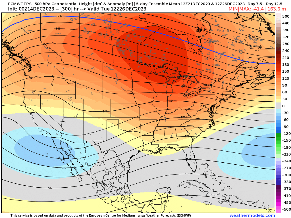
We start to climb back down a bit heading into Christmas weekend. There has been some indication of another storm system around that time. Still a long way off, but in terms of a weather maker, that's likely our next best chance... We'd like that blue to be centered a bit further north to see a better chance for snow along and north of the Palmer Divide.
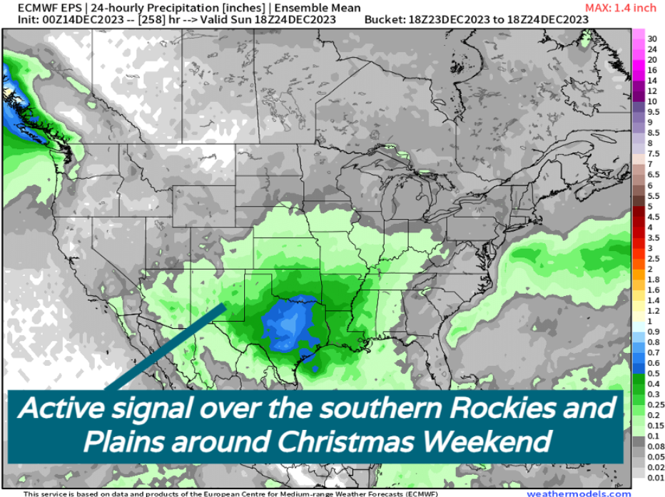
Precip map shows the potential for another slow-moving, moisture rich storm system bringing rain and snow from Arizona, through the four corners and into Texas.
Fun times! While the snows haven't been terribly big so far, we have had plenty of opportunities. Makes you wonder what the Spring might have in store... ;)
More to come, if you haven't done so already, subscribe to our email list, you'll get notified of our latest posts– and if Christmas Weekend looks like it could impact travel across Colorado, you'll be the first to know it!