Another update on pre-Christmas snowstorm set to move through Colorado, NWS issues winter weather alerts

Bah humbug.
That's how forecasting this system's got me feeling.
Still a lot of uncertainty today with regard to who sees how much snow. A few things we do know for sure and we'll cover them in this update, and we'll again touch on latest snowfall forecast amounts for the region.
Let's dig in.
What we know
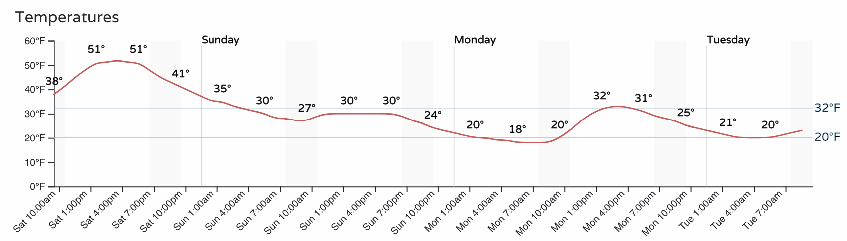
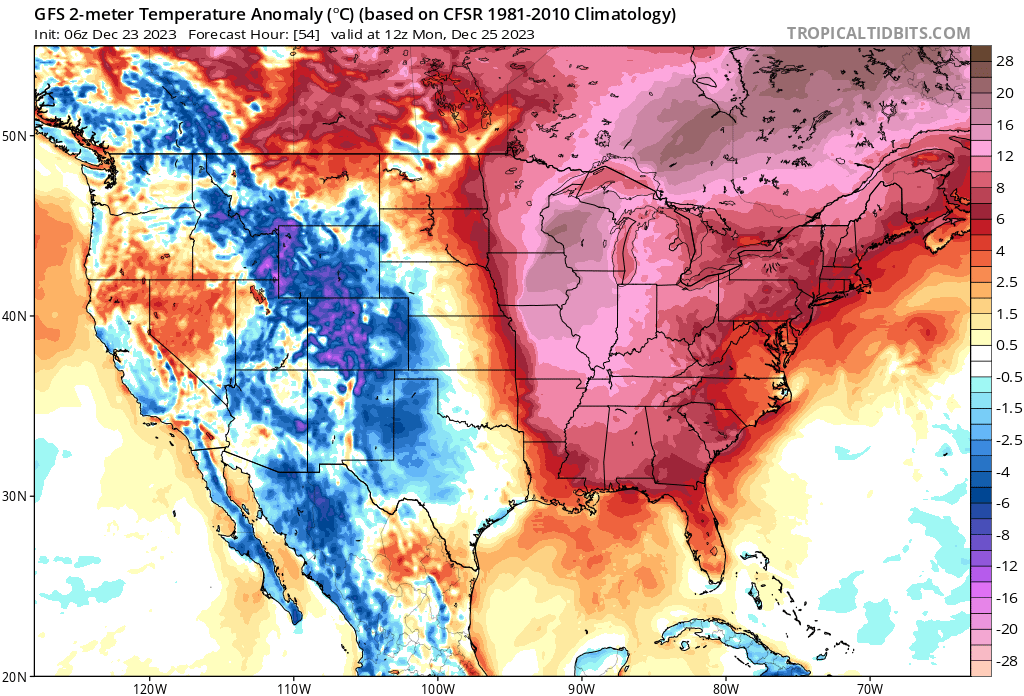
Temperatures are set to tumble. Anomalous heat across much of the CONUS today will shift east as our moves through tonight and Sunday. By Monday morning temperatures will be below average across Colorado.
Saturday morning temperature anomalies 🔥

Monday morning temperature anomalies
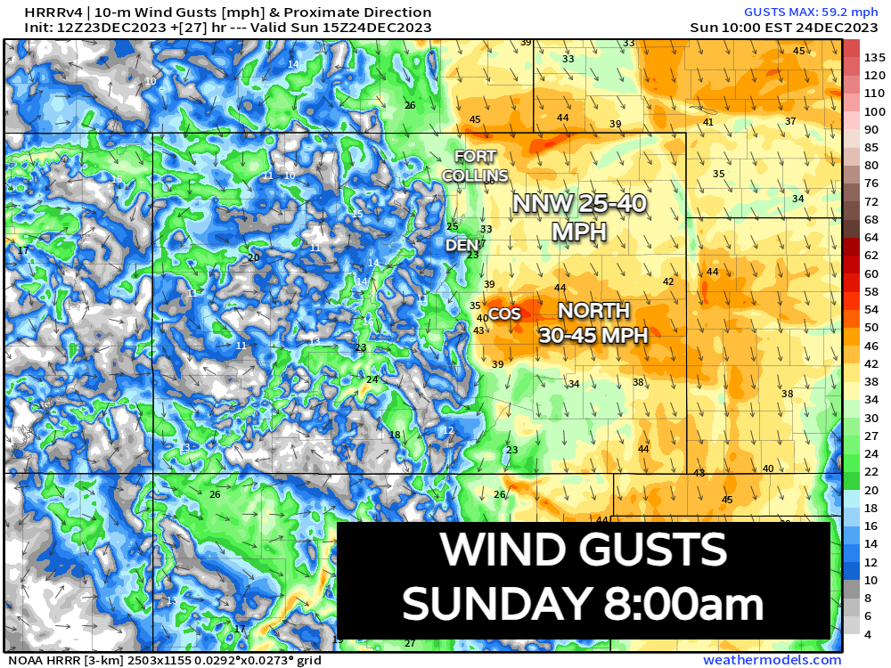
There will be wind! This will be a windy system, with gusts upwards of 40 mph at times on Sunday, especially for favored areas along the Cheyenne Ridge, Palmer Divide, and Raton Pass. This will no doubt be a factor in overall impacts from this storm, even for areas that may see lower-snow totals, the northerly wind (especially east of I-25) will be an issue at times. Blizzard conditions will be possible on Sunday over the eastern plains as the storm exits.
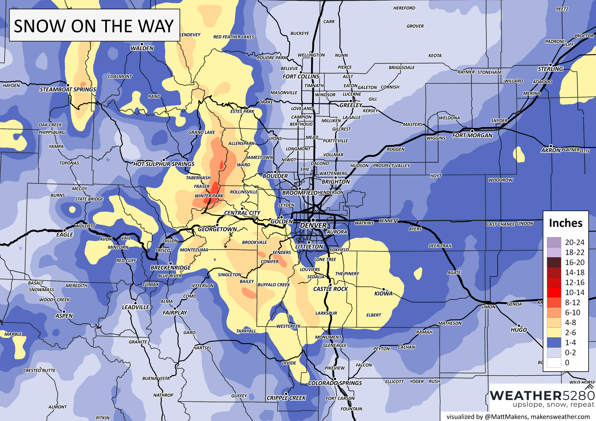
Some of us will see snow! And with that a White Christmas. The issue is, not all of us are likely to get in the action. If you live in cities north of Denver, while your odds aren't zero... they aren't great. For Denver, anywhere from just a Trace of snow to about 4" seems on the table still. Greatest potential for several inches will be across the Palmer Divide and then wherever the trowal organizes east of us on Sunday.
The most likely place for this to set up looks to be from east of Colorado Springs northeast through Akron and points east. Wherever this trowal sets up we could see that "boom" snowfall, with locally 6"+ of snow.
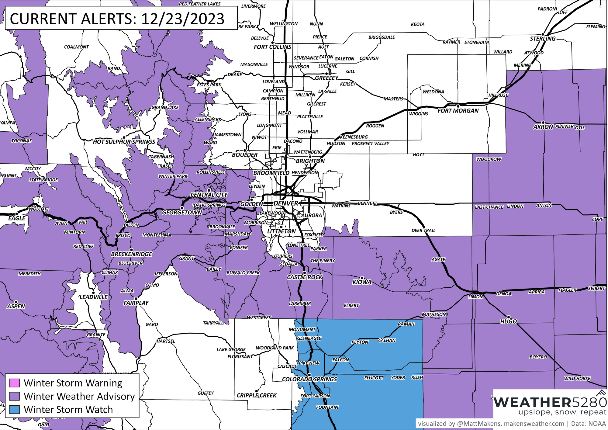
Given the potential across the Plains, a Winter Storm Watch has been issued for these areas. If your travel plans take you across the plains late tonight through early Sunday morning it may be best to delay those plans until the storm kicks east of us Sunday night. The Watch does include COS, but we think the greatest impact potential will be outside of the city core.
NWS alerts map as of Saturday afternoon
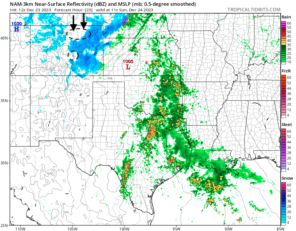
North wind giveth, north wind taketh away. There will be a strong northerly wind with this system. This will rob areas of snow that end up under downsloping winds like Fort Collins, Loveland, Erie off the Cheyenne Ridge and the Colorado Springs vicinity south of the Palmer Divide, but potentially help snowfall for more favored areas like the southern Denver suburbs, Palmer Divide, cities southeast of Denver.
This effect is easy to spot in the NAM reflectivity forecast for early Sunday morning. Little snow north of Denver, some in the city, good coverage over the Palmer, but again drying for COS. East of Denver snow is starting to ramp up.
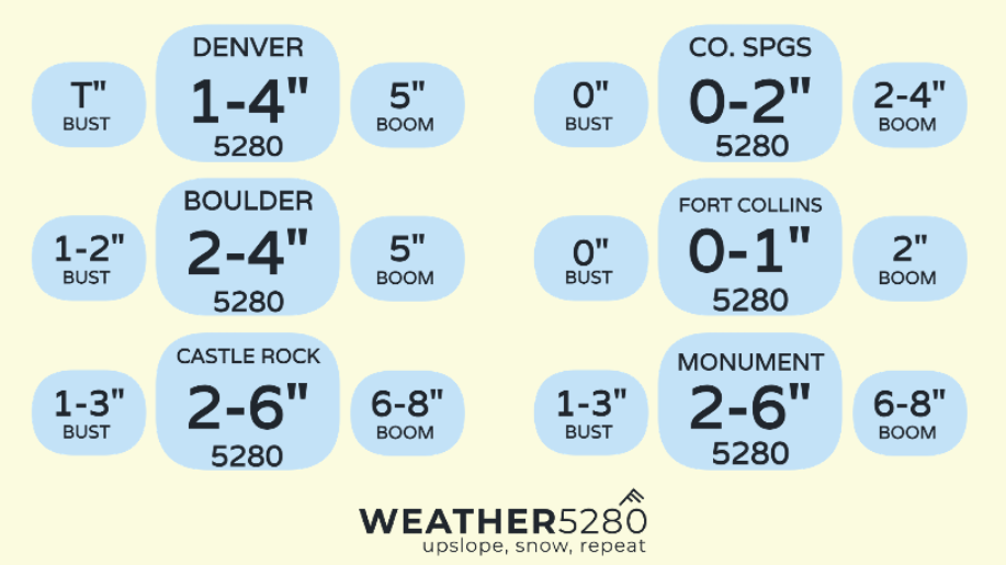
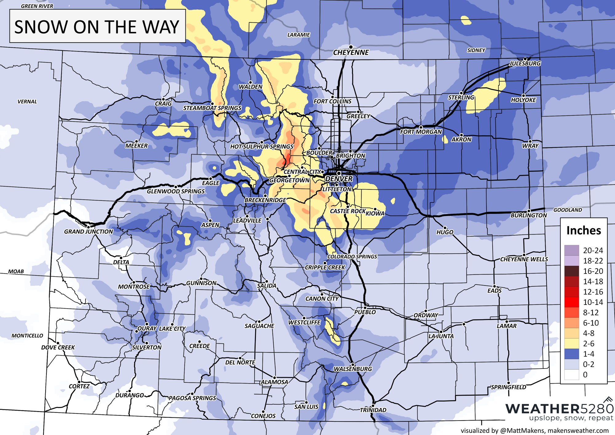
Our snowfall forecast
We won't change our forecast much from yesterday. We will highlight the potential for a locally heavy band of snow across the Eastern Plains, but it won't bring that heavy snow to everyone.
For Denver we'll stick with 1 - 4" (won't be shocked to see a Trace, wouldn't be shocked to see 4"), with at least marginally greater odds for several inches of snow for the foothills southwest of Denver and across the Palmer Divide. Colorado Springs we still have in the 0 - 2" range as we think northerly winds there will shut things down quickly even if we see a period of moderate snowfall initially later tonight.
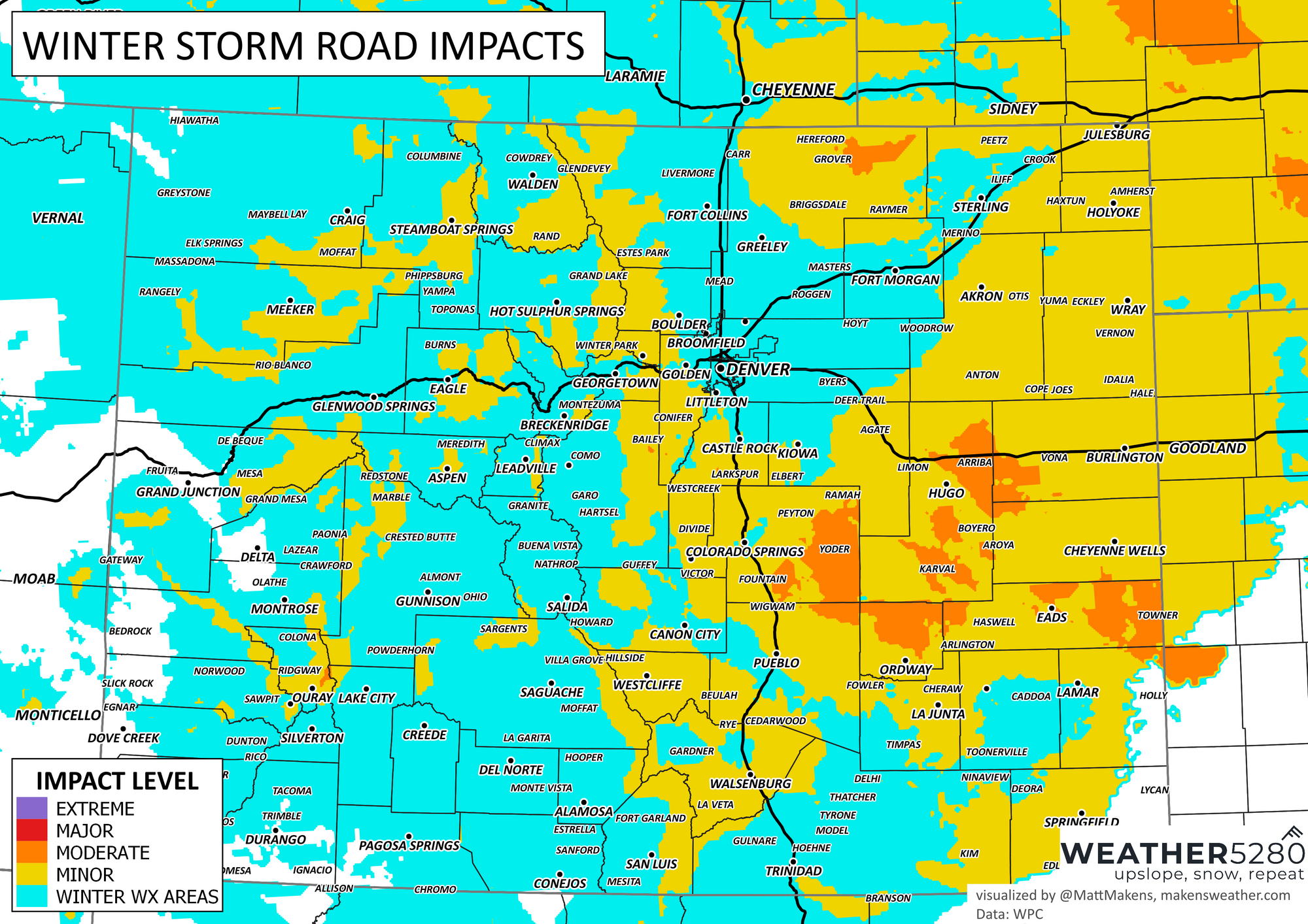
And finally, your impact map. If you can get your traveling done today it's a good idea to do just that! Between the areas of snow, wind, slick roads, and colder temperatures Sunday won't be a particularly fun day to travel, especially during the morning hours.
We'll pass along any updates as needed, but if you don't hear from us beforehand enjoy the snow (we hope you manage some!) and Merry Christmas to those celebrating.
Stay safe, and stay tuned!