High winds and potential for blizzard conditions across Palmer Divide, Eastern Plains of Colorado Tuesday

We hope those of you celebrating are enjoying a beautiful Christmas holiday, if a bit chilly after yesterday's change in the weather and snow. We write today to give you the heads up that this same system looks like it's back for more. Yep, that's right, the storm that brought some of us some snow ahead of Christmas this weekend is going get so wrapped up today that it's going to end up retrograding west into tonight and Tuesday morning. We've been eyeing this potential and it seems like data is coming into good agreement that we'll see impacts in Colorado.
What's most certain at this point in time will be the wind. The gusts will pick up a few hours after midnight into early Tuesday morning. We'll feel them first along the northern front range and far NE Colorado – the type of stuff that will wake you up in the middle of the night.
Winds will scream out of the northwest all the way through early afternoon on Tuesday. Below is when winds are most widespread in the state, around lunchtime Tuesday. 40-60 mph gusts can be expected. Make sure your Christmas decorations are secured or brought in!
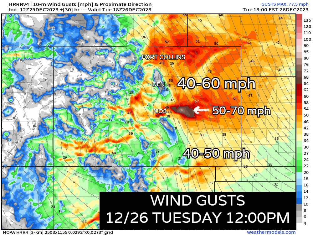
On the map above though, notice how the wind is basically non-existent on the west side of Denver, while there are 50 mph gusts at DIA. We're actually going to see some interesting mountain meteorology in play here. Longs Peak is going to act like a barrier to shield areas like Arvada, Highlands Ranch, Golden etc. Meanwhile, places like Aurora, Green Valley Ranch and NE Denver could see gusts as high as 40-60 mph.
Watch out around Colorado Springs – this area, and especially into eastern El Paso county probably get the brunt of the wind as it crests and descends the Palmer Divide. Hwy 94 and 24 will likely be dangerous commutes through the morning tomorrow with 50-70 mph gusts possible. Sporadic wind damage and power outages will be possible for areas in the high wind warnings.
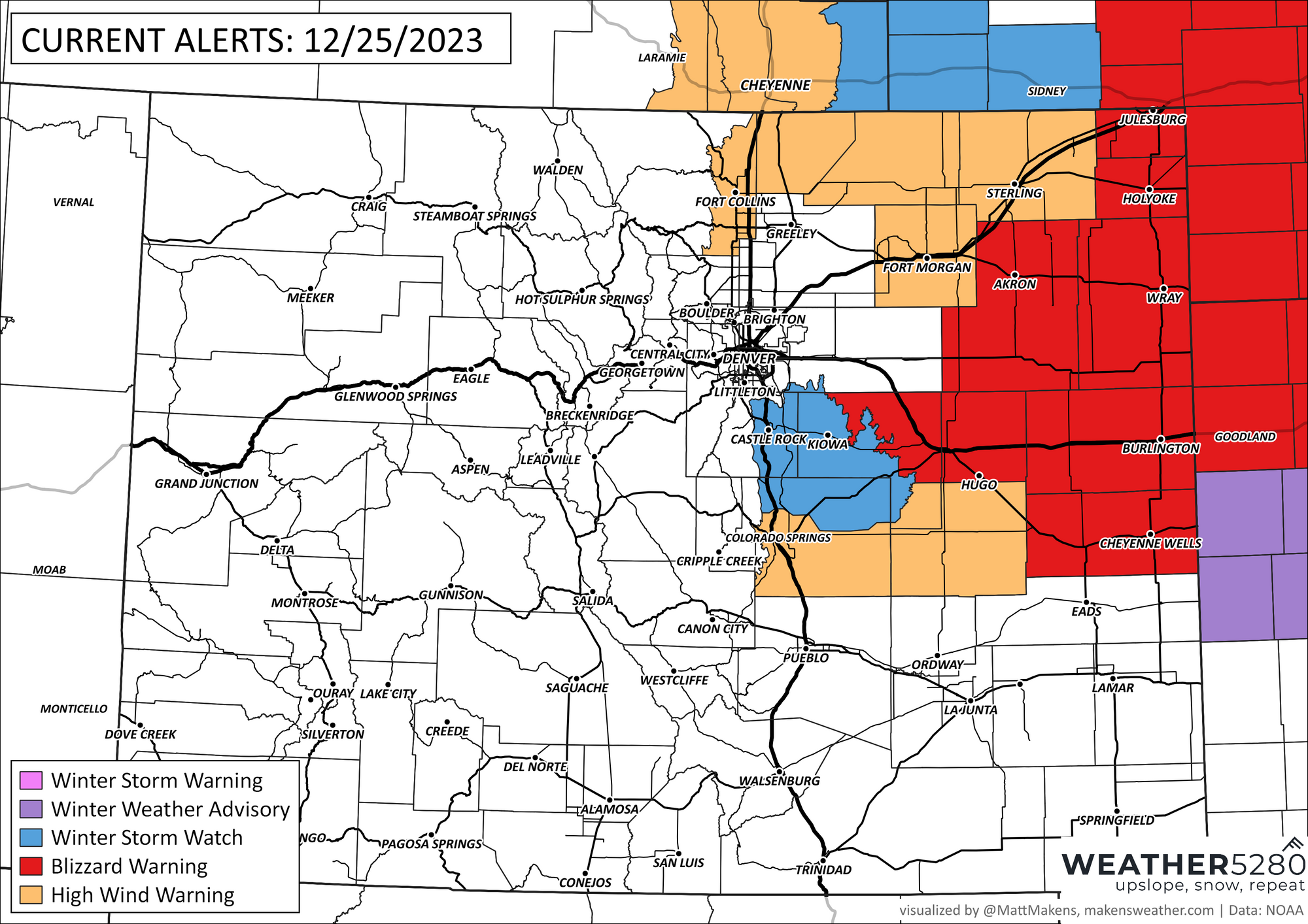
The NWS hazard map has a host of High Wind Warnings (light brown), blizzard warnings (orange) and a Palmer Divide Winter Storm Watch (likely to be upgraded to a blizzard warning).
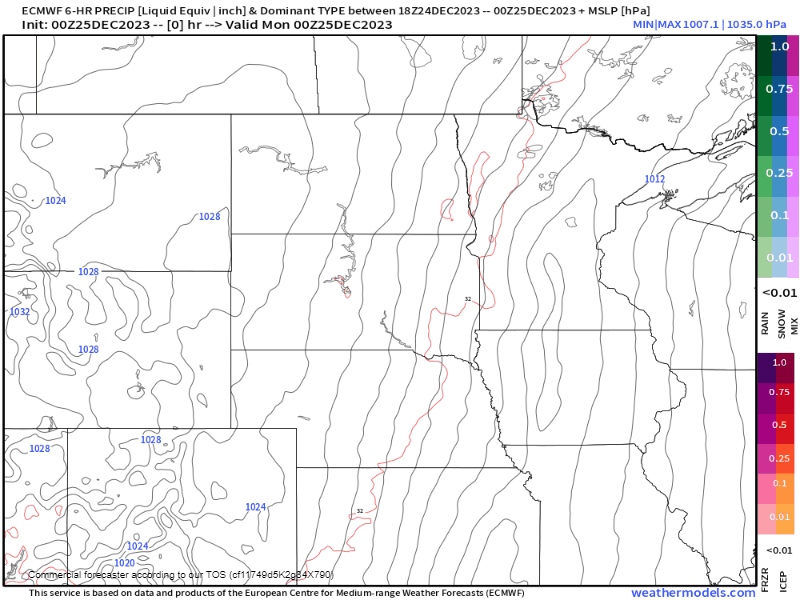
That gets us to the potential wintry side to the storm. Eastern Colorado and the Palmer Divide have a chance at significant blowing snow Tuesday morning.
If we look at alerts in a different way, the impact level of the storm, we come up with this outlook.

Snow potential starts as early as early as 3 or 4am Tuesday on the Palmer Divide and into parts of Teller County. It will be a sharp gradient between Castle Rock and Denver, and between Monument and Colorado Springs.
The HRRR model is by-far the most aggressive solution for snow in these areas printing out anywhere between 4-10" of snow. This is likely overdone. Below that is the latest EURO data which is not nearly robust with the snow. But in combination with the wind, a few inches could still produce blizzard conditions tomorrow.
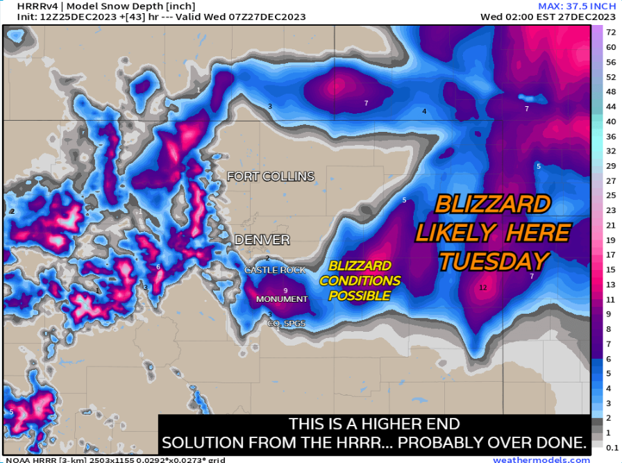

The blend of models may have the best idea here – very little snow expected in Denver, but to our southeast we could see a bullseye of 4 - 6" of snow, not that you'll be able to measure it.

Remember: blizzard doesn't mean there has to be a lot of snow, but rather the snow in combination with the wind causing reduced visibility at times near-impossible travel conditions. You can have blizzard conditions and very little actual accumulated snowfall.
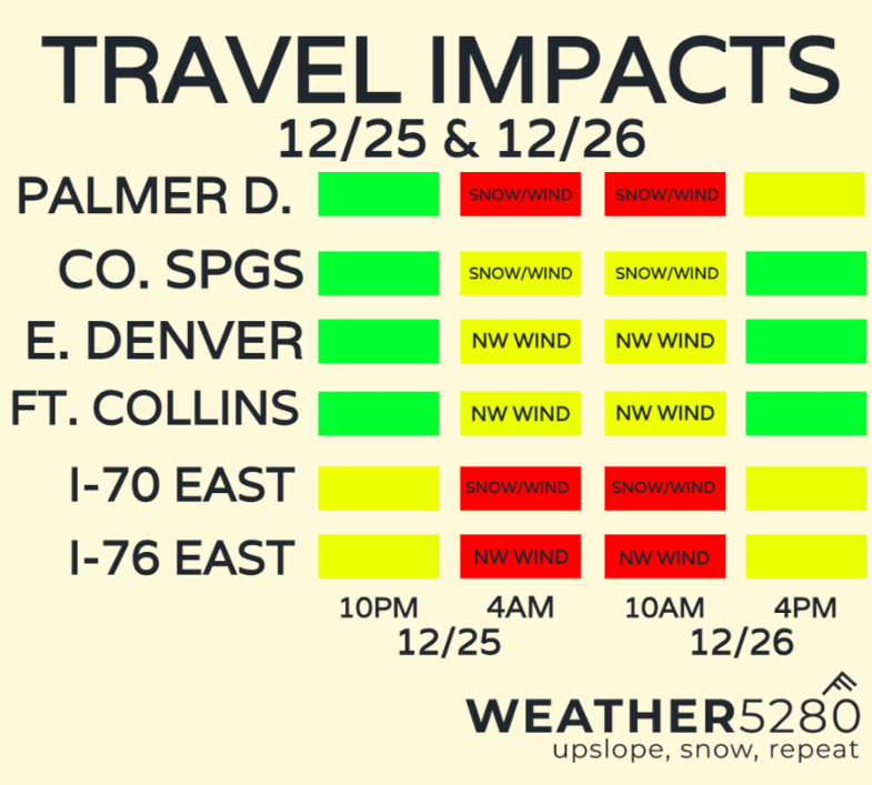
The potential for the worst travel conditions will be before sunrise Tuesday through the early afternoon. The best chance for snow will be along I-70 east of Denver and over the Palmer Divide.
Heads up on I-76 east too! While that road will likely stay dry due to downslope off the Cheyenne Ridge, strong, direct NW crossroads will cause problems for high profile vehicles.
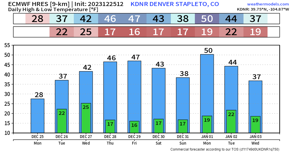
Once we get into Wednesday, this storm will finally decide it wants to get the heck out of here. Beyond that, most of the front range should start to recover into New Year's Weekend!
Have a Merry Christmas and a Happy New Year everyone! Here's to another year of wild Colorado Weather! Thanks so much for your readership and we hope to bring you even more value in 2024! And as always, don't forget to subscribe to the e-mail list to get these posts right to your inbox!