A bit more snow to go... system that just won't quit delivers plenty of wintry surprises Tuesday

Ironically, what wrecks me as a forecaster today was exactly what made me fall in love with forecasting snow however many decades ago. One of my earliest memories of snow along the Front Range was from a very similar setup to the one we are dealing with today. A system that was meant to move on delivered a wallop of 6+ inches of snow to my street in similar fashion to what we saw unfold early this morning across parts of the metro area. I remember listening to forecasters on the radio try to explain the unexpected snow as I watch dollar size flakes fall out the window with word school had been canceled, and I couldn't have been happier!
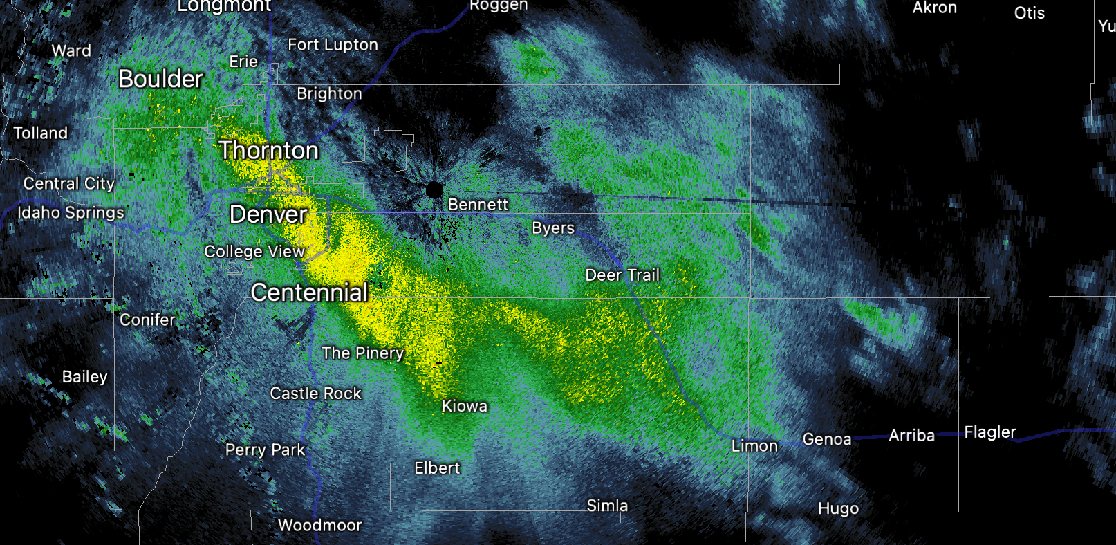
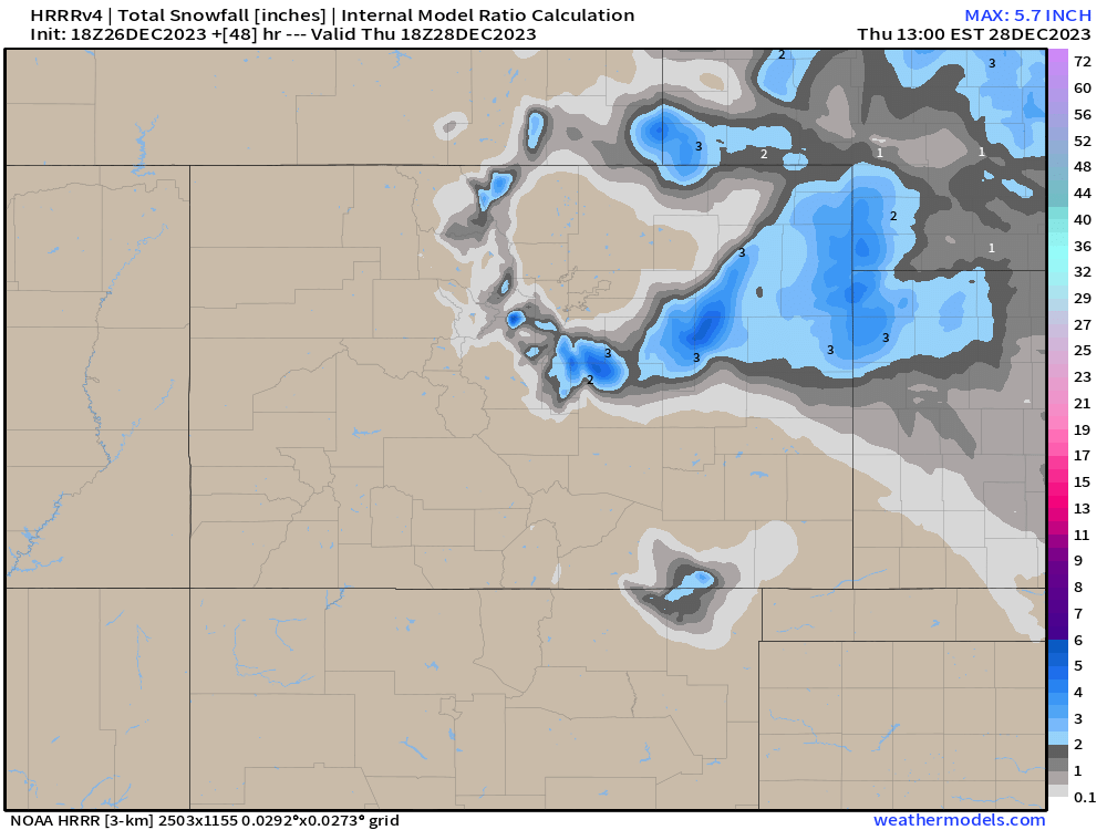
Here's a look at the sneaky band of snow that setup early this morning over central and southeast Denver – snowfall from 3 - 5" was reported under this band!
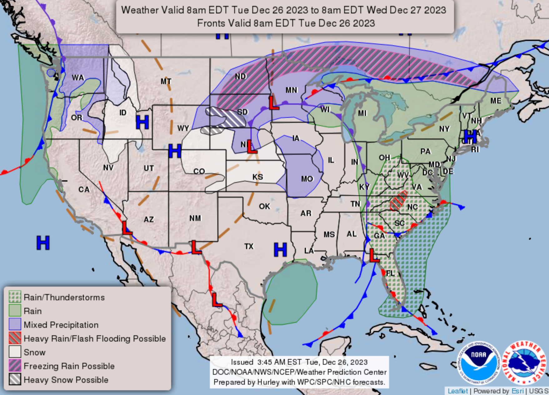
This evening the system is still churning to our east, and on the backside of the system keeps pushing pocks of light to moderate snowfall – along with those winds! – into Northeast Colorado. For some the evening commute will again be slick, including the Denver area that is seeing another burst of snow move through as we write this.
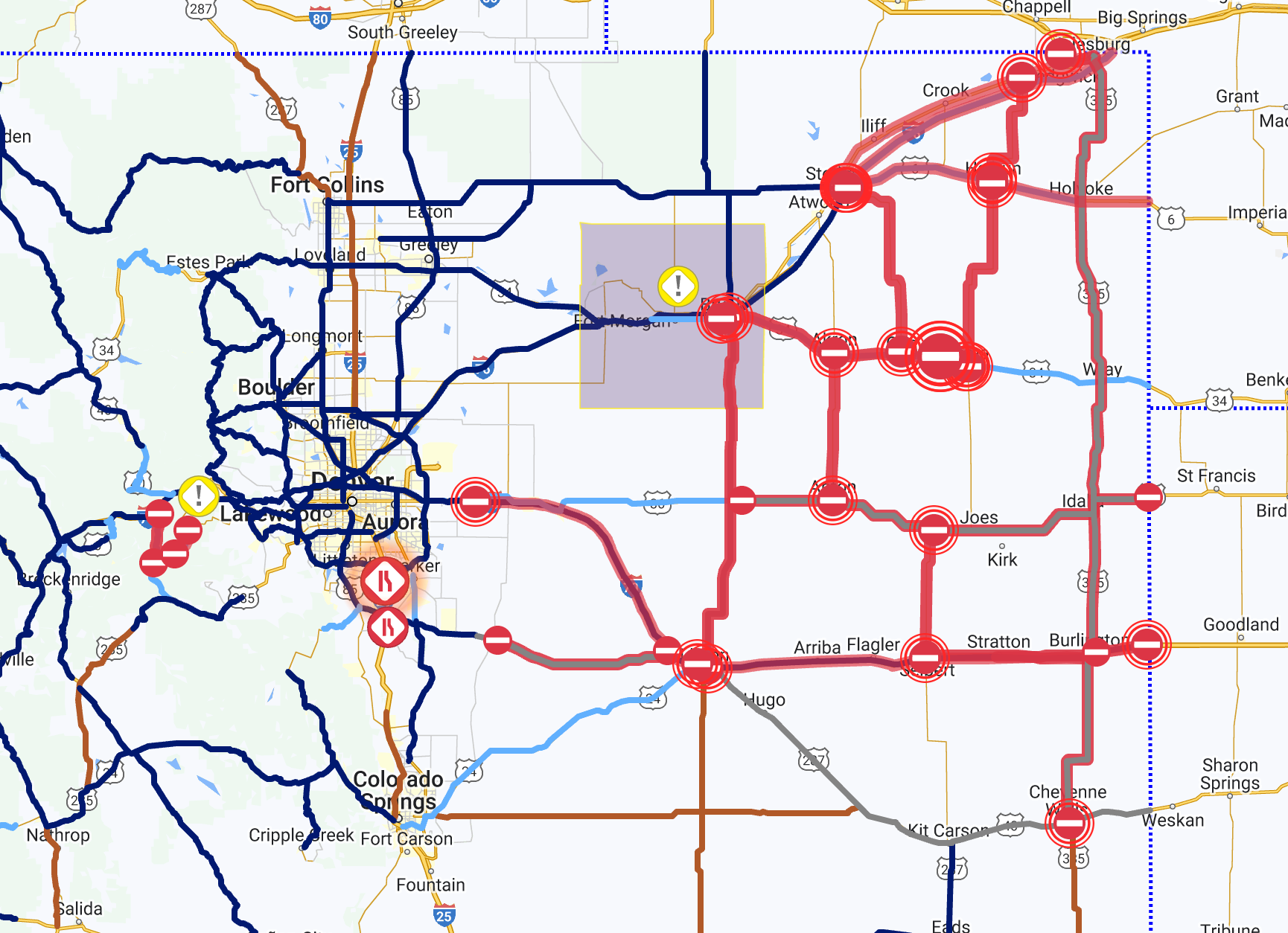
Travel across the eastern plains has been about as impossible as we thought it would be in yesterday's update, as of mid-afternoon look at all the road closures in place east of Denver!
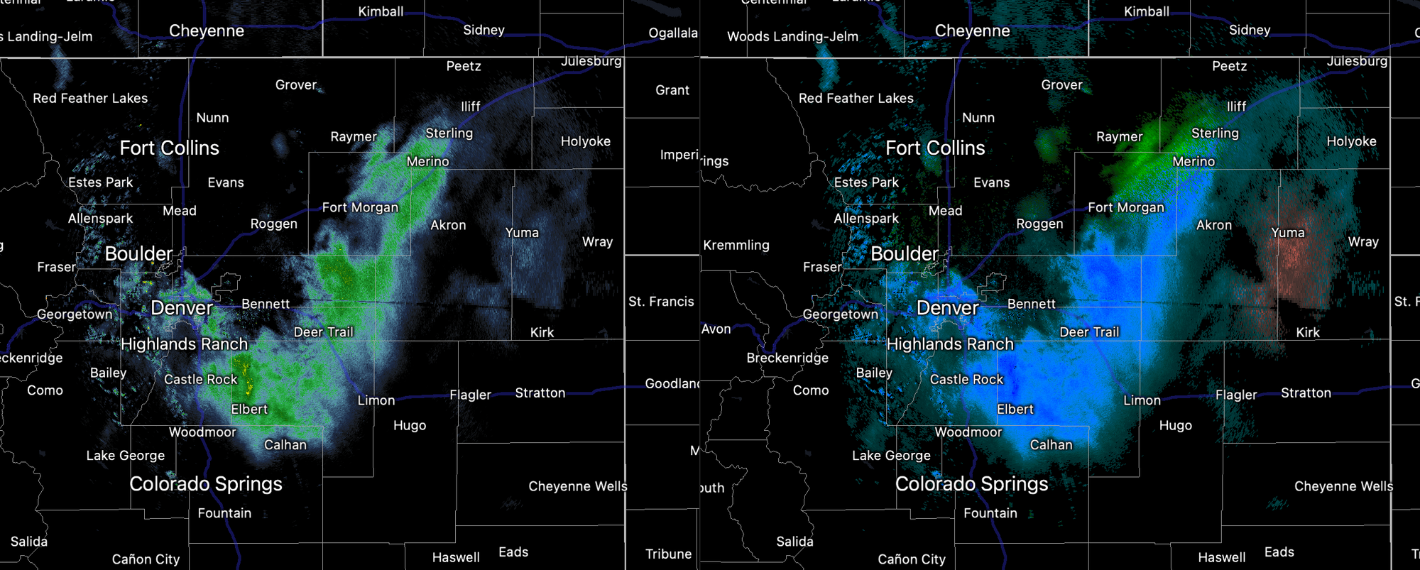
We are still tracking those snow showers this evening. The are racing from north to south, and while not a lot of additional accumulation is expected, where we do see those showers pass through we could see conditions on the roadways turns slick for the evening commute once more. Here was the radar as we pushed the 4pm hour in Denver:
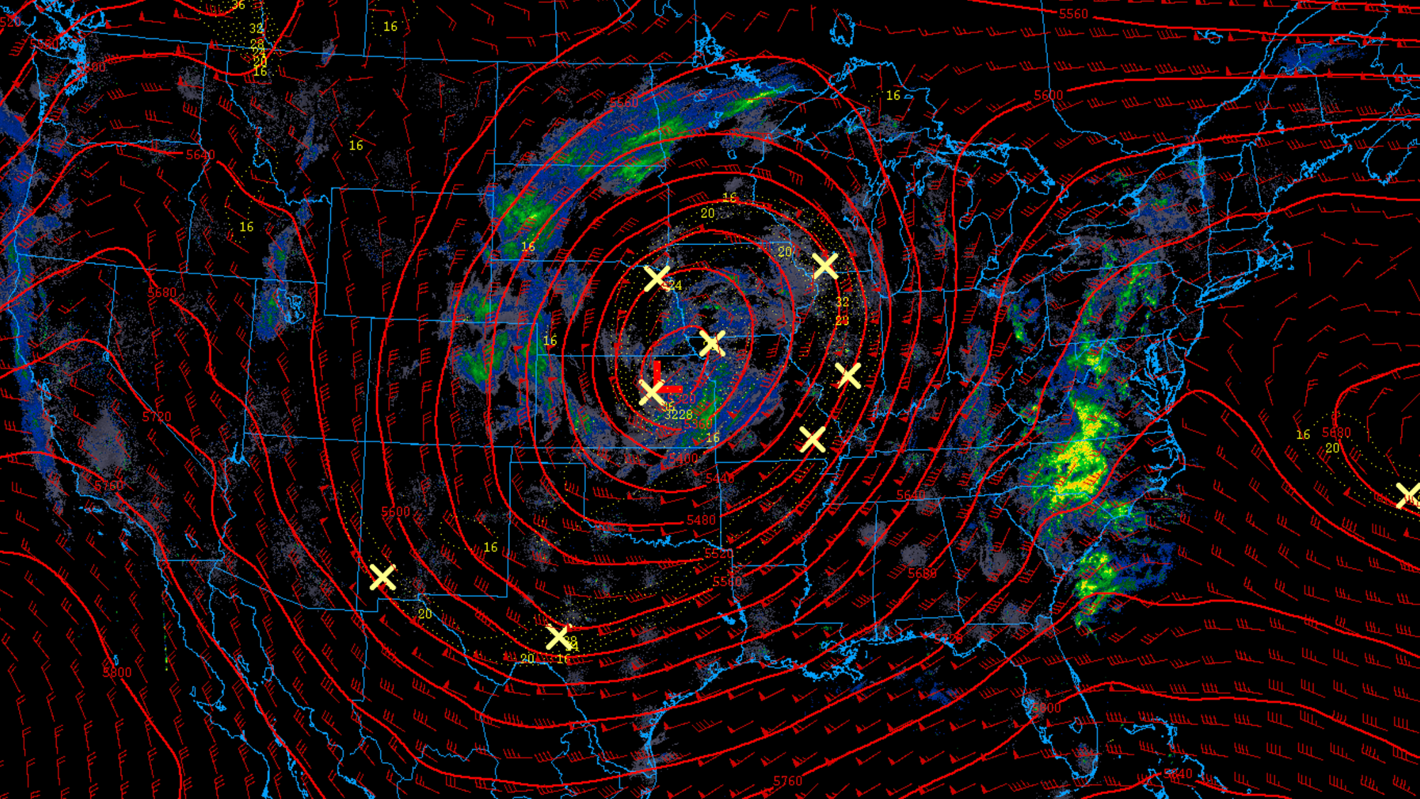
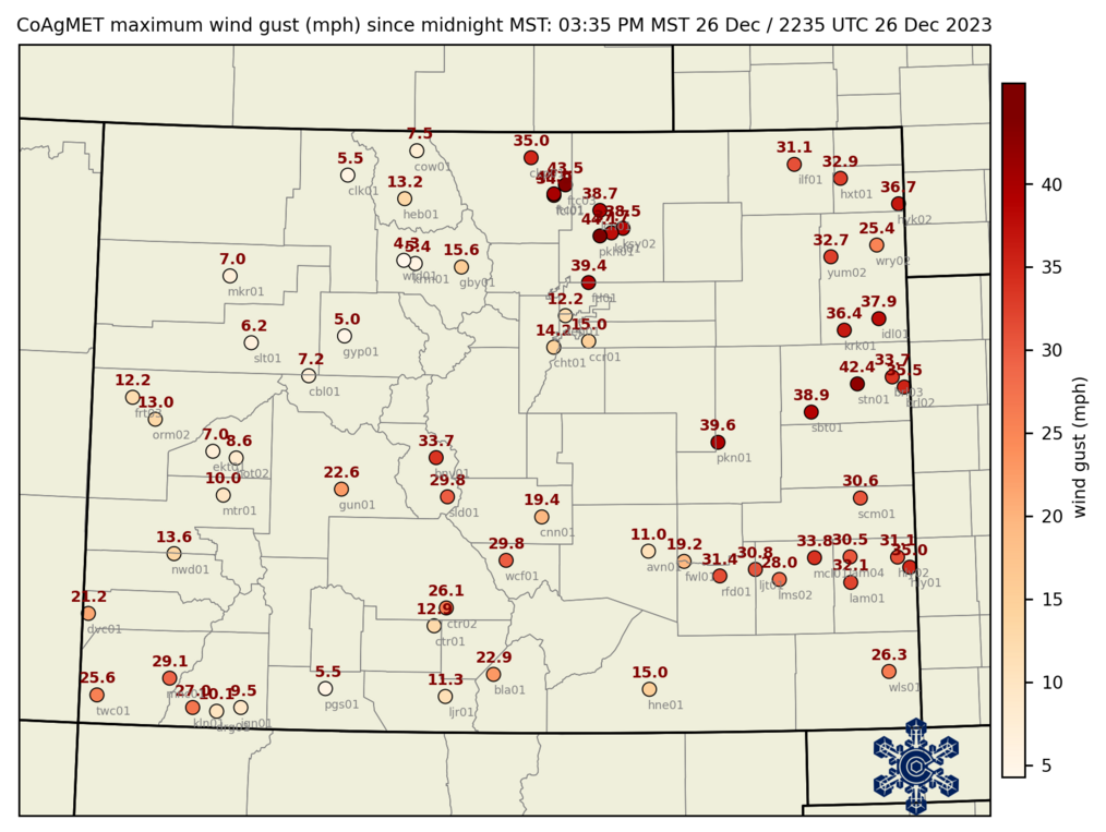
Looking at wind gusts across the state so far today we've seen a lot of 30 mph+ gusts with some 40s across the far eastern plains.
Snow moves on tomorrow
We'll see snow showers off and on through the night across parts of the plains. In fact, some folks could be dealing with showers through a good portions of Wednesday, particularly the closer to the Kansas state line you are. The animation below takes us through Wednesday evening, you can see how slow things are to clear out...
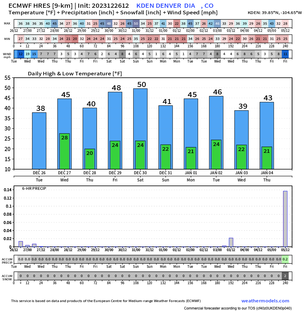
As for additional accumulation?
We don't expect much more in the cities, but across the Palmer and areas east of Denver could still see another 1 - 3" before this thing finally moves on. Of course we are seeing that snow in Denver now, and this morning's snow wasn't supposed to happen, but still... odds aren't favorable for that to occur again.
Quieter weather arrives eventually! Highs tomorrow will be in the upper 30s in Denver, to near 45F on Thursday. Drier weather is anticipated through the weekend.