Focus of storm on Thursday will be across Southern Colorado, more snow for the weekend?

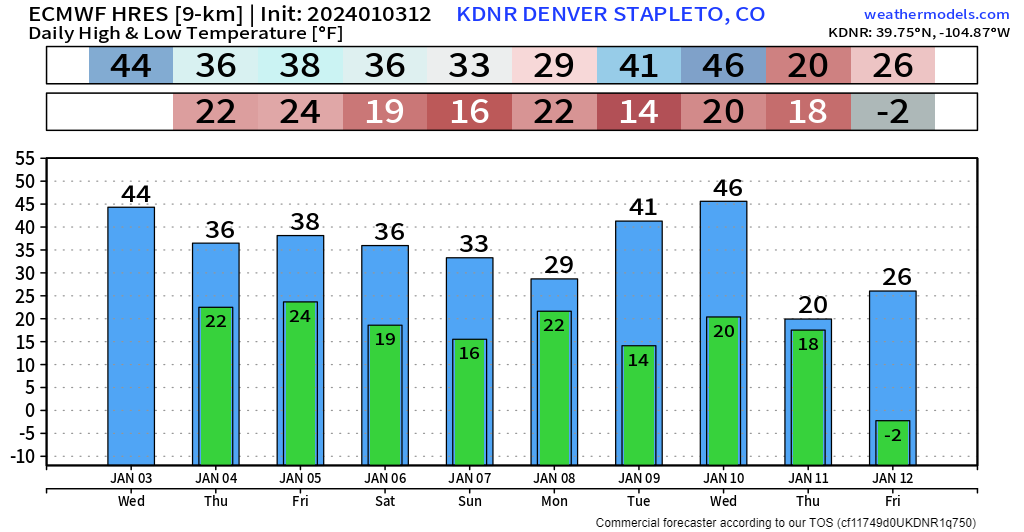
It still looks like a wintry weather pattern over the next 10 days, kicking things off tomorrow with some snow across parts the state, and cooler temperatures for everyone along the Front Range. Here's the latest 10-day temperature outlook for Denver from the ECMWF model:
As mentioned, a storm system will impact mainly southern portions of the state with snow on Thursday, another storm system flies through Friday evening, and another is possible Sunday night and Monday – but that one has been giving models FITS! We won't focus much on the latter system just yet until we get Thursday and Friday out of the way. Oh, and another system is possible at the end of next week too.
First signs of change to this pattern will be some areas of fog overnight. It is the time of year when we should be mindful of ice/freezing fog, too, so be careful if you find yourself in the "pea soup."
Let's move on to these several chances of snow... fair to say, active, but will we cash in is the question...
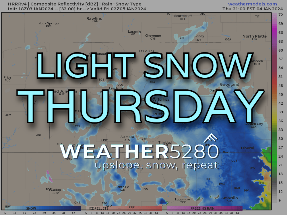
Snow on Thursday focused south, some will spread north
Clouds will build in fast Wednesday into Thursday morning. It will be a raw and chilly kinda day for most of us. Temps only get into the 30s for many along the Urban Corridor. We'll see moisture start to break out by lunch time along and south of HWY 50 (Pueblo and south). That slug of moisture will lift into the Pikes Peak Region/Colorado Springs into the early afternoon.
For areas like Pueblo and Colorado Springs, the heaviest snow looks to be from 3 to 7pm. It's possible for the evening commute to be a little slow. Areas between Castle Rock and Monument will also see some snow in the afternoon and early evening hours. For much of the Denver metro and north, this looks like a very minimal system, perhaps only a few hours of light snow tomorrow evening and that will be it. Most will see less than an inch in these areas.
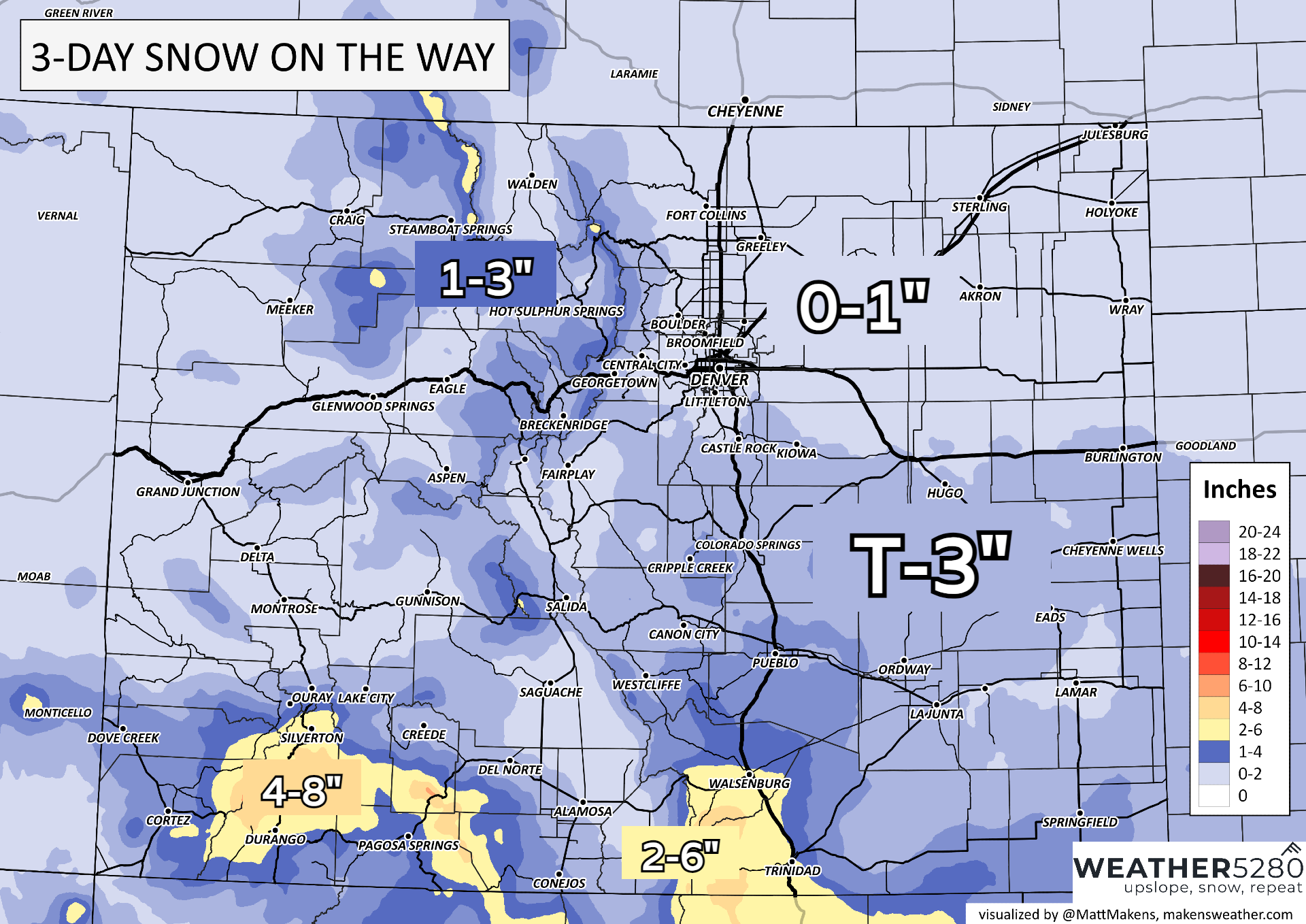
Higher snowfall totals are expected further south but even then, a huge helping of snow isn't really on the table. For most south of the Palmer Divide, a dusting to a few spots approaching 3" could be possible. Areas between Walsenburg and Trinidad may fall between 3-6".
Snowfall from this first system ends before sunrise Friday for most. Then...another round?
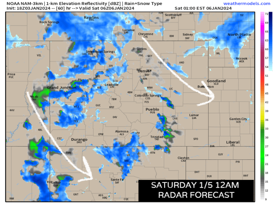
Another weak wave passes by Friday evening, bringing some scattered snow showers across the state. We may see some additional accumulations along the foothills of the front range and the interior mountains by sunrise on Saturday... but that's not looking terribly significant at this time.
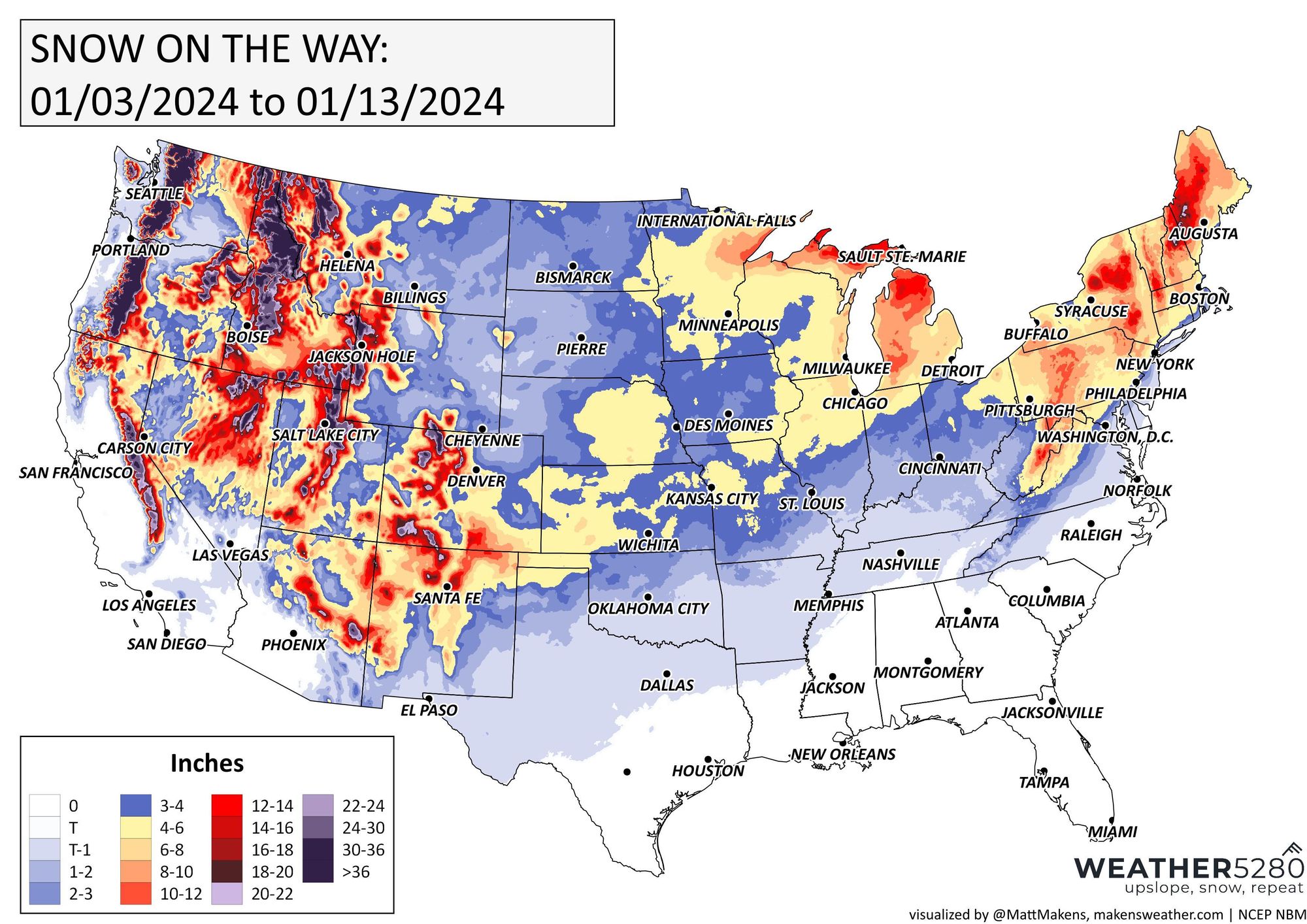
As mentioned above, more wintry weather could continue into next week. Below is a graphic that shouldn't necessarily be taken at face value. But it does show elevated confidence for an active storm track from the western US all the way through the northeast.
For now, chances of snow for Colorado include the storm for tomorrow, another windy/colder storm Sunday night into Monday and a chance of another system next Wednesday – or so.
Will one of these connect and give Colorado a big, widespread storm? Only time will tell. And if and when it does we'll relay that info to you the best we can! A great way you can keep up with this active pattern is by subscribing to our email list!