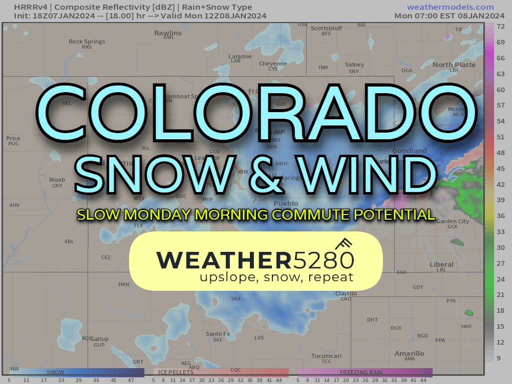
Colorado snow and wind tonight, Monday

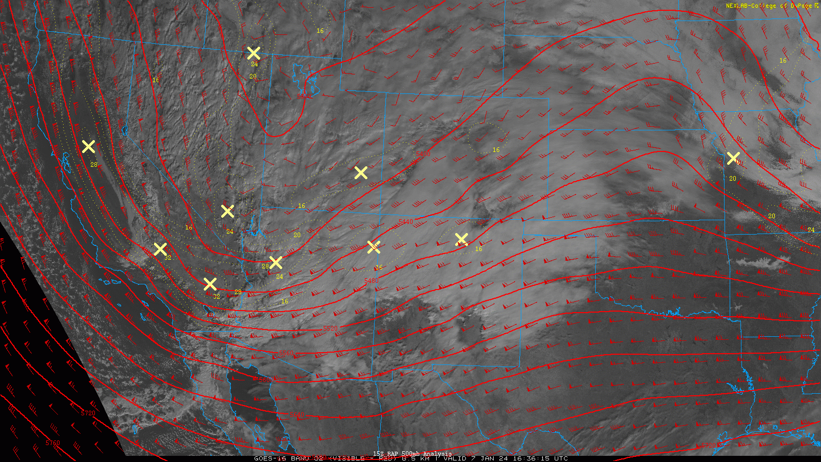
Another strong storm is taking shape over the four corners Sunday afternoon. While the pattern remains favorable, it seems like we'll have to wait for that elusive "big storm" that really clocks everyone.
That being said, for some of the favorable spots in Colorado, along the front range and in the mountains, this is STILL going to bring some impacts.
Another point to drive home: this storm has legs. It's not going to stick around for long. Snow is beginning to fall in the mountains here on Sunday. By midnight, snow showers will start to fly just a bit for the front range, however, the bulk of the accumulating snow chances don't arrive until morning. Several alerts are in effect. Winter storm watches, high wind watches and blizzard warnings scattered across southeast Colorado.
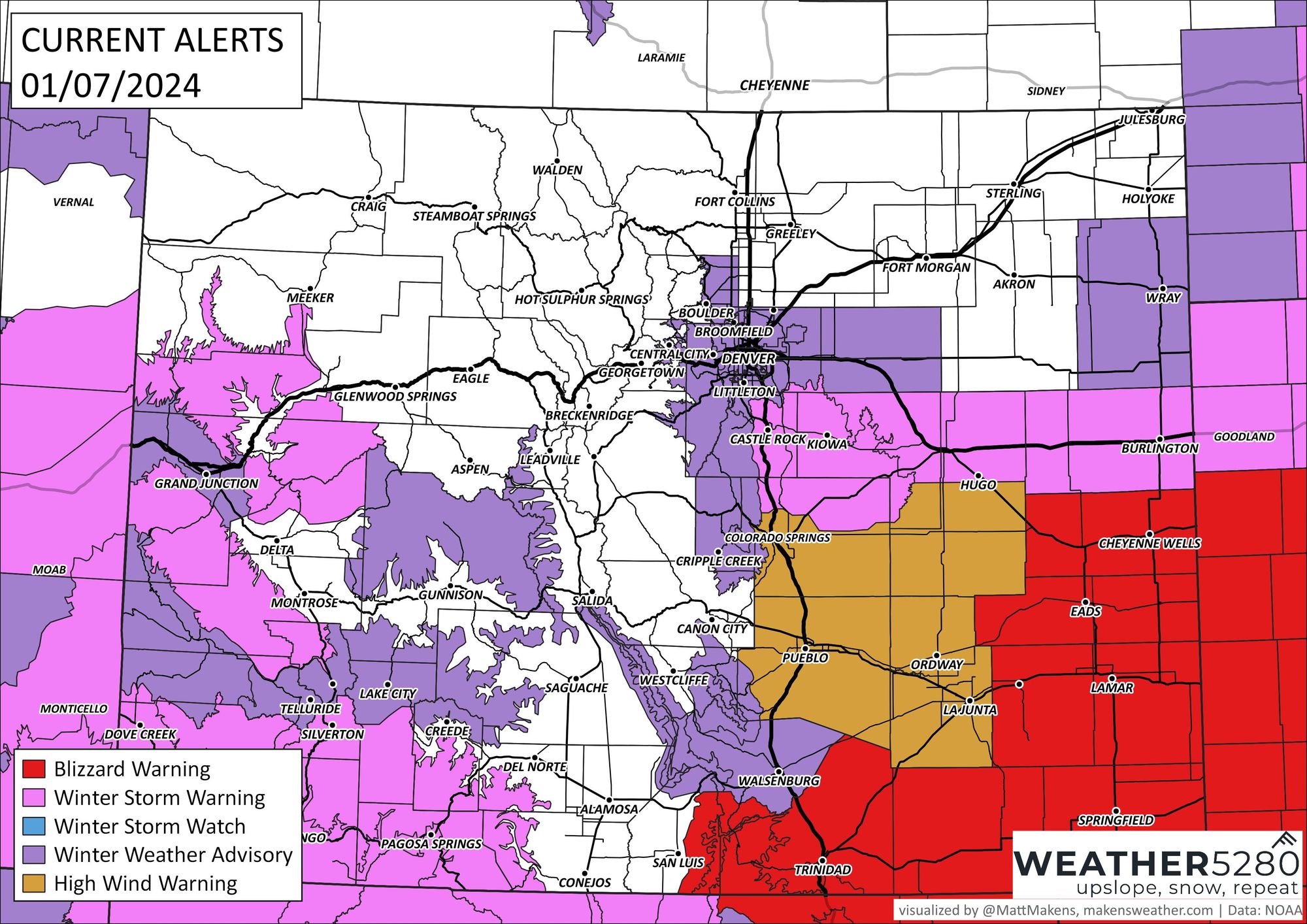
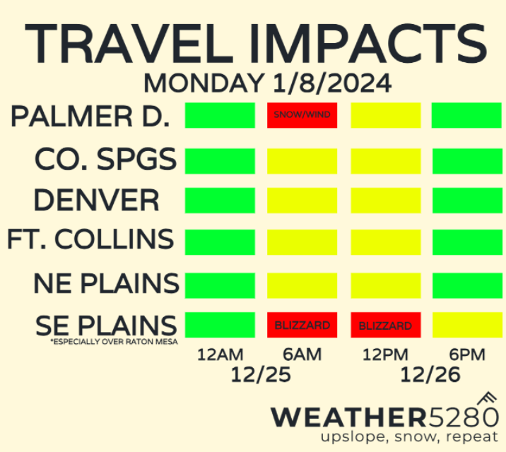
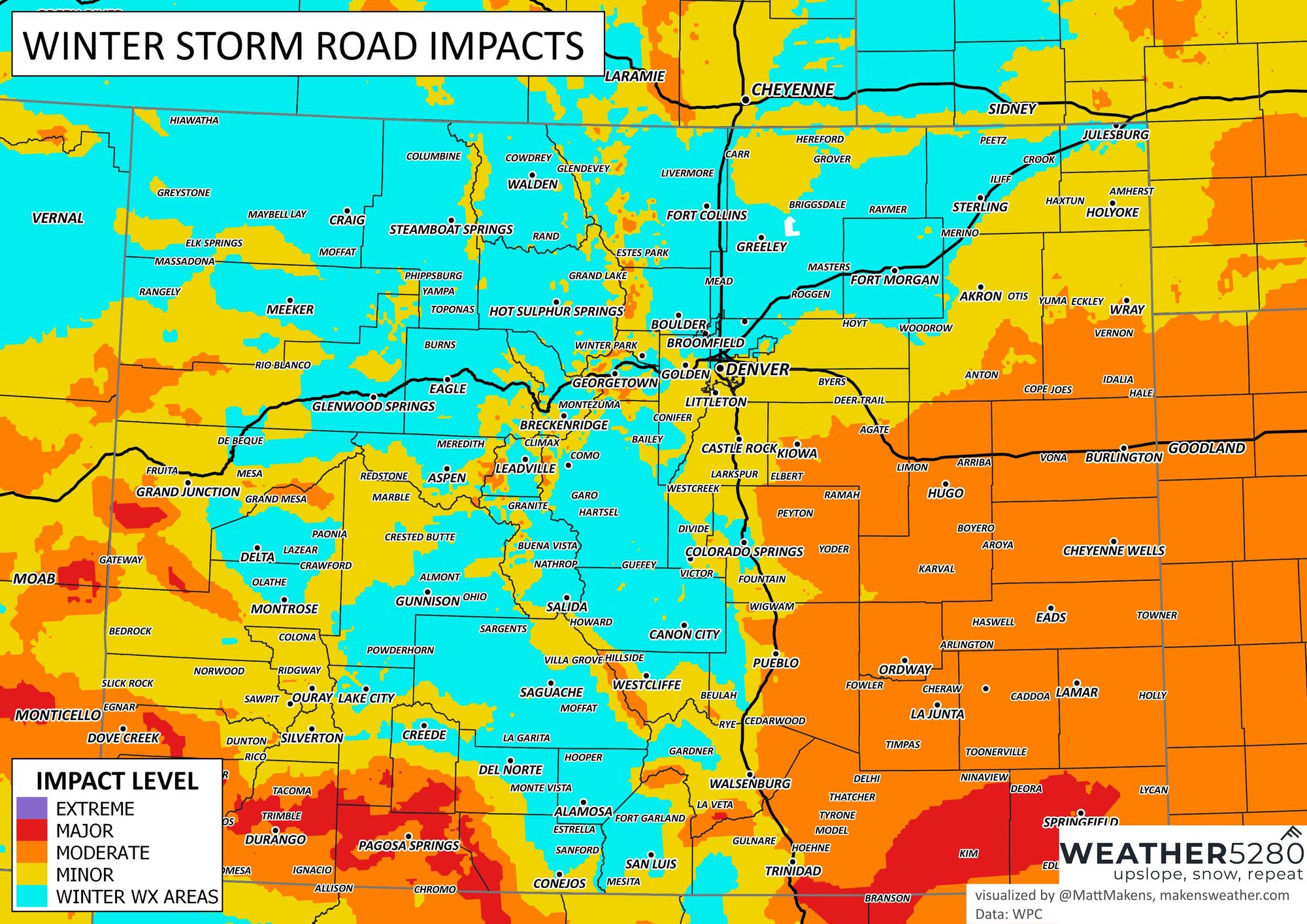
A look below at the travel impacts, the worst of it for many of us will be the Monday morning commute. A short window, that comes at a bad time. If you have to travel in areas along HWY 50, but especially SOUTH along HWY 160, a blizzard is looking likely. Probably not many of you... but definitely worth being aware of.
BREAKING IT DOWN BY THE HOUR
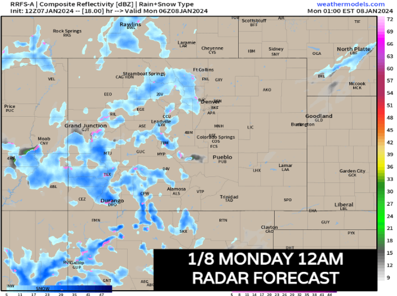
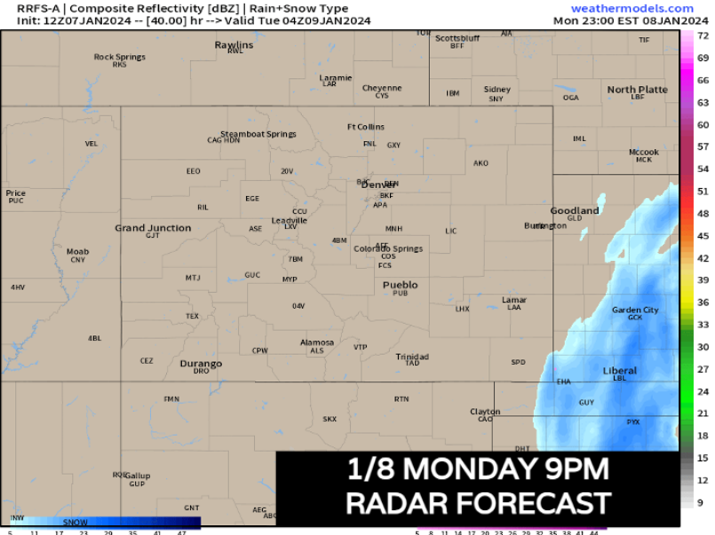
Through Sunday evening, most snow stays in the mountains, with the heaviest snow falling over the San Juans. As seen below, through midnight, there shouldn't be any snow along the front range, outside of some increasing snow showers along and west of the Denver foothills.
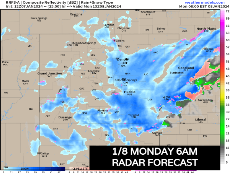
After midnight, especially 2 or 3am, snow will quickly pick up along the front range as the surface low begins to spin up east of the mountains. Now, there's a little tug-of-war going on between model data in terms of front range snowfall. We're going to try and blend solutions a bit in our snowfall maps which are shown further down in the post.
Most of the hi-res modeling is pinning down the heaviest snow showers between 4am to 10am, right in the heart of the morning commute. Bullseyes for heavier banding is in your typical spots: Palmer Divide and over the Raton Mesa. But for places like Denver and Colorado Springs, it may be important to tailor in extra time to your commute: even a lighter snow is going to get blown around by strong winds.
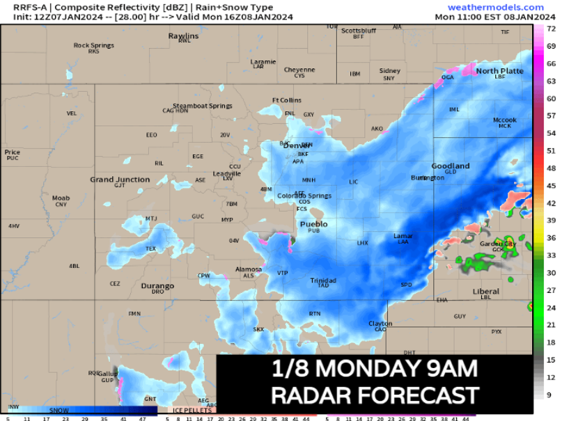
Snow looks to continue through 9am, but quickly thereafter starts to taper off along the urban corridor. For the far SE plains, heavy snow risk continues 9am and beyond.
Even up until 3pm, SE Colorado is still going to be under some moderate to heavy snow. That in conjunction with 40-55 mph winds, the blizzard warning is certainly warranted down south.
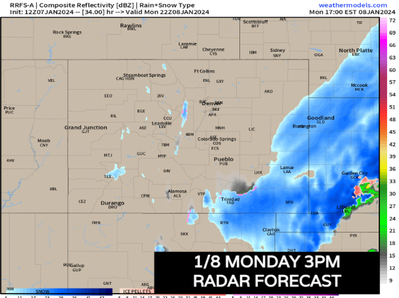
After sunset, the storm exits the state. As mentioned, it's a relatively quick moving system, but it will leave it's mark.
And not to be forgotten in all of this: The wind is going to kick! Below is a map of some of the highest potential wind gusts of the day, around 10:00am Monday.
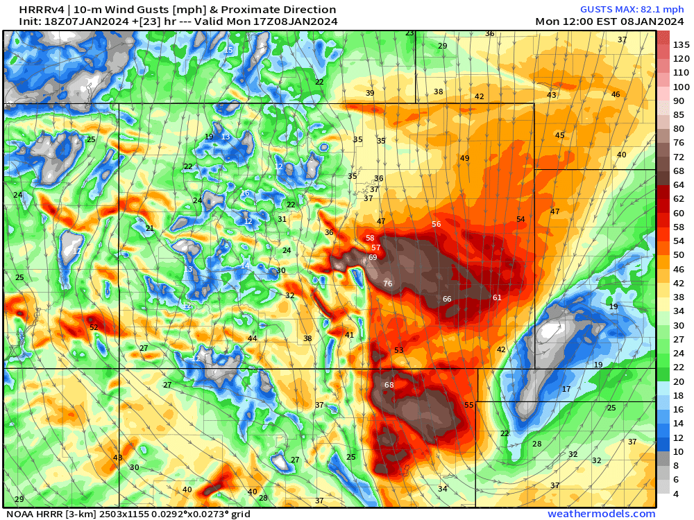
Gusts from 30-40 mph are expected for much of the morning from Fort Collins to Denver. Even stronger stuff near and south of Colorado Springs. Some of the 70 mph gusts you see might be a bit overdone, but it gives you an idea where the worst of the winds will be.
Combine light-to-moderate snow with that type of wind, the morning commute won't be great – especially between Denver and Colorado Springs. Winter storm road impacts below show where the worst travel conditions can be expected.
SNOW TOTALS
18z HRRR has backed off from the 12z HRRR which was showing a bit more snow for the Denver Metro. In general, this seems like a good blend of solutions – with heavier snow being favored on the Palmer Divide and along HWY 160 near the Colorado border.
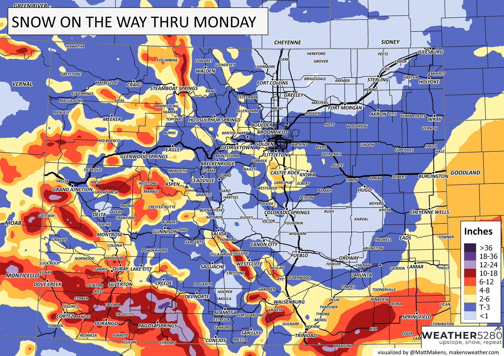
Snow totals by city are as follows:
Denver: T-3", heavier on the south side of town
Castle Rock: 2-6"
Boulder: T-2"
Fort Collins: 0-1"
Colorado Springs: T-3"
Monument: 2-6"
Pueblo: 0-T"
Trinidad: 4-8"
Springfield: 5-10"
Main takeaways from this system: Even without a ton of snow, the wind could make things problematic for the morning commute.
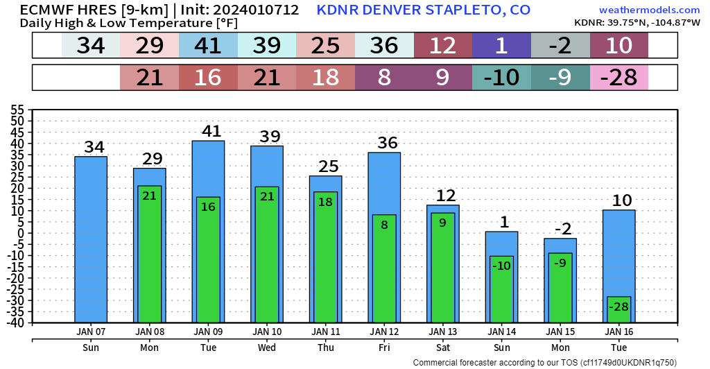
And looking forward... no end to the wintry pattern in sight. In fact, the bottom has been looking like it will drop out around next weekend. Our first shot of arctic air looks to be on the way, with more snow chances Thursday night and throughout next weekend!
The best way to stay informed ahead of all this is by subscribing to our email list! Updates will come straight to your inbox as we publish them!