Arctic cold headed to Colorado this weekend, big mountain snow, some Front Range snow as well

Winter will make itself known across Colorado this weekend! Several cold fronts, plenty of arctic cold, lots of mountain snow and a shot at some Front Range snow as well.
Winter lovers, this is your kind of weather coming up.
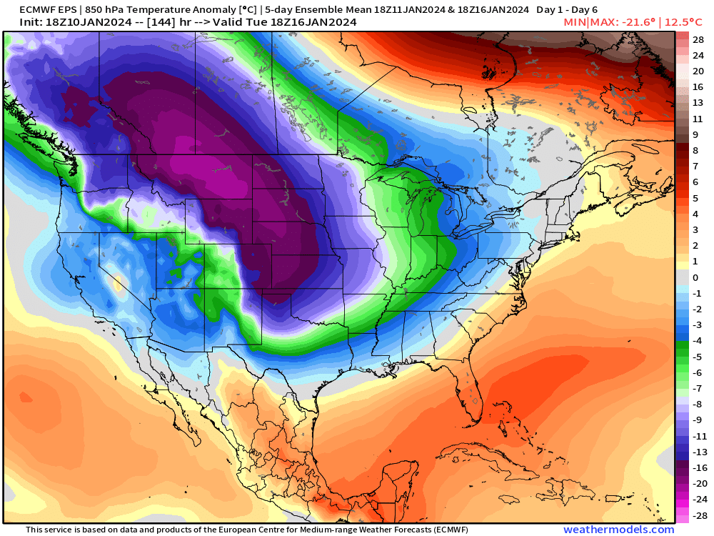
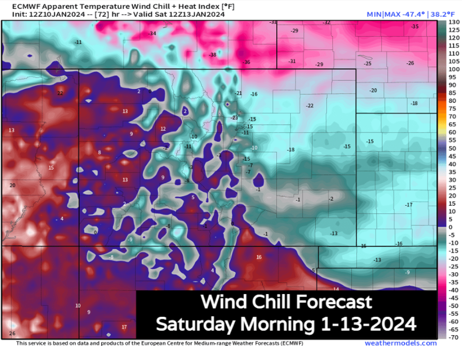
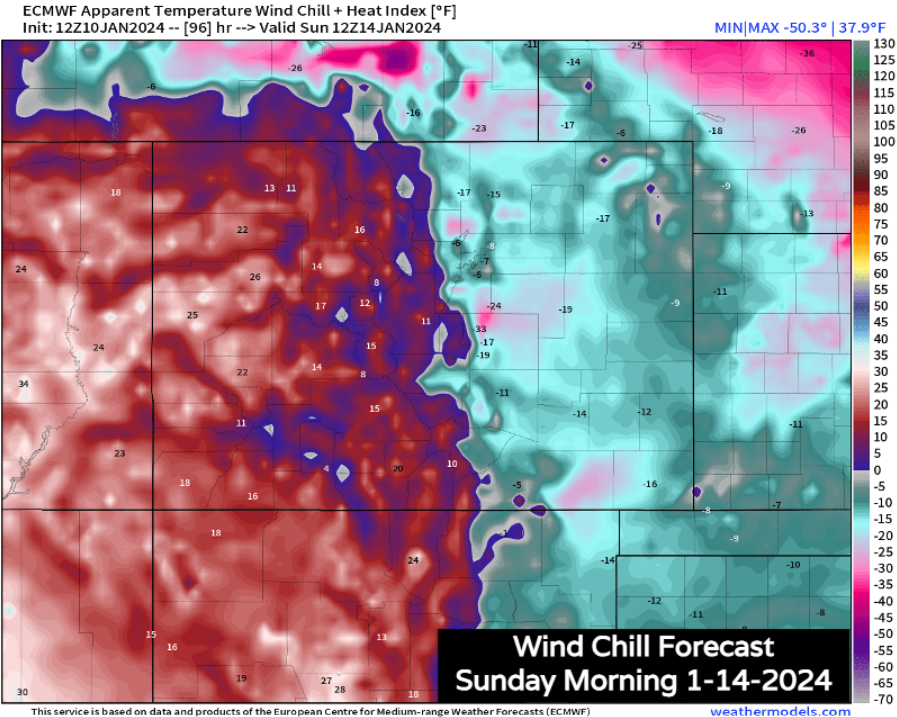
The 5-day temperature anomaly shows us that this is cold isn't just going to be a quick in-and-out type of event. It's likely that parts of eastern Colorado see 3 consecutive days of near and below zero wind chills – potentially dangerous stuff if exposed too long.
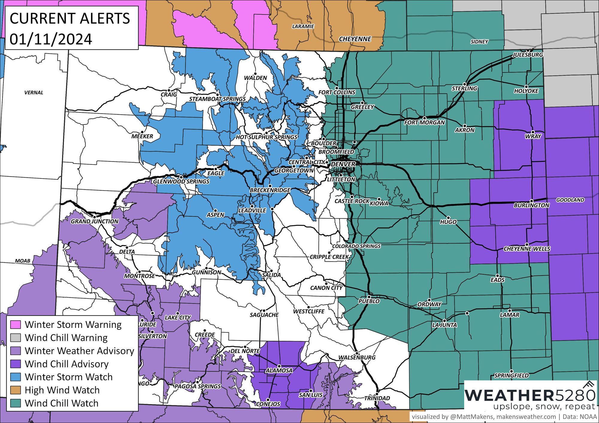
A Wind Chill Watch has been posted for all of Eastern Colorado and much of the plains states which goes into effect Saturday and carries through early next week. From the NWS:
...WIND CHILL WATCH IN EFFECT FROM SATURDAY AFTERNOON THROUGH TUESDAY MORNING...
* WHAT...Dangerously cold wind chills possible. Wind chills of 20 below to 30 below zero, with the most severe conditions over the eastern plains.
* WHERE...East central and northeast Colorado.
* WHEN...From Saturday afternoon through Tuesday morning.
* IMPACTS...The dangerously cold wind chills could cause frostbite on exposed skin in less than 30 minutes.
We'll be chilly to close out the week on for Thursday and Friday with a quick storm system passing by. Our arctic front arrives Friday night into Saturday morning, with wind chills for most.
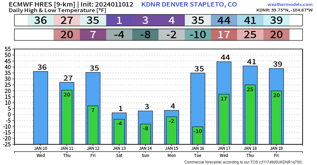
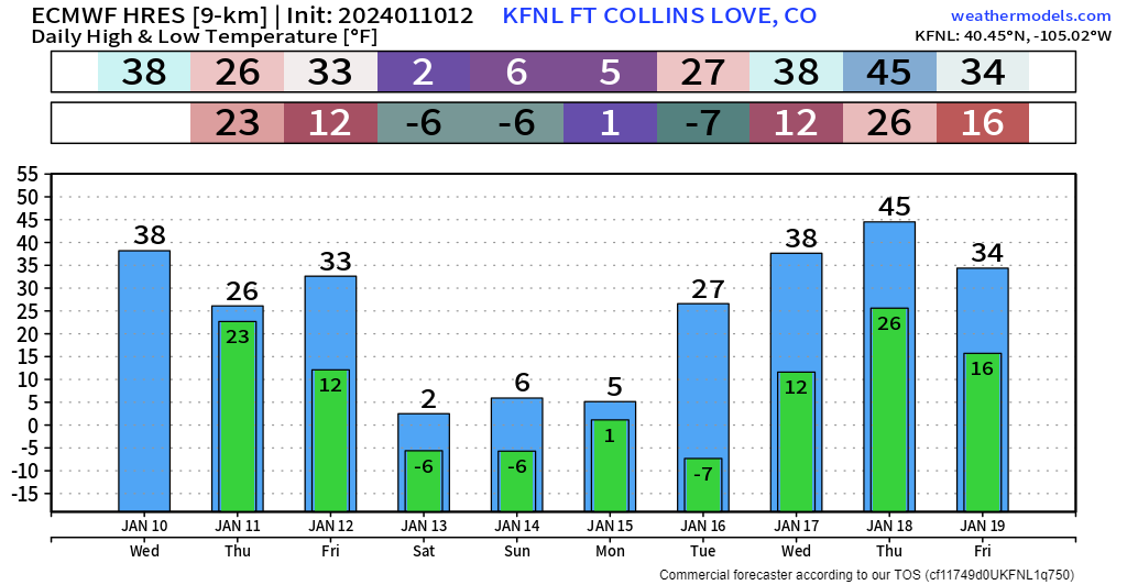
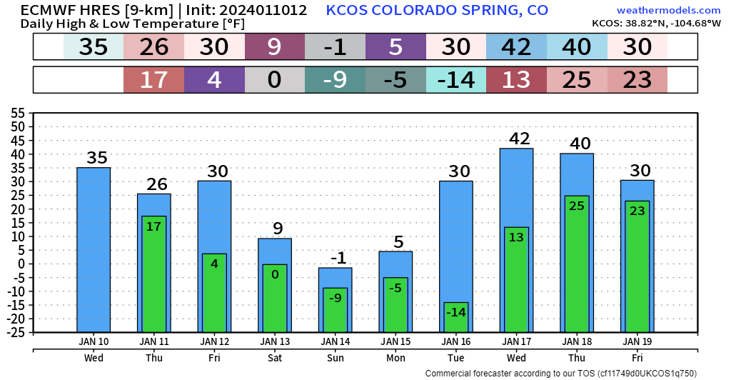
Frigid stuff expected each day, and especially each morning from Saturday all the way through Tuesday morning.
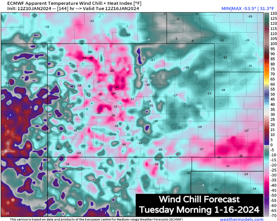
Some of the coldest stuff looks to be Monday night into Tuesday morning as the arctic air begins to spill into the continental divide as well.
This would-be cold snap puts the Front Range at risk for the potential of 60-70 hours of sub-zero wind chills.
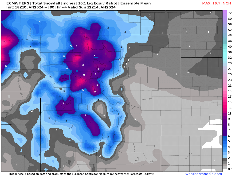
Along with the arctic front Friday night into Saturday, a strong jet streak will pass overhead, giving the mountains quite a bit of heavy snow, with some moderate snow possible along the Front Range.
With the strength of this cold air, the 10:1 liquid equivalent that this snow map is underdone for many locations. Mountain snowfall potential through Sunday morning shows a healthy swath of 6+ inches of snow (likely going to be 12+ inches for the major ski resorts).
Early look at totals could suggest a range of Trace-4" for the Denver Metro, with 3-6" possible in the foothills between now and Sunday. Placement, and details around where the more meaningful snow will setup will change a bit, so we'll narrow in on those numbers as we get closer to the weekend here as well.
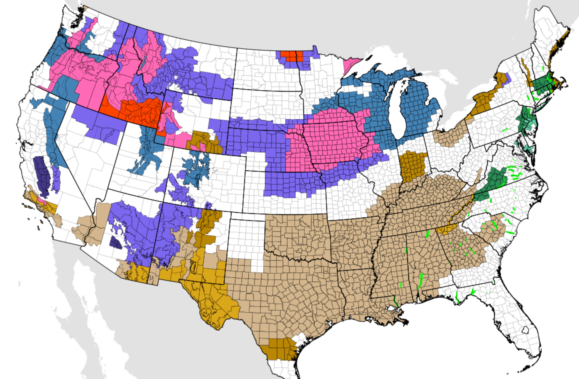
For now, here's our snowfall forecast through Saturday as you prep for the snow and cold on the way:
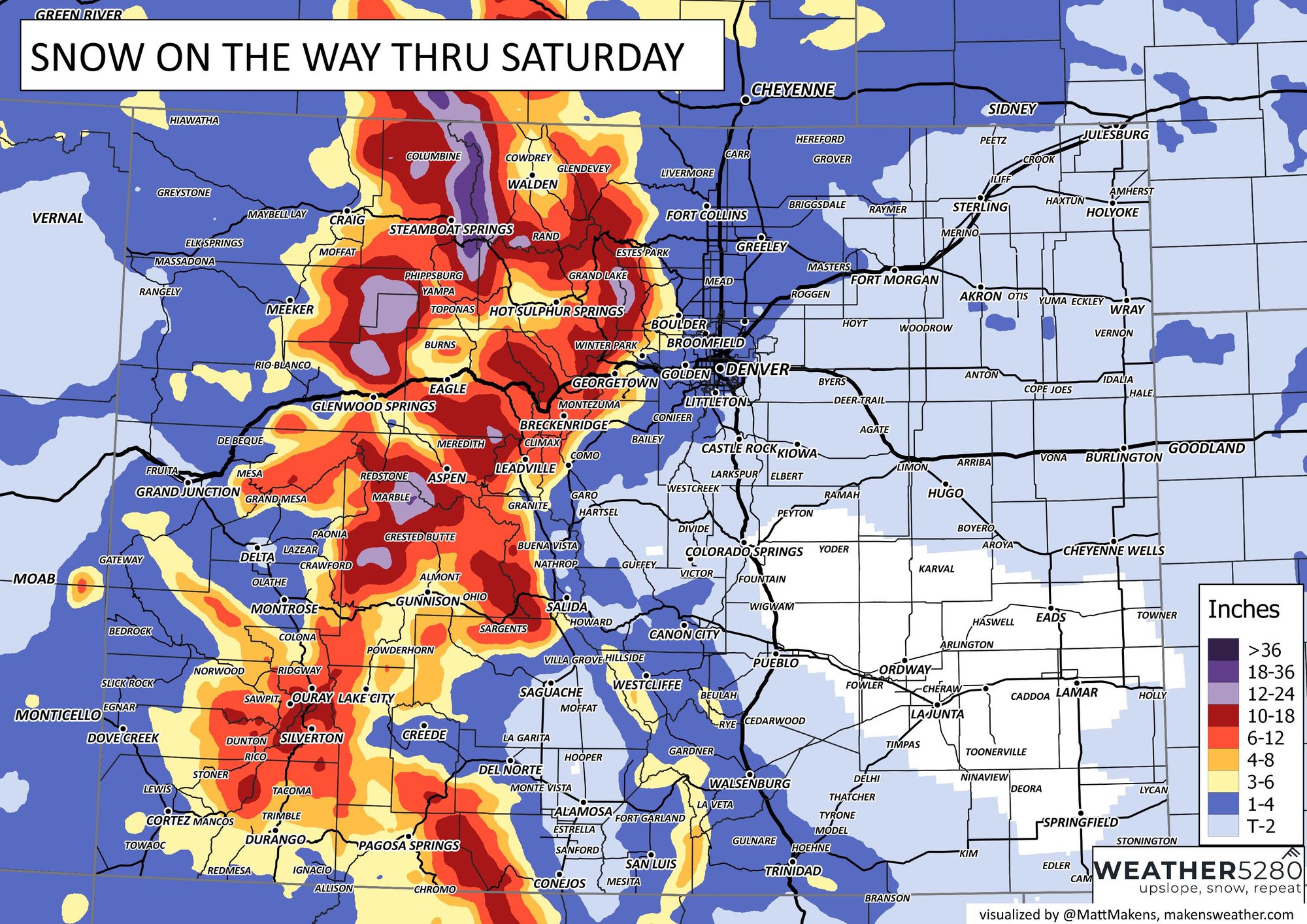
And hey, look at that Fort Collins and northern Front Range friends, we know you've missed out on the last few snow events, it looks like the storm Friday night may finally get you folks some of the white stuff! 🤞
The strong jet flow aloft stays overhead through weekend and will feed off and on snow chances through the duration of this arctic cold outbreak.
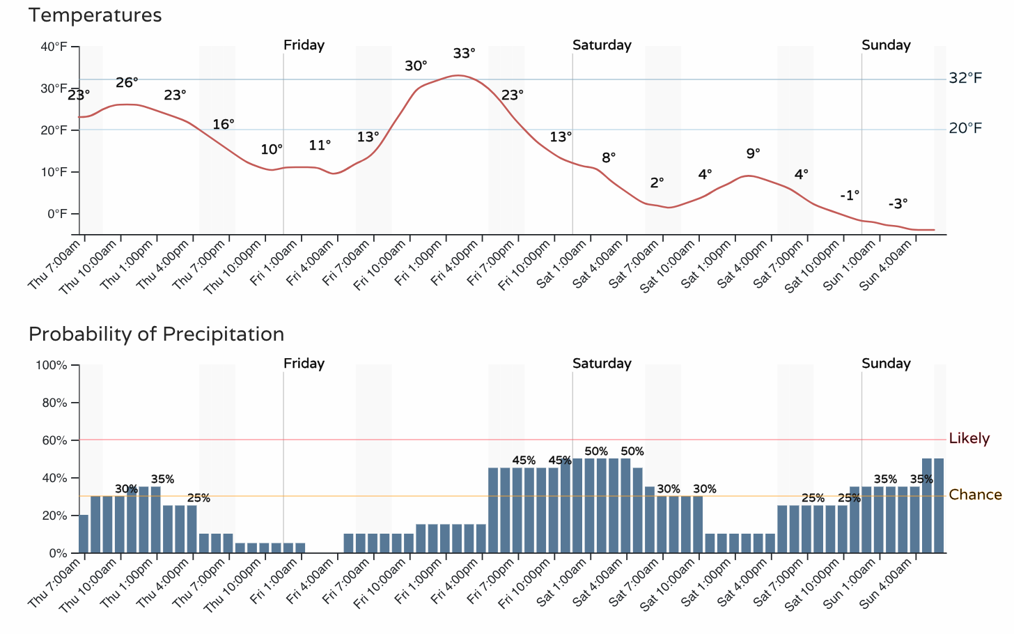
In fact, it's possible at the very least we could have a chance at flurries/snow showers from Friday evening through Tuesday with a setup like this, and you're already seeing that reflected in the hourly planner to end the week/begin the weekend – not even including the flakes we could see around today!
The mountains will benefit in a HUGE way from this pattern too – conservative snow estimates by the middle of next week put a big chunk of the high terrain somewhere between 2-4 feet... but I've got an itch that 4-6 feet in a few spots isn't impossible... Some deterministic model data has gone as far as 60-70+ inches of mountain pow between now and next Wednesday. This should get us back on track in ski country! Check out the data from Steamboat Resort:
If you were a gambling person, how many feet of snowfall would you bet on for @skisteamboat in the next several days? The models' average brings you reasonable chances of more than six feet!#cowx #ski pic.twitter.com/sSIhbbFohS
— Matt Makens, Makens Weather (@MattMakens) January 10, 2024
Plenty more to come, and as always the best way to stay informed ahead of all this is by subscribing to our email list! Updates will come straight to your inbox as we publish them!