Colorado weather: Coldest night of the arctic outbreak tonight; how much additional snow to expect, and when it will end?

A good chilly morning to you all! We hope everyone is somewhere warm and safe this holiday Monday, and enjoying a wintry weather day that may be reminding some of you of the good ol' days in Colorado. ☃️
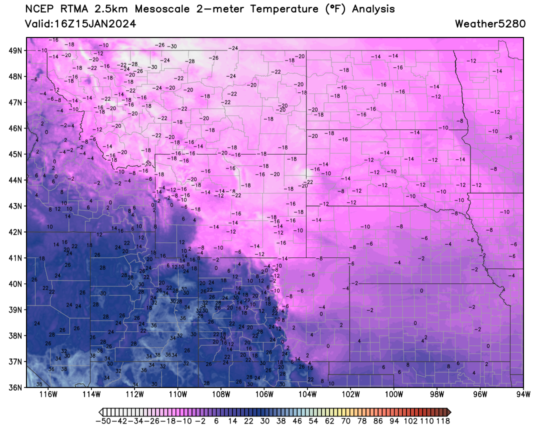
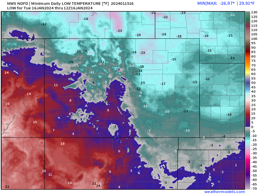
Here's a look at current temperatures across the northern high plains this morning – Colorado almost looks warm compared to our neighbors to the north, but look at those single digit values all the way down into Oklahoma this morning. Brr!
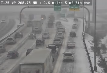
The snow and cold has been real with this impressive arctic outbreak. Parts of the northern and central mountains have picked up FEET of snow over the last several days, with heavy snow continuing through Monday evening for much of the high country. Across the plains we've seen most locations along the northern urban corridor pick up several fluffy inches Friday evening, and we're adding to our totals today with snow ongoing along the Front Range at this hour.
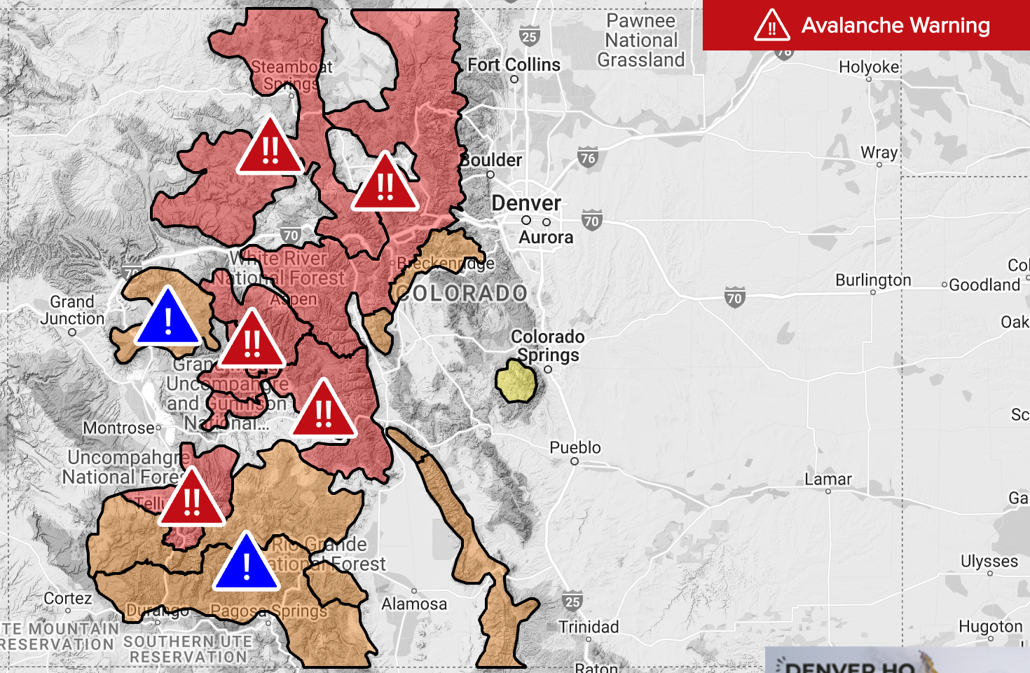
IF your plans take you west today, please reconsider and stay home. Many interstates have closures through the mountains today, with heavy snow, extreme cold, and high avalanche danger in place across the mountains Monday. Here's the latest warnings and alerts from the CAIC.
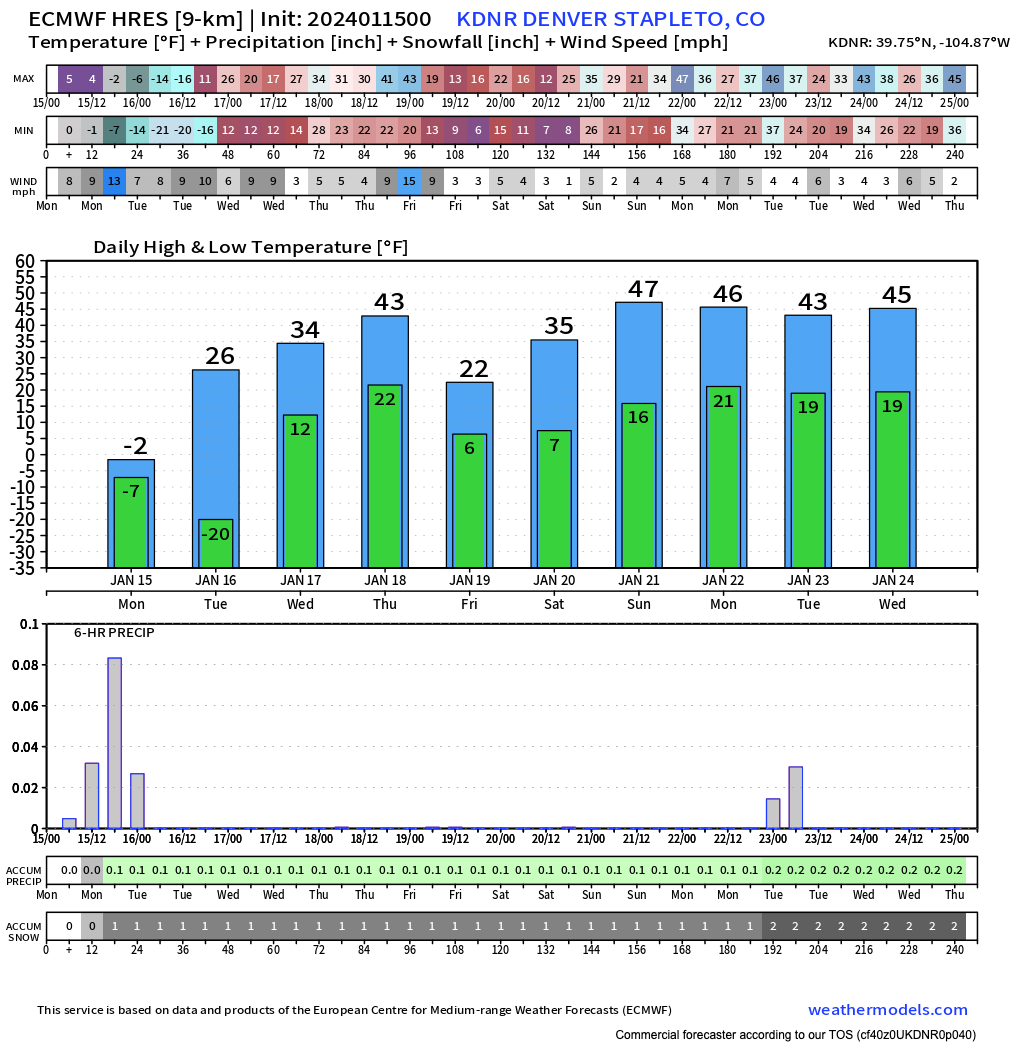
The cold remains firmly entrenched through tonight, but relief is in sight. Tonight's lows will be some of the coldest we've seen yet across the state, but highs in Denver could climb above freezing Tuesday which will feel downright warm after several days with temperatures hovering near zero.
The hourly planner shows snow gradually diminishing through the afternoon hours, with temperatures never making it above 0°F today. We're sitting -6°F officially in Denver as of this writing.
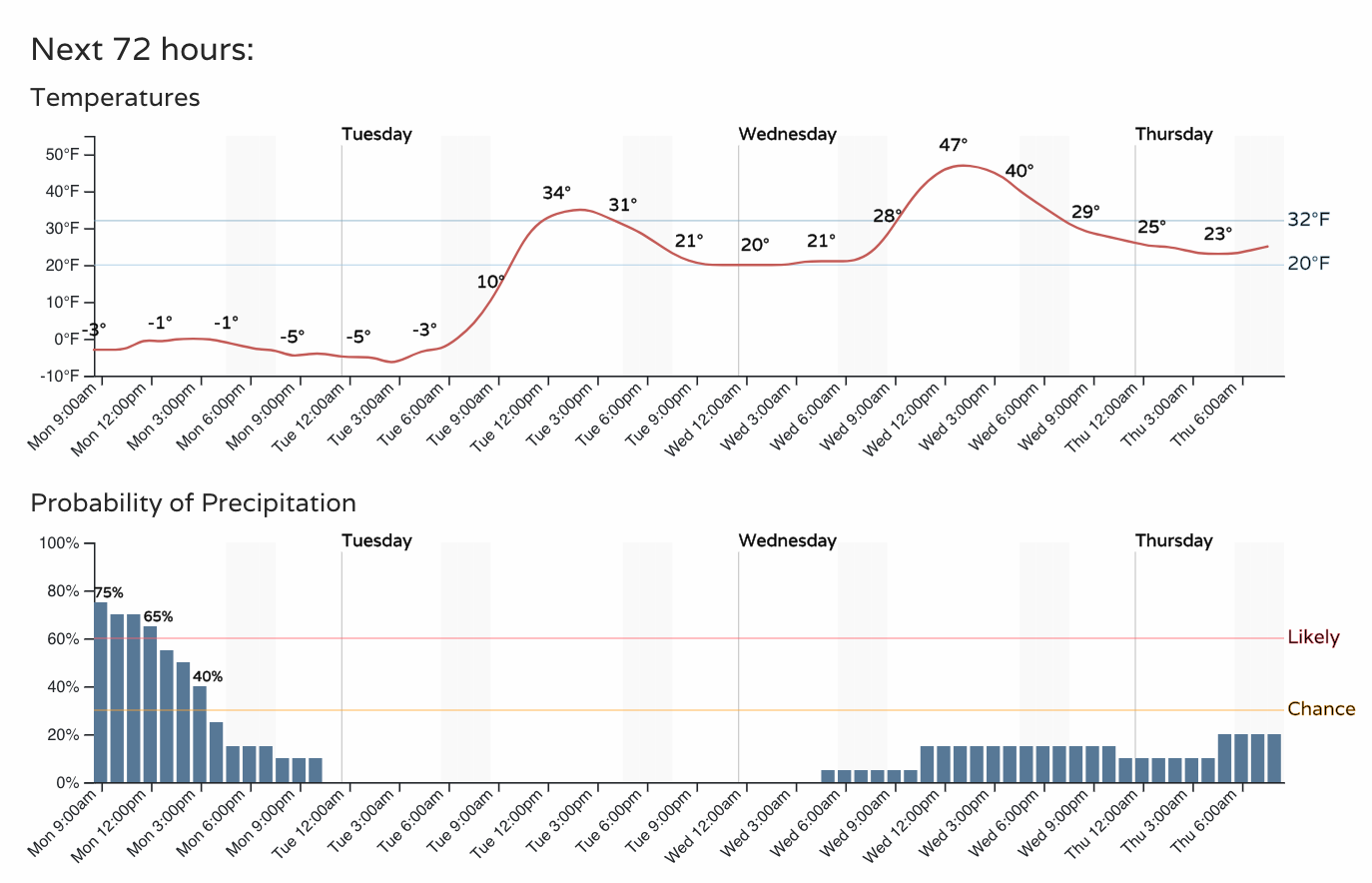
Overnight lows are forecast to be around -10°F in Denver tonight, but I suspect we'll see some lows well below that across portions of eastern Colorado, and that's not even factoring in the windchill. A Wind Chill Warning remains in effect for all of Eastern Colorado through Tueday morning:
...WIND CHILL WARNING REMAINS IN EFFECT UNTIL 11 AM MST TUESDAY...
* WHAT...Dangerously cold wind chills. Wind chills as low as 35 below zero.
* WHERE...East central and northeast Colorado.
* WHEN...Until 11 AM MST Tuesday.
* IMPACTS...The dangerously cold wind chills could cause frostbite on exposed skin in as little as 10 minutes.
The NWS forecast for lows across northeast Colorado tonight are impressive, some -20°F+ readings northeast of Denver, with the minus teens likely for DIA!
We kick the coldest stuff Tuesday, but remain chilly. Guidance shows highs anywhere from 26°F to about 36°F for highs in Denver on Tuesday. A bit of a spread in potential, but both scenarios will feel mild after our weekend in the deep freeze.
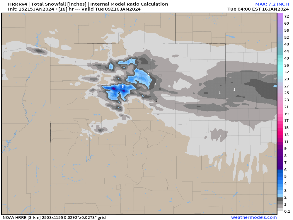
As for snow? We'll see it continue off and on for the next several hours but gradually come to an end across the plains this afternoon. Most of us will see only another inch or so of accumulation, but under heavier bands peeling off the high country it could be we see some additional 2 - 3" totals before things wrap up later today.
The latest HRRR shows this idea, with Jefferson and Boulder counties still under some of the more impressive snow production, but overall light/fluffy additional snowfall along the urban corridor and adjacent plains today.
The remainder of the week
We warm up a bit, and dry out a bit, but still some unsettled weather possible through the end of the week.
The Euro, below, shows the next meaningful front moving through Thursday into Friday, but keeps much of the metro areas dry. The GFS, meanwhile, is a bit more bullish in snow potential east of the hills, but main event looks to be for the northern mountains again as this next wave passes through.
We will enjoy today's snow, and focus on tonight's cold, then worry about anything that may or may not move through later in the week.