
Latest Colorado snowpack numbers, and what's on tap for the remainder of the month

Temperatures have warmed and the storm track has quieted after a pretty good stretch of winter over the first part of January across the region.
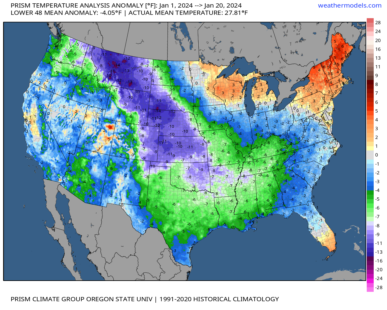
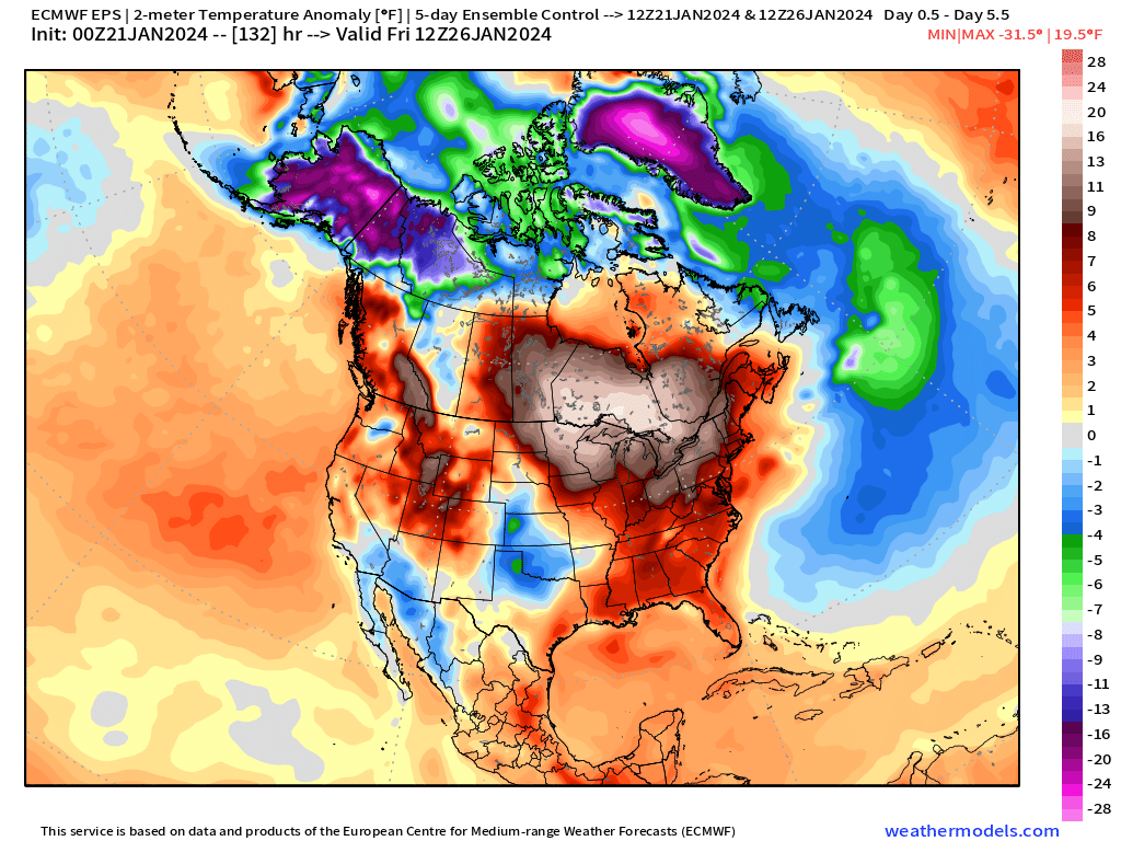
Much of eastern Colorado is running from 8 - 12°F degrees below average through the first 20 days of the month. Last week's cold was impressive, and not just in our backyard but across much of the country as you can see below:
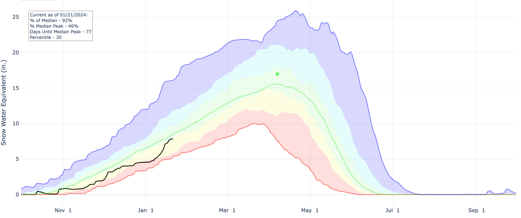
We have also finally seen some meaningful snow across parts of the state, and after a dismal start to the new year for snowpack across the region we've seen some good recovery across our basins. Still, snowpack remains below average statewide, sitting at 92% of median as of this morning. Heavy snow for the northern and central mountains have boosted numbers from just 60 to 75% of average to start the month to near average today, but clearly more work needs to be done.
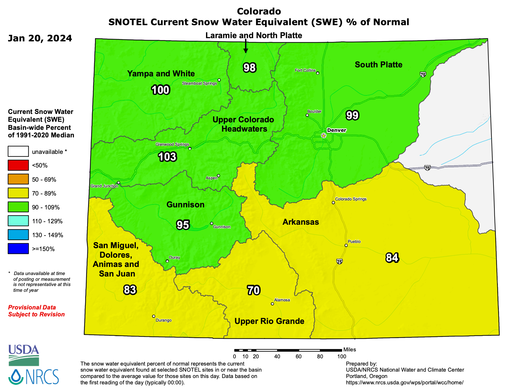
A look at per-basin snowpack numbers across the state shows where the recovery has been best to kick off the year, but that southern Colorado still has some catching up to do.
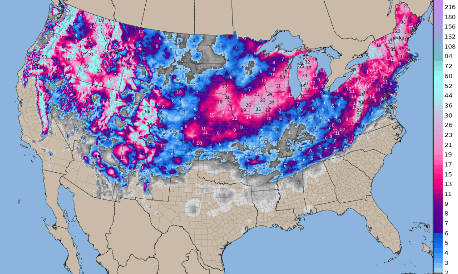
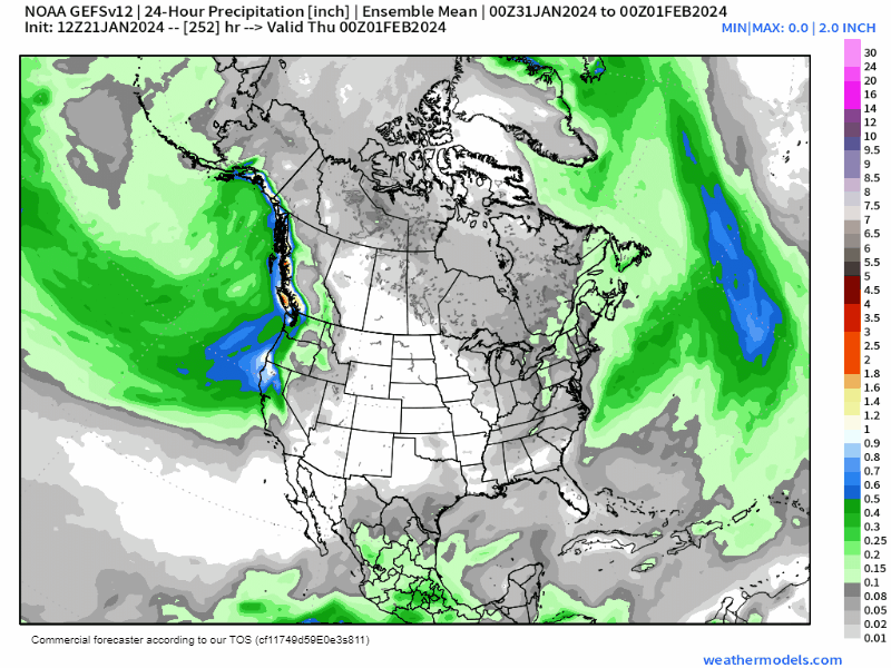
In pure numbers, January 2024 has been pretty snowy across the CONUS, with multiple impactful storms delivery measurable snowfall coast to coast:
The outlook
A generally quieter, and certainly warmer period of weather appears on tap for much of the remainder of the month. Ridging, first to our east, then to our west will help moderate those month-to-date cold temperature anomalies shown above across much of the CONUS.
Over the next 5 days we see ridging going up over the eastern half of the country...
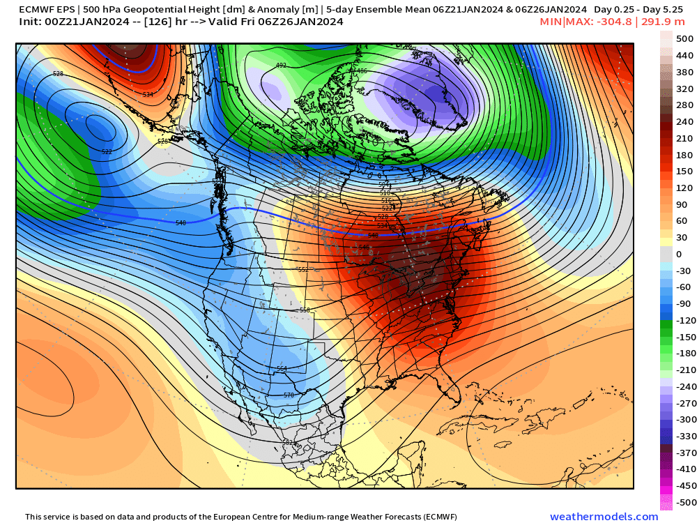
With much above average temperatures under the ridge...
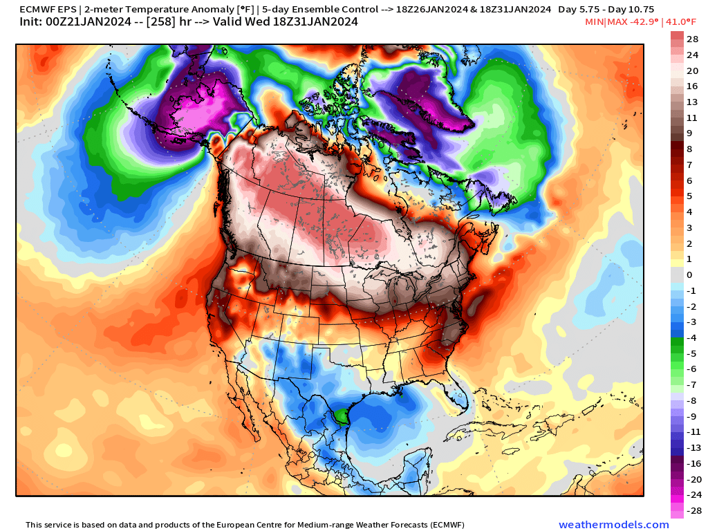
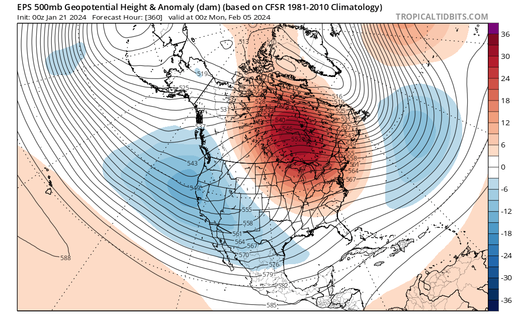
With a serious ridge going up over the western/central portion of the country for the last 5 days of the month...
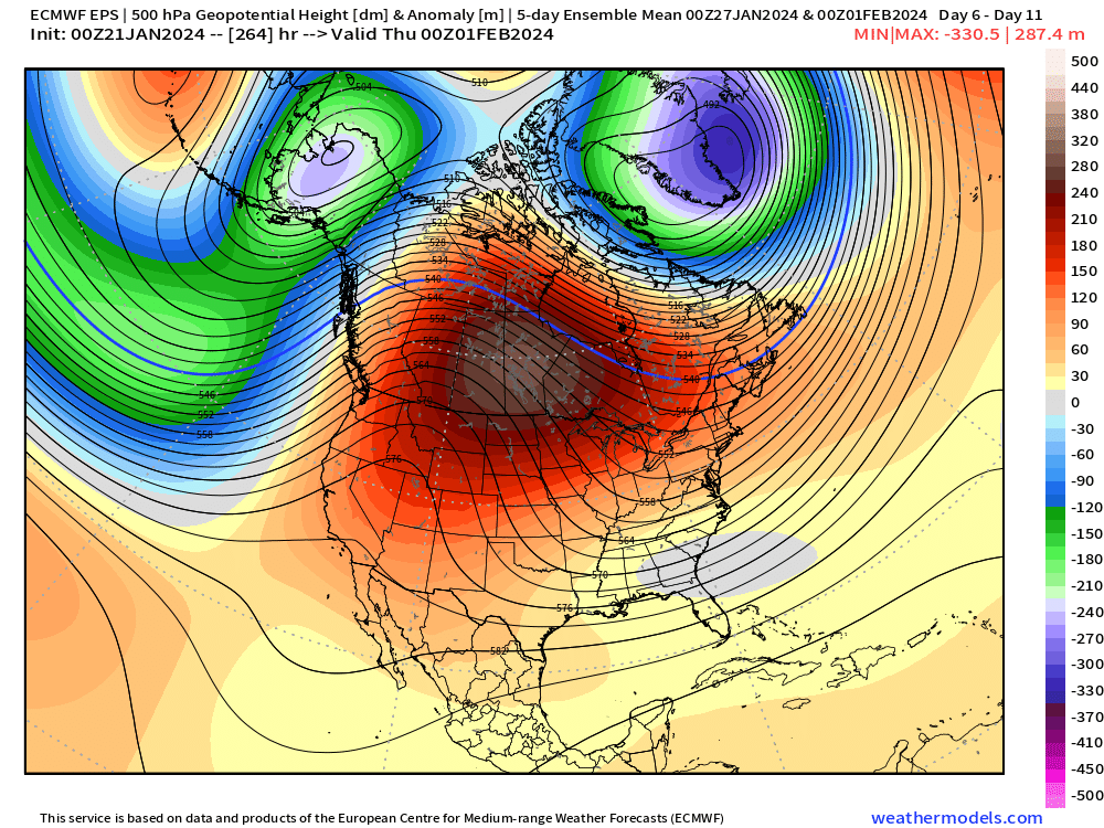
And temperatures WELL above average under that ridge...
The bias for Colorado looks warmer and drier than average, but that comes with a bit of caveat as there is some chance we'll be able to tap into a storm or two that will swing across the southern tier of the U.S. between now and the end of the month. This is particularly true for southern Colorado, but we can't completely sleep on the pattern given where we'll be situated in relation to the storm track.
The cooler than average anomalies showing up to our south for the latter days of the month are indicative to where we expect the best precipitation as well.
The latest European ensemble mean forecast shows what should be relatively wet period of weather for parts of the West Coast and especially so for the southern plains and Southeast U.S. to end the month, but again – a bias toward average to drier than average for Colorado and points north.
The next system that has any potential to bring some wet weather to our area looks to be late this coming week, think Thursday/Friday timeframe. At this time, it looks like the bulk of the energy stays pretty far south and with that we don't expect much in the way of precipitation along the urban corridor, nor do we expect a push of any meaningfully cold air – though we could shave a few degrees off afternoon highs to end the week. The mountains may see some periods of snowfall, but it does not look like a huge storm up high at this time either.
It may not be until early February that we start to see a pattern flip and erosion of that western ridge. We'll see how things unfold as we get closer, but certain some signs of more active weather for the western U.S., including Colorado, to start next month.
While nothing is as home-run at this range, February 1st through the 7th looks to be our next window of opportunity for meaningful storms to move through our area. Although, it could also be the 3rd or 4th time a favorable pattern has shown up in the longer range only to vaporize to fairy dust as we get closer and closer this season.
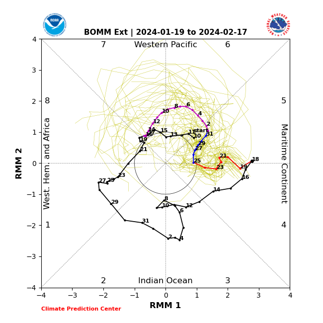
Some hints to this pattern change can be seen in the MJO projection below. Following the purple line from Feb 1 to Feb 14 show propagation from phase 6 through phase 8 in that time period. That's a favorable look for active Colorado weather – however, we'd like it to swing out just a bit wider instead of caving into the middle of the graph... But the fact that it seems to park itself somewhere between 7 and 8 may indicate that the pattern stays active in our region into mid February. We'll see.
Ensemble members are also showing the EPO teleconnection trying to tank a bit during early February which indicates a potential cooler and wetter weather pattern over the western U.S. as well.
If you're a model watcher and have had the pleasure of watching some of the GFS fantasy runs the last few days, you'll know it's pumped out some pretty big Colorado storms... Don't get pulled into that just yet – it can, and will, let you down. For now we'll keep it simple to close out the month and see what kind of stuff we have to work with closer to the beginning of February.