Colorado weather: Wet snow possible Friday, huge thaw ahead

Well, depending on who you are, it's either been a good or bad thing that you haven't heard much from us lately. Mother nature won't throw much our way lately – we touched on a few things ahead in our update on Sunday, we'll dig into that again at the bottom half of this write up.
First up, we're seeing an uptick in snow potential for some Thursday night through Friday afternoon.
We'll see a weak wave pass to our south here on Wednesday, that's going to lead to some mountain snow showers with isolated mixed showers along I-25... Today won't mean much for a lot of us. More of the same unsettled skies by afternoon, with near normal temps.
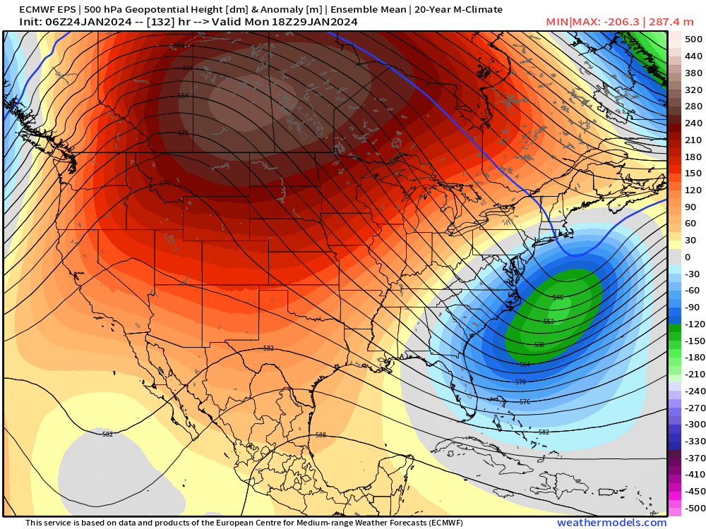
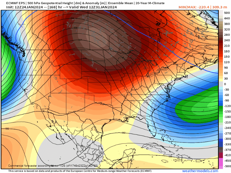
A stronger wave of low pressure is hot on the heels of today's system. This one has seemed to stay "open" the last few days, but a few models were picking up on the "closed" contour (for the map below, the 558 dm contour) developing, meaning a stronger system with more capability of upslope flow.
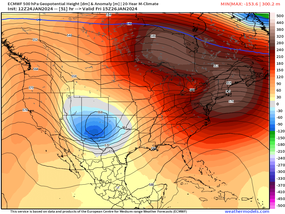
And just because we're seeing the system close off doesn't necessarily mean we're now booking a huge storm... but it definitely has more potential than what we were thinking a couple days ago.
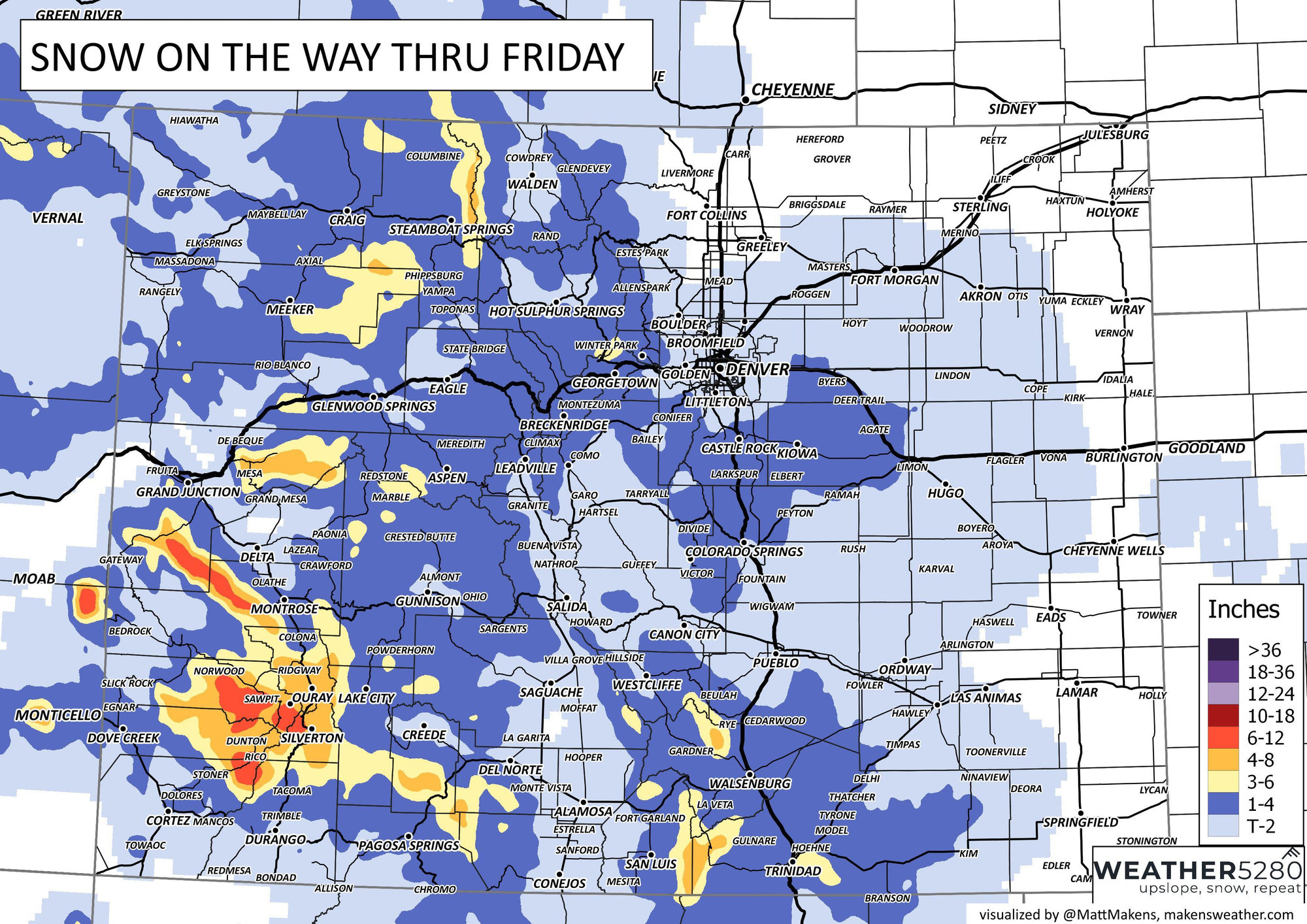
This system starts to affect the I-25 corridor around midnight Thursday, with showers during the morning commute and most precip ending before dinner Friday. It's also not a very cold storm, so while impacts are possible, they likely only happen in areas that see heavier upslope snow. Areas with lighter precip probably don't see as many issues.
For the northern I-25 corridor, snowfall seems to favor the Palmer Divide, with some higher uncertainty around Colorado Springs. Generally 1-4" can be expected... but these types of systems can have some boom potential. I'd say areas near Kiowa are not out of the woods on up to 6" of snow. For Fort Collins... this most likely will be another miss.
Further south, I'd say the best bullseye for snow is probably going to be up the hill south of Pueblo. Areas from Rye down to Raton will likely be able to push 2-6" of snow with this thing.

The mountains will also see a bit of a boost from this storm, especially over the San Juans where up to a foot is possible. Take care with mountain travel if you're heading up early on Friday.
There's still quite a bit of uncertainty with this storm right now, because it all hinges on how quickly the low closes off and how much upslope is maintained... there won't be many other "dynamics" to make up for things if the strength/timing is off.
Regardless, any snow that does fall is going to melt off fast heading into the weekend.
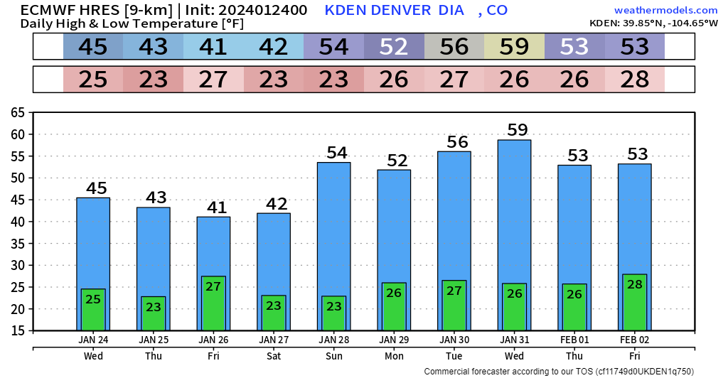
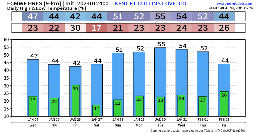
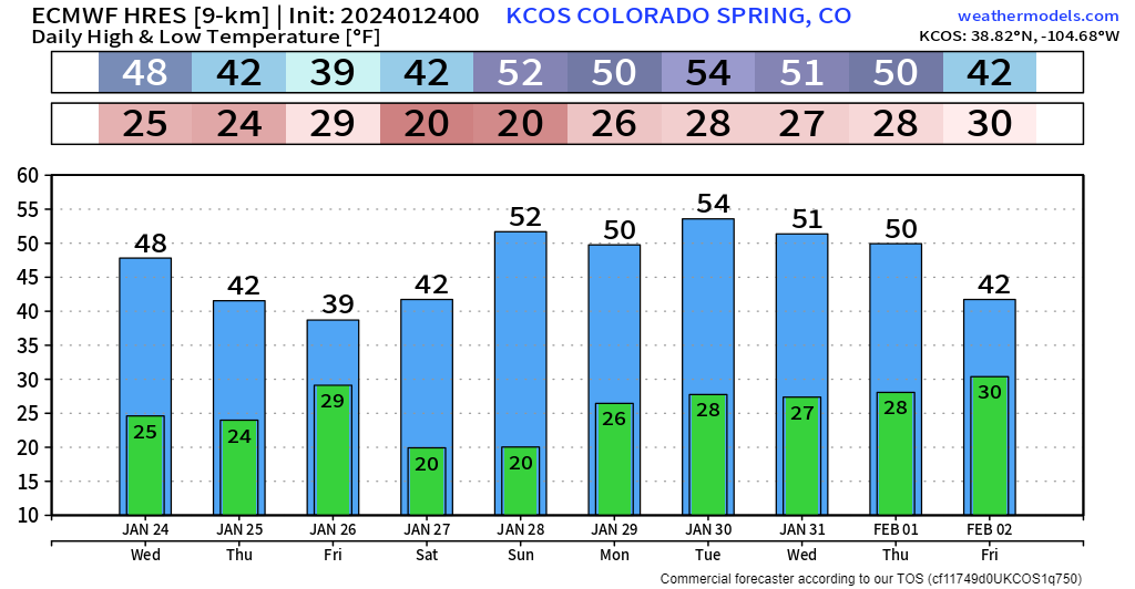
10 day trend along the urban corridor calls for a prolonged thawing period with many folks seeing mid-to-upper 50s for what could be up to a week straight! Basically a total flip-flop from the bitter arctic air we dealt with earlier in the month. That's as a powerful ridge of high pressure develops over the northern high plains. It likely doesn't budge until the end of next week and into the weekend.
As we teased on Sunday, early February has some promise to it. As the ridge exits, a power push from the pacific jet stream will lead colder and stormier weather, especially after Feb 2 or 3. And this looks like it could potentially be a prolonged period with multiple chances at wintry storm systems.
However, with a potent pacific jet, you'll usually completely lock out any major cold air sources... rain contamination may also play a role in these systems as well (sorry snow lovers).
In terms of a little cheat sheet:
1) A (most likely) "minor" system Friday morning, early afternoon
2) 7 or so days of warmer weather from 1/27 to 2/3
3) Potential for a prolonged cool & stormy pattern 2/3 to 2/9+
You're going to see more posts from us as the pattern starts to crank into February, make sure to subscribe to the e-mail list so you get updates like this one straight to your inbox!