Colorado weather: Who sees rain, who sees snow, and who sees nothing at all
We've been a bit quiet, but there hasn't been much to report on with regard to the upcoming system either. Most of what we outlined on Monday remains true, though the paths to a big time snow at lower elevations are certainly far fewer this morning vs what we were seeing in guidance a few days ago. But so it goes.
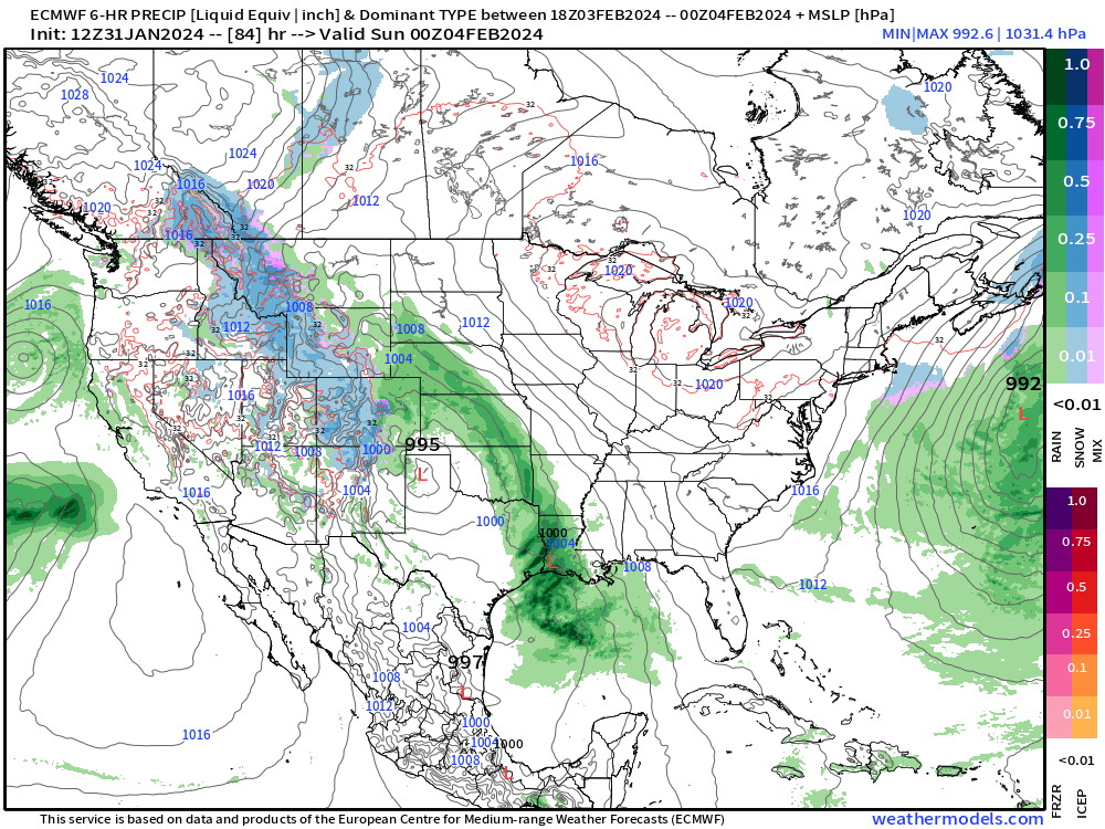
The storm track has been relatively stable in the modeling since our last update, and takes a relatively favorable track for wet weather along the Front Range, but unfortunately for the snow-lovers in the group that's only one piece of the puzzle. Temperatures and some dry air may put a real damper on snowfall potential at lower elevations, as guidance continues to suggest borderline cold for snow, and at times models really want to slog a good amount of moisture well to our south and east this weekend – robbing us.
Timeline
We get a couple more very nice, mild days before changes arrive for Friday and the weekend. Even Friday won't be all that cold, but we'll start to feel those changes, particularly by the afternoon.
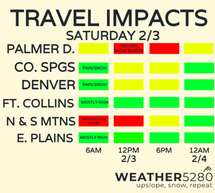
Rain and snow chances ramp up along Front Range foothills and adjacent plains Friday evening, and will stick with us off-and-on through Saturday night before the system gradually departs on Sunday.
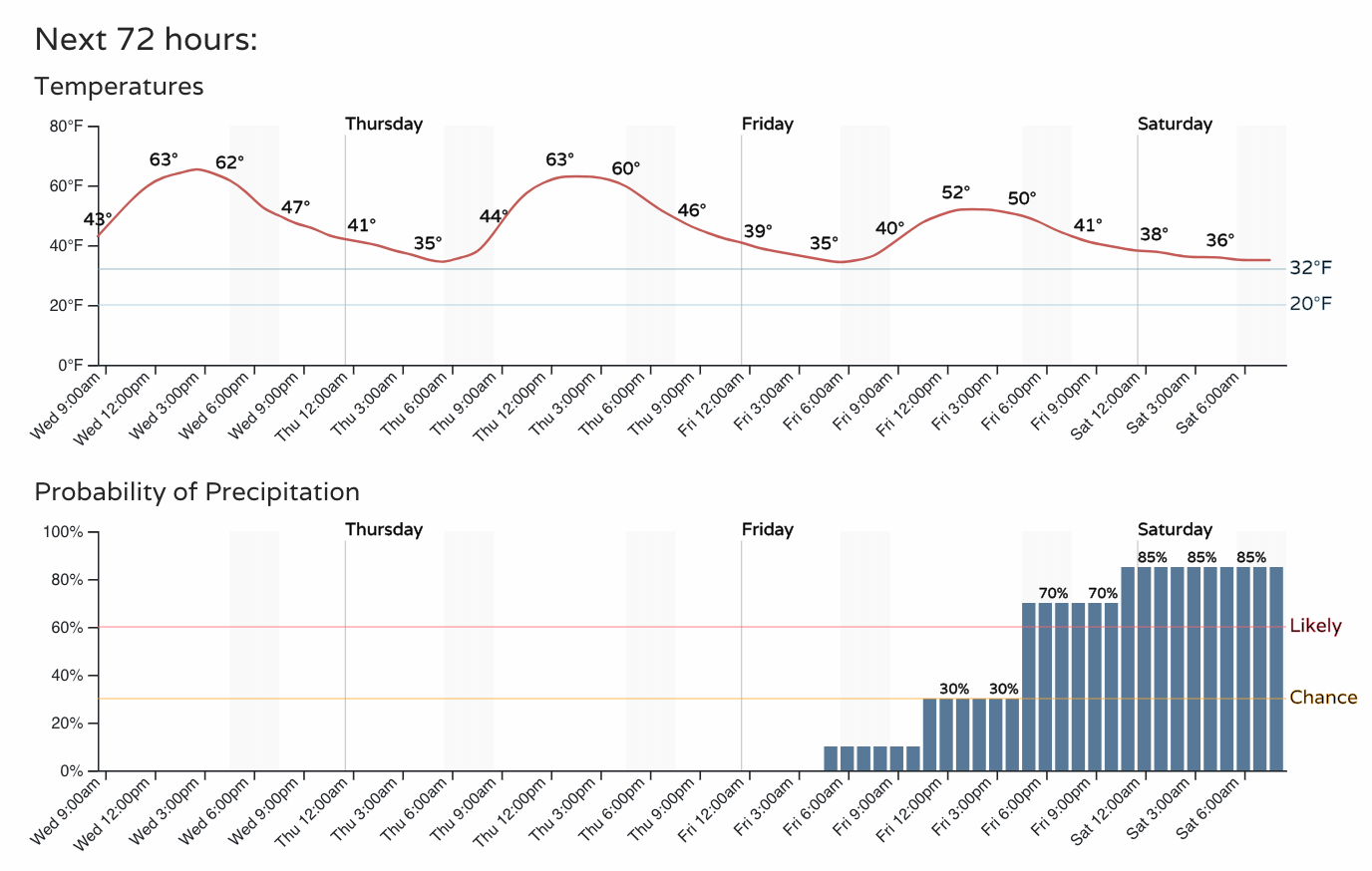
The best chance of snow at lower elevations may hold off until Saturday and Saturday PM, but should it align with the daytime hours Saturday that too will be impactful to any snow accumulation we may see.
If you plan to head to the high country for the weekend, best to try to get that done tomorrow or on the early side Friday as conditions will deteriorate through the evening Friday for the foothills and mountains.
Impacts and early snowfall projections
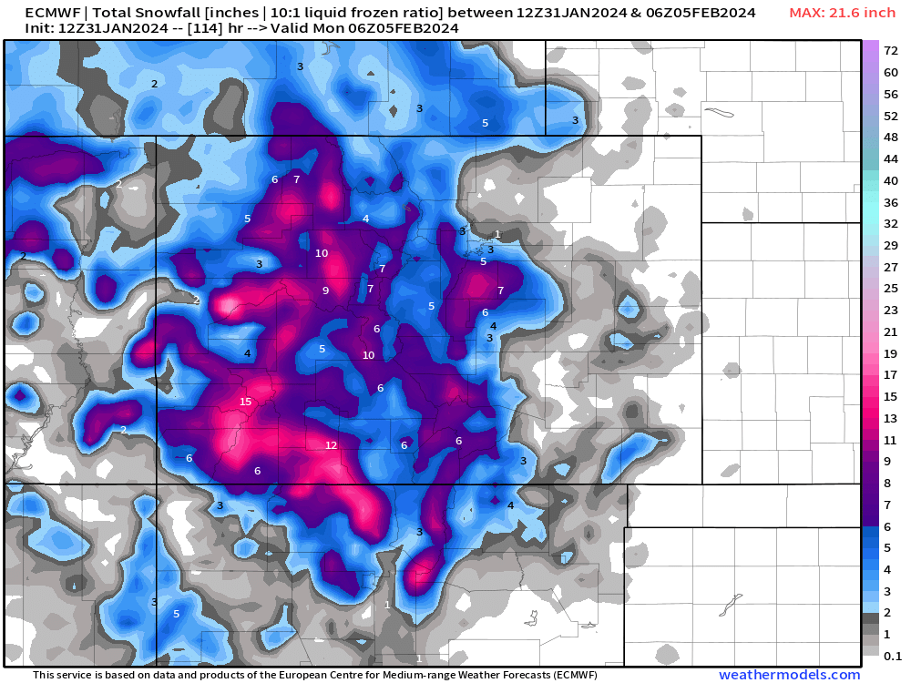
Impacts will almost certainly be worst for the mountains. Latest guidance suggests some snow for the lower elevations, but that the bulk of the measurable snow will favor the foothills, Palmer Divide, and higher peaks of Colorado to our west. It's likely we'll see a sharp gradient from accumulating snow to not much from west to east along the elevation change.
For the northern urban corridor cities – Denver / Loveland / Fort Collins early numbers are putting us in the Trace to 4" range, with a lot of that being slush.
For Castle Rock and Monument a 4"+ snow is on the table.
For Colorado Springs, again, high uncertainty but generally a Trace - 4" supported in the data, with greatest totals north and west.
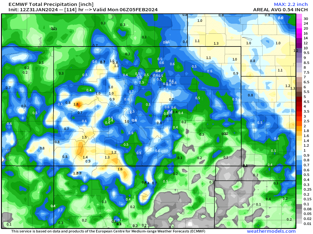
The latest from the ECM seems like a pretty reasonable look at this point... And it's not a total loss for places like the northern front range. While you have a higher chance of being shut out from snow, you look to get some rain out of this at least.
Euro snowfall forecast:
Euro precipitation forecast:
For the foothill communities west of Denver, some upside potential still hanging on, with decent upslope, prolonged event, and cool-enough temperatures some 8"+ totals are possible.
What to watch for
The biggest factor at this point has to be temperatures: The EURO prints out a lot of precipitation before sunrise Saturday and into Saturday afternoon.
And this map (temps at 7am Saturday) seems to be the coldest that temperatures get through this event before moderating up into Saturday afternoon. Notice plenty of above freezing readings through the Denver Metro and northern foothills, and in the Pikes Peak Region.
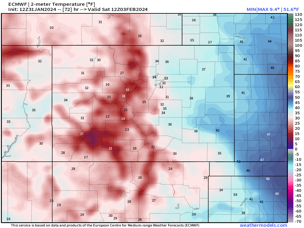
Certainly seems like this will be a heavily elevation-dependent storm where areas around 6,500 ft + have the best shot at accumulations. The slightly cooler temperatures in the Denver compared to say Colorado Springs may also be a factor dependent on precipitation rates. Heavier rain/snow has a cooling effect on the surrounding atmospheric temperature.
We're leaning towards a low-to-moderate impact even in higher population zones. For areas on the Palmer Divide, in the foothills and mountains, a moderate, and in a few spots high(er) impact event are possible.
We've got some time to focus in on snowfall totals and impacts. There's also enough time for this thing to finally figure out it's February and not April and that cold air shouldn't be an issue, but it sure seems like that's going to be an issue for us.
We'll see how the data trends tonight and get an update on the system again your way tomorrow. Stay tuned, and remember to subscribe to Weather5280 and stay ahead of the storm!