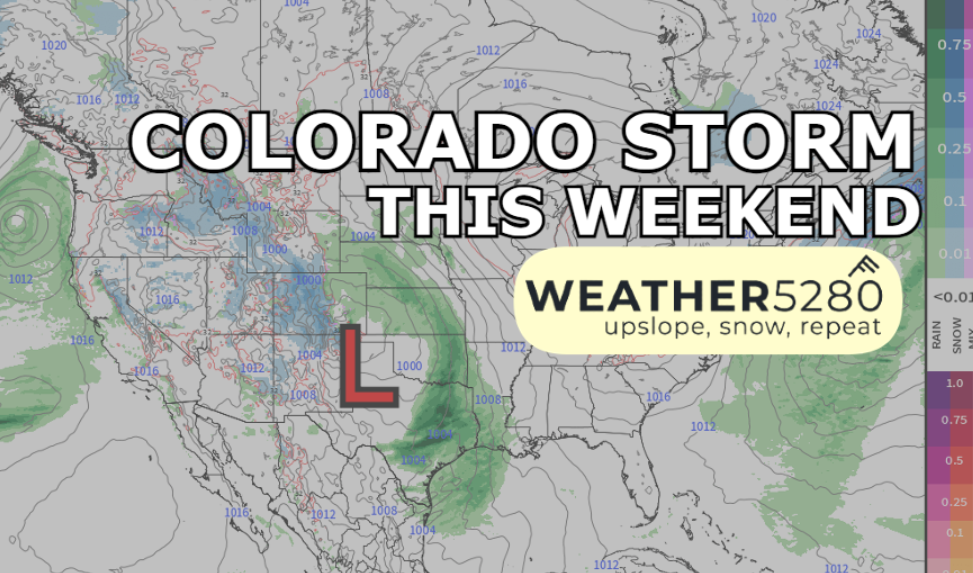
Colorado weekend rain and snow storm: Timing, total, impacts

We're starting to get into the "increasing confidence" range of the storm set to impact Colorado in the coming days. But "increasing confidence" doesn't mean "high confidence" at this point. For now we've got some data to at least share, and give some general guidance – but we still have another 24 hours worth of model data to comb through by tomorrow evening to give you a better idea of how this will play out.
In short – you know what we're going to say: watch for the changes, maybe not much in timing, but more so totals/impacts.
Timing the storm out
Kicking off Friday morning, we're already going to see rain and snow impacting the western slope, with heavy snow likely over the San Juans.
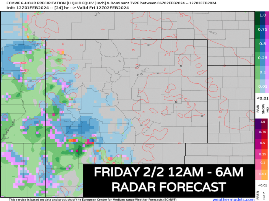
Light to moderate snow will spread into the central mountains and along the foothills south of the Palmer Divide by Friday afternoon/evening. The heaviest snow looks to be focused in the terrain west of the San Luis Valley at during this time
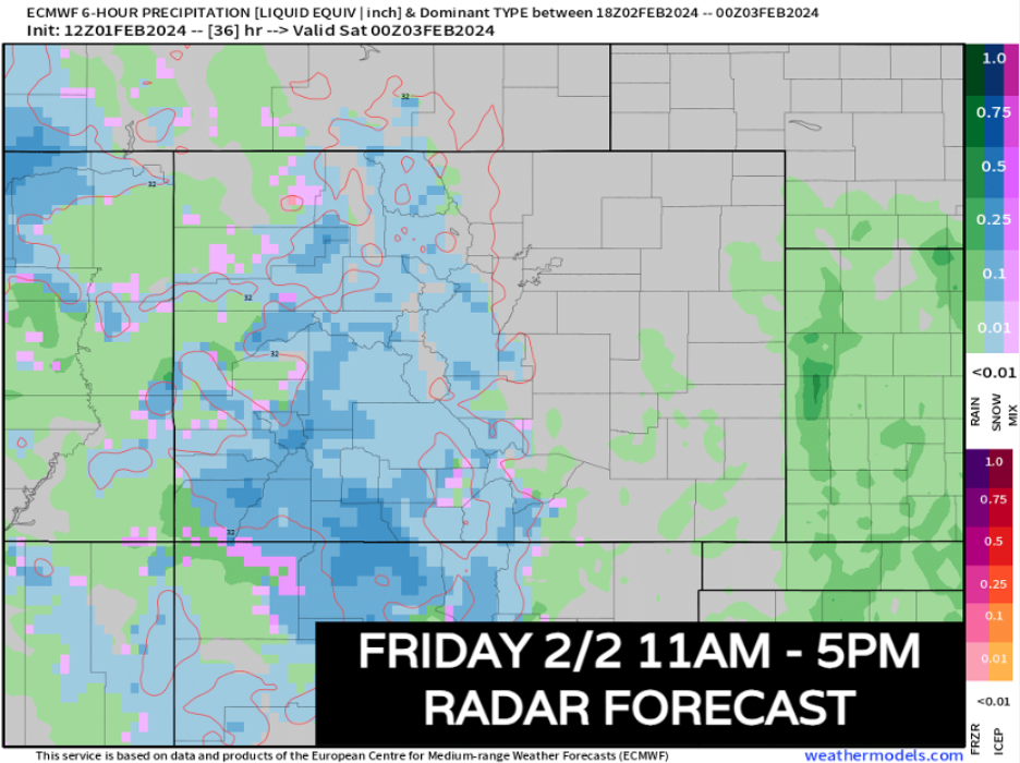
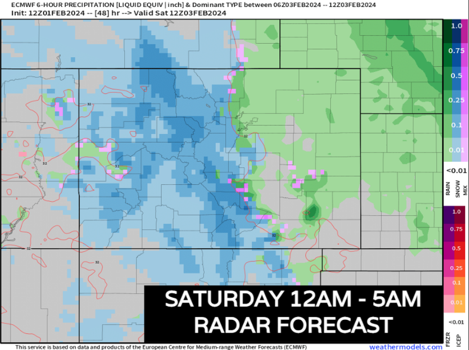
Snow will start to become a little more generous in the central and northern mountains after sunset Friday and into early Saturday morning. This also when upslope will start to pick up a bit in eastern Colorado.
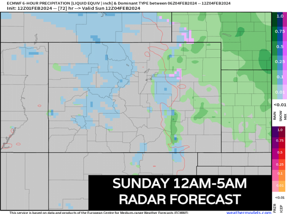
Notice rain showers along and north of HWY 91, with some snow mixing in for parts of the Pikes Peak Region. Depending on moisture rates, Denver will fall somewhere between a light rain, to mixing in big wet flakes at times. Fort Collins will likely be mostly dry at this point.
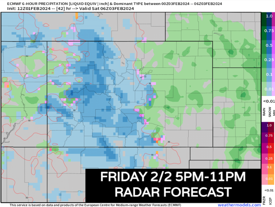
As we start to turn the corner into Saturday morning, the mountains will continue to crank out some heavy snowfall. Expect I-70 to be a really tough drive starting Friday afternoon and not getting better until Saturday night.
This is also the timeframe where we either changeover a bit early to snow in the Denver metro and up to Fort Collins, or we keep it rain. The longer that process takes, the more likely it is that those locations end up on the lower end of snowfall totals.
Colorado Springs and surrounding areas on the Palmer Divide will get some help from elevation. Snow is a bit more likely in those areas by sunrise Saturday.
The foothills west of Denver should also have a pretty good shot at seeing snow during this time too. Communities near the wet mountains will likely have heavy snow.
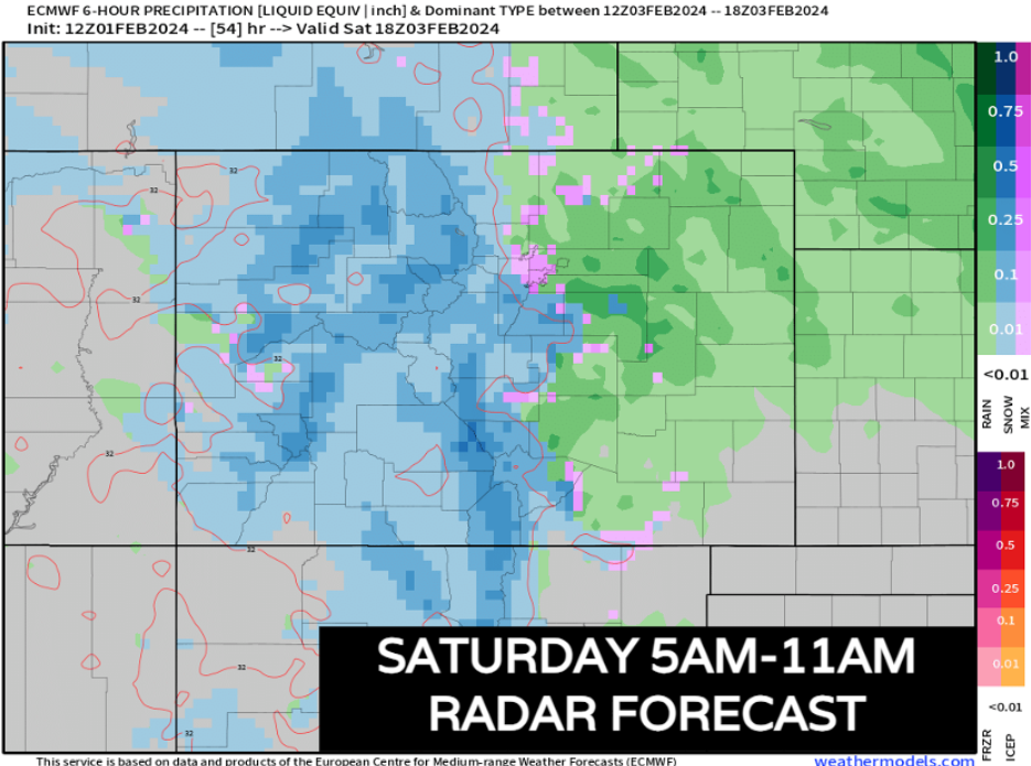
As the main mid-level low begins to form, this is our best chance to get snow to mix in to about 5,000-5,500 feet with higher moisture rates/evap cooling. Mountain/foothills snow will continue at a good clip. We will see snow attempt to fill in across metro Denver and atop the Palmer Divide and north Colorado Springs. Some snow will try to mix in around Fort Collins.
By lunch Saturday and into the evening, the 700mb low begins to rotate to the southeast. More intense upslope is possible during this time so we'll have to watch for heavier rain/snow bands. For now, it seems like the foothills are still favored.
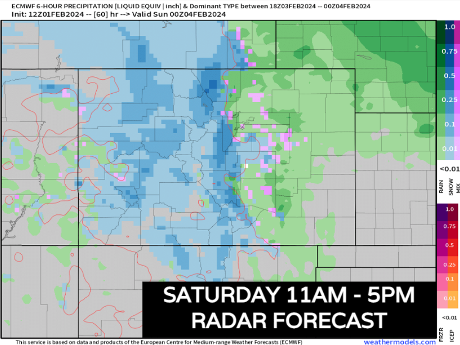
For the above map, this is likely where our biggest questions still lie. As the storm retreats, SOME data has indicated some heavy banding potential along the urban corridor. If you were model watching the EURO Wednesday night into Thursday morning, you probably saw that broad uptick in moisture along the I-25 corridor. During the lunchtime runs today, it has scaled back significantly.
As we start to get in the territory of the hi-resolution model data tonight and tomorrow, we'll try and get a better handle on if that intense upslope banding can be verified.
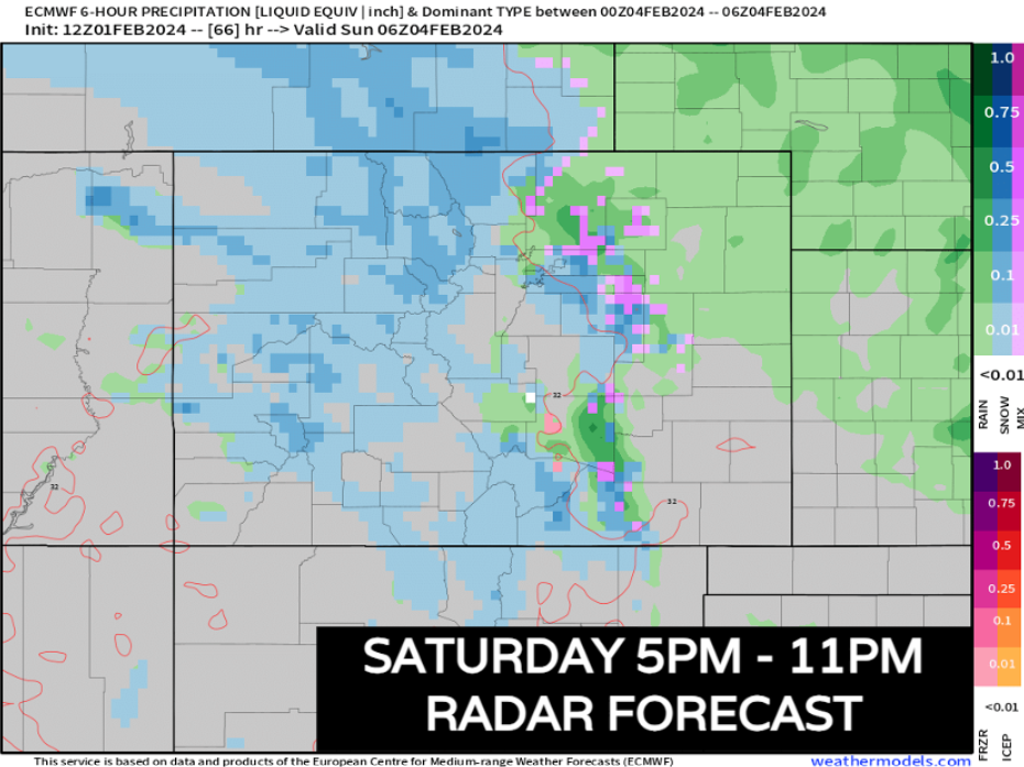
The system departs Saturday night as we begin to see some colder air filter in. Any lingering rain/snow will come to an end by sunrise Sunday.
How much rian/snow will we see?
So here's the deal – model outputs can help us calculate how much snow might accumulate, however, these don't take into account melting. It just takes the moisture potential, throws it into a 10:1 ratio and spits out some numbers. If temps are at 35 or 36 degrees during any snowfall, you could be talking about cutting some of these numbers in half!
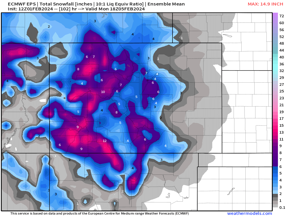
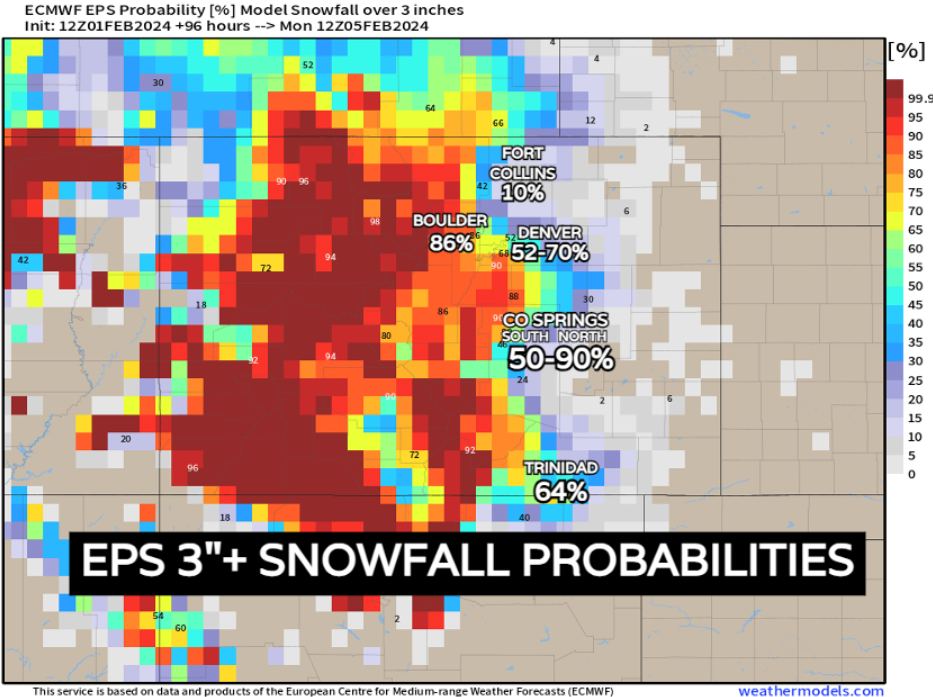
We can also take a look at some probabilities – the EURO ensemble prints out some OK chances for Denver to get up to 3" of snow, or more. Fort Collins is fairly low. Boulder has a good shot. Depending on what end of Colorado Springs you're on, either really good or sub-par chances. Those totals increase again on top of the Raton Mesa.
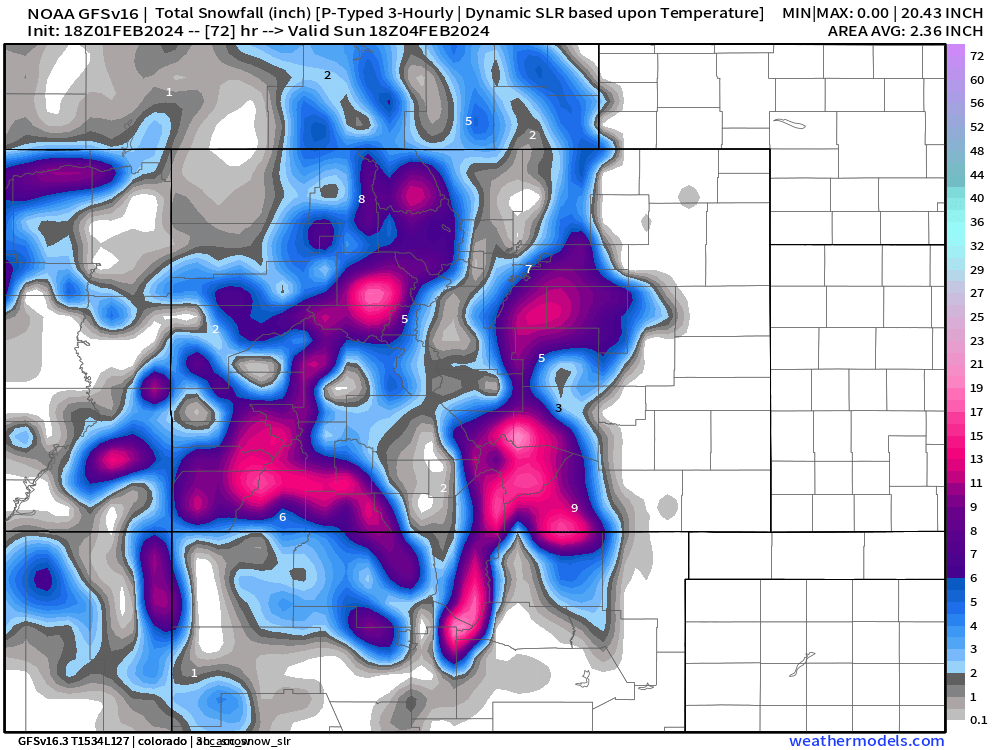
And below, just for fun, and NOT to be taken seriously at this point, today's 18z GFS hits SE Denver hard, on the Palmer Divide, through Colorado Springs, and brings over a foot to the wet mountains southwest of Pueblo. Only showing you this map to illustrate the continuing uncertainty with the evolution of this storm. Timing out the speed and strength of the mid-level low progression – even VERY small difference – are going to mean potential significant changes.
Once again, it will be nice to dig into hi-res data tonight and tomorrow to see if we can reign this thing in.
For now, snow totals by city:
Denver Metro: 1-4"
Boulder: 2-7"
Fort Collins: 0-2"
Castle Rock: 4-10"
Monument: 5-10"
Colorado Springs South: 1-4"
Colorado Springs North: 2-8"
What are our main forecast concerns?
1) Development and evolution of the upper level low, as it develops late Friday night and Saturday along the Colorado / New Mexico line: This is really a make or break for this storm. Subtle changes with this feature even by a few hours or miles will create big changes in the snow forecast.
2) Lack of truly cold air: This creates a problem with rain and snow mixing, versus just snow. Also, the relatively warm temperatures may end up making for a lot of slush on the roads, instead of snow pack and ice. Main accumulation with this storm will likely occur on the grass and elevated surfaces and in areas away from core city warmth.
These two items are going to give us trouble before and during this storm. Storms coming in from the west/southwest always have a few forecast curveballs. So, it behooves you to stay very current with the forecast. If you have travel planned across the region, just know this... We feel pretty good about the mountains, foothills, and higher elevations of the Palmer Divide getting some good snow. Lower elevations are the big question that we will work to resolve. STAY TUNED...