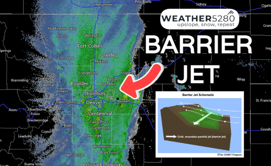
Colorado snow storm update: Barrier jet engaged

Alright, it's been like cranking the engine on an old truck, but this storm is finally starting to grit its teeth a bit. The low found a good spot, we've got plenty of moisture, rain has changed to snow in most locations, and a barrier jet has set up along the Front Range lending to enhanced snowfall rates this afternoon.
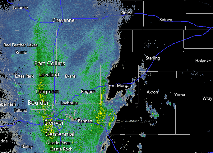
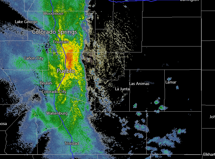
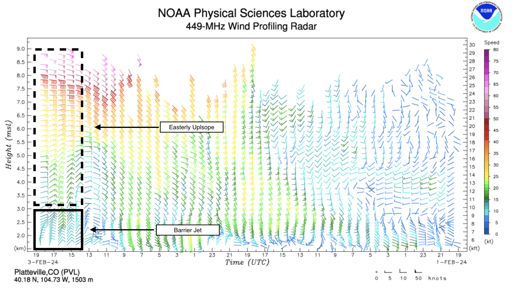
The barrier jet has set up from Cheyenne all the way to Raton. The phenomenon is not all that uncommon with these strong upsloping setups – especially with upslope aloft, you can spot the feature on radar looking at the darker greens/yellows extending north to south along the Front Range at this hour.
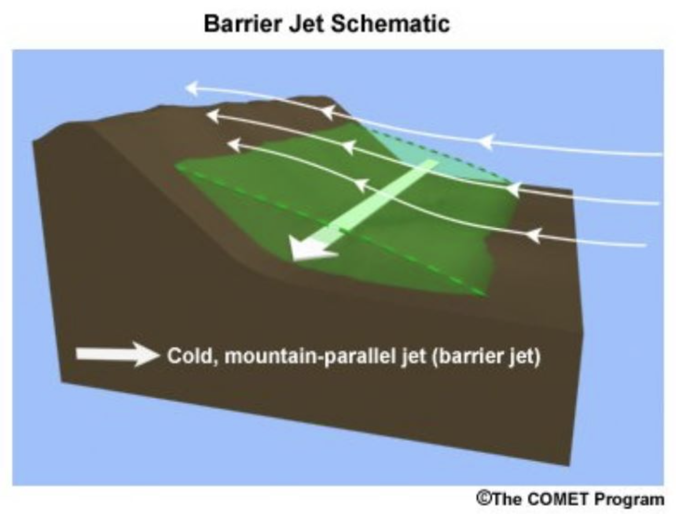
This schematic show the general make up of wind patterns in this setup. Easterly flow up high, with an area of flow that develops along the terrain, usually drawing in cold air from aloft. This can enhance precipitation rates, and why we've seen snow really ramp up into this morning.
If we look at the wind profiler from Platteville we can see exactly this taking place – with strong easterly upslope flow aloft, and that change in wind direction out of the north near the surface. Pretty cool!
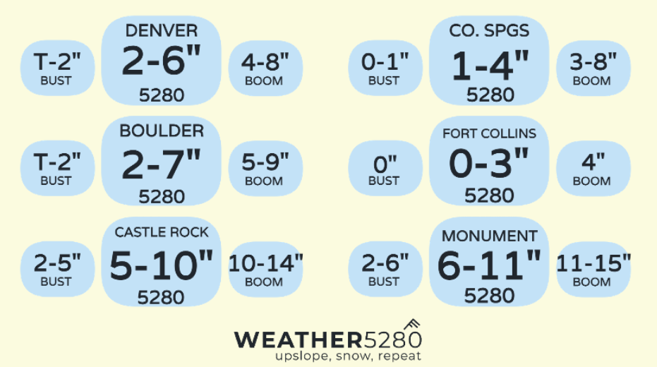
Some snowfall reports already getting into the low ends of our forecast range like this one down in Castle Rock ⬇️. We think most areas will fall within range, with some "boom" snowfall totals still on the table as we indicated would be the case in yesterday's update.
Nearing 4 inches in Castle Rock. We’ll see if we get to double digits 👀 #cowx @BianchiWeather @kodythewxguy @weather5280 pic.twitter.com/eIvOMEdRfx
— Palmer Divide Weather Guy (@PalmerDivideWX) February 3, 2024
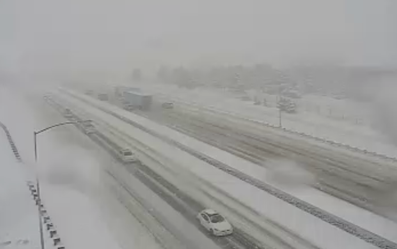
As of 12:30pm, I-25 NB was closed near Monument Hill due to a crash, conditions look nasty on the Palmer Divide right now, stay home if you can!
You can also comment your snow amounts and pictures here on the site or on the thread below!
We're barrier-jetting! Heavy snow has picked up along the urban corridor. We're working on a quick update for you.
— Weather5280 (@weather5280) February 3, 2024
What are you seeing right now?#cowx
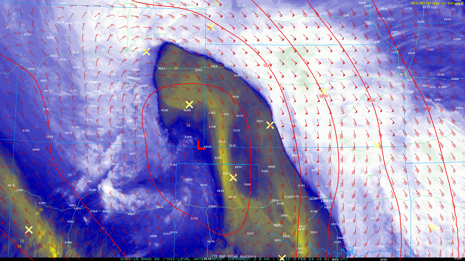
Still a good amount of storm left too, below you can see the stout flow of moisture... a dry slot (yellows) that is wayyy too close for comfort, and the strong low-level northerly flow of the barrier jet riding up against the foothills. The red L is indicative of where the 500mb low has setup, a great spot for upslope along the Front Range!
Beautiful storm and a beautiful day for many of us... Take it easy out on the roads, especially for any areas above 6,000 ft where conditions have really deteriorated the last few hours.
We're going to continue to keep tabs on this storm throughout the day, but this is probably the last update you'll see from us before we recap tomorrow... unless something crazy happens between now and then! Here's a reminder of our snowfall forecast from yesterday:
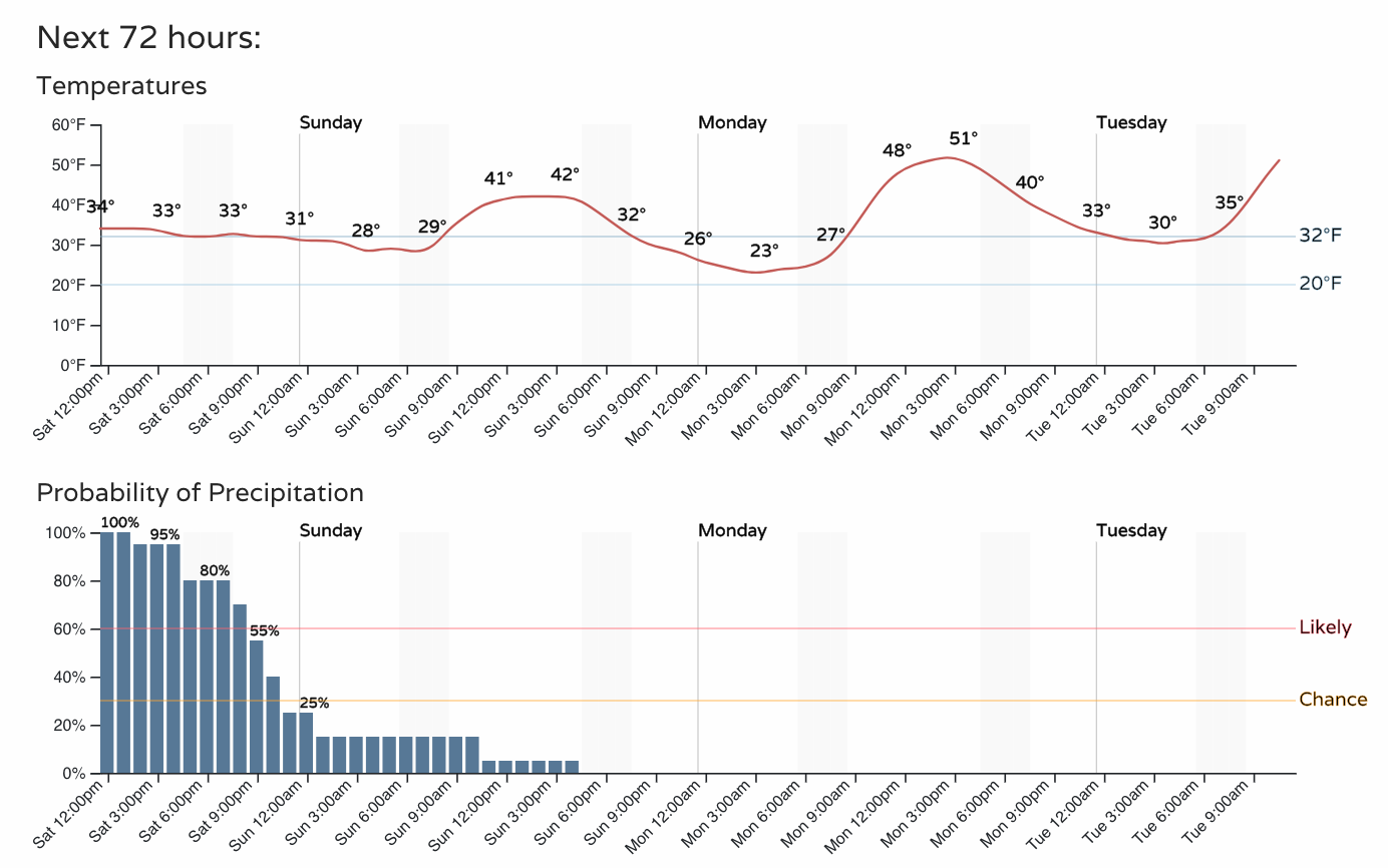
And the latest hourly planner, with snow coming to an end for most of us early evening, though holding on a bit longer in the foothills or under and rogue snow bands that may develop.
We LOVE all the engagement on the site this week, keep your comments coming and please share those storms reports and photos below!
Make sure to subscribe to our e-mail list for the latest Weather5280 articles on this storm and any storms ahead!