
Colorado weather: Tracking two systems to impact us with rain, snow, wind, and a cool down

A warm Tuesday is underway, occasionally breezy, but have you seen the additional cloud cover where you are? That's the next system, increasing moisture ahead of putting down heavy snow in parts of the mountains Wednesday and then rain and snow to parts of the plains. There is also a weekend system to put on your radar.
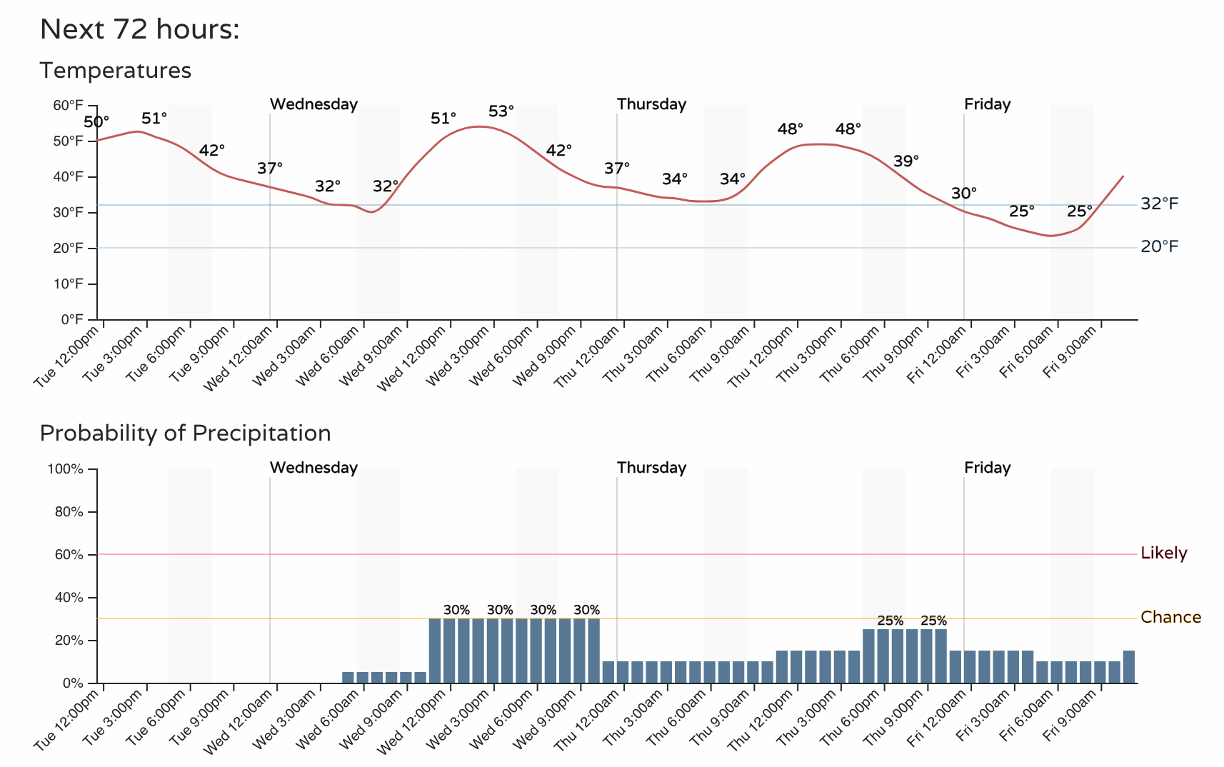
Let's start with the near term. Here's an hourly planner for Denver going out 72 hours.
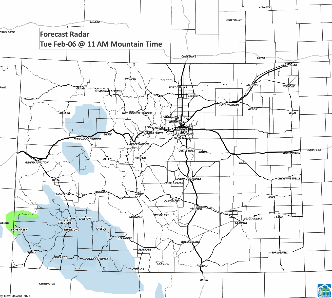
Wednesday has the potential to be a touch warmer than Tuesday, but we see the chance for rain and snow increase and stretch into the later week. Let's sort that out with this series of images showing rain (green) and snow (blue) areas through the next few days.
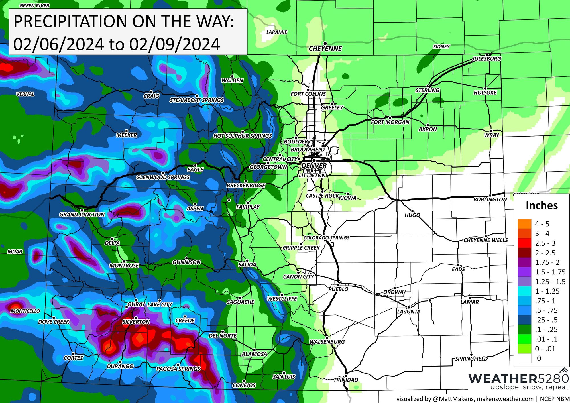
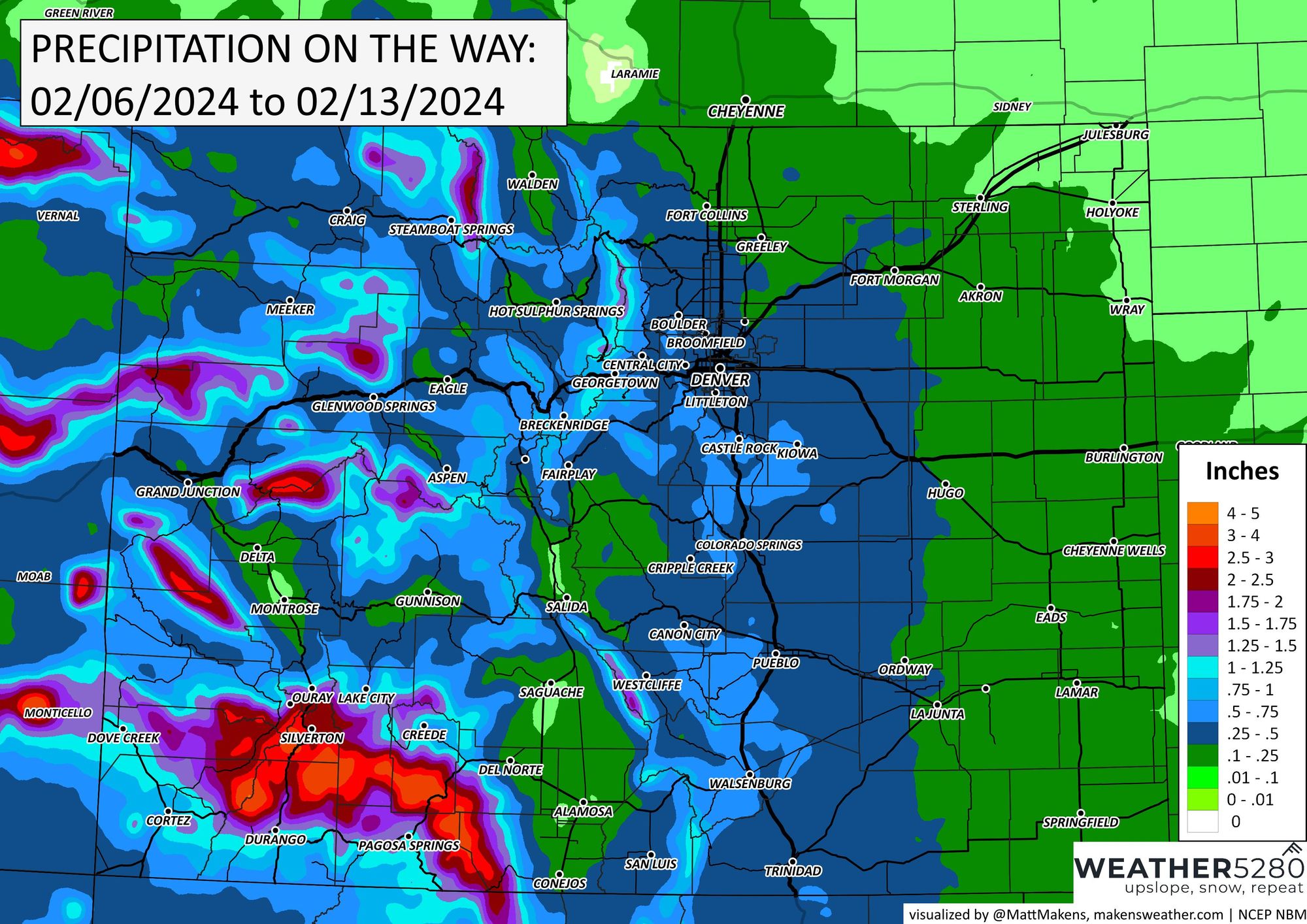
From that, we have the following in terms of total precipitation (including rain and snow) on the way.
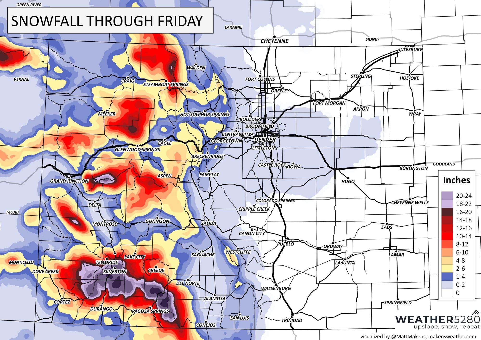
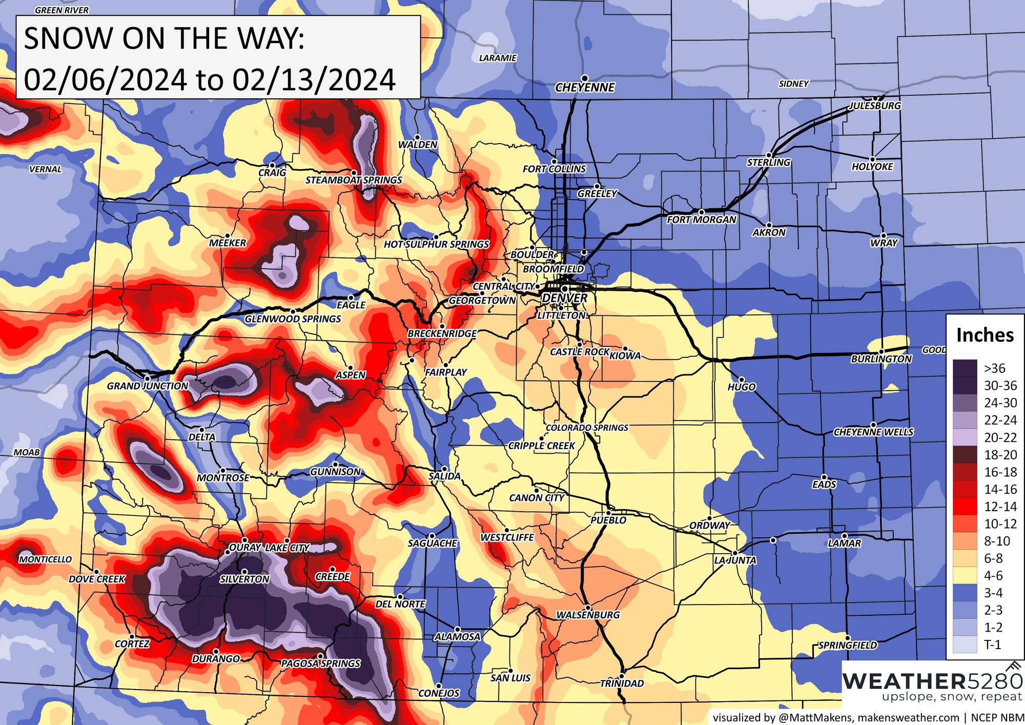
Now let's look at just the snow aspect of that precipitation. Here are the estimated snowfall totals for the next three days.
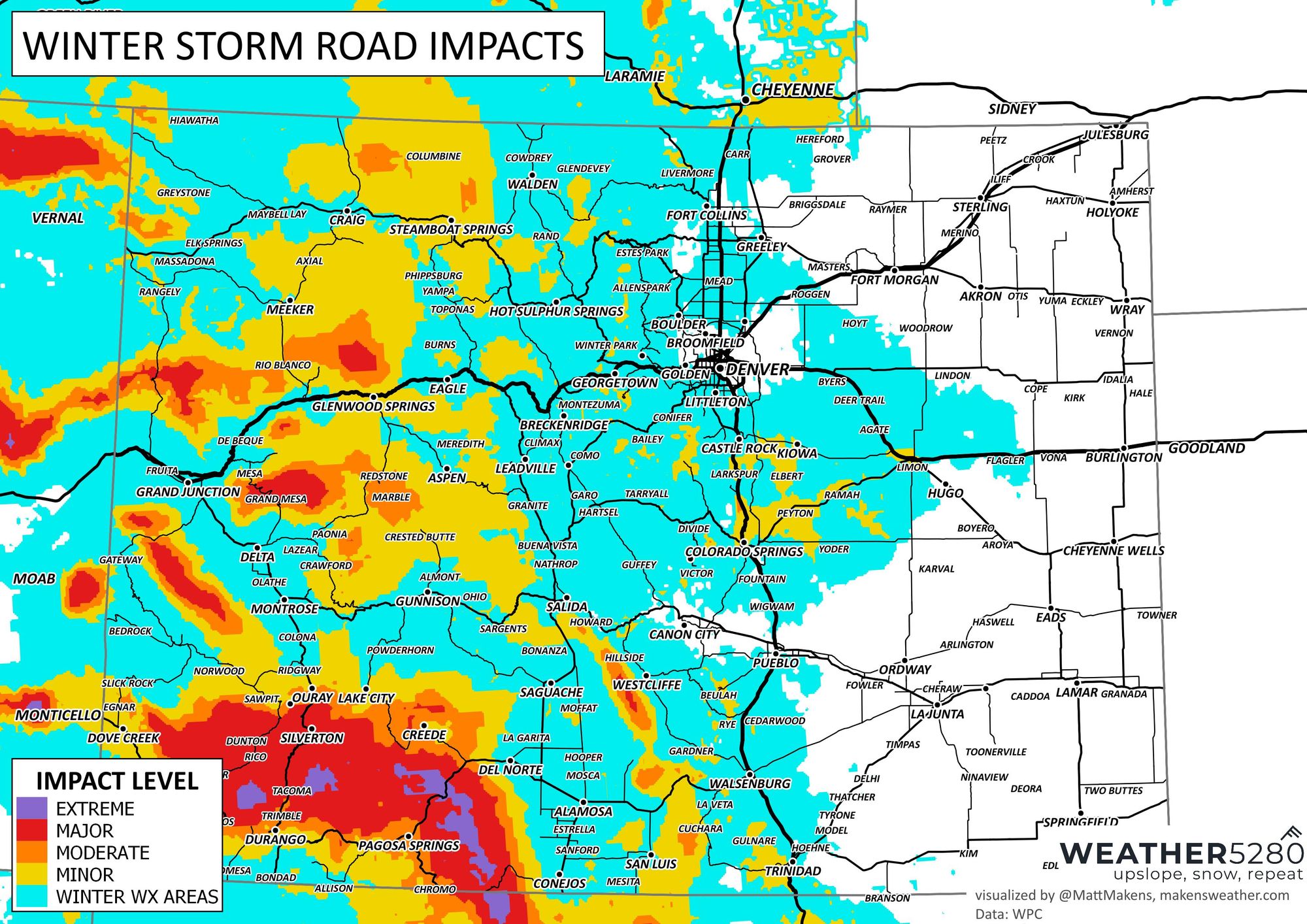
Now, to how this might impact travel. The impact in the next three days is low for metro areas but higher in the mountains. Some travel impacts could be to areas around Castle Rock, Monument, and down through the north side of the Springs.
It'll be nice to boost the high country (and some of us in the foothills) over the next few days. Ahh, but there's more - another system will focus energy on us this weekend into early next week. So, let's look at the potential weekly total precipitation and snowfall.
And the 7-day snow total:
If you prefer, which we do too, the probabilities of such a forecast at a such a lengthy range, here is the Gambler Chart for the Northern Front Range for the next seven days.
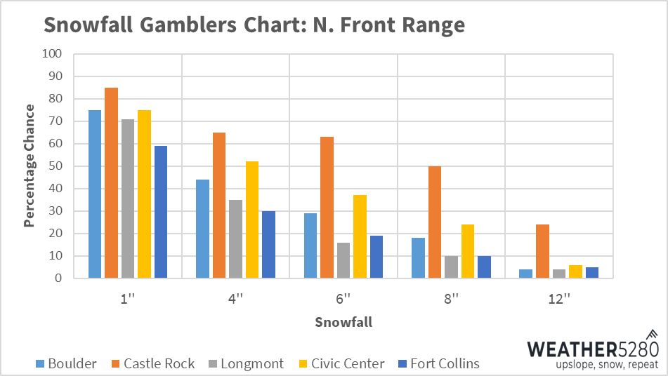
Even the odds, currently, favor another heavy snowfall event for the Palmer Divide near Castle Rock and potentially a heavier event into Denver. We will take detailed looks at this bigger impactor as we get closer, have you signed up for our emails yet? Don't make me beg... lol, subscribe to our e-mail list
It's good to see more snow on the way; the state is running behind the eightball in several locations.
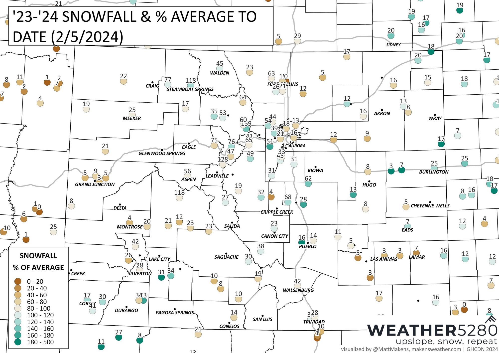
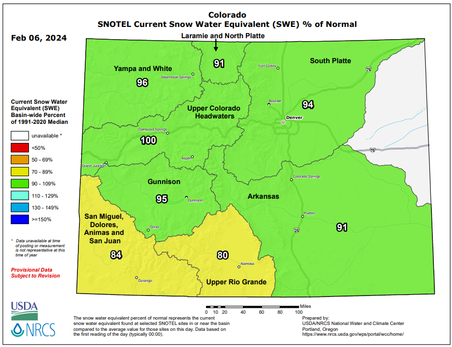
If you prefer the view of snowpack by basin, we have this situation reported through this morning.
Again, we'll have another boost to snow totals in a couple of waves. We will have more on the bigger impactor in our updates into the weekend.