Colorado weather: Next winter storm(s) is on the way, will deliver snow to much of the state

We're tracking more accumulating snow for much of the state Friday and into the weekend as more wet weather moves our way to end the week and our unsettled pattern continues.
For the urban corridor that means an uptick in snow chances Friday, then again Friday night and Saturday before odds drop off Saturday night. Temperatures will cool into the low 40s Friday, and hover around freezing on Saturday with that off and on snowfall.
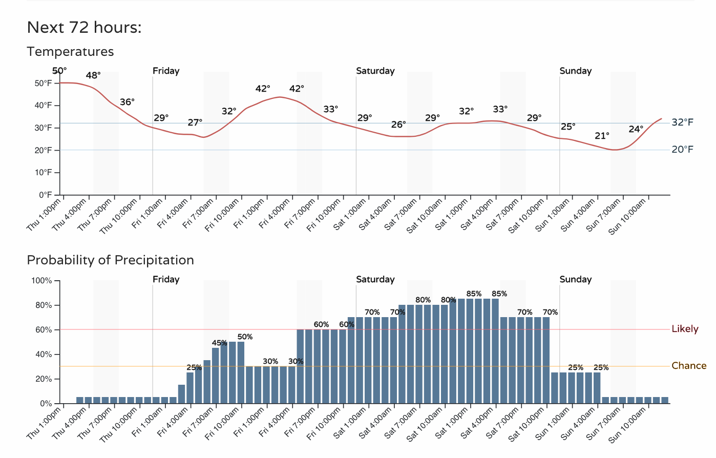
The forecast remains a bit messy, even as we could see some folks pick up accumulating snow by early Friday morning. But planning for chillier weather and likely some snow looks like a good plan as we head into the weekend.
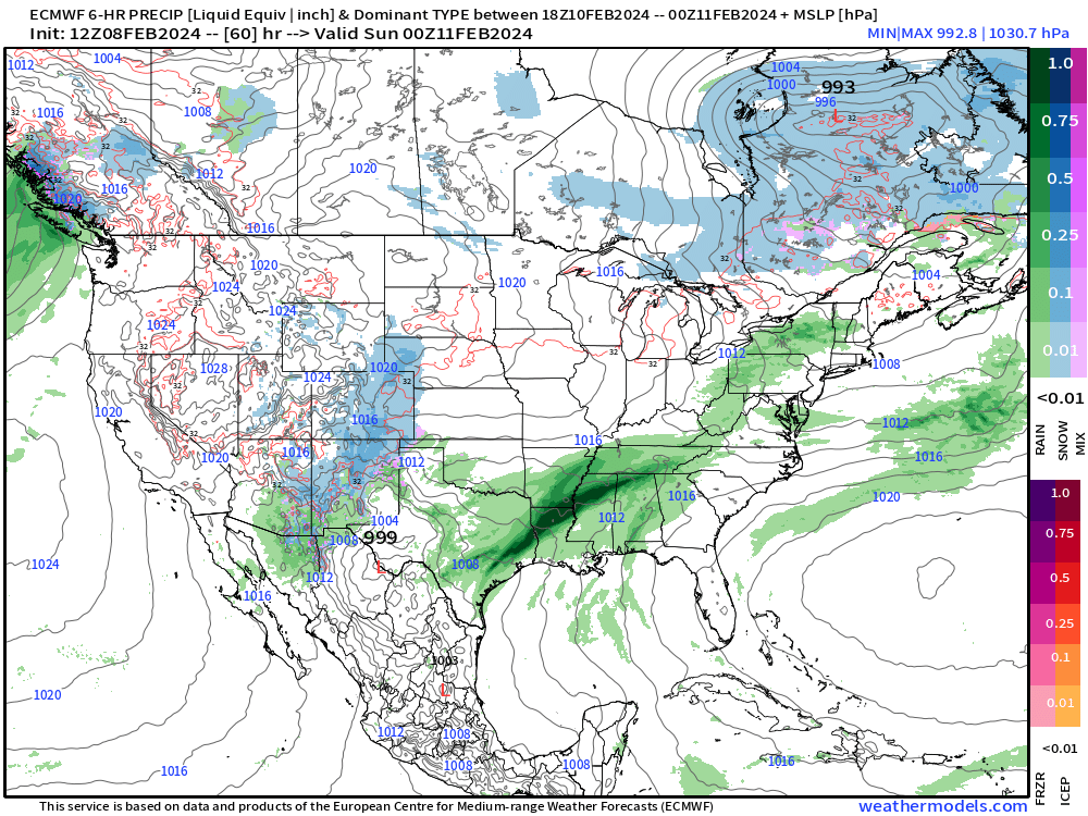
We see the snow coming in two primary waves, the first being early Friday morning, and the second chance focused early Saturday morning, perhaps continuing off and on through the day Saturday depending on which model you are to believe.
For wave one... it's a bit of a crapshoot as to who sees that snow early Friday, but it looks like it'll probably favor the Colorado Springs vicinity and Palmer Divide over far northern Colorado communities, unless something changes over the next hours. The HRRR insists on a few pockets of 1 - 3" snowfall totals through Friday afternoon, mainly along the Palmer and just south, while many of the global models haven't quite latched onto this idea, or spread just very light snow up into Denver and points northeast.
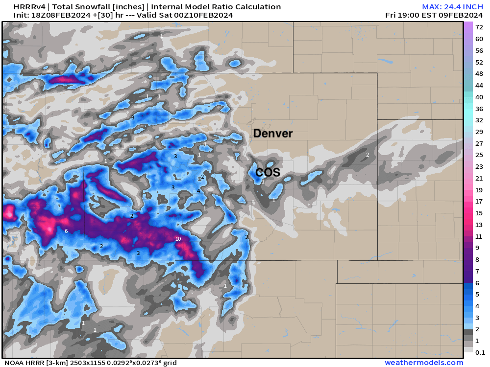
For our southern mountains, however, wave one looks nice! The higher peaks of the San Juans could pick up another 8 - 15" of snow through Friday morning from this storm.
The next wave holds a bit more promise for more of us to see accumulating snow, but also plenty of uncertainty. Some of the more recent guidance has trended a bit further south and southwest with the trough as it moves through the Great Basin Friday night into Saturday, which concerns me a bit should that trend continue in tonight's data...
Still, it does look like we'll see some snow at least with the passage of a cold front early Saturday, and perhaps some more sustained snow if we can keep shallow upslope going into Saturday afternoon. It's this part that I believe remains in question, and if the the sustained lift fails to materialize given how far south that trough gets Friday night, it could be a bit of a bust for totals along the Front Range.
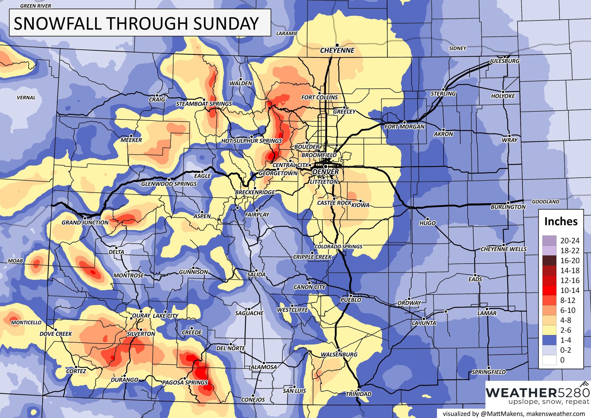
That said, between the shortwave Friday morning, and main feature Friday night/Saturday, it does look like most of us will manage some snow. This storm differs from last weekend in a number of ways, but while it'll deliver less moisture it won't be moving super fast, and temperatures will be colder. On the higher end widespread 4 - 8" along the urban corridor would be doable, with the low range shaking out to more like 1 - 4" for most folks if we can't sustain the post-frontal snow on Saturday.
Our latest snowfall forecast, below, shows this idea with some 4 - 8" totals in there, and otherwise 2 - 6" forecast from Colorado north into Wyoming. Please don't expect all this to have fallen when you wake up Friday morning, as these are totals through Saturday night, and largely dependent on the secondary wave not flopping on us!
We'll let wave one move through tomorrow and adjust the additional totals as needed. Again, most guidance continues to support the numbers above, but some trends today leave me feeling a bit apprehensive.
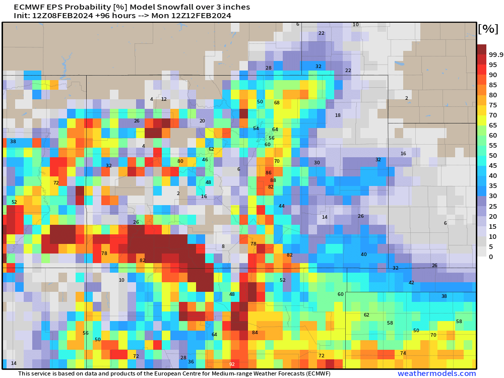
For probabilities, the latest Euro has roughly 50 to 60% odds we pick up 3" of snow or more through the weekend for most cities along the Front Range, with greatest odds for this occurring in Colorado Springs.
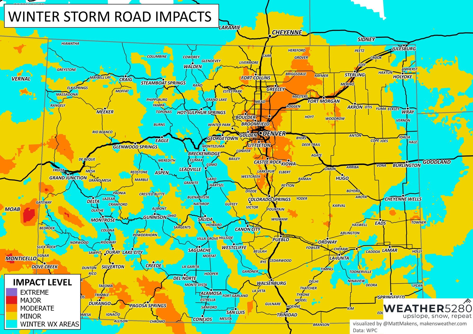
As for impacts? Look for winter driving conditions across much of the state this weekend, with some moderate impacts along the Front Range expected if the secondary wave pulls through for us!
We'll get another update out Friday for sure, so be sure to subscribe to our e-mail list for the latest on this storm and any others that may head our way...