Colorado snow forecast: A look at timing and snow maps

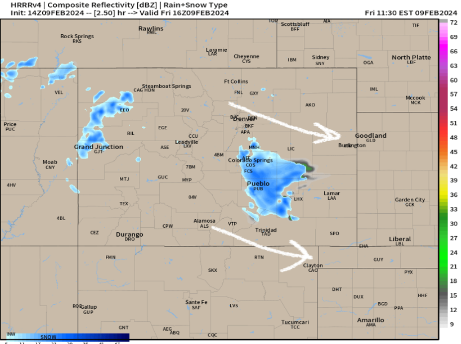
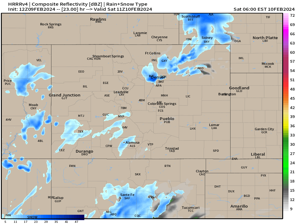
It's Friday morning and we're seeing a weak storm system bring light snow and flurries to the south Denver metro, just enough snow to cause havoc on I-25 in Colorado Springs and some heavier snow showers down near Pueblo and Canon City.
This morning's system is fairly weak, but it's a case of just enough snow at the wrong time which caused problems.
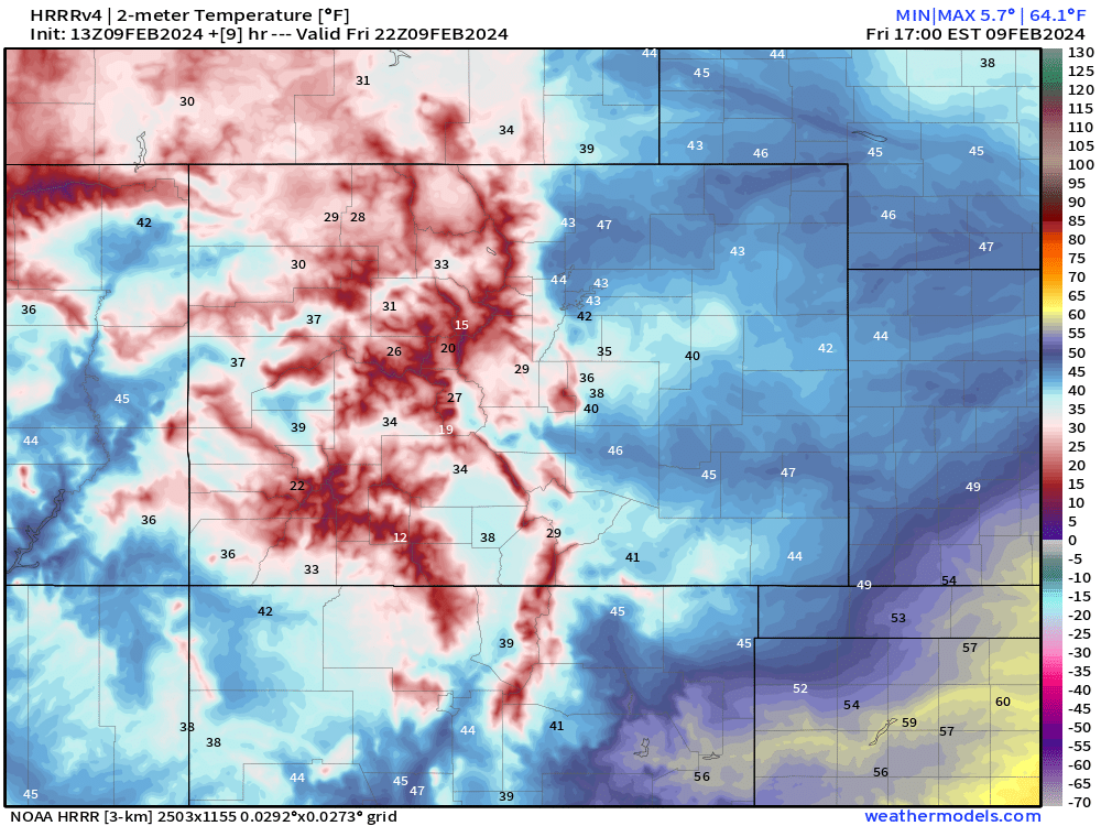
Into this afternoon, we're not looking all too bad. Most of us will see snow ending. Highs should top out above freezing for most, so any slick areas are likely going to improve quickly. Below is a look at temperatures around 3pm today.
Into the evening hours tonight, we'll see a couple showers attempt to kick off the hills, but they're looking pretty scattered in nature. We won't see much opportunity for any focused accumulations. There will be a little bit of convection driving these showers, so if you do get under something, it may come down pretty good for 15 to 20 minutes.
We'll see this pattern continue for most of the night before we see some better lift move into the region by sunrise Saturday.
Picking things up into Saturday morning
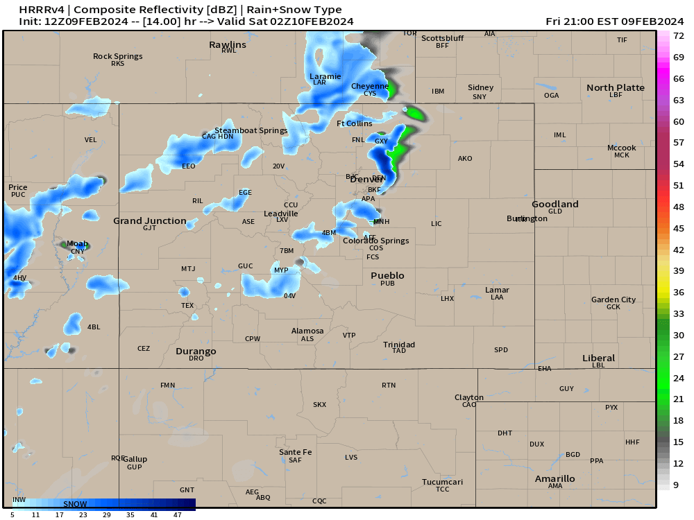
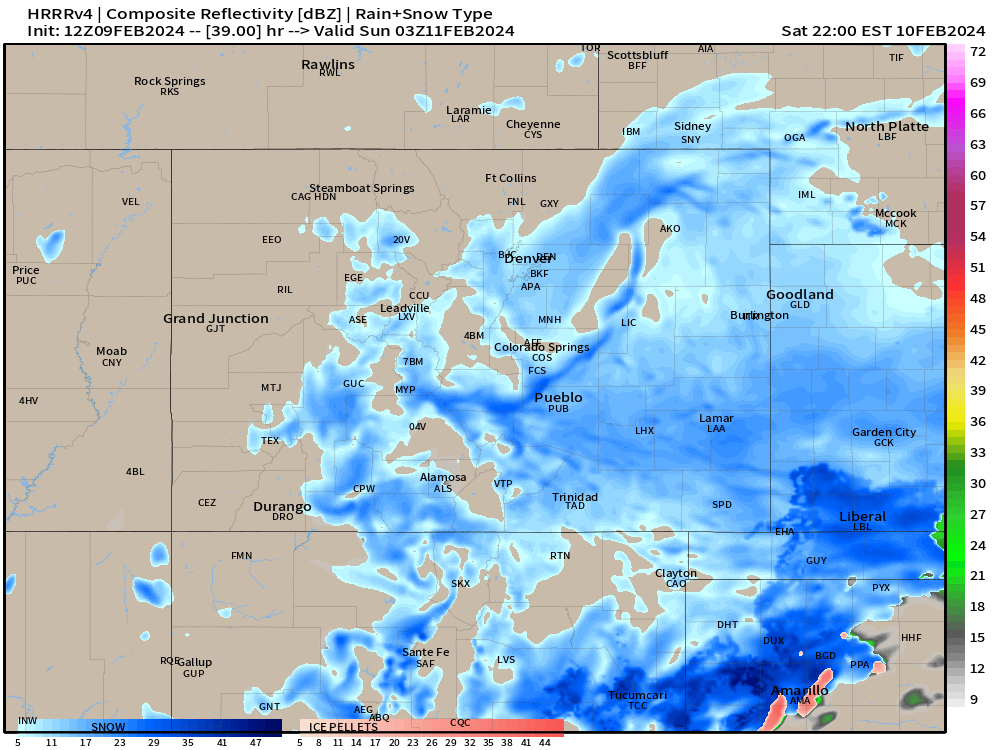
We'll start to ramp things up a bit morning as we get later into the morning hours. By 10 or 11am, we can expect snow showers to be a fairly widespread, especially the closer you are to the Palmer Divide.
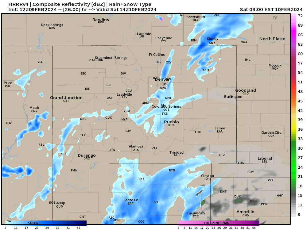
There's some discrepancies on where the northern snow band is going to set up... at this point, we feel like trends are further east, hugging the I-76 corridor. Some models are trying to bring that band a bit further east on a line from Fort Collins up to Cheyenne... but that's tbd for now. Model data this after will attempt to paint us a clearer picture for our northern front range friends.
Further south, snow will be falling around Colorado Springs and along HWY 50 and the Raton Mesa.
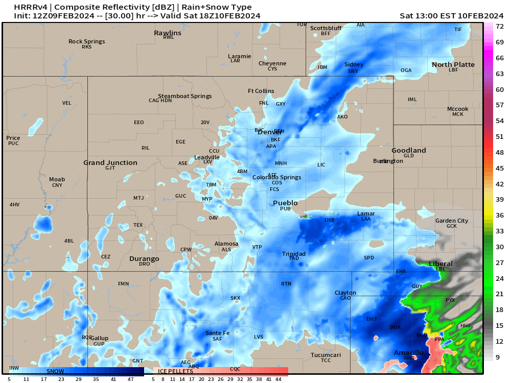
The system will slowly pivot east through the day. For now, it seems like the afternoon and evening will become more focused on the Denver metro and areas south into the Arkansas River Valley. Potential for a snow hole south of the Cheyenne Ridge is possible here too...
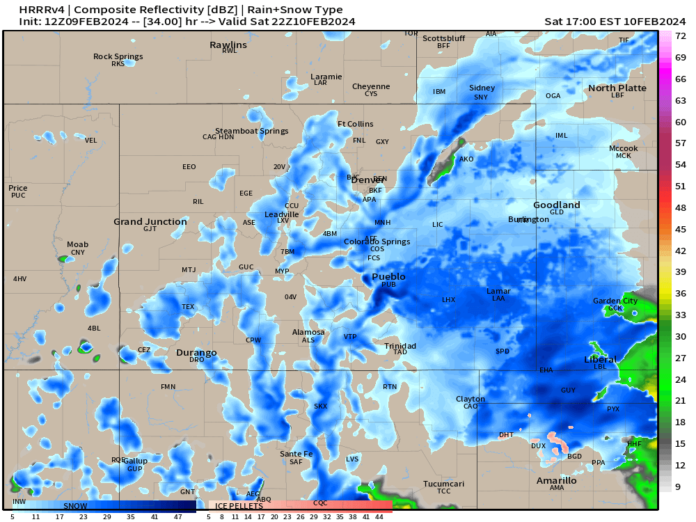
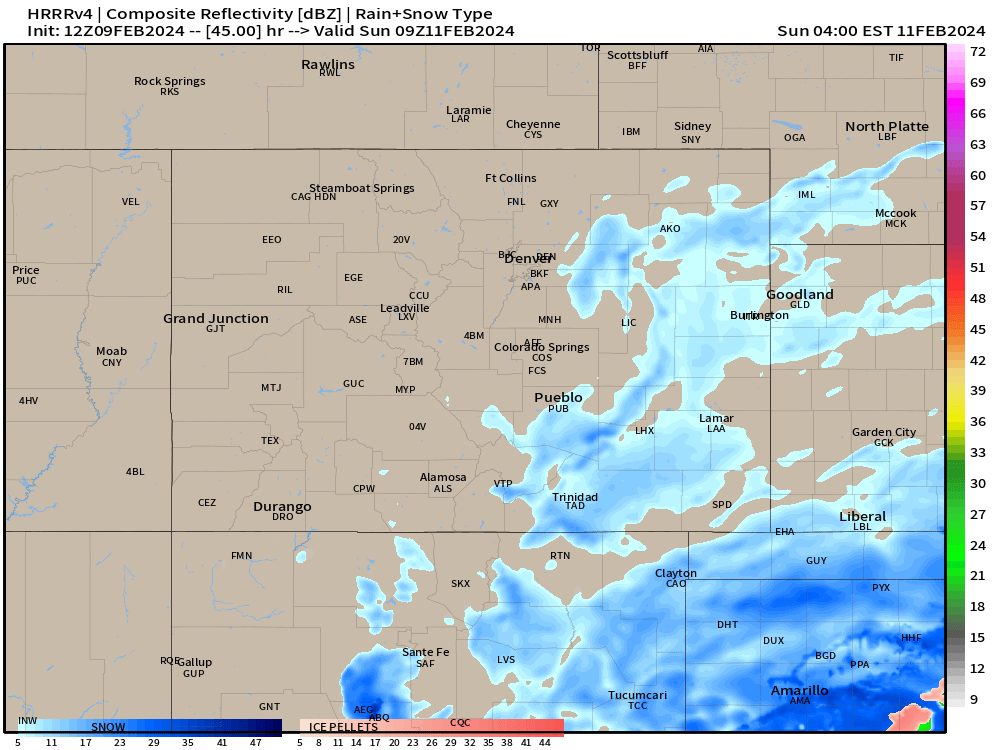
We'll see that shield of snow slowly begin to break up after sunset Saturday...
Most accumulating snow potential wraps up by midnight as we turn the page into Sunday morning.
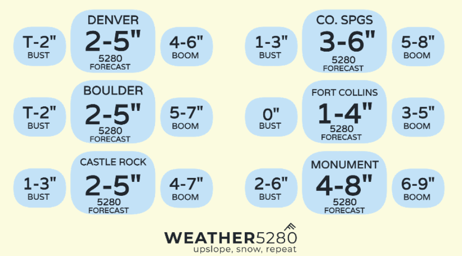
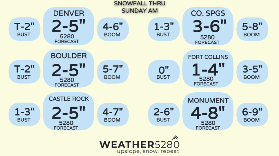
Snowfall totals still feel a bit uncertain
For now, we haven't made too many changes to our forecast from yesterday, however, it does feel like chances for folks north of the Palmer Divide are a bit diminished (Brendan on slack this morning saying "poor Fort Collins"). Listen FOCO, you're definitely not out the game just yet, but certainly playing on the back foot at this point.
We've really been trying to divvy up the forecast between this Friday morning junk and Saturday's stuff – with hi-res stuff pumping out Saturday numbers only by this afternoon, we should have a bit more confidence in numbers.
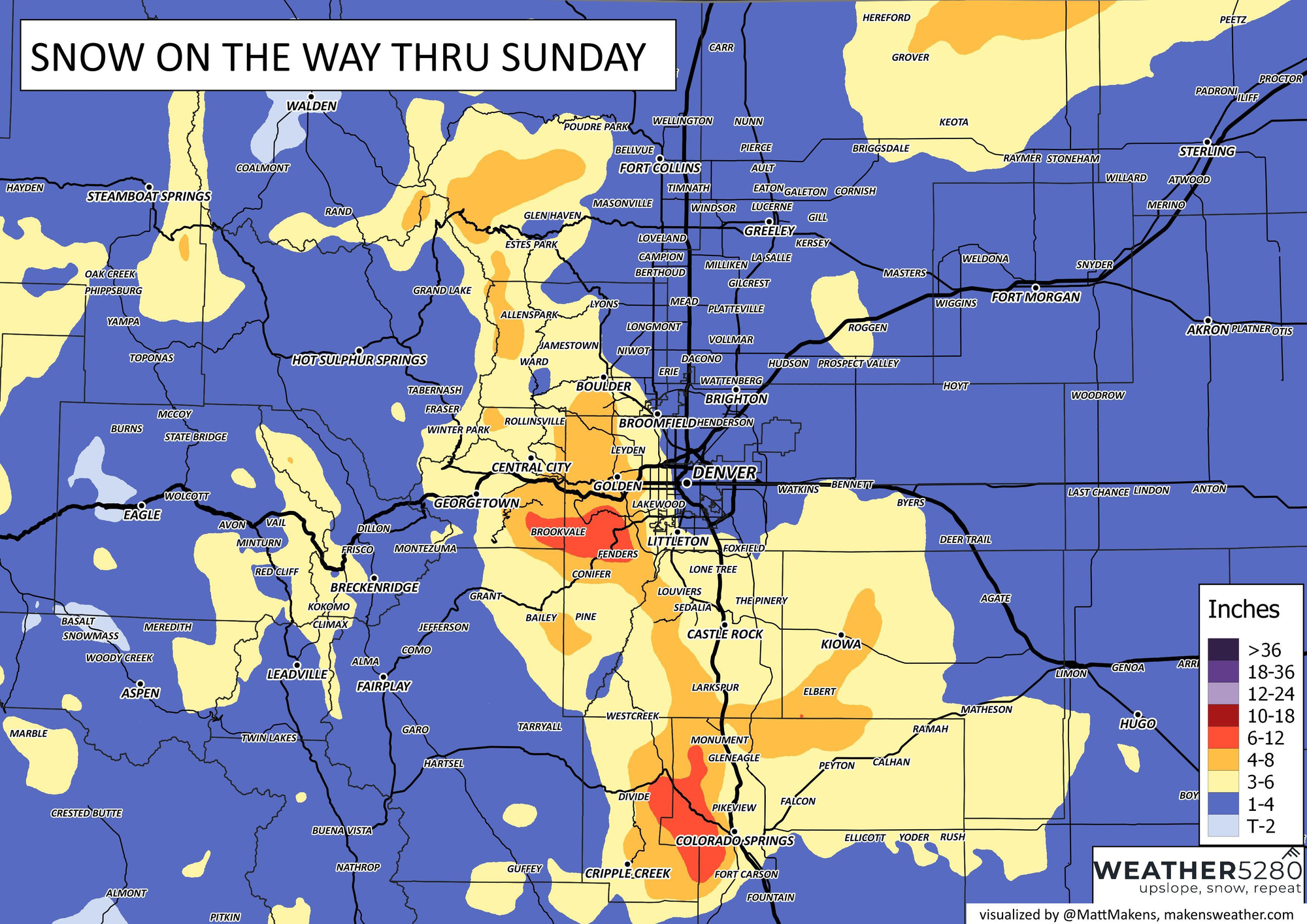
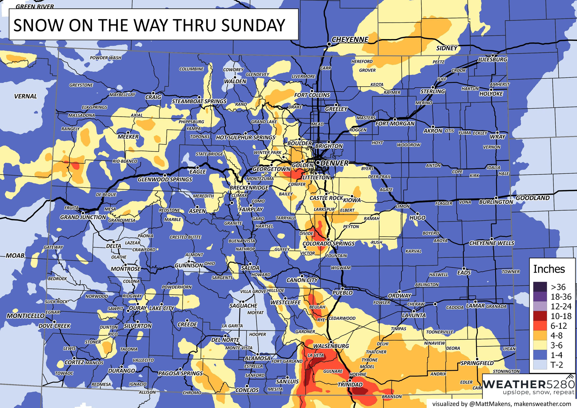
Some heavier snow numbers will also show up in the terrain areas over the southern I-25 corridor. Areas around Walsenburg, Trinidad and Raton will range from 5-12". Areas along HWY 50 in the plains will likely roll with totals between 3-6".
In short, not a whole lot has changed with the going forecast. Winter storm watch boxes will likely only turn out winter weather advisories at this point, and some warnings over the Raton Mesa. Perhaps we get the infamous northern El Paso County winter storm warning box too... Overall, this system will do enough to impact your Saturday by slowing you down 20-30 minutes, but shouldn't be enough to cause major road closures. And as always, better to stay in if you can with conditions like this.
We'll keep you up to date on this storm throughout the weekend, and per usual updates to your e-mail inbox are free!