
Measuring Saturday's "boom" snowfall potential along the Front Range

Just a quick post tonight as we're watching evening data come in, and figured we'd share a few maps with you Insiders as it does look like there's at least some potential for some sneaky solid totals for communities that end up under the heavier bands from this system.
A couple of the high-res models that have come in this evening are interesting to say the least. One question remains where we see the main band setup on Saturday, another is how much snow northern communities can manage tonight.
We'll see two waves of snow chances it appears. The first tonight (some of us are already seeing snow along the northern urban corridor) then another Saturday day/evening.
The action tonight should favor northern areas, and if Fort Collins is going to piece together a good snow it might come here in the next six hours or so vs later in the day tomorrow. Tomorrow's snow should favor more of the COS / Palmer / Denver areas and points northeast, with narrow bands of moderate snow likely producing "boom" totals for some folks.
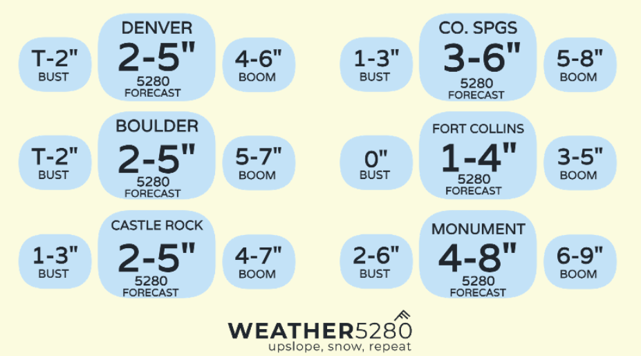
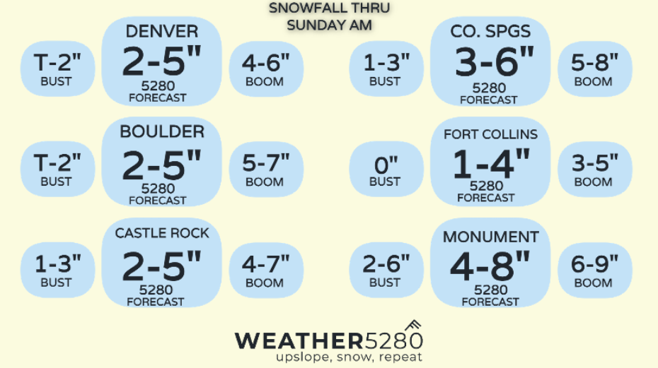
As a reminder, here are our forecast numbers from earlier today.
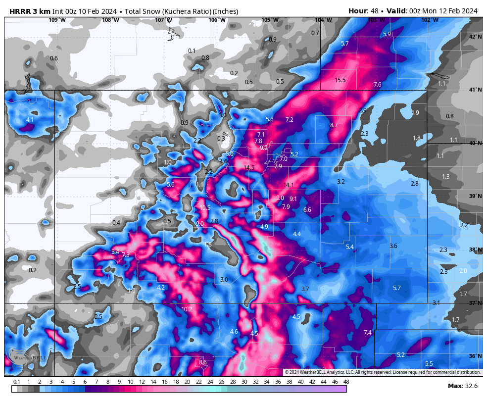
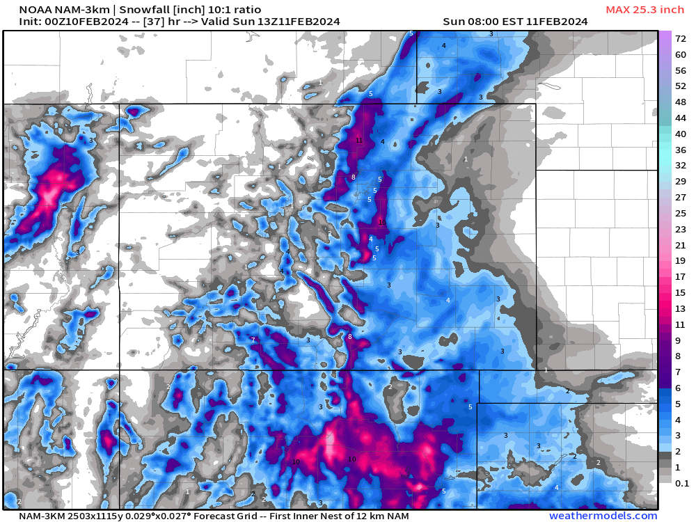
Now if we compare that to the high-res NAM and HRRR models tonight? Well, 1 - 4" would be low, 2 - 6" might be okay, but both models are supportive of some 8"+ totals under whatever bands setup tonight and tomorrow.
The HRRR with a stout band north of Denver, and another over the Palmer with upwards of a foot in spots:
A similar idea from the NAM, but perhaps more realistic on how narrow some of the heavier totals may be. Also a much better snowfall for the Fort Collins area than almost any other data supports, largely hinging on some action tonight.
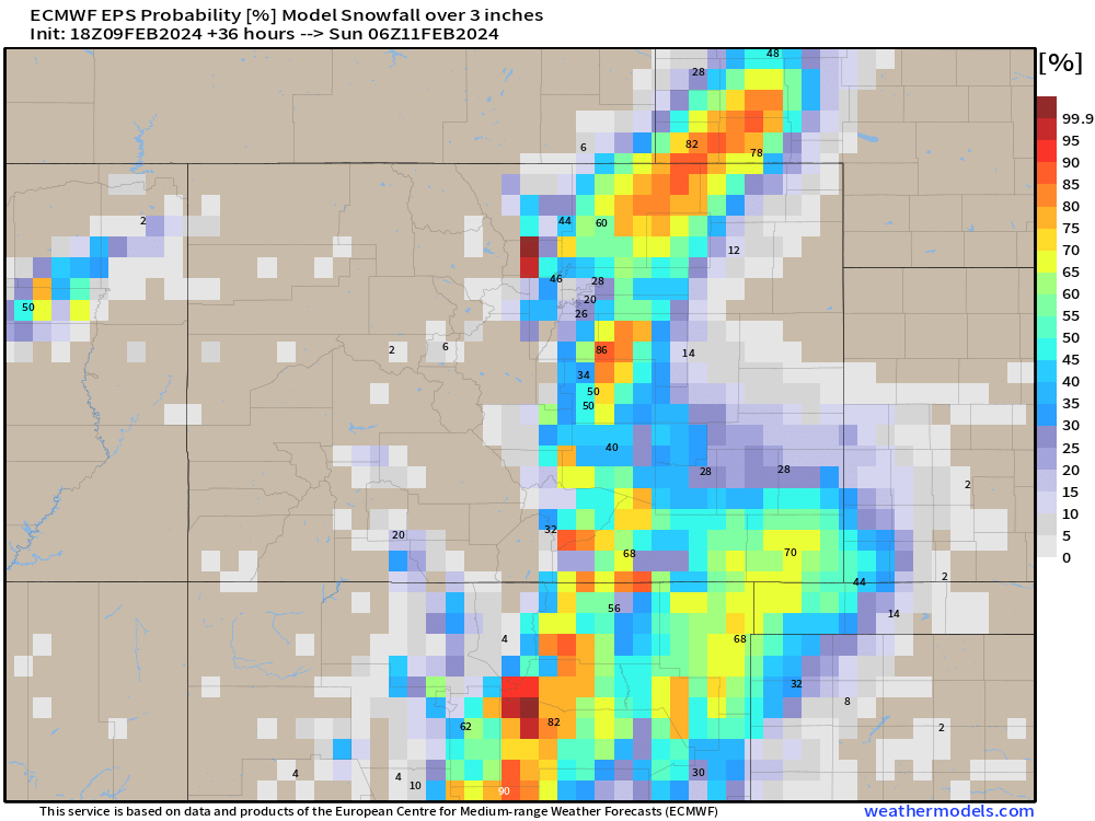
The probabilities for 3" of snow or more from the 18z Euro show it favors a band north of Denver and south of Denver, with low odds over the city proper. Pretty good odds if you live east of Fort Collins or in northern El Paso/Douglas counties.
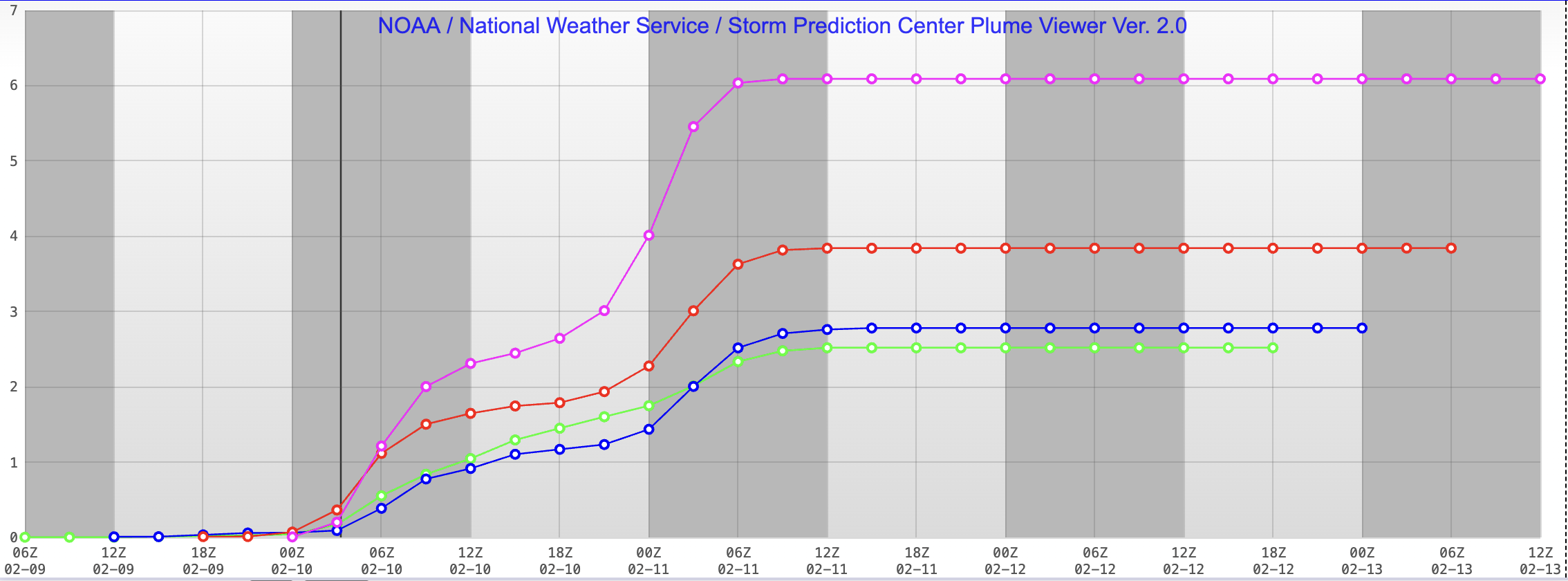
SREF plumes are also a bit stoked on snow tonight. They show 6" totals from Fort Collins south through Denver, and 7" for the Springs. Here's the output for FTC, and you can see that it's most recent run (pink) is quite a bit higher than the prior 3 runs!
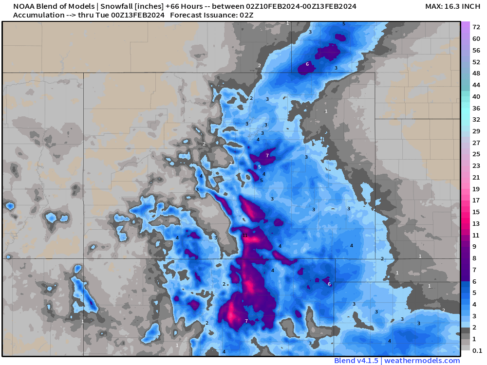
And finally, the blend of models would suggest the high-res models are doing their fairly typical pre-storm ramp up, and that our forecast remains on track. Some 7"+ totals under the heaviest snow, but largely 1 - 6" along the northern urban corridor and a bit heavier for COS vicinity:
We're definitely in that time will tell window, but figured it's worth a share in case we manage some fun with this system. We'll see how the globals look tonight, and what snow falls between now and the morning and pass along an update on how the rest of your Saturday will shake out at that time.
Isn't this fun!?
For now, enjoy the snow, enjoy the moisture, and keep us posted!