
Saturday storm update: Impressive snow band overnight; how much snow to expect today

As we discussed last night, this system has had a few tricks up its sleeve. A snow band last night delivered the goods, and oh-how-close it was to finally delivering Fort Collins a boom!
While Fort Collins did manage some accumulating snow as convective showers peeled off the hills, the main band setup just to the east of the city, extending from the northwest Denver suburbs up through Greeley. Here was the radar around 9:30 pm last night with some impressive snowfall rates at the time:
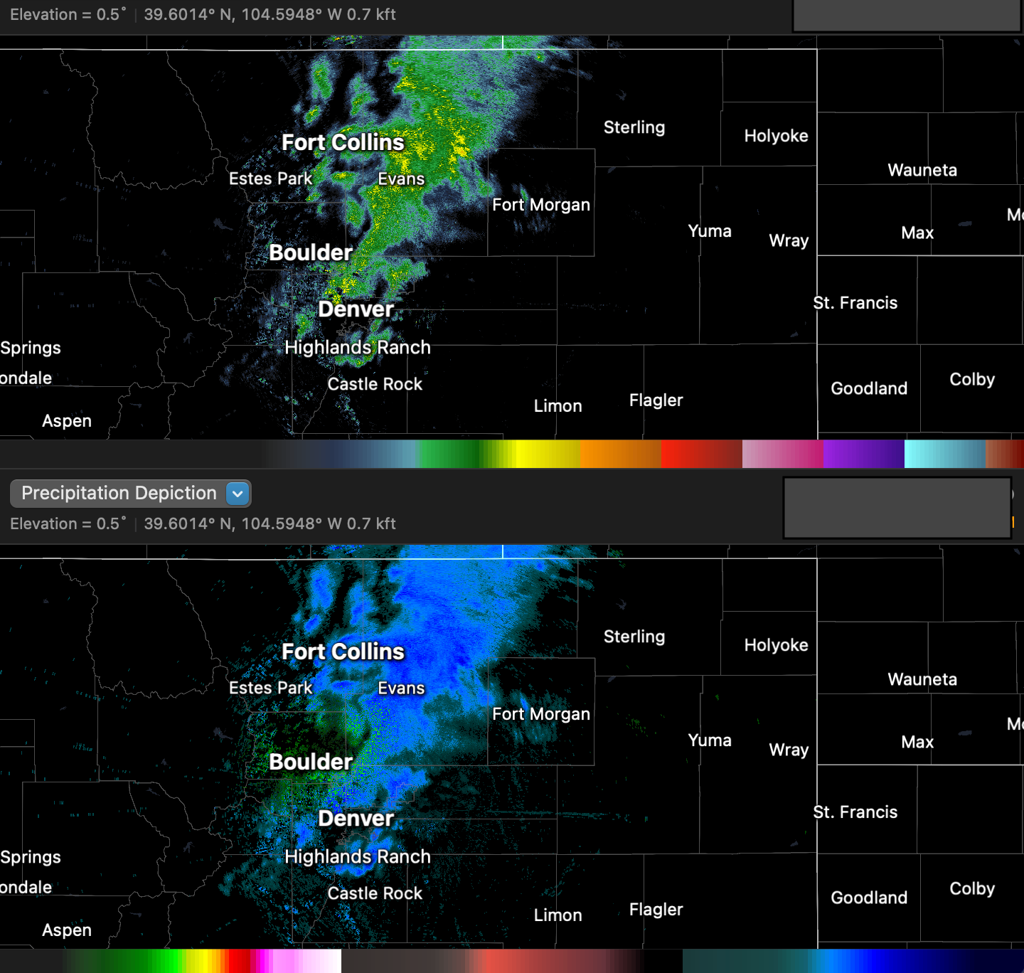
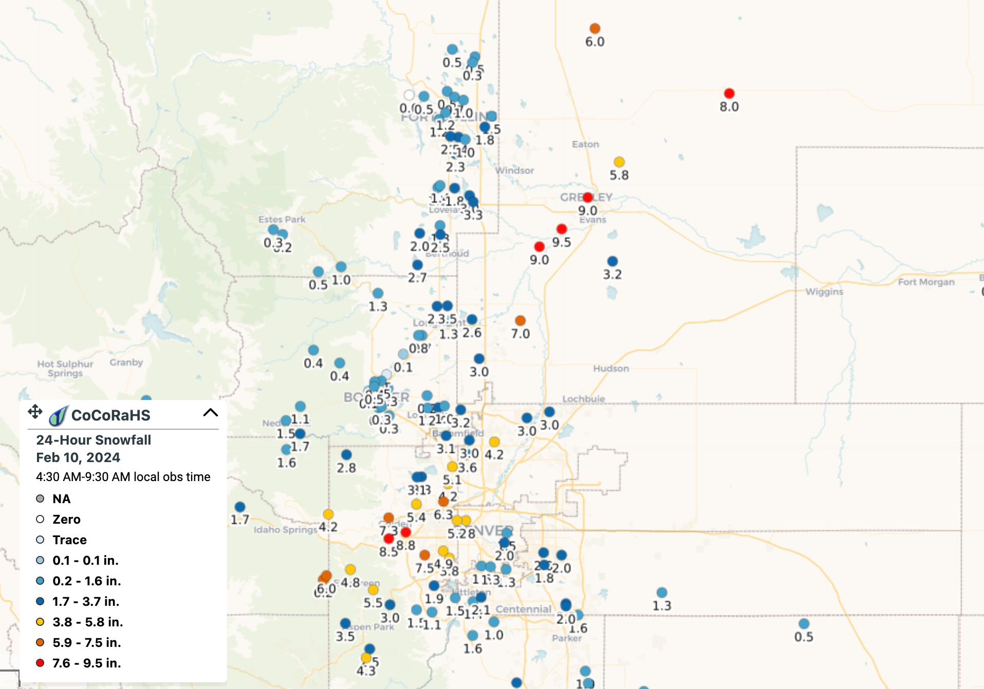
The climate station in Greeley logged 12" of snow in less than 8 hours, with upwards of 2" an hour snow rates at times. CoCoRaHS reports from the area this morning are showing 8 to 9" totals through 7am. Wow! You can also very clearly see who ended up under the band last night and who did not – totals to the northwest of the band in the 0 to 2.5" range, and similarly to the immediate east/southeast of it:
Today's forecast
We'll keep with the banded snowfall today.
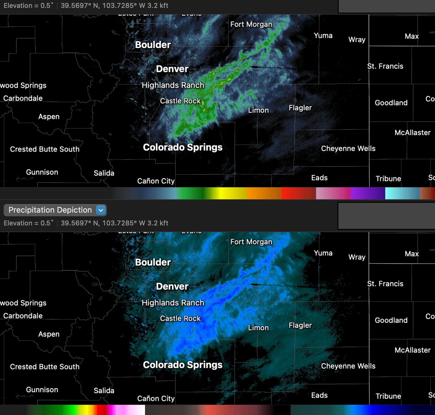
This morning's primary band has setup over the Palmer Divide with a gradual northerly movement over the last couple of hours. Snowfall rates under this band are also in excess of 1" an hour at times.
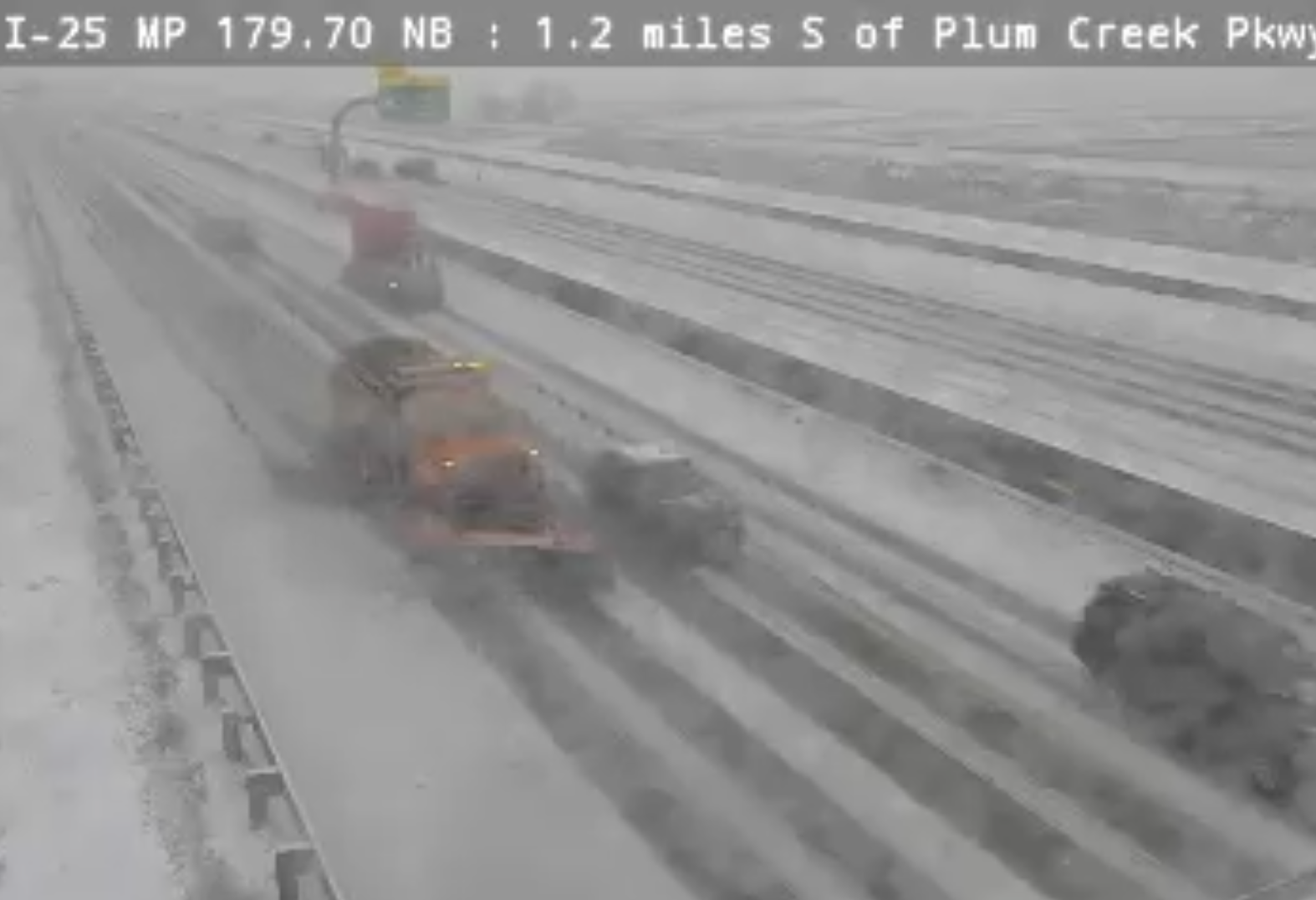
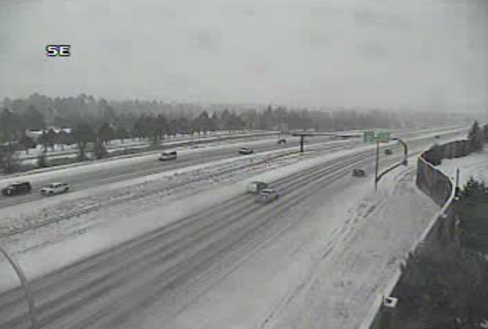
Daytime snow will help at least a little on the roadways today, but the system is a bit colder than last week and under the heavier snow bands rates will cause snow packed and icy roads, particularly as we get later in the day and into this evening. Here's the latest view south of Castle Rock this morning under that band – a good day to stay home and off the roads!
And snow packed roads around Colorado Springs this morning as well:
As we mentioned in our last update, last night's band favored northern communities, and today's will favor southern. Denver was on the south side of last night's band, and may end up on the north side of today's. We'll have to see how far north it's able to make it before things wind down this evening.
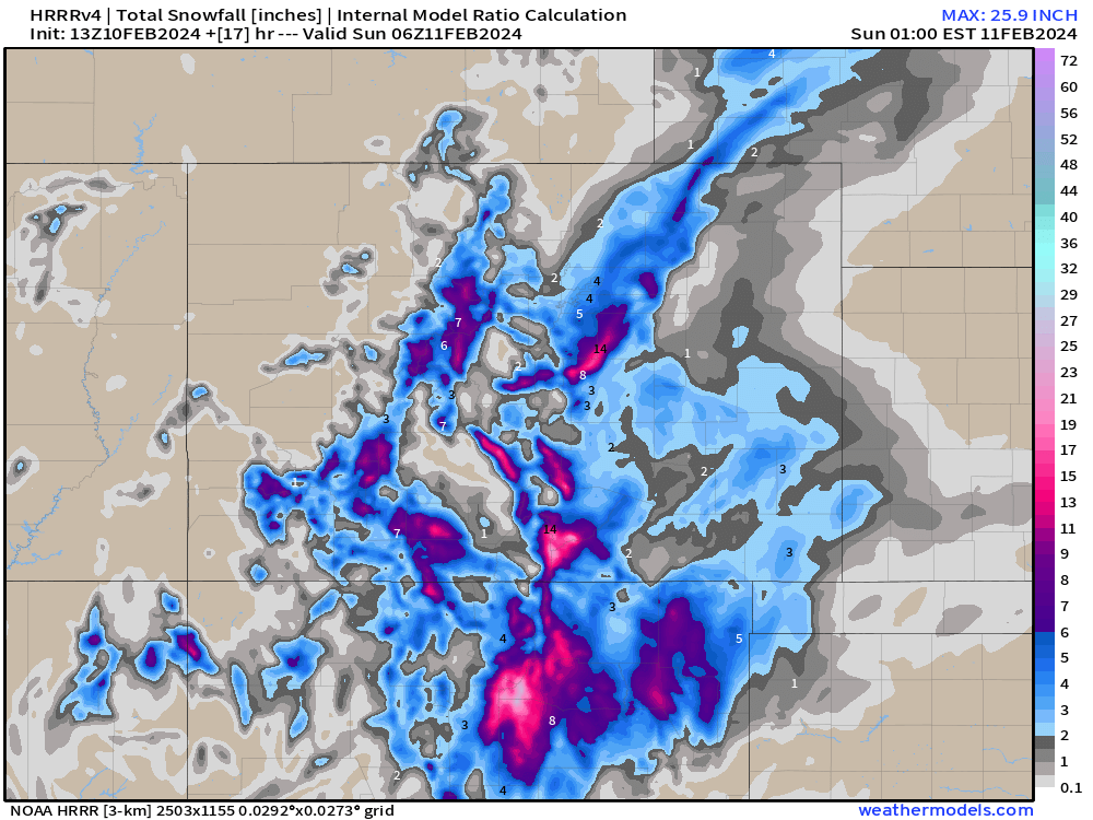
The trusty HRRR has about 1 - 3" of accumulation for Denver today (mainly this afternoon evening) with the bulk of the heavier stuff on the south and southeast side of the metro area.
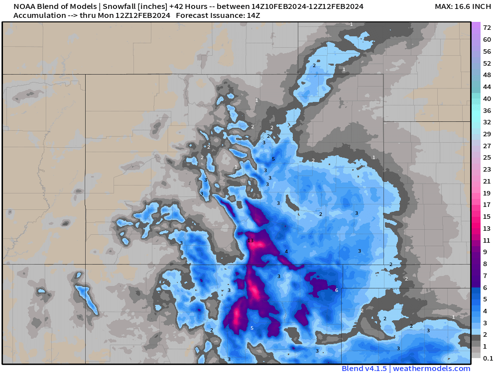
The blend of models is in a similar camp, again another 1 - 3" possible for Denver, but the bulk of the storms energy will be focussed to the south and southeast as the storm gradually exits later today.
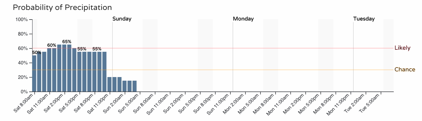
Finally, for timing, look for that snow chance to continue through the afternoon and evening hours then drop off quickly as we head into the early hours Sunday.
Here's the latest hourly probabilities for Denver:
And Colorado Springs:
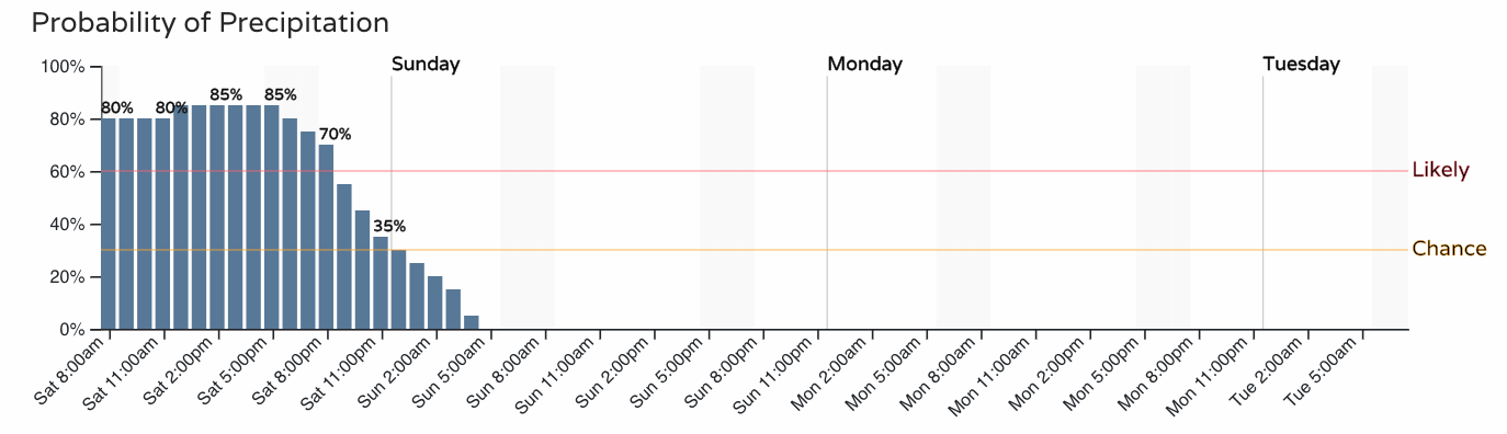
Tempeartures begin to moderate on Sunday with sunny skies back in the forecast for the urban corridor!
Please share your storm reports and pictures in the comments below!