
After an active start to February, do we have any more left in the tank?

Back-to-back weekends in early February brought wintry weather to Colorado. Do we see any more on the way as we look forward? Our prospects don't look all that exciting, but the passage of a broken upper-level jet streak will provide the mountains with a chance of snow through this weekend, and might we manage a bit at lower elevations?
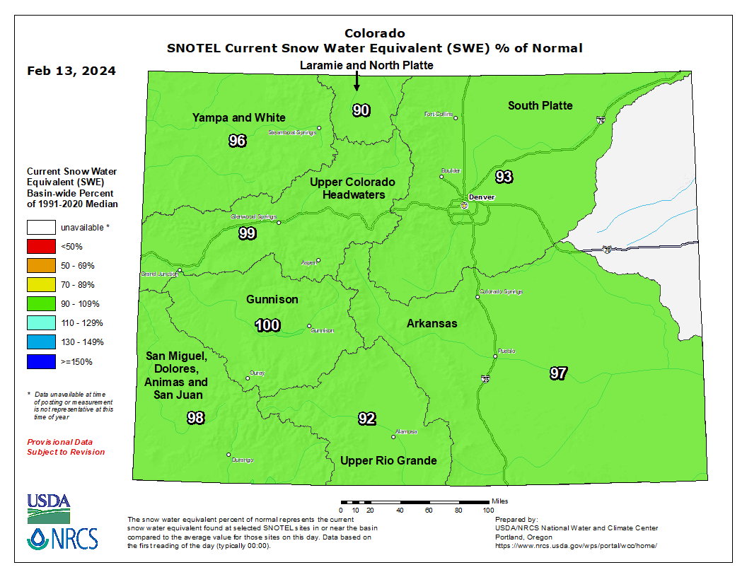
Here is a look at the current basin-level snowpack, these are within a normal range but will decrease a bit with a calmer pattern for the next bit.
What about that snow on the way? As the main energy passes by Friday night into Saturday, there's some indication that we sneak in a little bit of low-level upslope following cold frontal passage. Most bullish on Friday has been the GFS, with a few other models picking up on very light precipitation chances.
Behind it is the Canadian model which as of 00z Tuesday evening stalls the front out along the Wyoming border leaving most of the snow along I-80.
The EURO model has been the least favorable, most consistently, of the big three global models. It's been leaning to a mostly dry frontal passage Friday.
When in doubt, you can always ensemble out – and... well.. like mentioned, northern mountains, pretty good! Front range?... ehh...
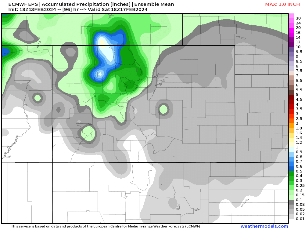
If anything, it seems like the snow favors the overnight period Friday, may have slightly better ratios than the slop we had the last two storms... and even then, maybe a few folks get a fluffy 1-2" out of that – not much to write home about.
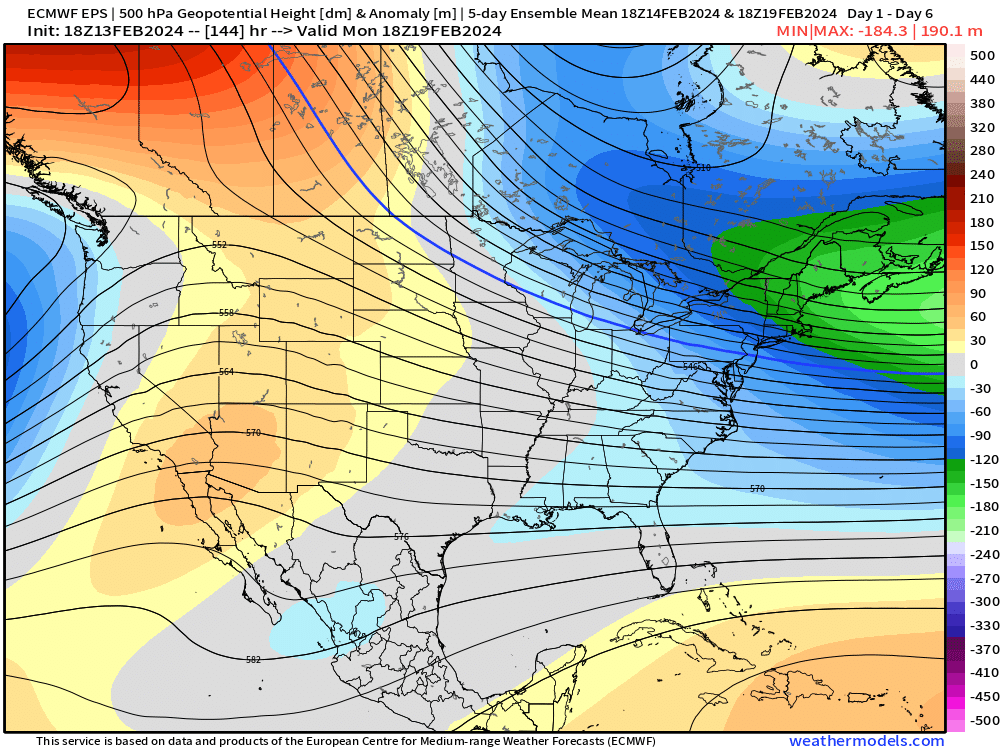
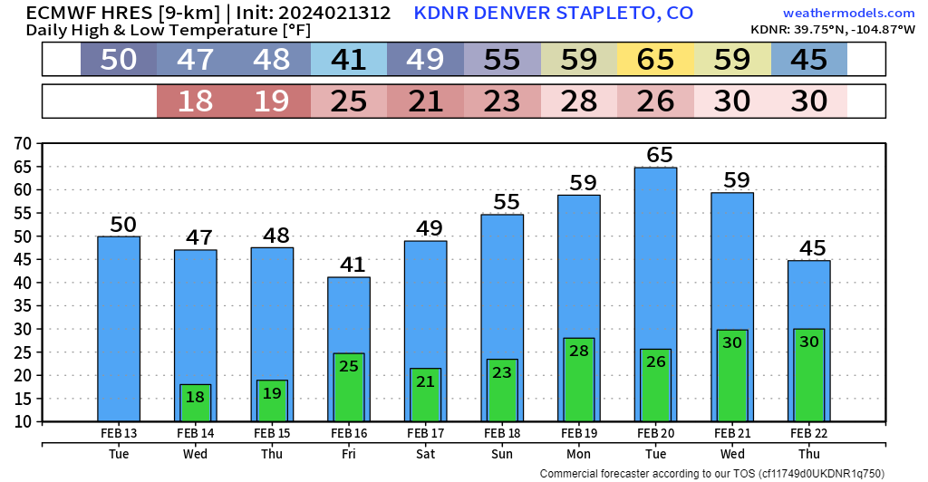
Not much headed our way the next week or so either. A look at 5-day averaged 500mb height anomalies look pretty ridgy & mild (calmer weather periods). A peek at 10-day temps paints the picture well with a huge surge in temps by Tuesday next week. Is 65 a stretch along the urban corridor? Might not be depending on how/where the ridge sets up next week.
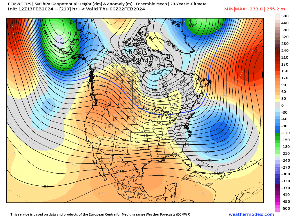
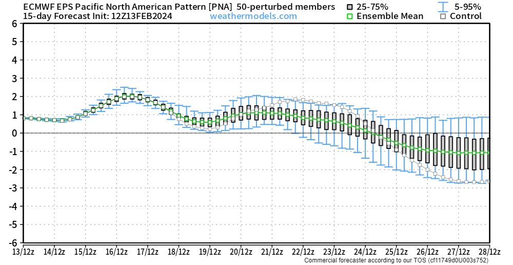
That ridge doesn't really look like it wants to budge much either. Signs point downs this thing continuing to maintain itself well into the 3rd week of the month. We may get this thing to slump down a bit though looking ahead to the end of February and into early March. A peek at the chart below shows a fairly significant dip in the PNA index after February 25th, which for us may translate to more active weather again.
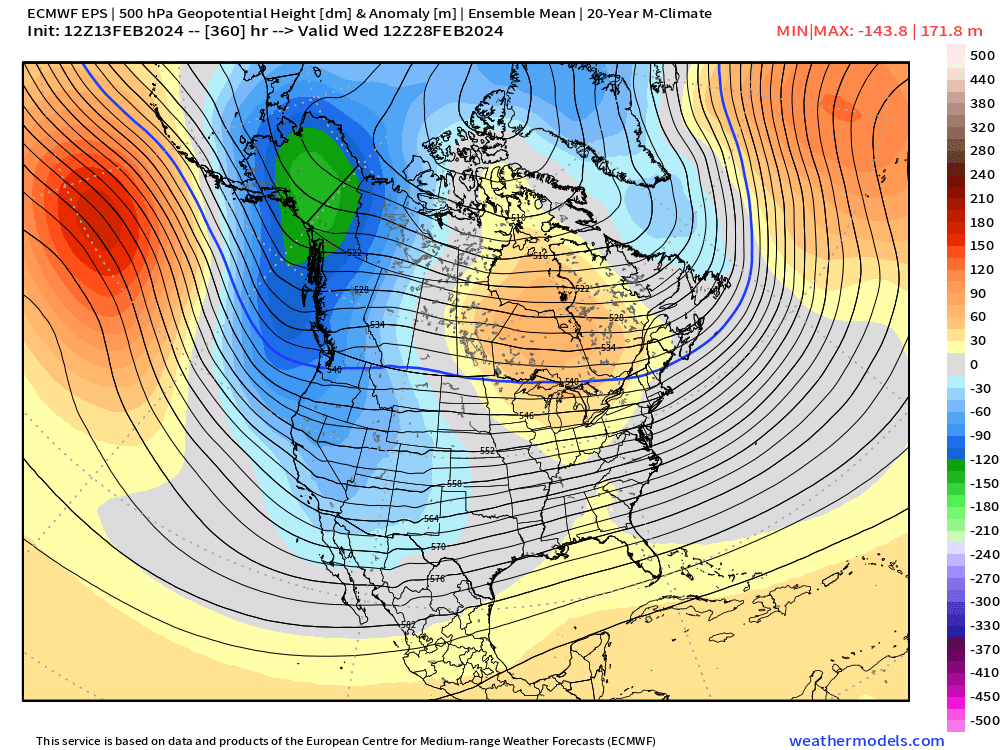
And that is very clearly represented on the map below – a classic negative PNA setup with significant troughing along the pacific coast, ridging beginning to push into the Gulf of Alaska and ridging developing near the east coast.
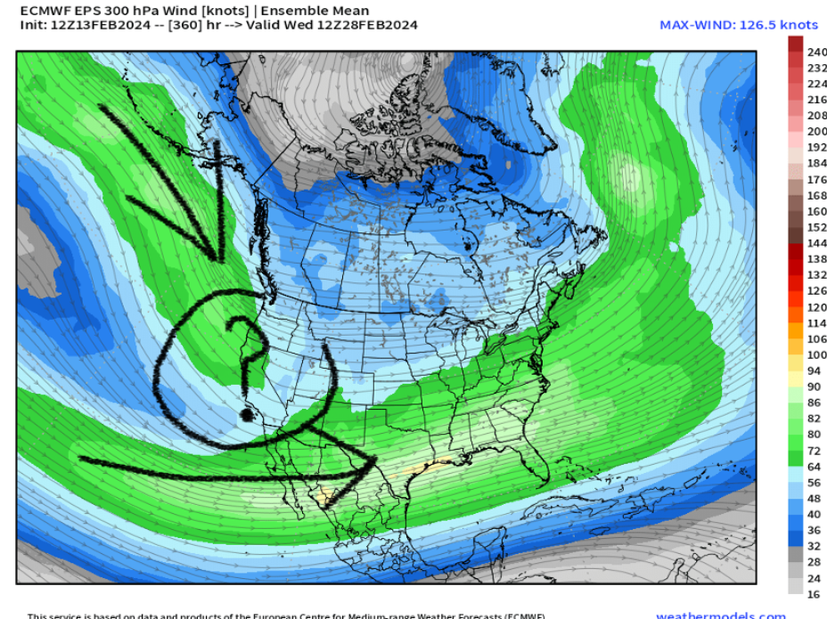
The big question with a pattern like this is: Can we get that cold air to dislodge south and link up with an already stout subtropical jet? Maybe. But that's a fool's errand this far out. For now, nothing looks that great. We likely have at least a week before we can really dig into this 'end of the month' pattern. So far now, we'll just have to enjoy a bit of a break and perhaps some spring-like temperatures next week!
If anything starts to look a bit better with the upcoming Friday system, we'll let you know, and per usual, updates to your e-mail inbox are free!