
Colorado weather: Quick chance of snow Friday could bring accumulation to Denver, Front Range

We continue to track the week-end storm, which will bring pockets of good accumulating snow to the northern mountain to kick off the weekend, and it looks increasingly like a few bands of snow will develop along the hills Friday evening – with perhaps a few communities along the urban corridor picking up a quick 1 to 3" of snow under those bands.
Here's the hourly planner for the Denver area, you can see it's a relatively brief window Friday afternoon/evening for that snow to occur, but a fairly good shot at seeing something across the area:
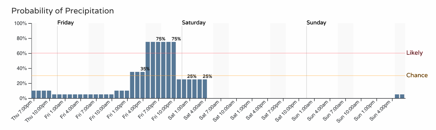
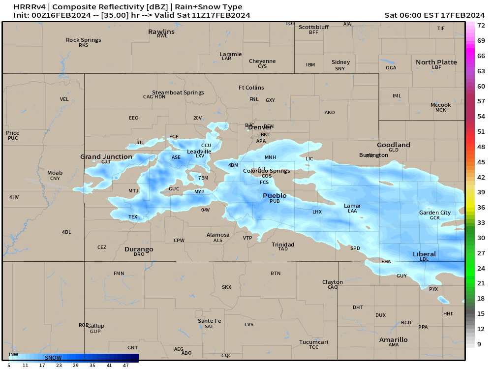
Guidance tonight ranges from just a dusting to upwards of 3" in the latest HRRR. Most guidance suggests 1 - 2" will be the most likely under whatever banded snow does setup, but not hard to see a scenario where someone picks up a high-end total if things play out just right.
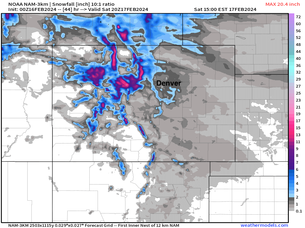
The NAM, below, may have a decent handle on things and shows the banded snow idea well. The Denver area with T - 2" of snow, but a few pockets of 3" totals north of Denver under those bands.
We are seeing some rain and snow across the northeast plains tonight as well, but that will come to an end later this evening with a lull in the action Friday morning.
By mid afternoon Friday we see snow really getting going in the high country, with snow beginning to push into northeast Colorado as well. I wouldn't be surprised at all if Fort Collins was seeing some snow by early afternoon.
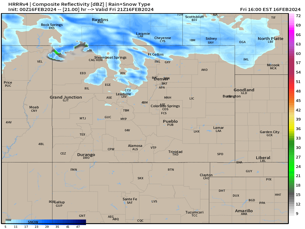
The HRRR (again on the more bullish on snow) shows that coverage gradually sagging south through the evening hours, with a period of light to moderate snow for the Denver area by the early evening hours:
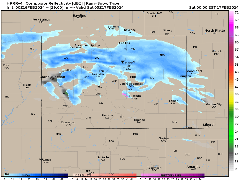
The snow shifts south overnight, and will be moving into (and out of) southeast Colorado Sunday morning.
Commute Impacts:
Friday morning commute should be just fine.
Friday evening commute should largely be ok (outside the mountains), but snow showers will likely be moving into the Denver metro.
Travel Friday night into early Saturday morning will be slick for many of us, until the sunshine improves things late Saturday morning and afternoon.
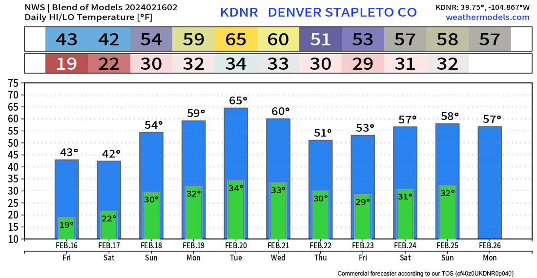
This system keeps us chilly to end the week and start the weekend, but the promised warmup still looks on the table. Whatever snow we see tomorrow will be a distant memory by Sunday, with mid 50s in the forecast to end the weekend, and perhaps some 60s on the way by the early to middle part of next week along the urban corridor!
Keep an eye on the sky tomorrow, and if need be we'll check in tomorrow morning with an update on that snow potential for your Friday PM.