
Denver Weather: 60s this week, I thought the calendar said February

No, I'm not implying that 60s should be considered rare in February, but my point with the headline is that this week looks very mild for February, with all daily high temperatures coming in at or well above average through next weekend. Don't take this to mean the weather will be quiet, however, as we will have a chance for rain (yes, rain in February - we saw this last week, too) and snow in the metro this workweek.
Many Februarys have been mild, with lots of 60s included. Here is a list of the top 10 number of 60-degree days in the month for the Denver area:
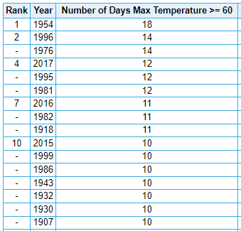
This February has only had one such day, but we will add a few more to that tally this week. Here's a general forecast for the city of highs and lows for the next seven days.
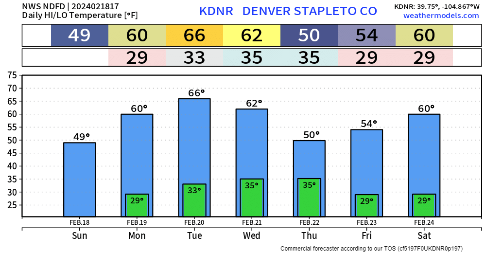
It looks mild, and it is; Thursday, we do cool off with some showers around - more on that in a second. Using our Insider's Weather Board, let's see how much above average the forecast is.

For Denver, we are expected to be 17° warmer than normal on Tuesday, and Colorado Springs 20° warmer than normal.
Am I trying to imply this is an unusual month? Don't take it that way, as this is just a warm spell. When I look at the Denver Area temperature record back into the 1800s for all Februarys to date, 2024 is right in the middle of all of 'em.
What's propelling temperatures so much? Well, mostly, a ridge of high pressure is going to sit on us for a bit. A ridge keeps the weather calmer, and we associate that with warmer temperatures in most conditions. Part of this ridge moving into place will be some strong wind, though. Many of us will need to hold onto our hats and small dogs tonight. Shown here are probabilities of wind speeds of at least 40 mph.
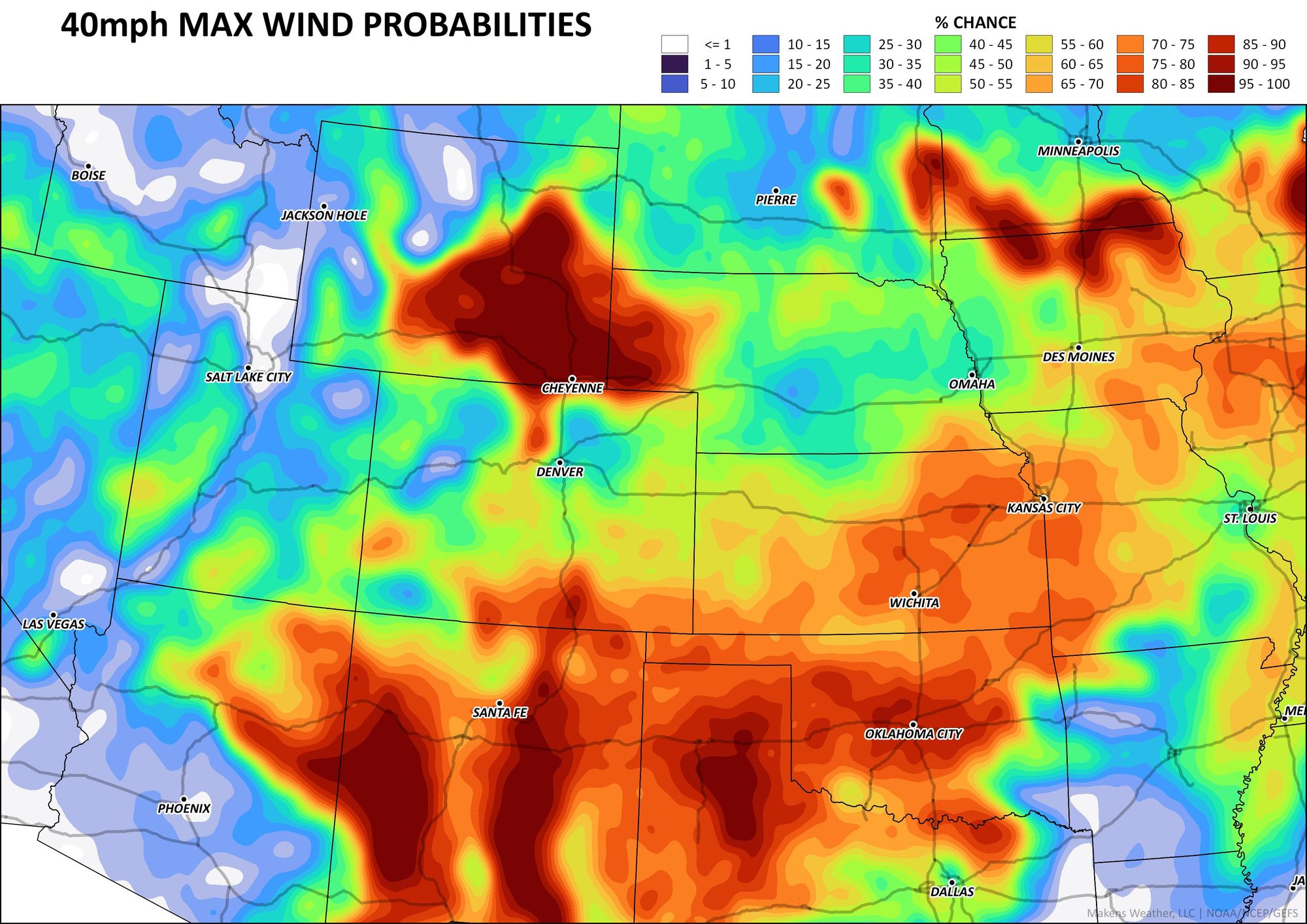
Winds are strongest in the usual areas, the Northern Front Range Mountains and into Wyoming, as well as the Southern Front Range Mountains and Raton Mesa. This wind is, generally speaking, warm.
With this warm week, we may see rain and rain/snow in a few days instead of just a straight-up snow chance.
For this, let's watch the following animation. This is a general estimation of showers' location and timeline for the week.
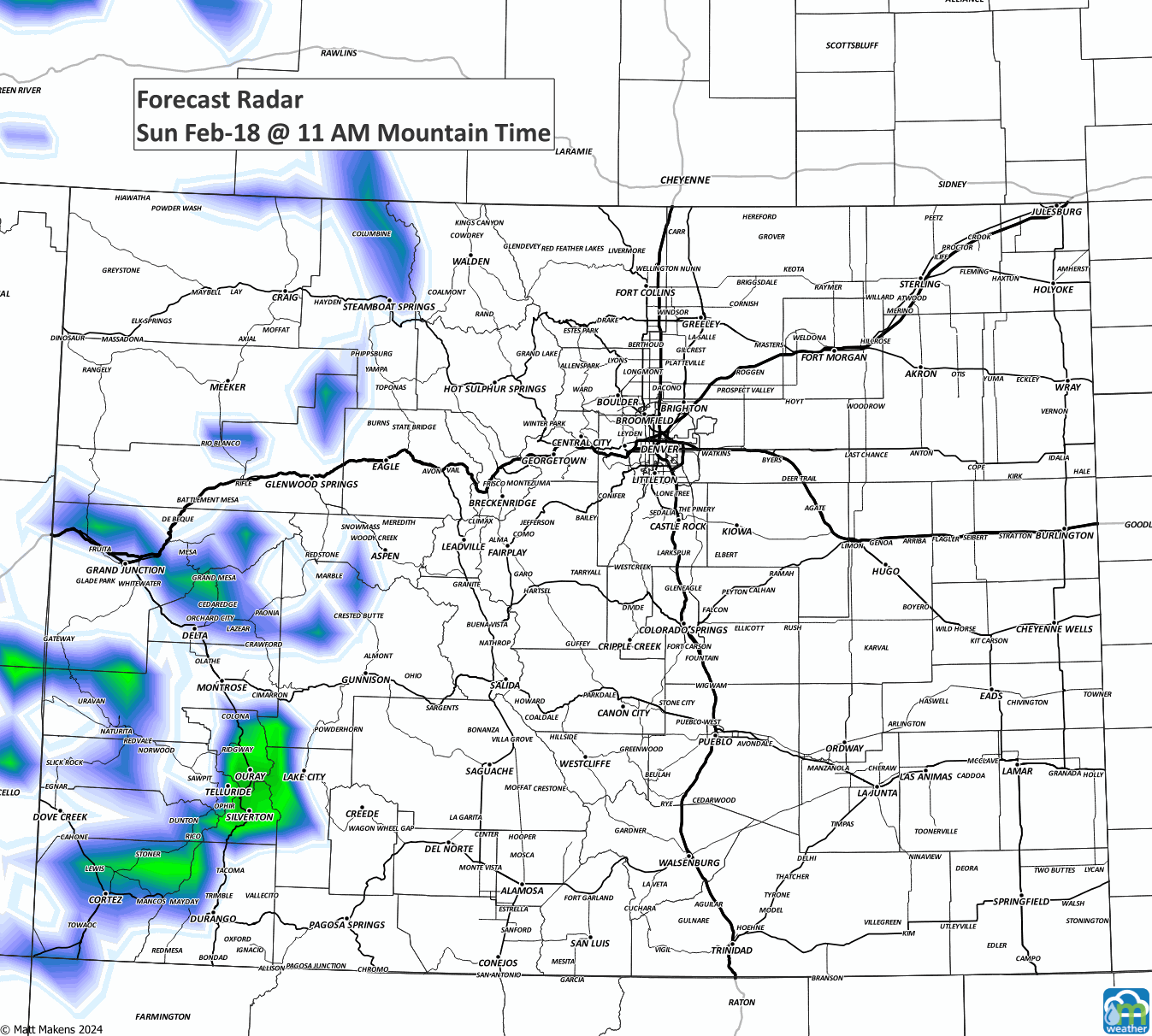
You'll see some showers cover parts of the state just about all days this week until the weekend. For Denver and the metro areas, we will have chances of rain and snow on Wednesday and Thursday.
If we combine the whole week, let's look at an estimated total snow first:
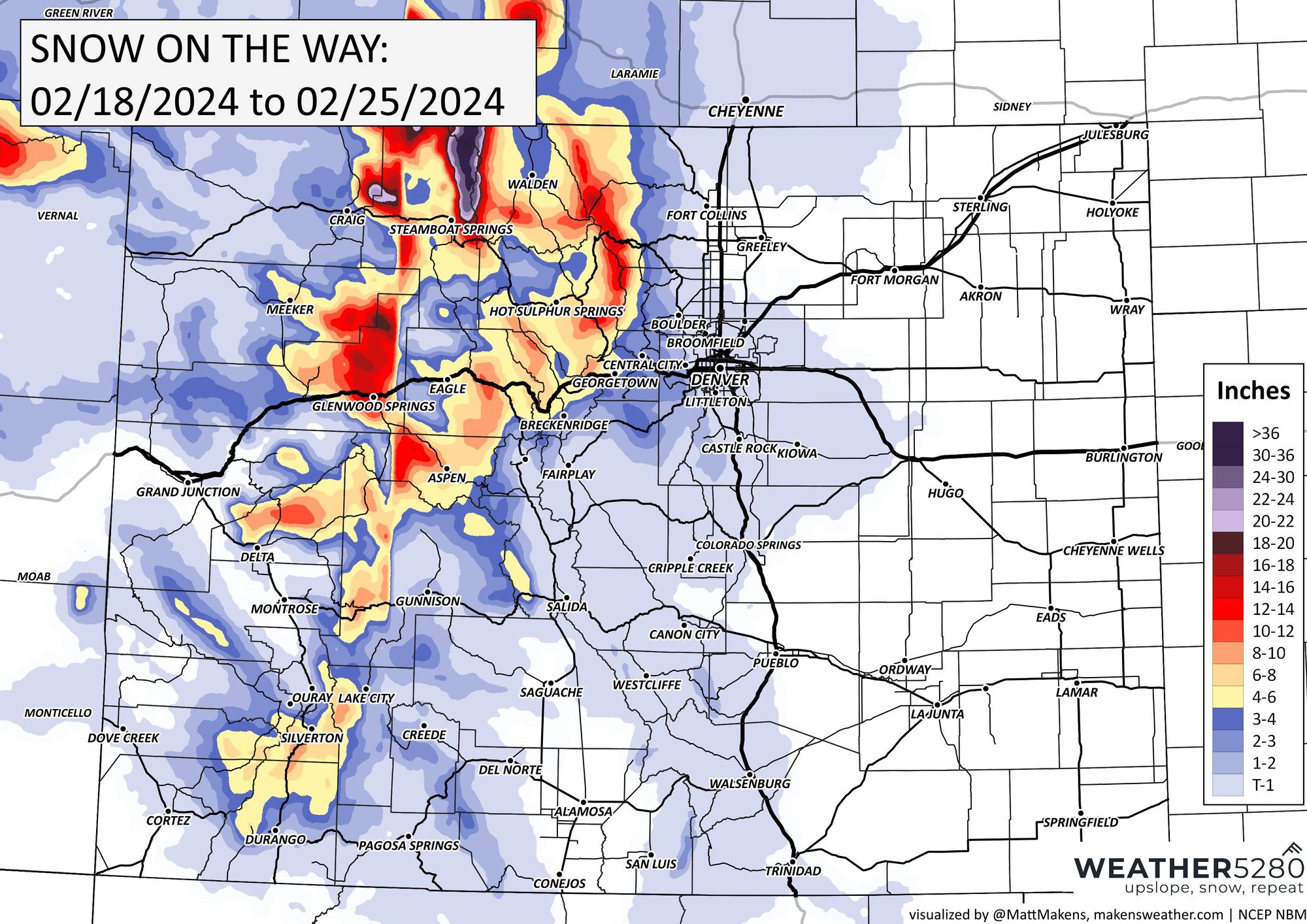
The northern mountains get some nice snow; everyone else... meh, okay. Now, onto the plains and metro areas, we have a mild week, meaning we need a tap of colder air to see a lot of snow. Instead, a rain or rain/snow/ice mix.
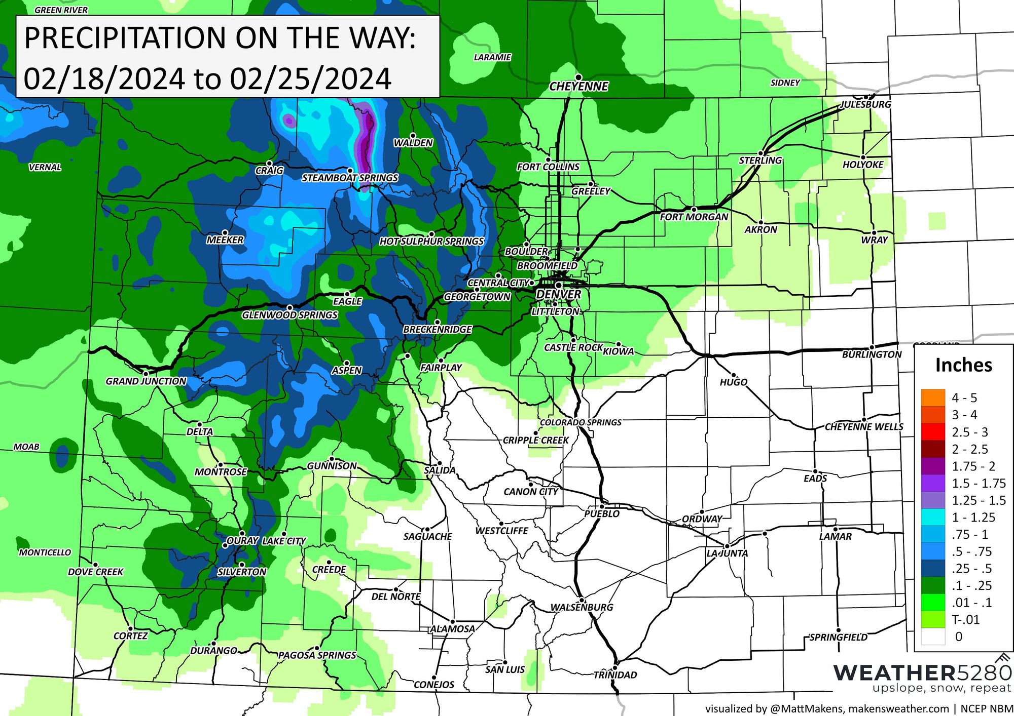
So, if we look at total precipitation which combines all of those things, we see more areas painted with some color over the northeastern quarter of the state.
Although rain is easier to deal with for drivers, we do face a bit of a potential issue in the metro areas if/when the temperatures fall below freezing and we turn from rain to snow and our roads become ice covered... we will offer more insights on that as we get a bit closer and can pinpoint the chances plus phases of precipitation.
In the mean time, enjoy the warmth early this week and we will be in touch with the latest snow and rain forecast details - updates to your e-mail inbox are free!