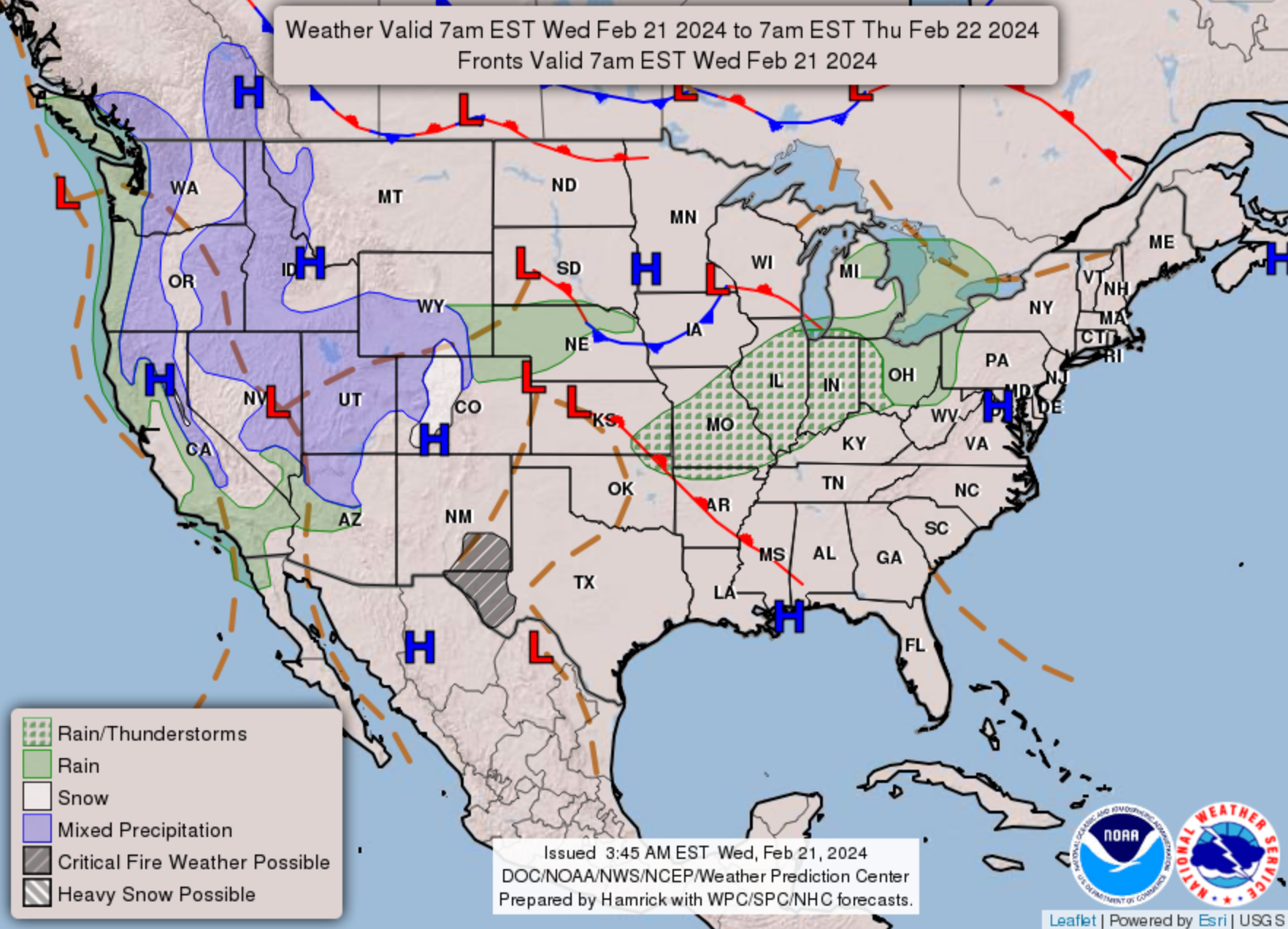
Colorado weather: Another mild afternoon in the forecast ahead of rain and snow showers across the state

Our mini-heatwave continues today as temperatures will again climb into the mid 60s along the Front Range ahead of a bit of change in the weather later today and for your Thursday.
Temperatures on Tuesday were similarly warm across the region, with more than a handful of daily record highs being set across Colorado and the central plains states. This animation shows those locations that set records, or came close.
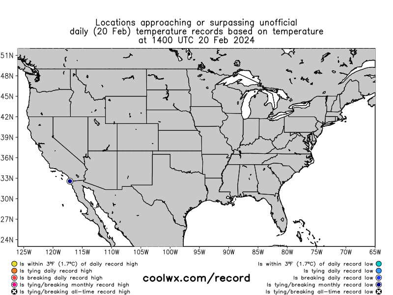
For Denver, the high of 66°F on Tuesday was well shy of the record for the date (75°F, 1935) but still well above the average high for this time of year which is is 49°F. Today's high will again be well above average, but likely several degrees shy of the record for the date (73°F).
In the planner, you'll note we cool things off by about 15°F degrees for your Thursday behind the incoming "cold" front, but this only knocks us back down to where we should be for this time of year.
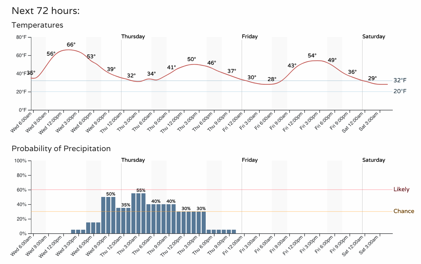
You'll also note that chance of precipitation by this evening, and lingering for your Thursday a bit as well. Lows overnight will be near freezing which could mean some snow or rain mixed with snow, but for lower elevations we aren't expecting much of an impactful snowfall from this event – mainly just a cool down with some passing showers, and perhaps a Trace to 1" for spots that cool enough.
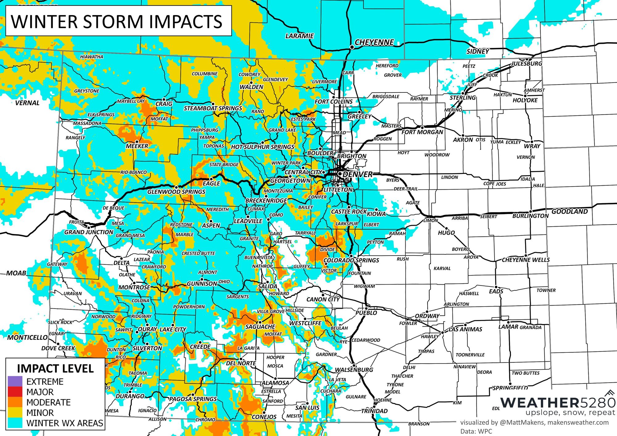
However, keep in mind that wet pavement early this evening could turn icy as the temperatures drop. Here is an impact-based representation of those most likely to have some slick drives.
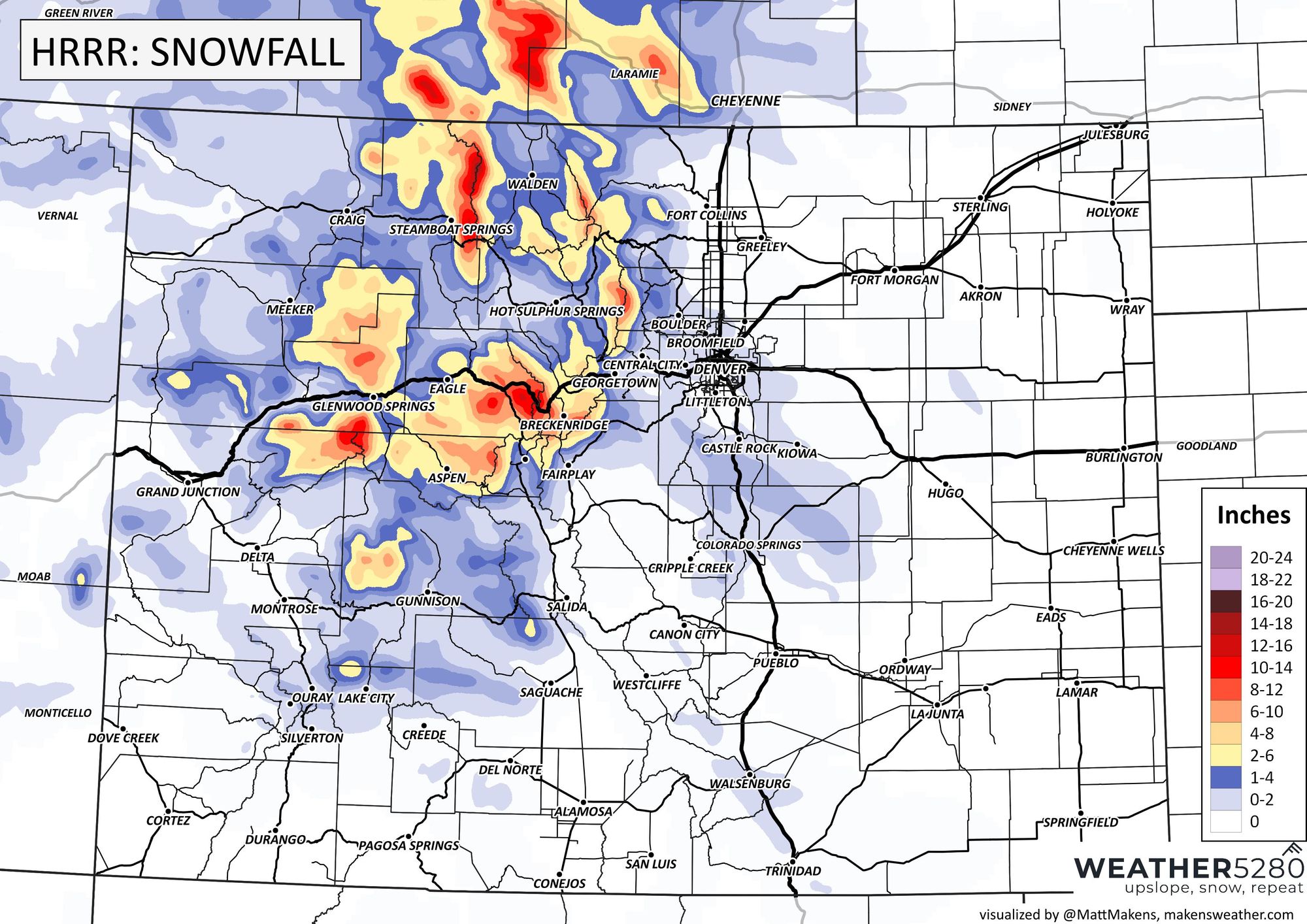
The latest HRRR (short-range high-resolution modeling) certainly supports this idea, with some decent snowfall on the way for the northern and central mountains but just a trace to 2" or so (mainly along the higher elevations west of Denver and between Denver and Colorado Springs) through early Friday morning.
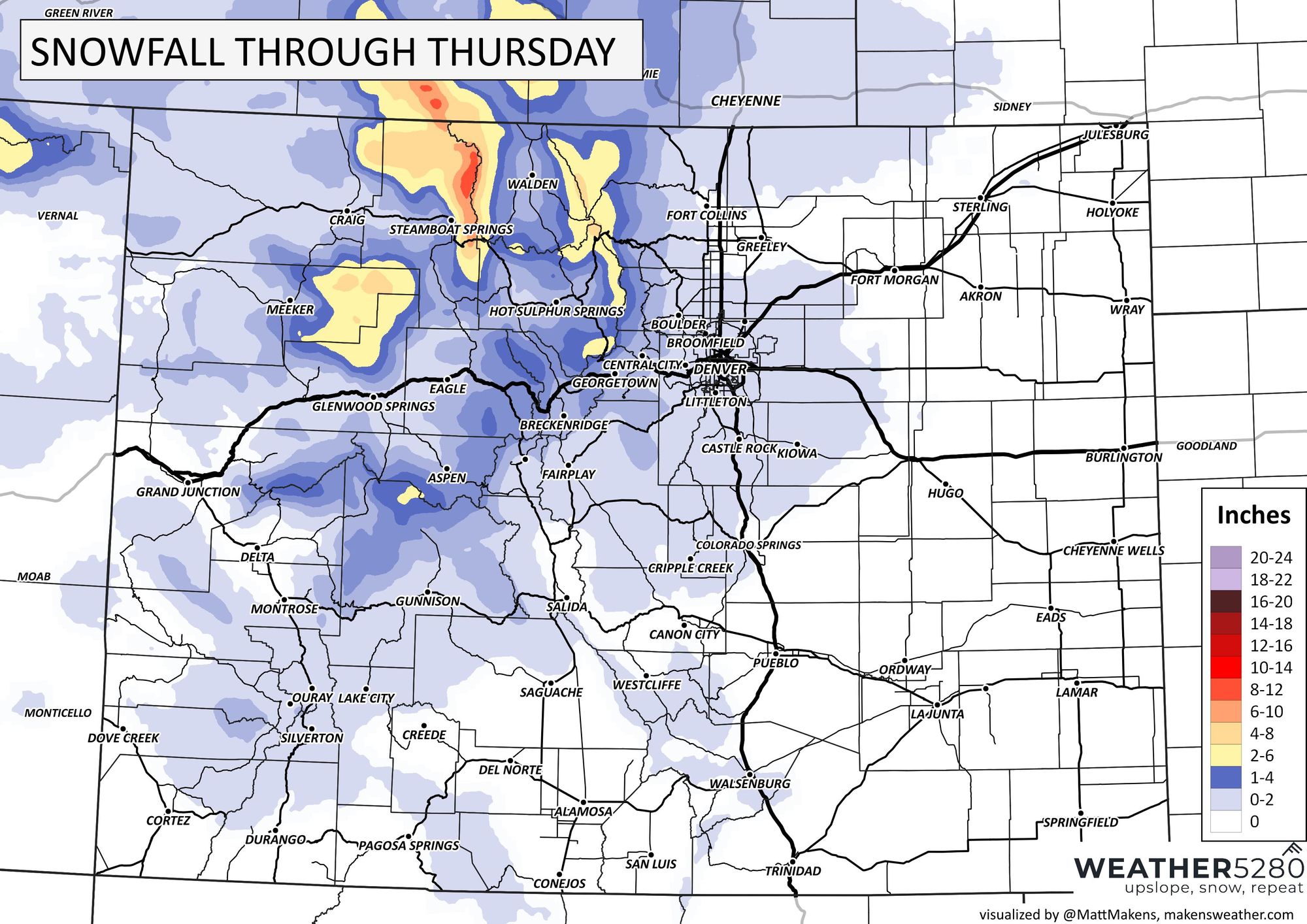
And here is our snowfall forecast taking you into the weekend:
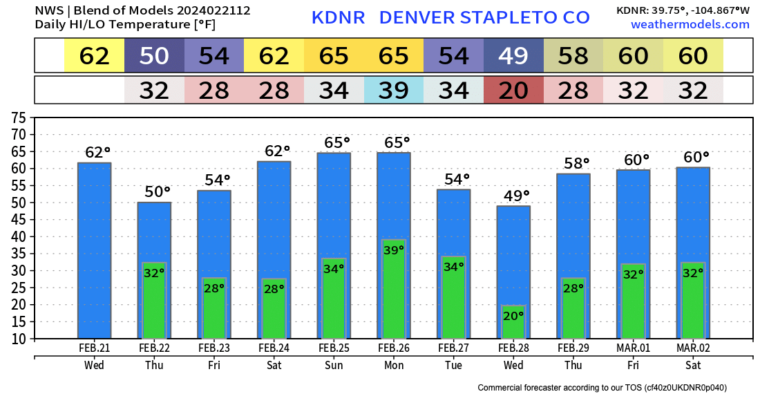
This cool-down will be brief, with warmer-than-average temperatures back in the forecast for the weekend along the urban corridor. Here's the latest blend of models showing highs in the 60s again for the greater Denver area by Saturday:
Another system will race across the state early next week and could hold a bit more potential for some wintry/wet weather for our area. It certainly looks like the mountains will see a good round of snow, but details east of the hills will need to be monitored as we head into the weekend and early next week.
As always, stay ahead of the weather by subscribing to our mailing list (it's free!), and we'll keep you posted as to any changes headed your way!
Let us know if you see any rain or snow this evening!