Denver Weather: System brings rain and snow with temperatures dropping all of Tuesday

There's a system set to arrive in the metro areas overnight through Tuesday, meanwhile the mountains are cashing in on snow from that system Monday. Meanwhile, Denver hits the 60s with this wind Monday prior to see a downhill trend all day Tuesday.
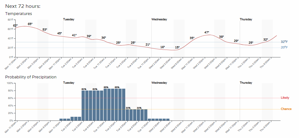
Starting with the hourly temperatures, you'll see that downhill slide all of Tuesday.
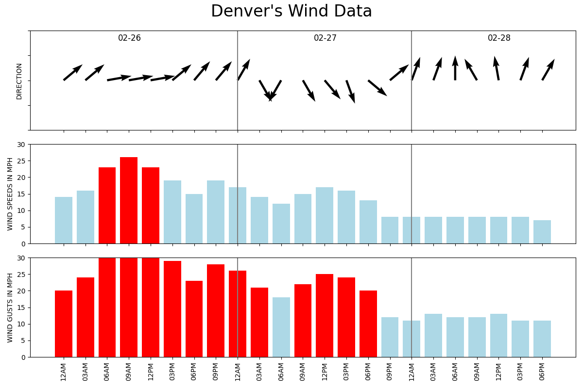
Although Monday is warm, that wind has a bit of a bite to it. While temperatures cool off Tuesday, more of that wind chill will be a factor. I certainly hope fires aren't not going to become an issue, but we do have that risk as we've seen with wildfires igniting the past several days. Here is a quick and dirty graphic to show you the wind on tap:
Okay, so it'll be cooler and windy - got it, but am I going to get wet and then fall down on the ice again? Let's run through the next three days.
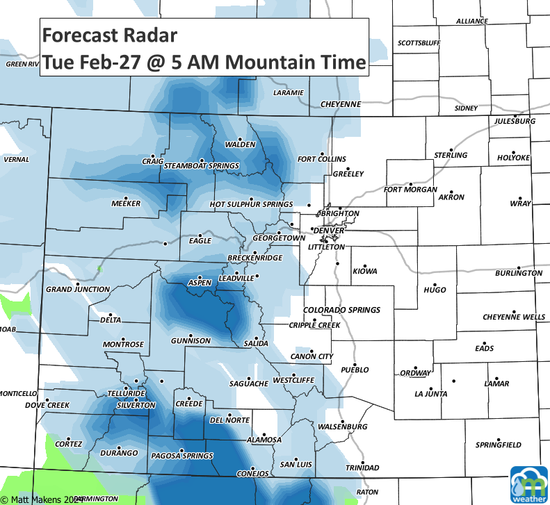
For the most part, showers are staying put in the mountains through Monday evening.
Inching closer and getting heavier by Tuesday morning.
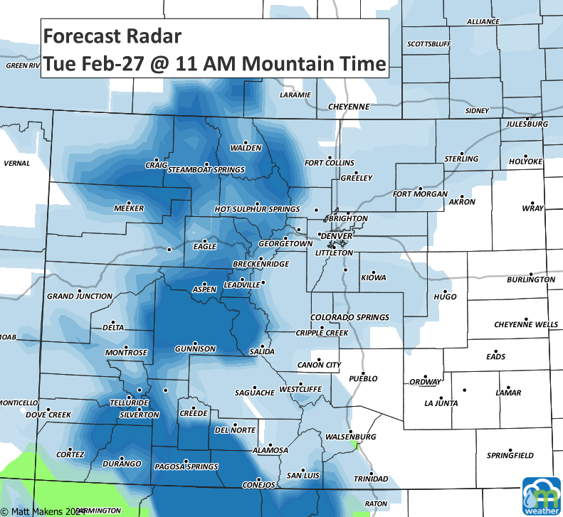
By your lunch hour you may be seeing some snow, or even a rain/snow mix if you are still in a warmer pocket.
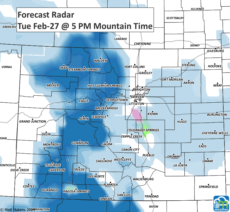
A few showers are around for Tuesday's drive home, too.
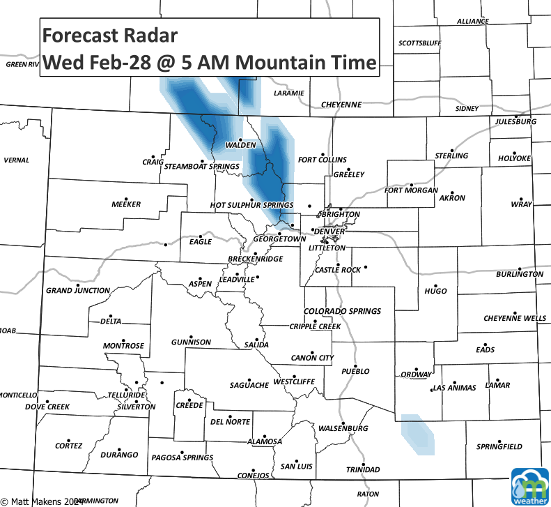
By Wednesday morning, just bits left over here and there.
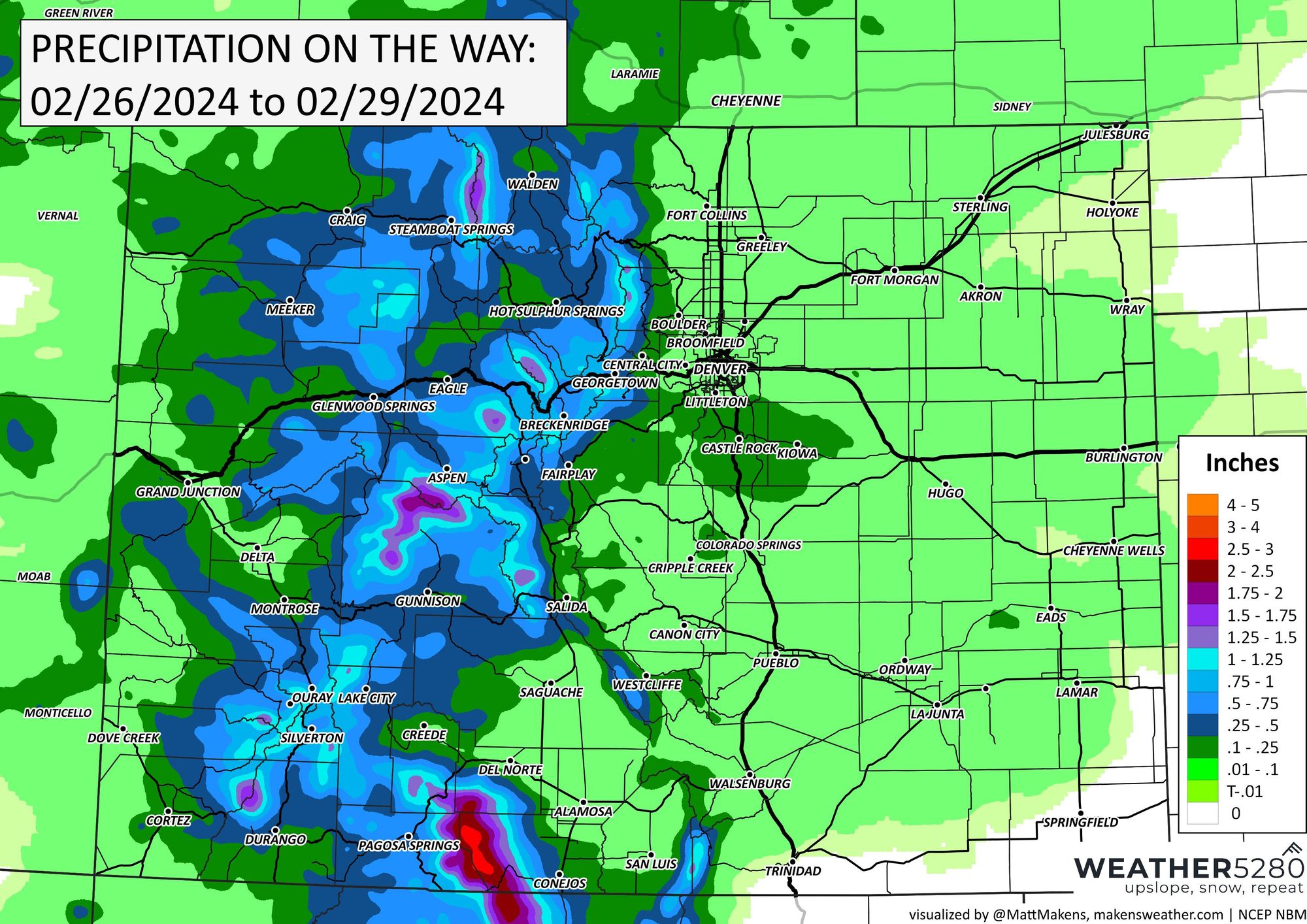
Okay, so tell me how much we'll have... okay, I'll start with total precipitation:

The green shades covering all metro areas and most of the plains is not much moisture, but those from South Denver to Northern Colorado Springs (including Castle Rock) could pick up enough to be useful, say up to a couple tenths.
Then, onto snow:
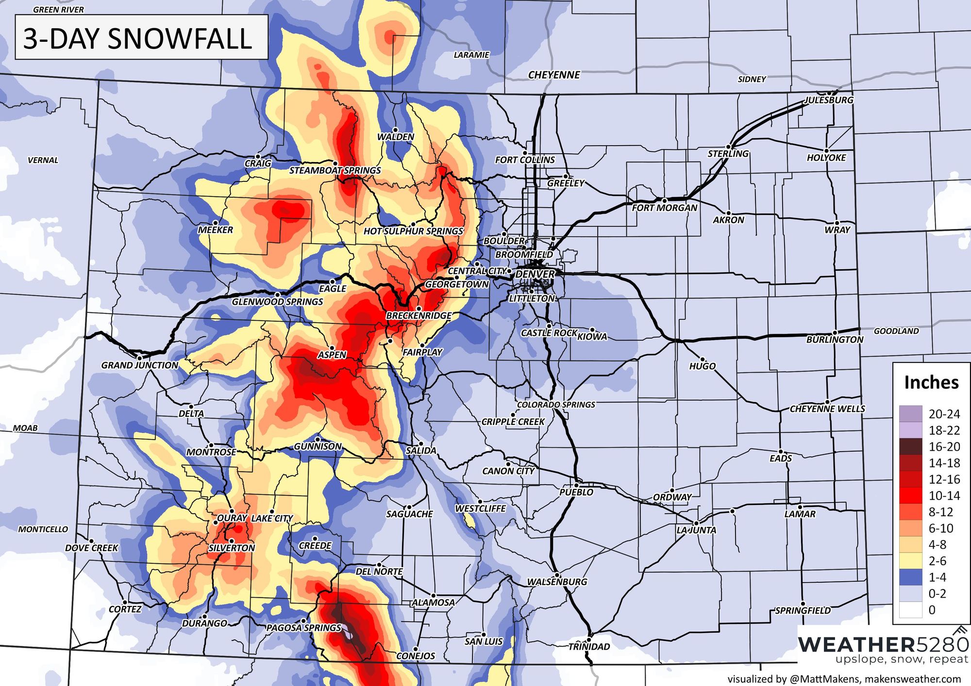
The mountains will cash in on a couple feet for the higher peaks in the San Juans, but for the metro areas there is more of a preference for a trace to two inches total.
So, if we wrap this all together: With snow showers, some rain in areas too, temperatures will be dropping steadily throughout the day Tuesday. No, totals are not overly impactful but temperatures dropping to below freezing with the moisture may create some slick areas by Tuesday's drive home or your plans Tuesday night through early Wednesday morning.
Here's a threat-level based look at the impact to come.
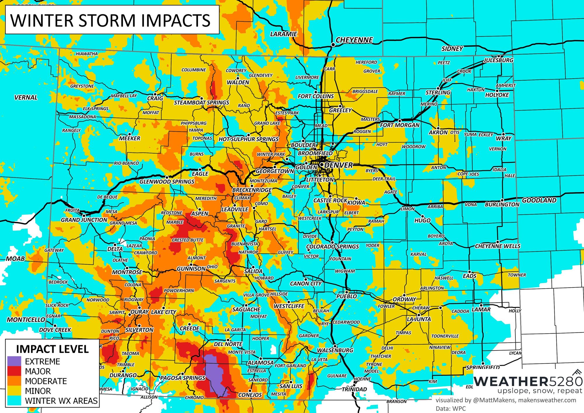
So, yeah, we could have icing and some slick drives. In the metro areas, that'll be more likely around Greeley, Castle Rock to Kiowa.
We'll keep tabs on the data, what else are we going to do, and bring you any needed adjustments. Get those updates straight to your e-mail inbox by subscribing today 😁