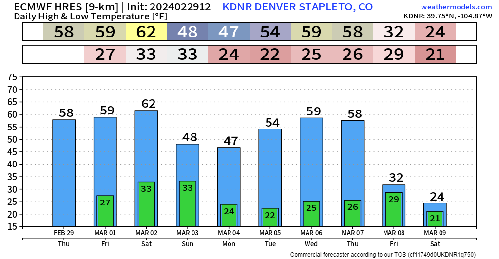
Colorado weather: More wind, mountain snow, and fire danger this weekend

Heading into this weekend... and almost a carbon copy of last weekend, a potent storm system is expected to ride a strong push from the Pacific jet stream, keeping most of the core energy north of Colorado.
With a similar storm set up, similar impacts are expected to move through the state. We'll see wind and fire danger ramp up, especially south of I-70 on Saturday, heavy mountain snow picking up Saturday night and throughout Sunday, with a chance of some lingering showers for the I-25 corridor Sunday and Monday.
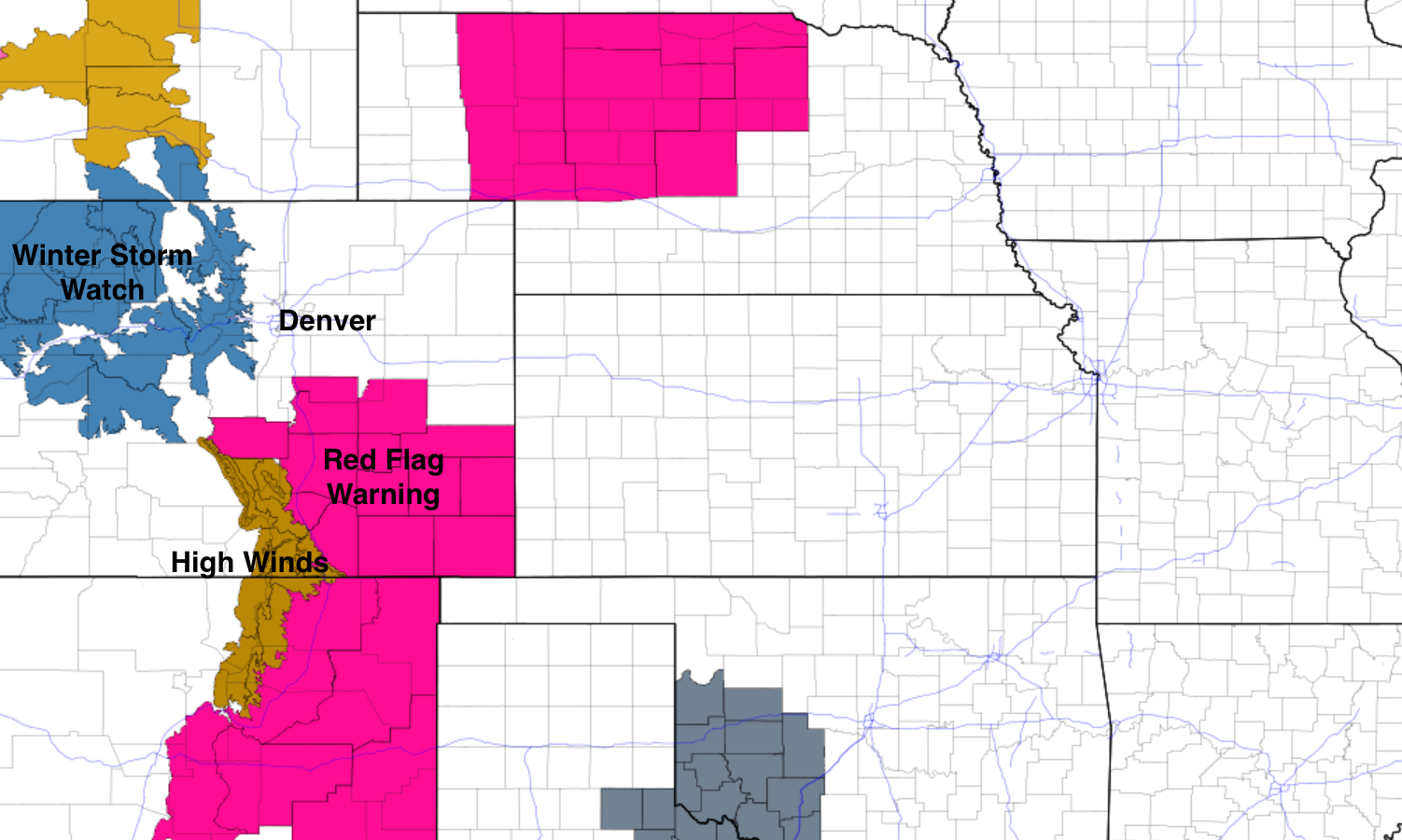
Red flag warnings are already hoisted for Friday for Colorado Springs and areas to east along HWY 94, and south along I-25. Friday shouldn't be too 'turned-up' in terms of fire risk, but with how volatile fuels/grasses have been, it won't take make to get some smoke churning.
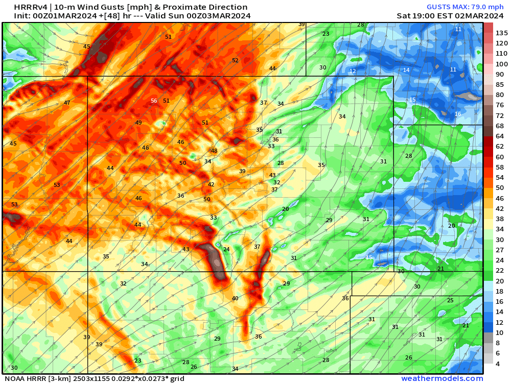
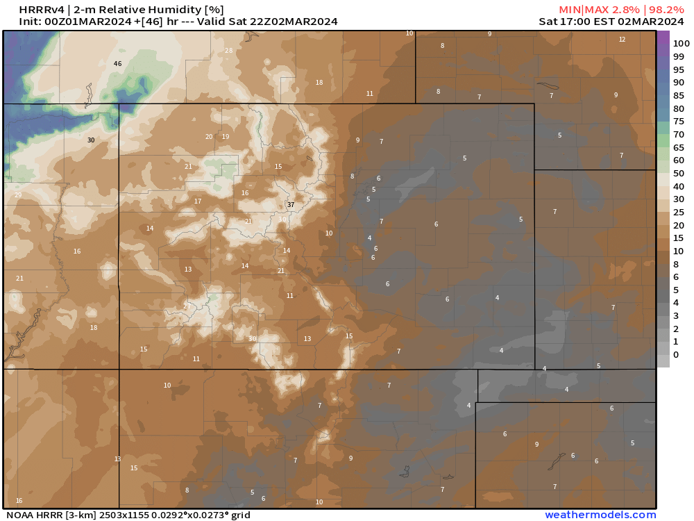
Saturday looks like it has the potential for high to extreme fire risk. Wind gusts will pulse between 30-40 mph, with bone-dry relative humidity values in the single digits! As important as it was last weekend, we'll have to be really fire smart and call out smoke if we see it.
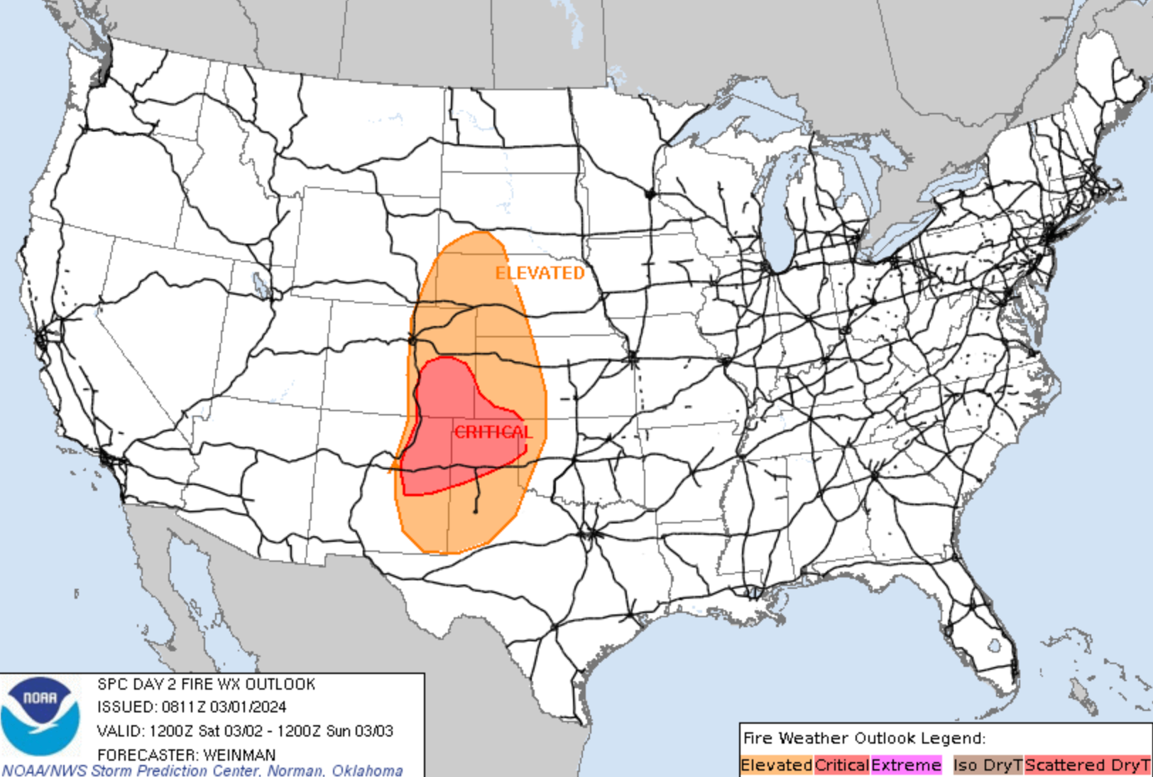
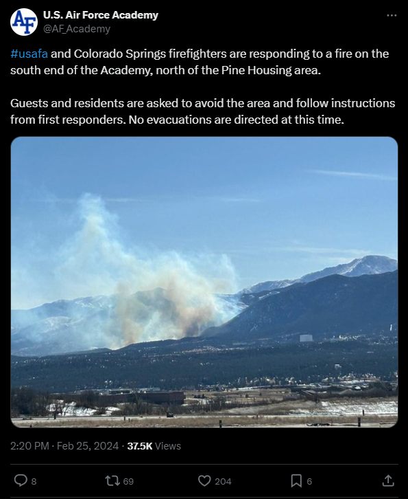
Unfortunately, these are similar conditions to the ones we saw last weekend when several fires broke out along the front range, including the West Monument Creek fire on the grounds of the Air Force Academy northwest of Colorado Springs. The latest Fire Weather outlook from the WPC shows that heightened risk across all of eastern Colorado on Saturday, particularly southeast:
We'd love to be able to avoid major issues this time around, but you can't account for everything or that everyone is "aware" of the fire danger... That's all I'll say about that...
Another similarity to last weekend will be the heavy mountain snow expected to blanket the high terrain with another 1-2'+ of fresh powder. Most of the snow is expected to fall late Saturday night, through the early morning hours of Monday.
Winds of 40-50 mph will create whiteout conditions for a majority of the early morning Sunday, through Sunday night – so if you're planning on skiing this weekend, be aware that a drive back on Sunday is going to be pretty wicked, and likely dangerous.
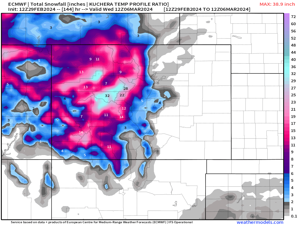
As you can see, a bit of that snow tries to stretch into metro Denver, onto the Palmer Divide and into Colorado Springs. The best chance for those rain/snow showers will be Sunday morning and into the early afternoon hours. In general, we're not expecting much snow out of this for the front range corridor, but we'll keep an eye on things in case that changes.
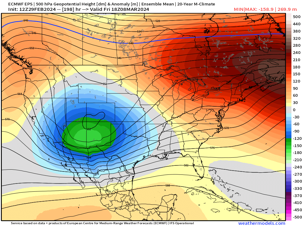
After that, cooler weather takes over to kick off the work week. We'll warm up a bit into the middle of the week... and then all eyes turn to... something at the end of next week, around the 8th/9th. Still a ton of questions on how that all plays out, but there's been some decent indication of a front range storm potential, and some of the longer-range data is trying to keep this storm train going well into March too.
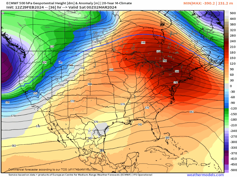
A quick peek at the 500mb anomaly... not so bad inside of 200hr... As always, it will be something to watch, and we'll update if it starts becoming a thing.
Add your e-mail to our subscriber list to get these articles straight to your inbox! We promise it's always something worth taking a look at! :)