Colorado weather: Winter weather possible late this week

Hey everybody! Finally going to see a more favorable pattern for rain and snow across the front range later this week. It looks like a slow moving... blob... of unsettled weather is on the docket come Thursday and Friday – and by blob, I mean this thing:
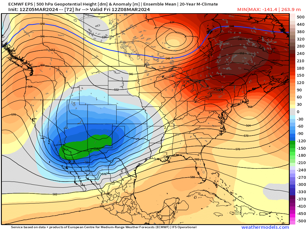
You can see it's not coming through all that organized, it's pretty far south and there doesn't seem to be a whole lot to get it to spin up a bit more and cause more of a ruckus.
Never fear, though! It does have something working in our favor – speed. It looks like this thing may take up to a day to a day and a half to get out of here. That could mean we see a slow shot of light to moderate precipitation that could potentially add up in spots.
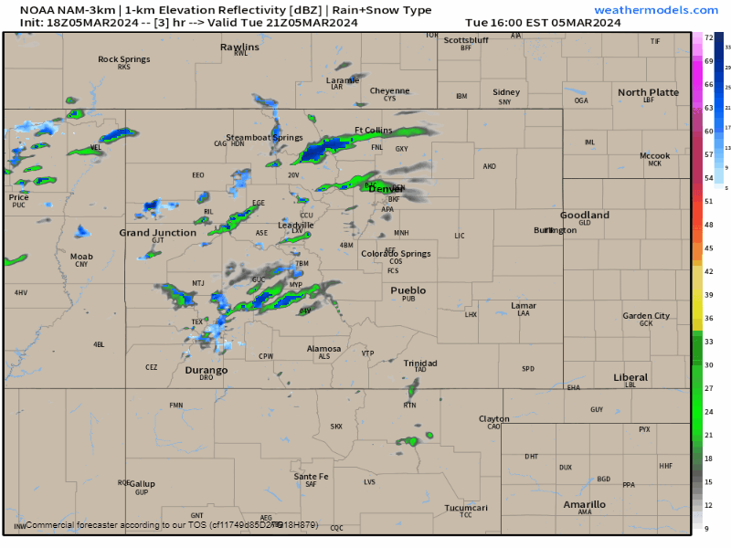
First off though, we have to deal with a weak system passing over head here on Tuesday evening. Overall, this system is looking pretty weak, but with some convective processes available to us, a quick burst of rain or snow is possible into the evening and overnight hours before shutting off on Wednesday before sunrise.
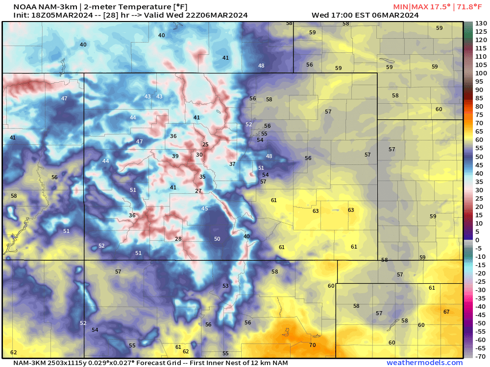
Wednesday will be the nicest day of the week with a pretty good bump in temperatures. Below is a look at high temp potential: plenty of 50s and 60s east of the hills.
After that, we should pretty steadily go downhill in terms of favorable weather. Clouds will build in Wednesday night through Thursday with showers becoming numerous into the evening hours Thursday.
Rain/snow prospects at this time look most steady from sunset Thursday through sunset Friday.
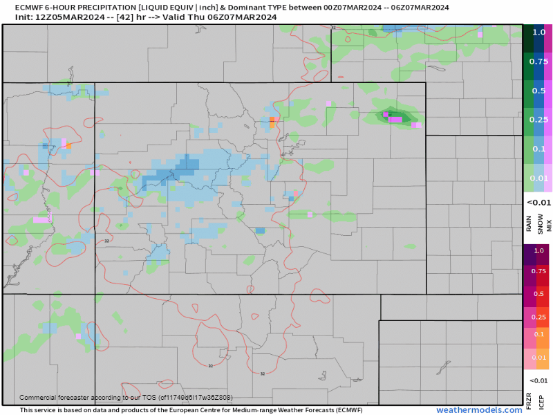
We do have a glaring problem for snow lovers, as has been the case seemingly all winter long: lack of cold air. There's a chance that folks below 5,500 ft may struggle with a mix of rain and snow for most of this system. The fact that much of this system drops moisture Thursday night likely helps elevations above 6,000 ft maintain snow a bit longer too.
Snow totals at this time look OK for the I-25 corridor. Generally 2-4" for Metro Denver, 1-3" near Fort Collins, 4-8" on the Palmer Divide, with 2-6" amounts around Colorado Springs. The foothills and ramparts have a good shot at running up 6-12" with this thing due to the slow speed.
This is our first pass at snow totals, and you'll likely see some shifting about in our future updates.
Regardless of rain/snow potential, moisture looks pretty beneficial for many of us and at the very least should give us some water to kick start the green up and lower fire danger a bit.
For any model watchers out there, you've seen some of the bigger snow totals being pushed out by a few of the globals, and even some of the higher-resolution data is puffing up a bit. We're hoping for a bit better of a handle on this thing, especially by tomorrow night, but it certainly seems like this storm could have a bit of boom potential. Obviously something we'll keep you privy too with updates in the next 24 to 48 hours.
Until then, make sure you're subscribed to the e-mail list to get updates to your inbox!